Good Wednesday to one and all. A big-time change is blowing into Kentucky today as a potent cold front gets set to push through here tonight. Ahead of it, it’s spring. Behind it, it’s a brief taste of some winter weather. That said, the overall pattern isn’t very springy in the closing days of March.
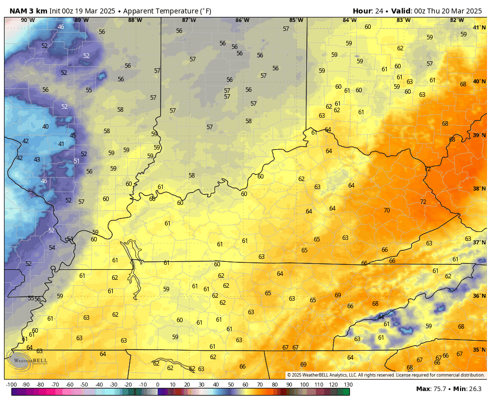
Temps today reach 70-75 across central Kentucky with 75-80 in the far east. Out west, clouds will be a little more prominent, keeping temps in the high 60s and low 70s. Winds are cranking from the southwest with gusts reaching 40mph and higher for many areas, especially this afternoon and evening.
A Wind Advisory is out for much of the region…

Please abide by local and state burn bans as today is a day where fires can get out of control if they flare up.
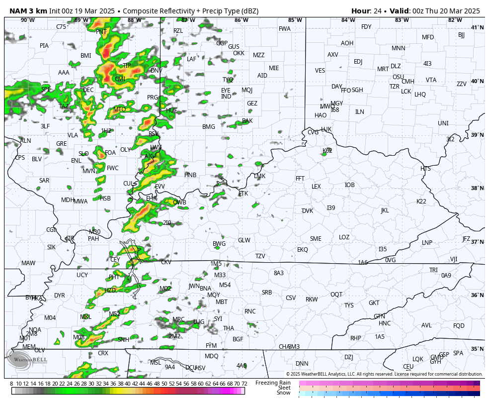
As the cold front moves in tonight, it will fire off a line of thunderstorms that moves from west to east across the state. There’s the chance for strong to severe storms with damaging wind the main player, but there’s a small tornado risk in the west.
While the greatest severe risk is to our northwest, the Storm Prediction Center has a low-end risk for severe storms across areas of western and central Kentucky…

Cold air crashes in behind this line of storms with some rain and snow showers around on a very ugly Thursday. The future radar from the Hi Res NAM shows this evening’s line of storms and the taste of winter behind it into Thursday…
That’s just nasty. With gusty winds blowing, we are talking about wind chills that absolutely tank from west to east tonight through Thursday. This animation shows wind chills from 8pm today through 8pm Thursday…
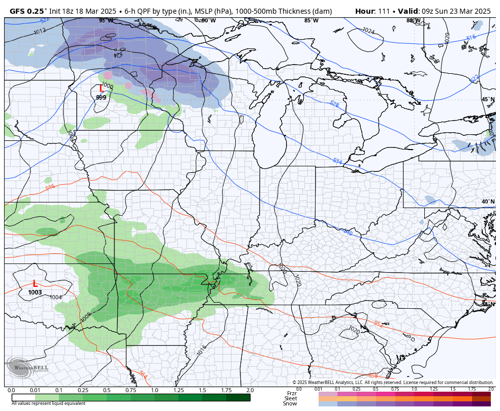
Temps stay below normal this weekend with the chance for a Saturday shower. Highs this weekend are mainly in the 50s. Another system brings rain sweeping in from west to east Sunday and Sunday night with the active pattern hanging around through the end of March. This brings a series of systems in from the northwest with below normal temps, giving us the outside chance for a few flakes.
Here’s the GFS from this weekend through the final day of March…
The EURO Ensembles continues to agree with an overall colder look with only one quick shot of mild. This animation starts next week and rolls through April 2nd…
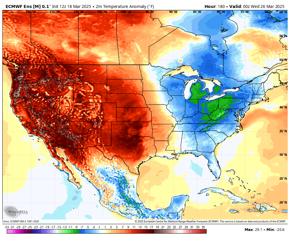
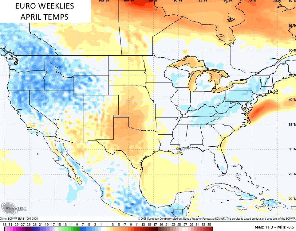
The EURO Weeklies upper level pattern suggests a decent April temps-wise across much of the country…
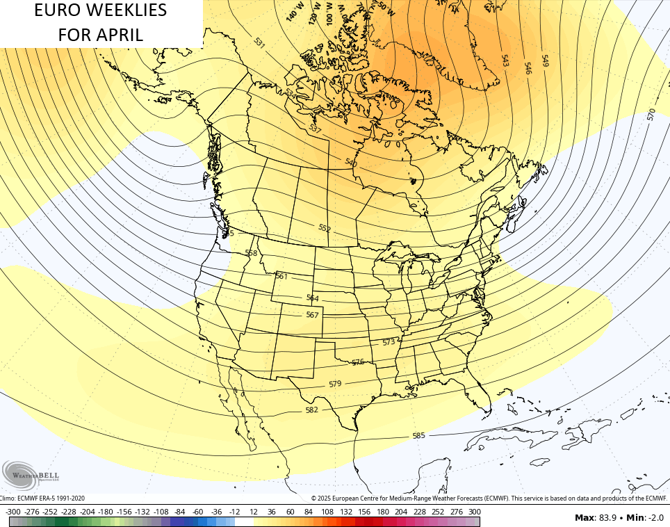
It’s still showing temps averaging slightly below normal for our region…
I’ll throw you another update later today. Until then, I have you guys all set to track today’s potential strong to severe storms…

Current watches

Possible Watch Areas

Make it a great day and take care.

The weeklies are gonna flip-flop like usual.
That’s a Given Jeff.
March Madness gives us an excuse to watch some good basketball and peer out the window occasionally at the chilly, damp weather.
Last week I fertilized my one Catawba Rhododendron, which was windburn this past Winter. I always used Nitro- form because it has a slow release form of Nitrogen with a Acid reaction. As luck would have it, the next day it rain three inches. The plant is now green again and may have a few blooms this coming May. Can’t wait !
Thanks Chris. These Storms across the CONUS here lately with their Strength has Really Amazed me. Has the Climate Really Changed, or is this just a Plain Old Weather Cycle ? Something has Definitely Changed in the North Pacific since the Year 2019. For instance, the PDO is still leaning towards the Negative. Will be glad if and when a Positive PDO returns, as this gives Our area more chances of Major Snowstorms. The month of March Use to have Record Breaking Snowstorms, but Not anymore.
Enjoy the Day, and Be Safe Everyone !
Your right Schroedor March did have some heck of snowstorm back then.
Another severe weather event is possible for portions of the Chicago area today, as a Tornado Watch is in effect until 9 PM this evening for much of IL, including the SW Suburbs of Chicago.
This comes after last Friday’s severe weather late in the evening, which produced four weak tornadoes (EF-0 or EF-1) in the Western Suburbs and NW Indiana.
We’re also expecting an accumulation of heavy, wet snow after midnight tonight through Thursday morning when the winds shift and the temps plunge.
Winter and Spring are really fighting the battle with each other!