Good evening, everyone. Severe storms are rumbling across the western half of the state and some of these may even drop a tornado or two. This is part of a potent storm system set to bring more high winds and a brief taste of winter.
The Tornado Watch us out until 11pm CDT for areas along and west of Interstate 65…
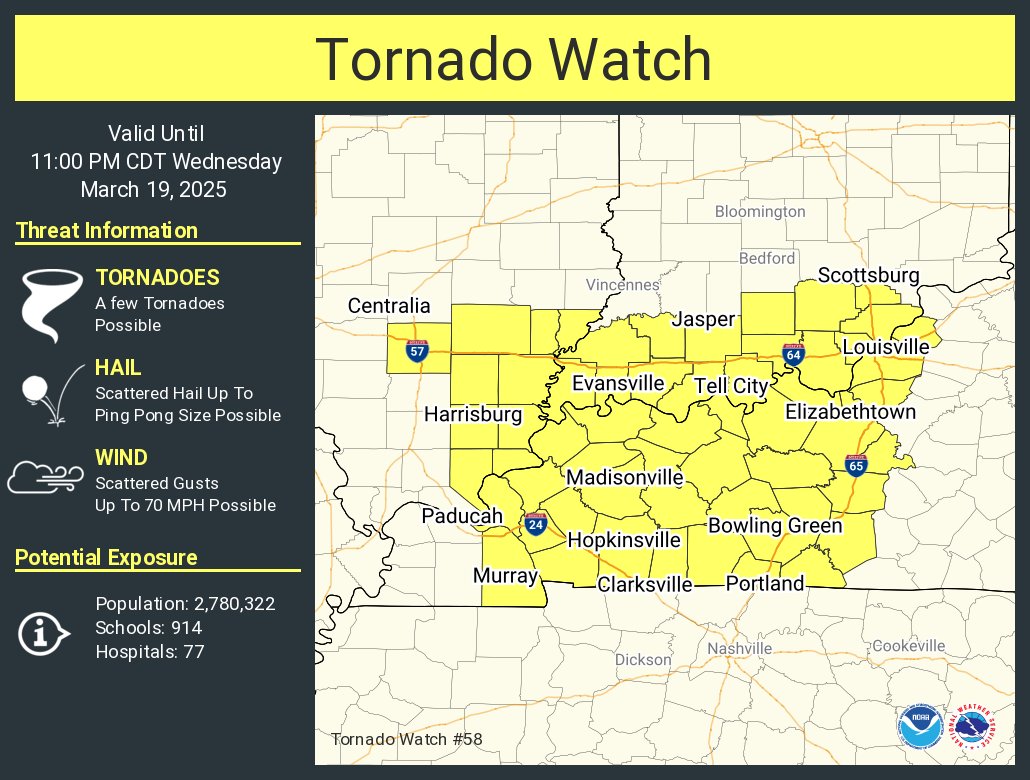
This is the area the Storm Prediction Center had for a Marginal Risk for severe storms. That has since been upgraded to a Slight Risk with the Marginal Risk a little farther east…

That threat diminishes quickly as the storms move into central Kentucky.
Here are the individual threats for the evening…


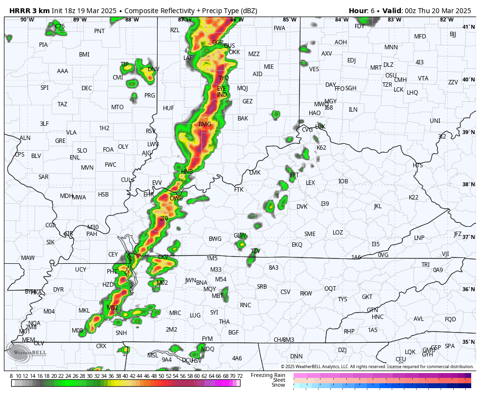
The HRRR shows this line of storms running out of steam as it moves into eastern Kentucky with rain and snow showers following it Thursday…
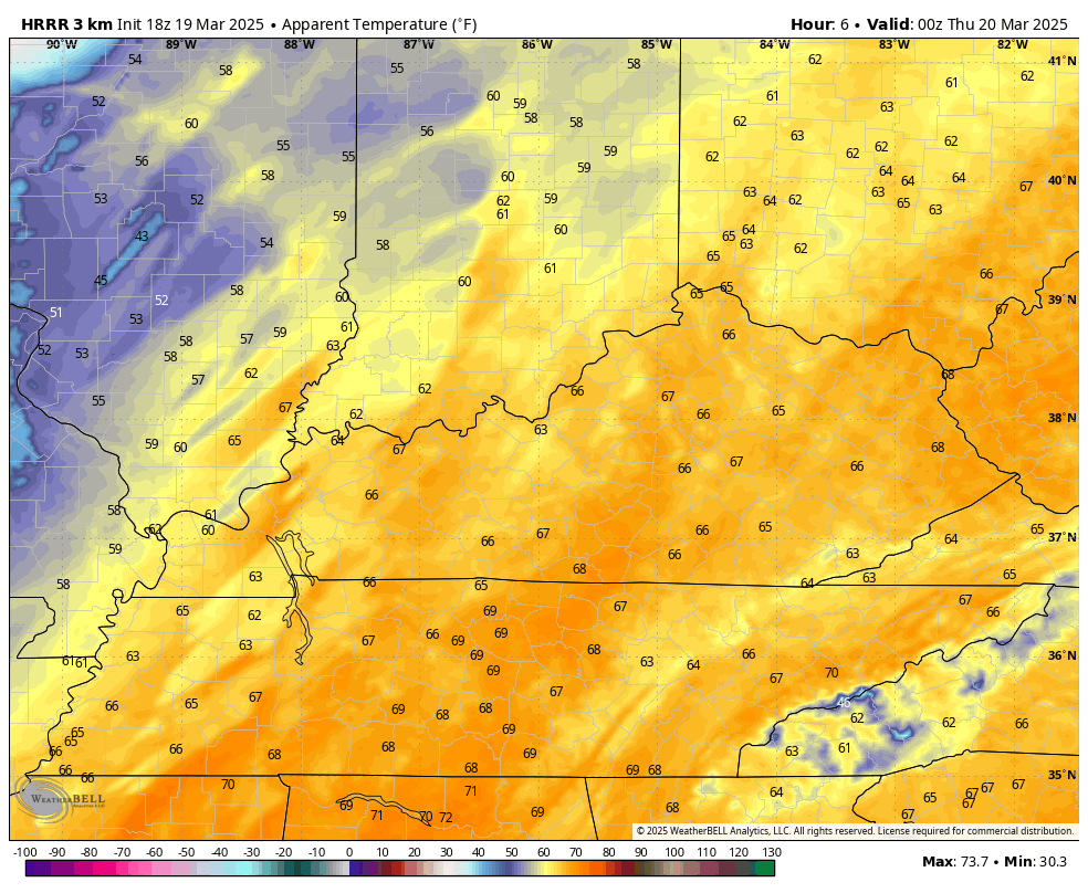
Temps crash behind this front with wind chills going way, way down for the first day of Spring…
I leave you with your storm tracking tools for the evening…


Current watches

Possible Watch Areas

Make it a great evening and take care.
