Good Thursday, everyone. Another cold front is surging into the region today and it’s bringing the potential for a few loud boomers. Some of these storms may briefly go severe as chilly winds get ready to settle back in for the end of the week and weekend.
We start the day with some showers and storms in the east but sun and clouds quickly take over. Highs may even push 70 in a few spots.
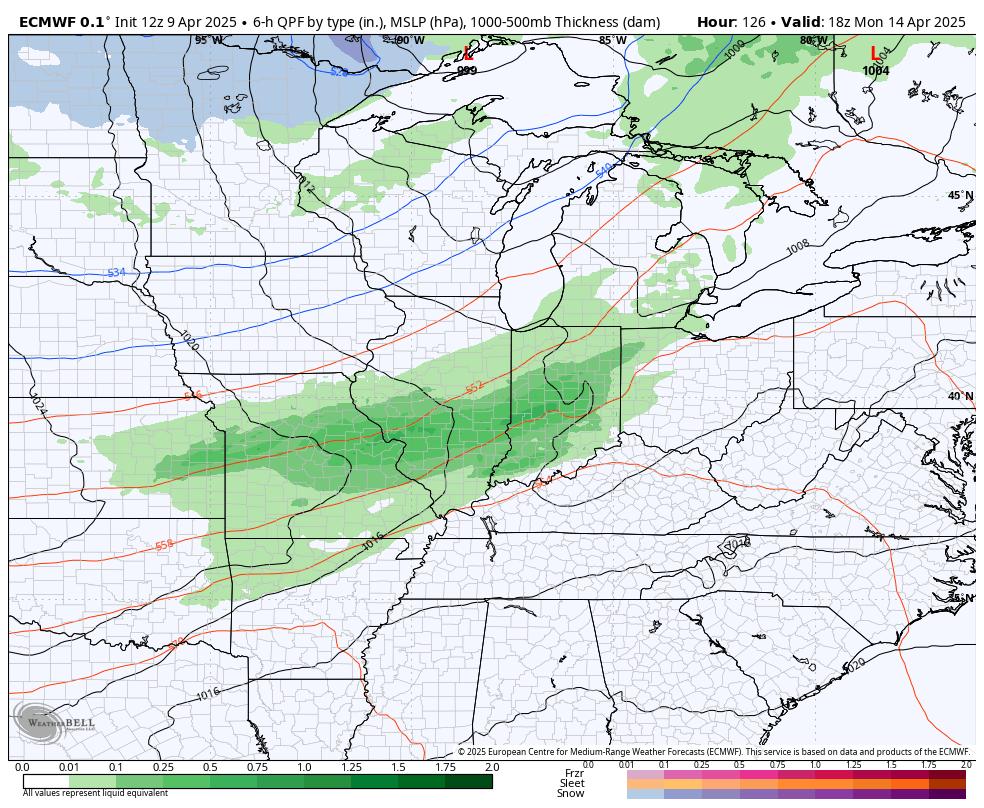
Another round of storms develops this afternoon and early evening in the west then slides to the east. Some of these storms may be locally strong to severe and the Storm Prediction Center is highlighting this possibility…

The greatest severe risk is across the southwestern part of the state down into Tennessee. Those are the areas seeing the small chance for a tornado or two to spin up…

A small damaging wind threat and large hail threat is out for much of Kentucky


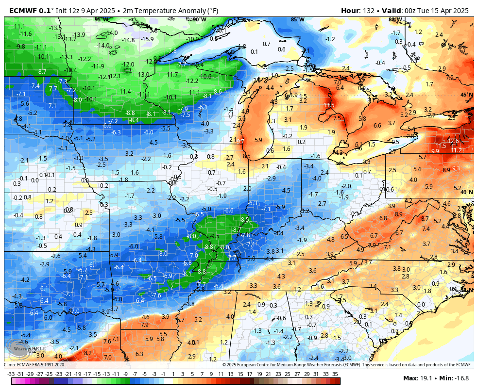
Chilly temps return behind this system with a few showers lingering into Friday. Areas of eastern Kentucky may not get out of the 40s, setting the stage for temps to hit freezing or below Saturday morning then again Sunday morning. Highs in the 50s Saturday should warm toward the low 60s on Sunday.
Monday looks mild with temps in the 70s but another cold front looks to knock those numbers right back down through the rest of the week. That system will bring scattered showers and thunderstorms with it…
Check out how far below normal those temps go…
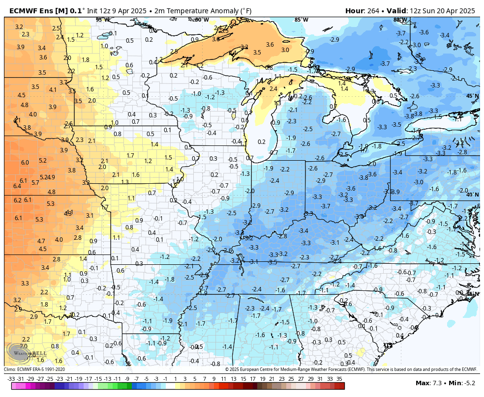
I do expect a bounce back in temps Easter Weekend and this is showing up at the end of the EURO Ensembles temperature departures…
In a pattern like this, when it warms it storms, so we will need to keep an eye on things Easter weekend into the final full work week of April.
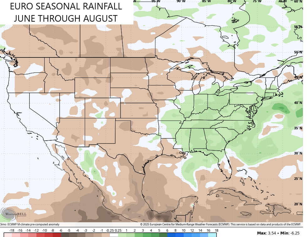
The latest EURO Seasonal is out and it goes through the summer months. The June through August pattern looks pretty tame as far as temps go with the three month average coming in just a hair on the warmer side of normal…
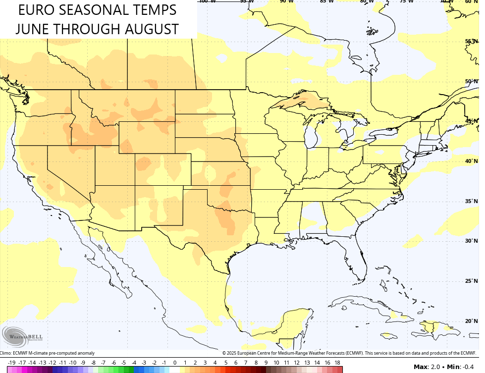
Notice the model has the real deal heat across the west and that’s also the area with what looks to be another dry summer. For us… Not so much. Above normal rainfall shows up around here and for much of the eastern part of the country…
Out in the equatorial Pacific, that same model is forecasting a warm neutral to weak El Nino during the summer…
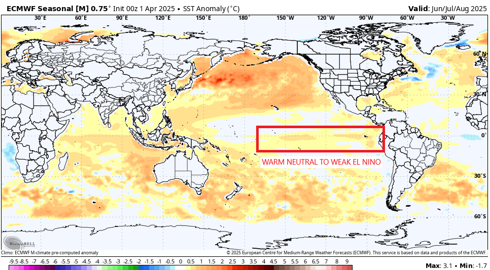
It does show that weakening by the start of fall, so we will see what it does from there and if it can factor into the fall and winter months.
I may drop by for another update later today. Until then, I leave you with all your tracking tools…

Current watches

Possible Watch Areas

Make it a great Thursday and take care.
