Good Wednesday to one and all. It’s another chilly day across the Commonwealth and this appears to be more of the rule rather than the exception as we roll forward. The pattern is now skewing below normal for both temperatures and, more importantly, rainfall.
Temps today reach the 50s with a mix of sun and clouds. Low 60s show up in the west and south as clouds thicken ahead of another cold front blowing in on Thursday. This will have showers and a few thunderstorms ahead of it and chilly showers blowing in behind it.
There is even the low-end risk for a couple of strong to severe storms on Thursday…

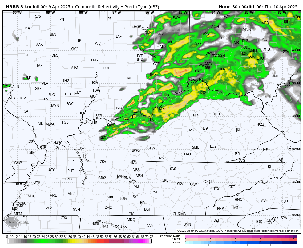
The future radar from the HRRR shows a band of showers and storms late tonight and early Thursday with a better shot of some scattered strong or severe storms later in the day…
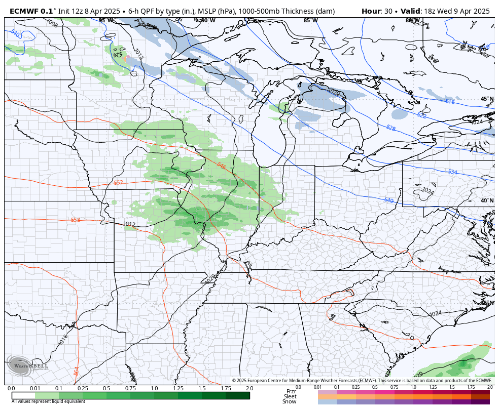
Here’s a look at those showers and storms and the chilly showers showing up on the EURO…
Check out how far temps go below normal behind this system through the weekend…
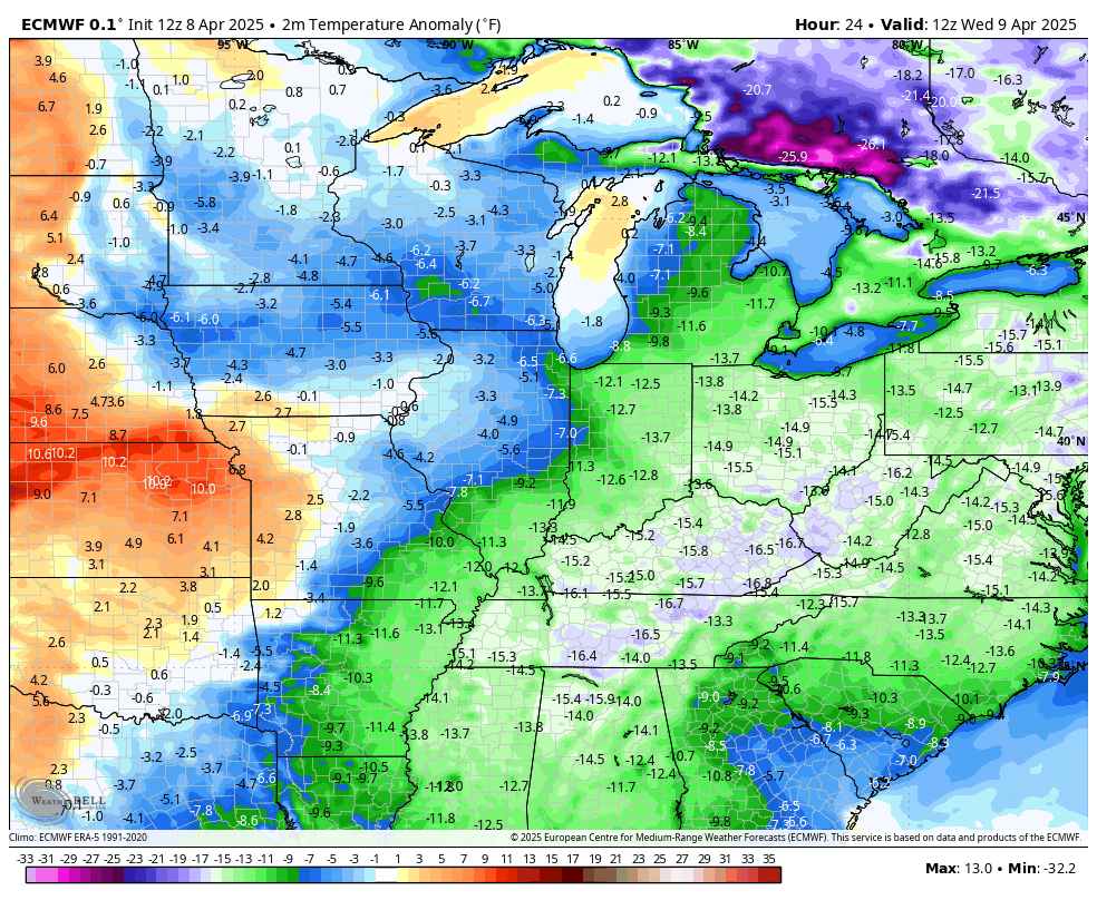
Lows this weekend will likely drop below the freezing mark.
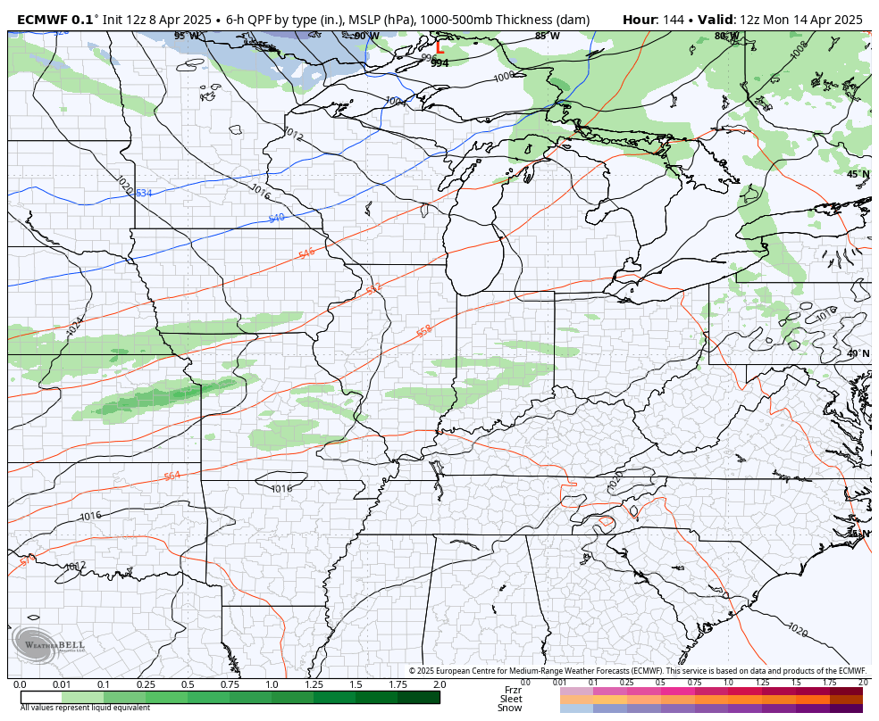
Sunday afternoon is a bit milder and that takes us into Monday as temps try to make a one and done run at 70. This is ahead of yet another cold front with additional systems dropping in behind that as the northwest flow is open for business…
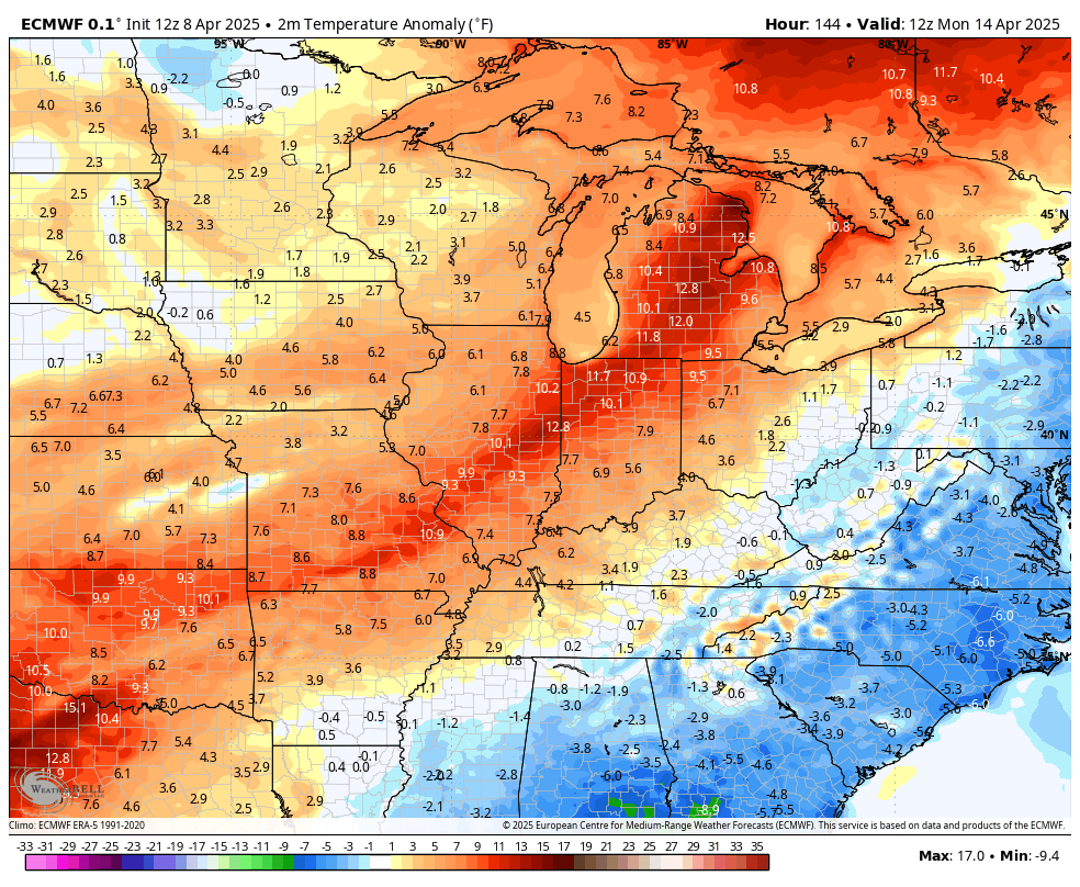
The temperature anomalies from April 14th through April 21st are pretty ugly…
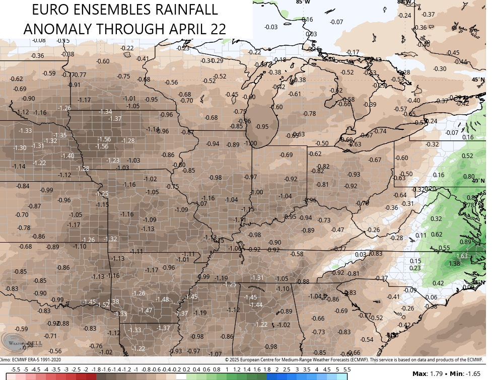
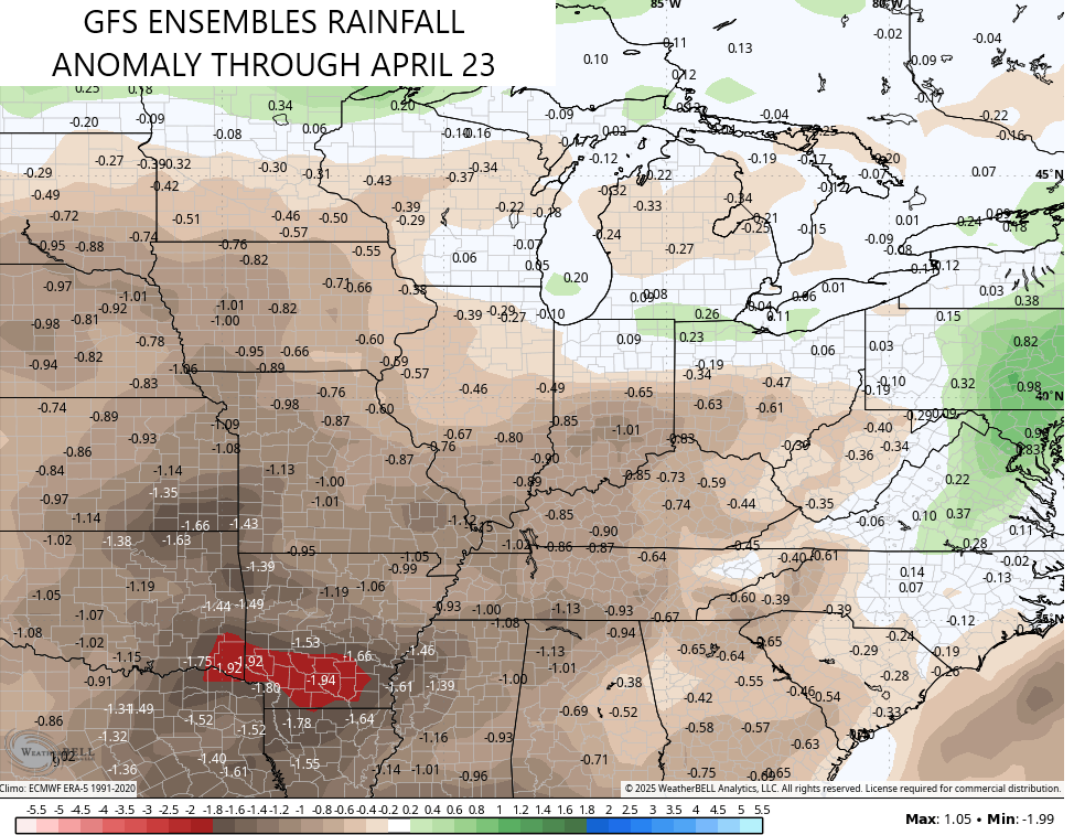
While we will see periodic showers and a storm or two along these fronts, the overall pattern looks to be skewed drier than normal for the next two weeks. This trend shows up very well on the ensembles…
EURO ENSEMBLES
GFS ENSEMBLES
DROUGHT!!!!
Sorry, I’m just trying to get a head start on the usual suspects that yell drought anytime it doesn’t rain in 2 days. 🙂
Enjoy the middle of the week and take care.

I’m certain someone out in the 27 weather-verse will kvetch about dry weather in a few days. 😉
Think it will be someone we know? 🙂
With plants in the great outdoors, some plants tolerate the variance in available soil moisture better than others. “Just right” is almost hypothetical. It seems there’s often too much or too little, and it’s OK to say so.
2 weeks without rain, I’ll take that.
It’s a crisp morning in Bowling Green, but after a stretch of 70’s and 80’s, I’d rather see crisp and those Barney temperature colors stay where they belong – – in late Fall!