Good Tuesday, everyone. It’s an absolutely frigid start to the day with temps deep into the 20s with wind chills in the teens. What month is this, by the way?! As we look ahead, our spring continues to have a chillier than normal look to it.
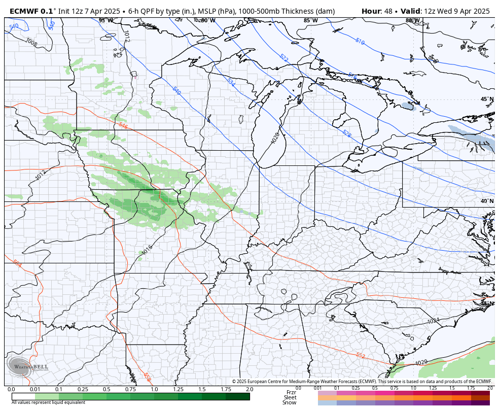
We continue to see major flooding across many of the large rivers today and this will continue for several more days before things start to improve.
Temps out there today reach the 40s with a mix of sun and clouds with that chilly northwest win making it feel a bit colder. This sets the stage for another night of frost and freezing temps for most of Kentucky and surrounding areas.
Here’s a look at all the Flood Warnings and any frost or freeze headlines…
The next system moves in late Wednesday and Thursday bringing gusty showers back into the region. This system slowly spins through here into the start of the weekend as much colder winds return…
Temps will once again drop below freezing for lows this weekend. Booooo!
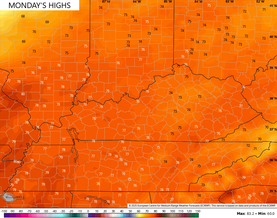
We should see quick rebound toward the 70s by Monday…
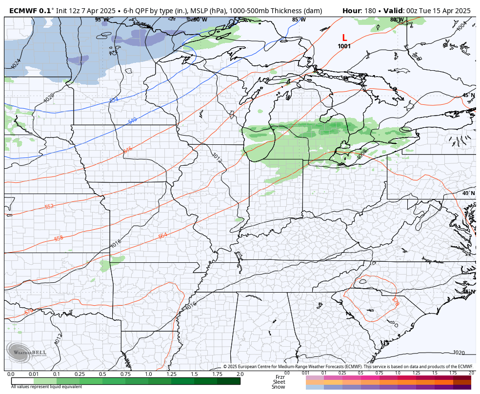
But that’s a hit and run taste of late spring as another front drops in from the northwest by the middle of next week and will be followed by another system dropping in behind it. Both of these will work to keep temps seasonably chilly with a few showers. This animation goes from next April 14th through April 19th…
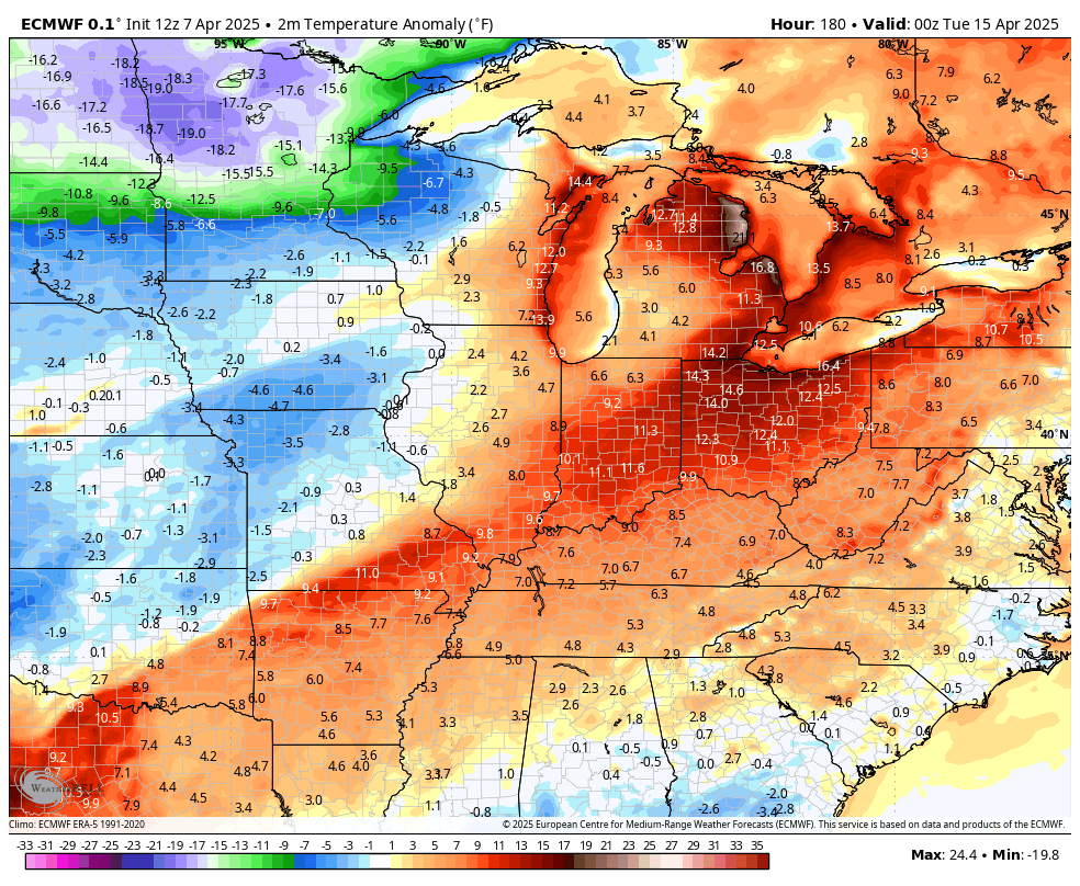
Just look at how far below normal temps are during this same period…
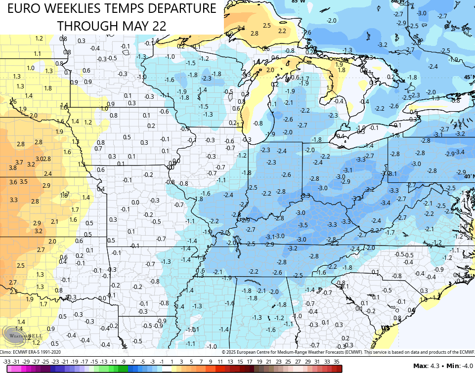
The EURO Weeklies continue to suggest this cooler than normal setup is the dominant pattern through the middle of May…
The same Euro Weeklies are also showing a drier than normal pattern through this same time…
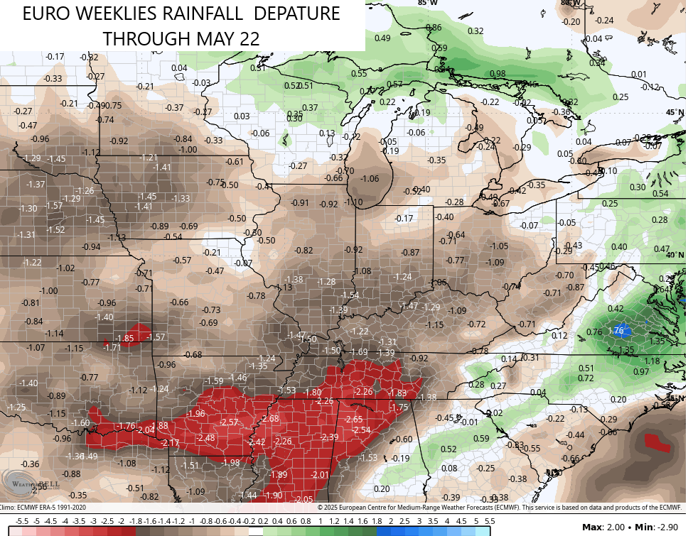
A cooler than normal and a drier than normal spring pattern don’t usually go together, so one of those may not work out the way the model thinks.
I’ll take a deeper look toward Summer later in the week.
Have a terrific Tuesday and take care.

The cooler part won’t work out.