Good evening, everyone. Friday continues to look like a VERY active severe weather day across Kentucky and surrounding areas. Multiple rounds of strong to severe likely during this time.
Here’s a quick breakdown:
- One round of strong to severe storms may impact parts of our region late tonight and early Friday morning.
- The prime time for severe weather for central and eastern Kentucky is from 3pm Friday through 2am Saturday.
- Waves of severe storms will race from west to east across the state during this time.
- SIGNIFICANT wind damage is possible with these storms.
- A few tornadoes will also be possible with the chance for a few strong tornadoes in western and central Kentucky.
- Large hail of greater than golf ball sized will also be noted.
- Flash flooding will also become an issue in some areas.
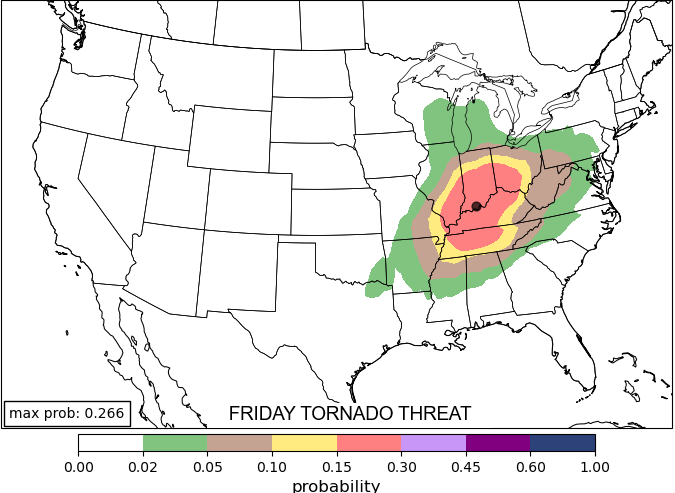
The Machine Learning Model (AI) shows Friday’s greatest tornado risk right on top of us…
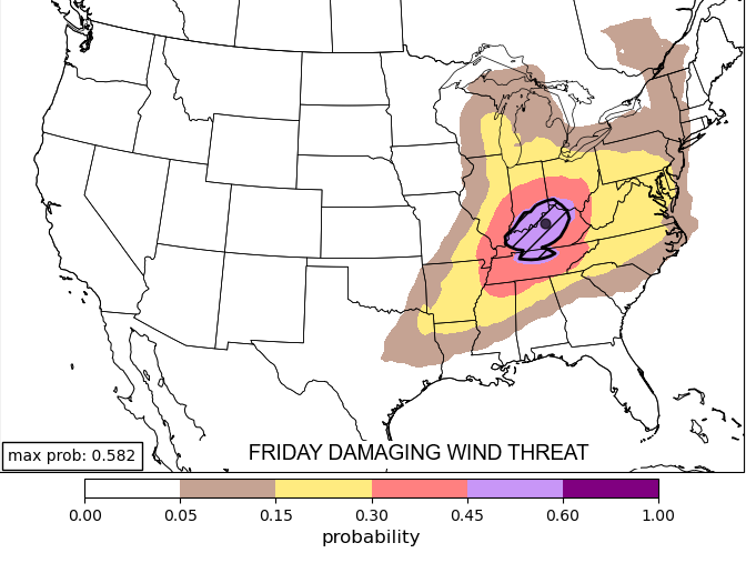
The potential for widespread wind damage is extremely high…
The Storm Prediction Center continues to get more aggressive with the severe threat and they now have a Moderate Risk out for much of Kentucky…

I expect the Moderate Risk to expand farther east with future updates.
In terms of the tornado risk, the SPC is highlighting central and western Kentucky for the potential for a few strong tornadoes…

The potential for damaging winds is crazy high…

Large hail should also show up in many areas…

I’ll be on WKYT-TV for any severe weather coverage. As always, I leave you guys with your severe weather tracking tools for the evening…

Current watches

Possible Watch Areas

Make it a great evening and take care.
