Good Thursday, everyone. We continue to track the increased threat for strong to severe thunderstorms rolling across Kentucky over the next few days. This threat continues to look a bit ominous Friday into Friday night.
Today finds summertime temps surging in with temps hitting the mid and upper 80s in many areas with a 90 possible in some of the traditional hot spots. Humidity levels surge with dew points in the 70s. Winds are cranking from the southwest with increasing instability.
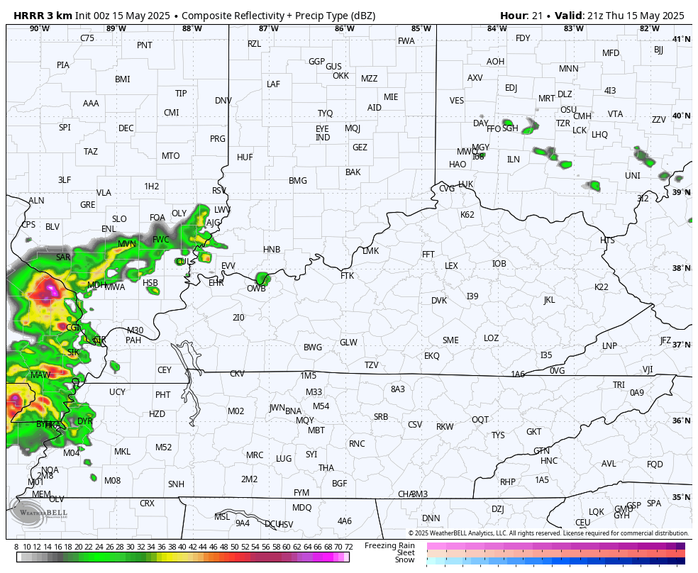
This could crank a complex of storm across the west late this afternoon with that rolling eastward during the evening. That opens us up to the potential for additional huge complexes of strong to severe storms to rumble across the state.
The future radar from the HRRR shows all this with the animation that starts at 5pm today and ends at 8pm Friday…
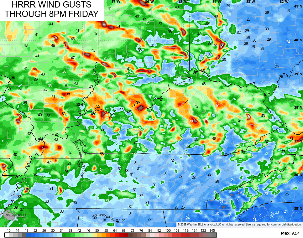
That model run is seeing the potential for some serious wind gusts…
The Storm Prediction Center continues to show the Marginal Risk to Slight Risk across the region today…

Here’s Today’s Tornado Outlook…

Damaging winds and large hail continue to be the bigger threats of the day…


The Severe Weather Outlook for Friday is even greater with much of the region in the Enhanced Risk for severe storms…

The risk is there for a few tornadoes to show up…

The potential for damaging winds is way up there…

Large hail should also show up in some areas…

Much better weather moves in for Saturday with some decent stuff hanging into Sunday.
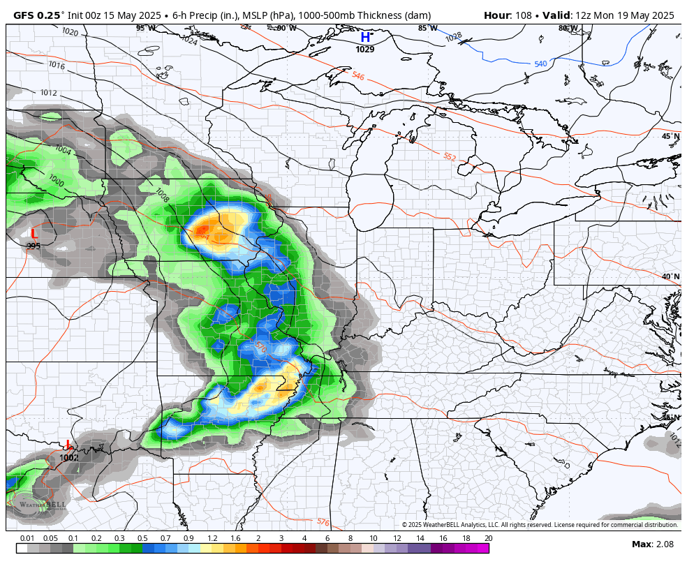
Another stormy setup then kicks in by Sunday night into early next week, giving us the potential for more severe storms and potential flooding issues. This will be ahead of another big, slow-moving low spinning from west to east through the region.
This animation goes from Monday morning through Thursday…
As the low spins through late Wednesday and Thursday, chilly air is likely to spin in here for the end of next week into Memorial Day Weekend. The Barney colors are back…
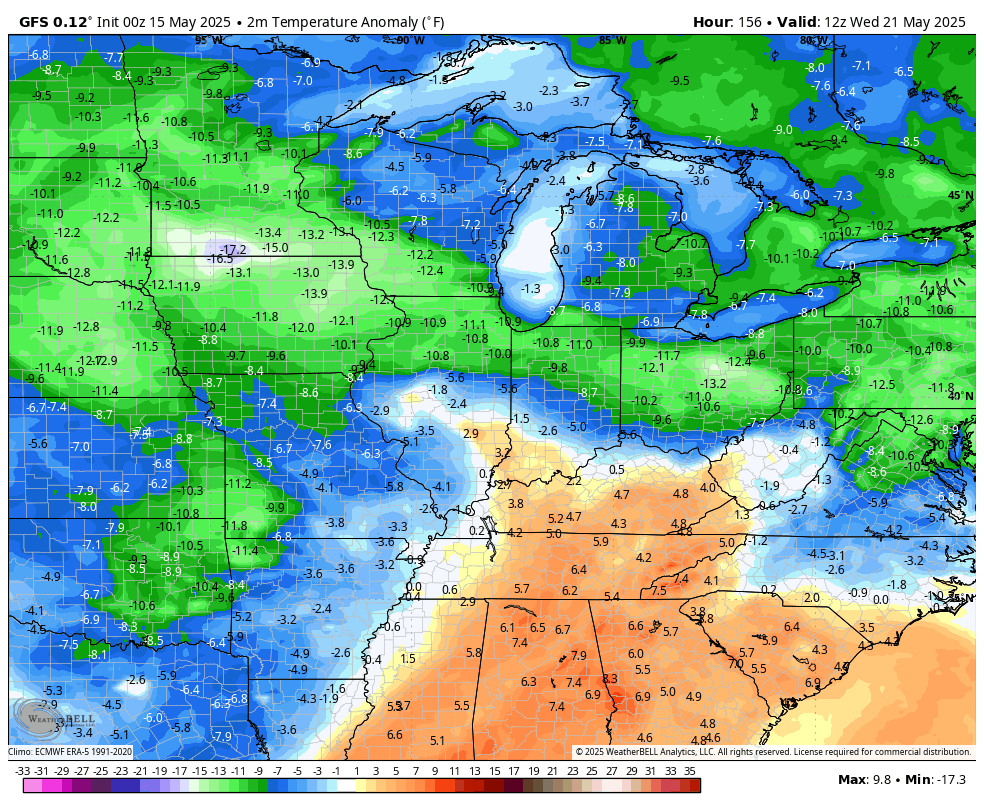
That could mean a few days with highs in the 60s and lows in the 40s. Ugh.
I will update things if needed later today and I’ll be on WKYT-TV for any severe weather coverage. As always, I leave you guys with your severe weather tracking tools…

Current watches

Possible Watch Areas

Make it a great Thursday and take care.

I will never see anything wrong with highs in the 60s and lows in the 40s
Sounds delightful, like the temperatures in Oregon this time of the year. Except Oregon doesn’t have tornadoes, only pleasant weather in the Spring, to enjoy gardening and many blooming plants.
The outlook for tomorrow continues to be very concerning. In particular, the positioning of the subtropical jet over western and south central Kentucky Friday evening will increase the amount of shear and encourages rotation in thunderstorm cells.
An upgrade to Moderate Risk seems likely tomorrow.
Everyone, please pray that this dangerous weather event doesn’t occur anywhere. We go through this BS every Spring. Very bad climate. I wish now that I moved to a climate where one can enjoy the weather. Too late now, and too expensive !
Our first 90-degree temperatures of the year are in the forecast for the Chicago Metro Area today, along with an Enhanced Risk of severe weather later this afternoon and evening. Supercell thunderstorm development along with large destructive hail and possible tornadoes are the main concern. It’s just a question of exactly where these will develop.
It’s been a rather quiet severe weather season here so far. Very dry also, with no measurable rain for the last 10 days.