Good Sunday, everyone. As we get set to wrap up the month of June and say hello to July, we continue with a fairly active pattern. This is ahead of a cold front set to blow into town to start the month and it’s bringing more in the way of strong storms and heavy rain.
Scattered showers and storms go up out there today with an increase Monday and Tuesday. Any of these storms may be locally strong to severe and put down enough rain to cause flash flooding. This animation from the GFS starts today and goes through Wednesday. You can see how quickly better skies come in behind the Tuesday front…
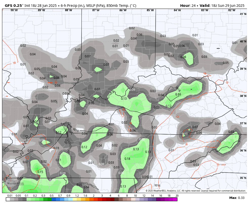
The Storm Prediction Center’s Severe Weather Outlook for today looks like this…

Here’s the Monday risk…

And just along and ahead of the front on Tuesday…

The 4th of July continues to look mainly dry with more steam and storms returning over the remaining holiday weekend.
Looking longer range, the EURO is digging a deep trough back into the eastern half of the country later in the 2nd week of July…
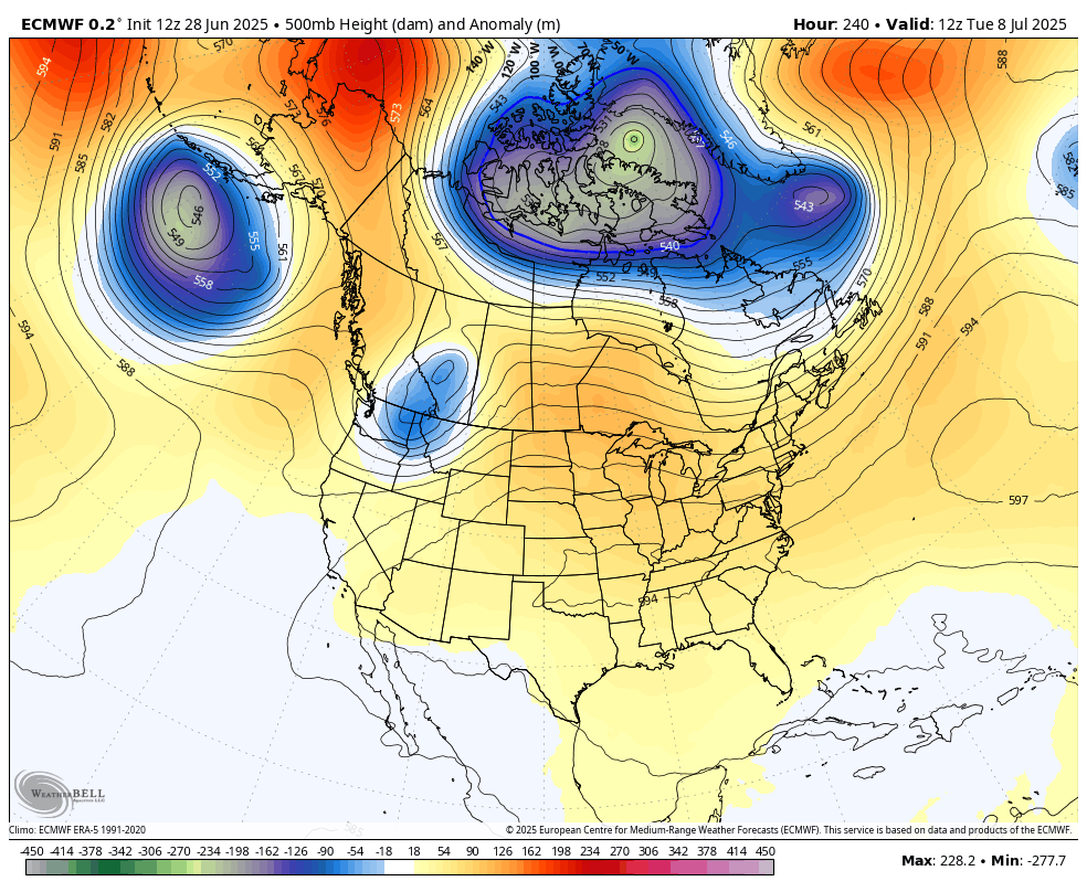
That would bring another round of below normal temps if it’s accurate.
As usual, I leave you with your storm tracking tools for the day…


Current watches

Possible Watch Areas

Make it a great Sunday and take care.

I dread tropical season. I hope this go round it doesn’t turn our weather hot dry and BORING for weeks.
Most all of our Summers are boring Mark, and Autumn weather doesn’t come in September like it use to. I remember frost occuring in mid September back in the early 1960’s.
The EURO won’t verify. Boring weather sounds great.
You may be correct Jeff ?
No measurable rain yesterday, either. Watering daily. The nearby wet-weather creek is bone dry. Rain would be good; it’s always better than chlorinated city water.
Check to see if Chloramines are in the water. When Evansville, Indiana started this program in their water department, I could’nt propagate any plants, so this is what put me out of business. Water from a gravel pit is the best water for plants, but very few have this in Indiana.
OK. Please tell me you’re joking?
Not any Joke, when talking about the weather.
We had a very brief shower yesterday afternoon. The high pressure cap just won’t break down. The only precipitation this morning is dence fog.
Outlook from CPC for the Summer, Fall and Winter 2025- 26. Also Spring, Summer and Fall 2026. Looking like North Pacific air will be the coldest air to invade the eastern part of the US this Fall and Winter. Again, we shall see how all of this plays out.
https://www.cpc.ncep.noaa.gov/products/predictions/multi_season/13_seasonal_outlooks/color/churchill.php
I could live with that
I could do with Pacifica junk tho lol, sounds like 33 and rain lol
Sorry for all the comments. I usually won’t comment on Sundays. For some reason I felt like it this morning. LOL… Done for today, time to give it a rest.
Getting pretty dry south of Corbin, just seems it cannot and will not rain here. Im totally expecting modeling to keep punting that Eastern trough.
We’ve not gone long without rain, so I highly doubt that anyone is remotely close to a drought.