Good Monday, everyone. It’s the final day of June and it’s also the day kicking off the 4th of July week. A few strong storms are rumbling through to end the month and those hang around for July first before things calm down and cool down in the days leading up to Independence Day.
Temps today are back into the steamy mid and upper 80s. Scattered showers and thunderstorms will be floating around with the chance for a few strong or severe storms this afternoon and evening.
The Storm Prediction Center continues with the low-end risk for severe storms today…

Damaging wind is the threat.
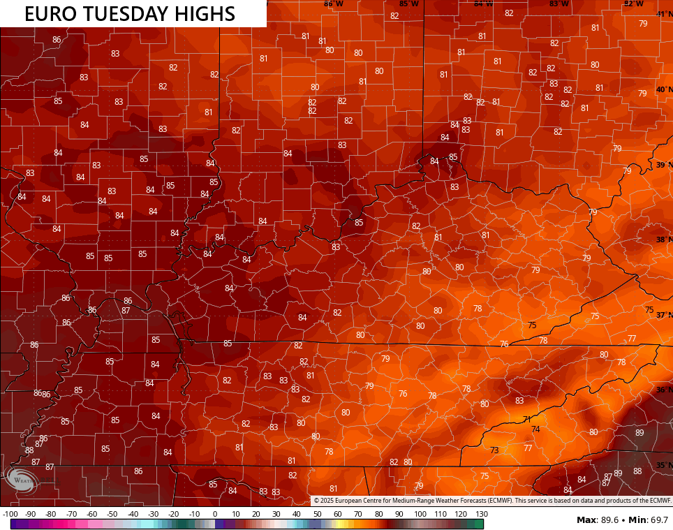
That threat may linger into Tuesday as the cold front drops in from the northwest. Here’s the Severe Weather Outlook for Tuesday…

In addition to the damaging wind potential, locally heavy rains may cause additional flash flooding issues.
Temps on Tuesday are pretty darn nice for the first day of July with some areas in the and southeast struggling to 80…
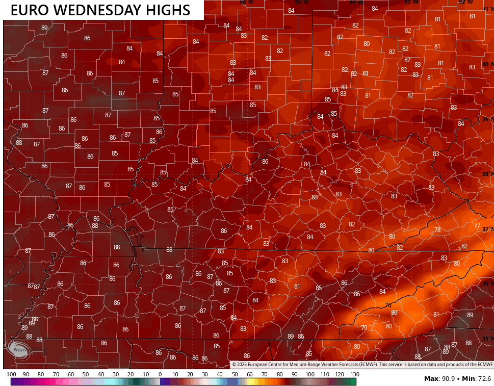
Wednesday’s temps look really, really good with low and middle 80s for most…
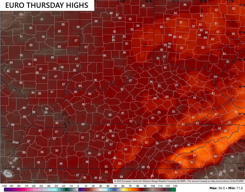
Those numbers edge up just a bit on Thursday, but are tame for the day before Independence Day…
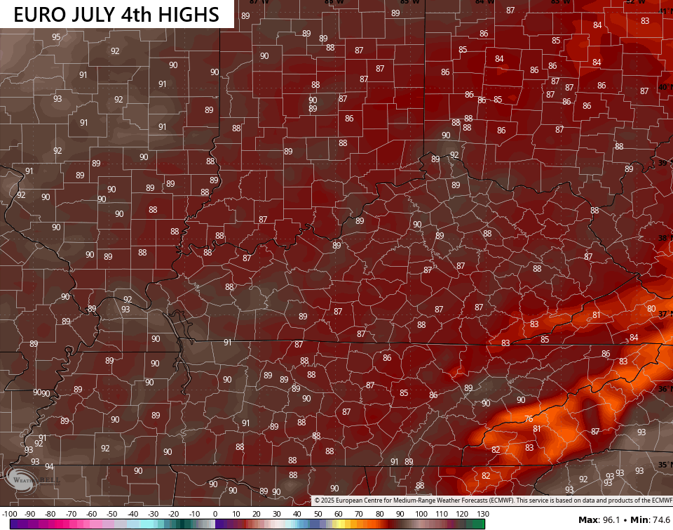
Normal highs are 85-90 for early July and we generally keep that as the normal through the middle of August. Normal is exactly how things are shaping up for the 4th…
Temps should hover around 90 next weekend with additional showers and storms rumbling in. This would be ahead of another pattern that delivers a few cold fronts into the region next week. At the same time, some tropical juice from the Gulf may try to get involved…
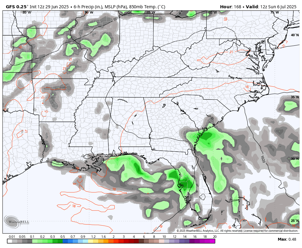
The National Hurricane Center is highlighting the area around Florida for potential development over the next week…

A little home-grown tropical development may be as good as we can get for a while as the Atlantic doesn’t look entirely ready to start spitting out storms just yet.
As usual, I leave you with your storm tracking tools for the day…


Current watches

Possible Watch Areas

Make it a magnificent Monday and take care.

We totally missed and had no rain at all yesterday (Sunday).. Wasn’t that supposed to the one of the better chances of rain the last week? We ended up getting the storms on the days with the LEAST chances of rain. LOL
The briefest of showers. Maybe today will be better.
Typical July weather forecast. Not a drop of rain here in Maple. The temperatures are about normal though. After the 4th, I’m ready for Fall weather discussion.
At this point… why wait?
https://www.almanac.com/fall-weather-forecast
New camera on Mountain PKY
https://api.objectspectrum.com/apps/vue/report:latest?token=c35886bf-9b98-4be0-b2ec-7781fdf1d90d&timezone=America/New_York&scope=vue_kdt1&camera_key=54f06fc6-4804-4d64-b740-914322823075
Beautiful part of Kentucky.
It’s not really dry at all.
In central Warren County, I’ve recorded less than 3 inches of rain for the entire month of June. Add to that 6 days in a row where the high temperature ranged between 95° and 99° and that translates to it’s getting a bit parched around here…
Regarding that area of tropical development, I doubt that it will amount to much, as it’s surrounded by an area of moderate shear, which will limit convection and development.q