Good Tuesday and welcome to July! The 7th month of the year is starting out with a cold front crossing the state, bringing a few more strong thunderstorms along for the ride. Much better air comes in behind it before we briefly toast it up for the traditional weekend that follows the 4th.
Scattered showers and storms will be out there this morning with a bit of an increase into the afternoon. The chance is there for strong to severe storms across parts of central and eastern Kentucky with local wind damage the main player.
The Storm Prediction Center has a Marginal Risk for parts of the region…

Temps today range from the upper 70s to middle 80s along and ahead of the front.
Comfy air comes in behind this with Wednesday and Thursday feeling pretty darn awesome!
Temps for the 4th of July hit 85-90 with a mix of sun and clouds. Humidity levels are in pretty good shape.
Temps and humidity levels climb this weekend with lots of highs reaching the upper 80s to low 90s. A few of the typical hot spots will do it a touch better than that as isolated showers and storms blow in.
Showers and storms increase ahead of a cold front set to arrive early next week. That’s the first of several systems dropping through the region, increasing the threat for showers and storms and decreasing our temps.
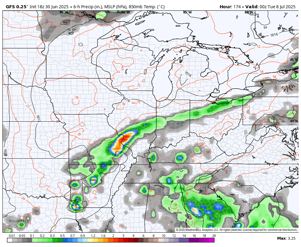
The GFS shows this well from next Monday through July 16th…
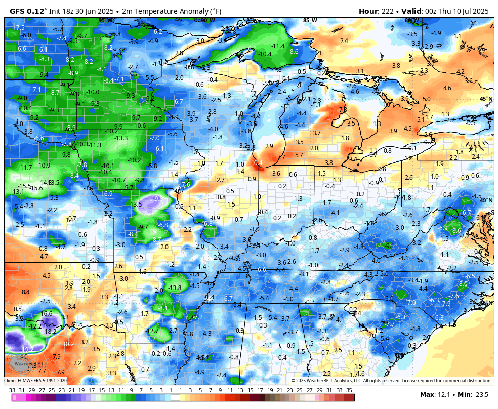
That same run of the GFS matches recent runs of the EURO and EURO Ensembles in showing temps trying to go below normal…
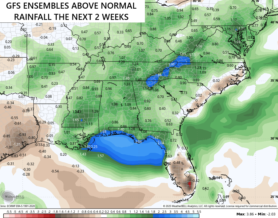
The GFS Ensembles are seeing the stormy potential for the next few weeks as they show above normal rainfall from the Gulf Coast into our region…
The GFS Extended goes all the way into the first few days of August and is even more robust…
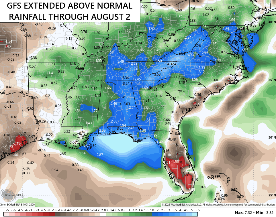
I suspect some of that may be tropical moisture associated with a disturbance or two forming around Florida. Will they develop into something? Maybe, and that’s why the National Hurricane Center is highlighting this area for possible development in the next week…

As usual, I leave you with your storm tracking tools for the day…


Current watches

Possible Watch Areas

Make it a terrific Tuesday and take care.

Here in Maple we finally received a little over an inch of rain yesterday, which brings our total for June at 5 inches. The maximum temperature for June 93 degrees, and the minimum 48 degrees. Not really a bad Summer so far.
No it hasn’t Schroweder, just to much moisture in my area only complain I got.
Not buying the models snake oil.