Good Tuesday to one and all. Our cold front is dropping in and slowing down leading to rounds of showers and storms through the week. The overall pattern looks rather stormy for the next week or two and this may actually settle in for the long run.
The front is on top of us today and that means the greatest risk for showers and storms is across the southern half of the state. Once again, there’s the chance for a few strong or locally severe storms with the Storm Prediction Center highlighting this across the west…

The rain in the coming days isn’t constant, but we will be dealing with showers and storms each day. With so much moisture available in the atmosphere, locally heavy rains will be a good bet when storms do roll through your area through the week and weekend.
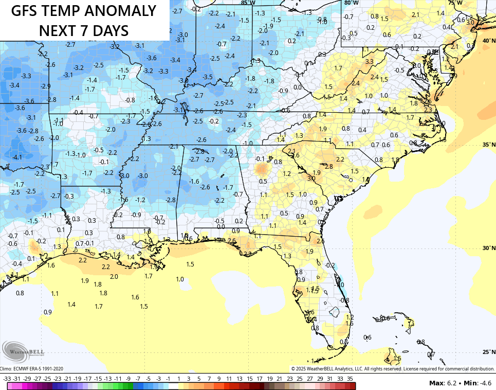
With the front around and the daily threat for some storms, temps over the next week are likely to average below normal…
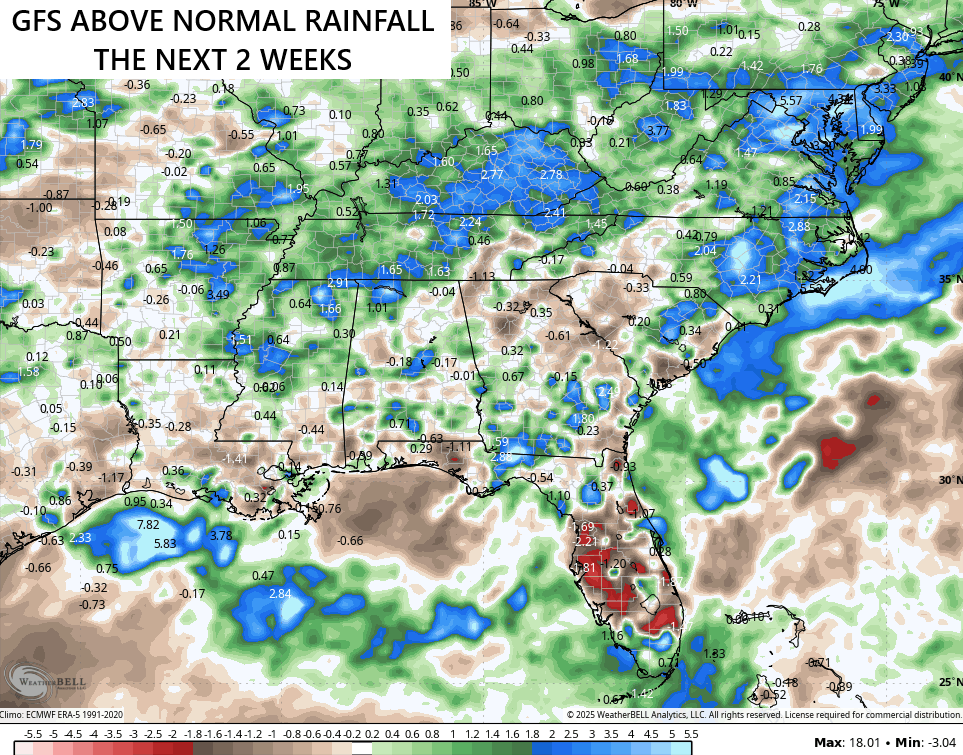
More in the way of showers and storms will be around next week and the models are picking up on the potential for a lot of rain. The GFS is showing much above normal rains during this two week period…
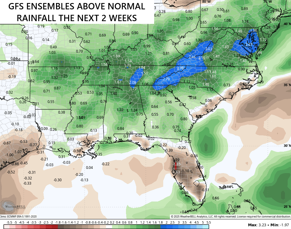
The GFS Ensembles have a similar look over the same period…
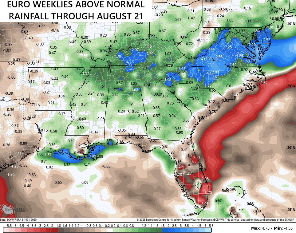
The EURO Weeklies go all the way through August 21st now and they are also on board for above normal rains through that date…
I’m concerned about the flash flood potential in the coming days and weeks as the atmosphere is loaded with moisture!
I leave you with your storm tracking tools for the day…


Current watches

Possible Watch Areas

Make it a terrific Tuesday and take care.

We had. 0.25” on 6/25 and 0.30” on 7/1. Otherwise, zippo. Combined with abundant sunshine and hot breezes, the neighborhood turf is stressed (except for those rare yards with irrigation systems).
I hope these models don’t verify.
My area of Warren County, just south of Bowling Green, picked up 0.75″ of rain last night. It was the first rain to hit my neighborhood in the past 10 days. On each day during that period, the heat index had exceeded 100°F, so the rain was more than welcome. Regional rainfall for the year remains above normal.
10 days is no big deal.
ENSO / neutral + negative PDO = a wet Summer for many, but will be scattered areas to receive such.