Good Monday, everyone. Rounds of showers and thunderstorms are getting ready to take control of the pattern once again. This all too familiar setup will bring the potential for local flash flooding issues this week and, likely, into next week.
A cold front drops into the region today, bringing scattered showers and storms along for the ride. This front slows down and stalls out as waves of low pressure roll along it this week and into the weekend…
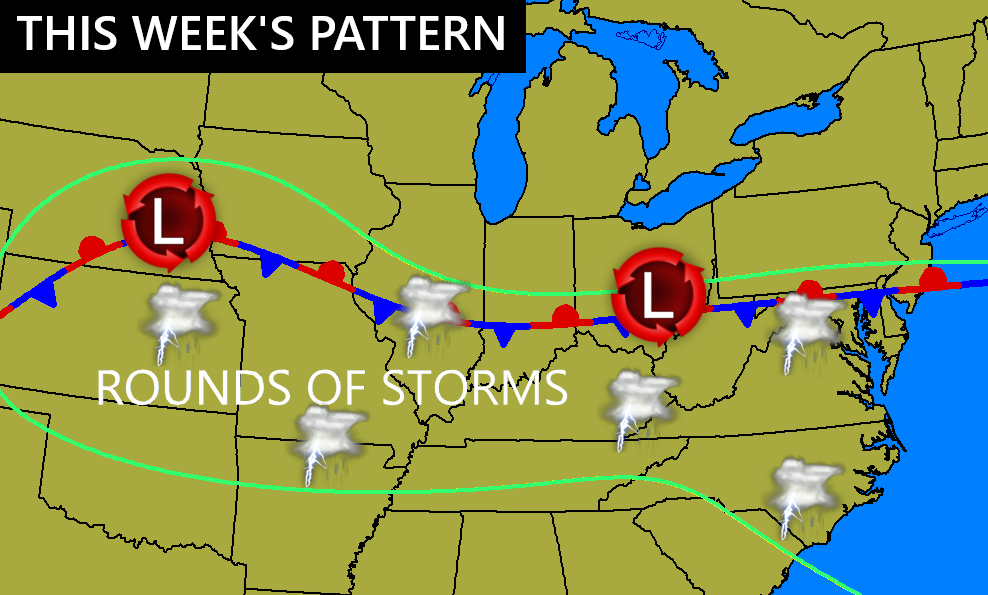
This sets the stage for locally heavy rains with most areas picking up a general 1″-3″ from today through this weekend. As you know, thunderstorms can drop a lot more than that in a short amount of time and that’s my concern.
We are moving into the height of flash flood season in our part of the world, so let’s stay alert to any slow-moving storms.
Can we get a few strong or severe storms? Maybe, but this isn’t a setup for widespread severe stuff. Instead, we may see something similar to a few weeks ago with pulse severe storms go up and produce hit and run wind damage.
Here’s today’s Severe Weather Outlook from the Storm Prediction Center…

This low-end risk may carry parts of the region into Tuesday…

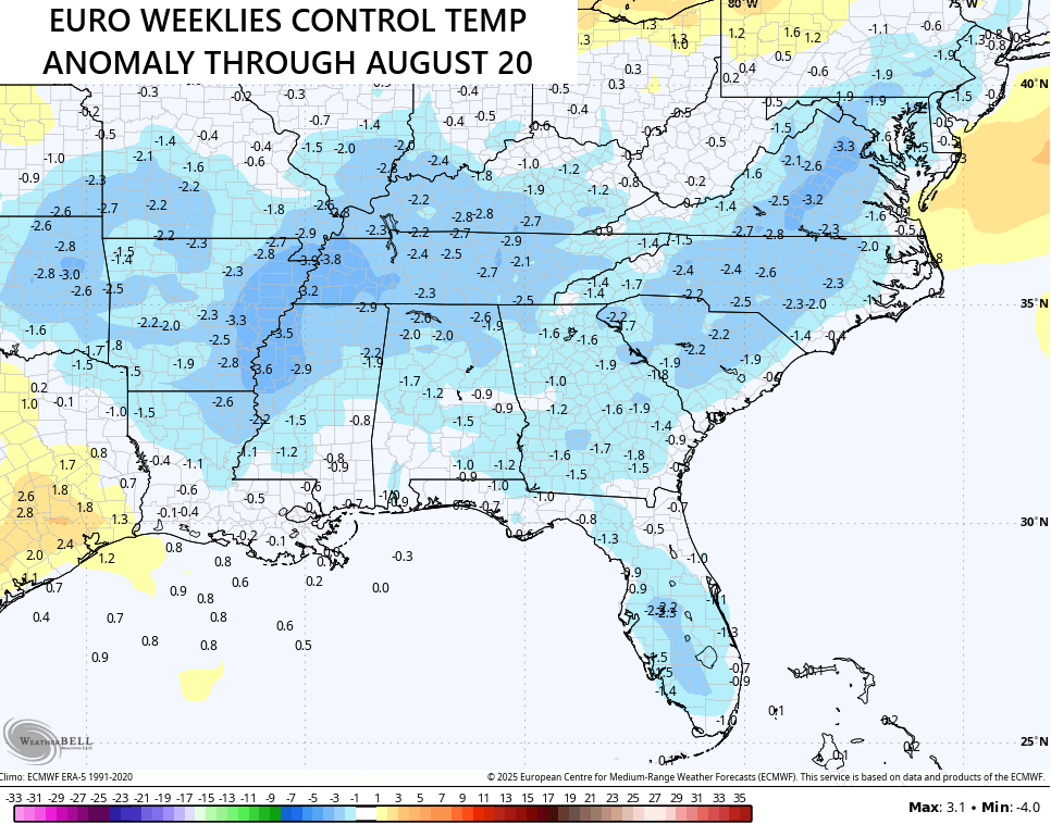
Temps this week will be held a bit below normal, so there’s your tradeoff.
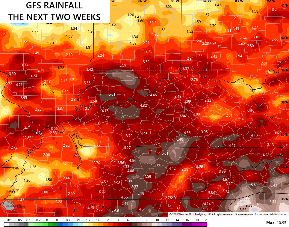
Additional rounds of showers and storms will show up next week and the models are certainly seeing the potential for some hefty rains over the next few weeks…
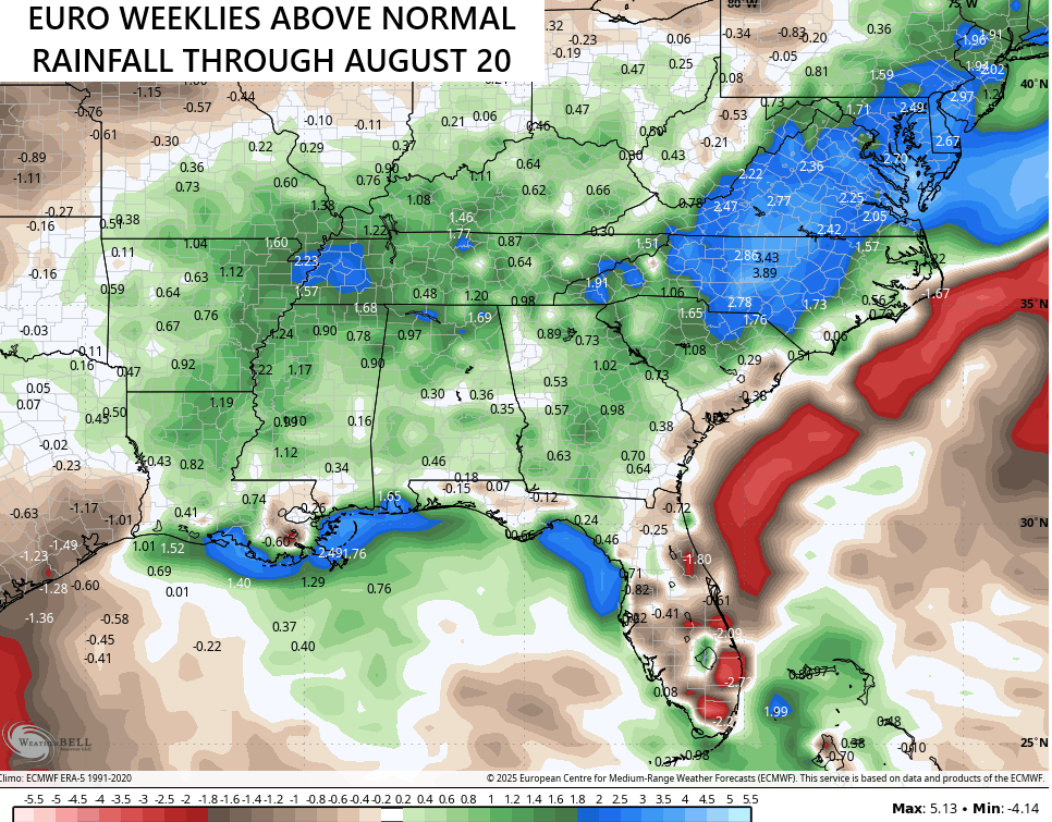
The latest from the EURO Weeklies shows above normal rainfall through August 20th…
That same run keeps our temps close to normal during this same time period…
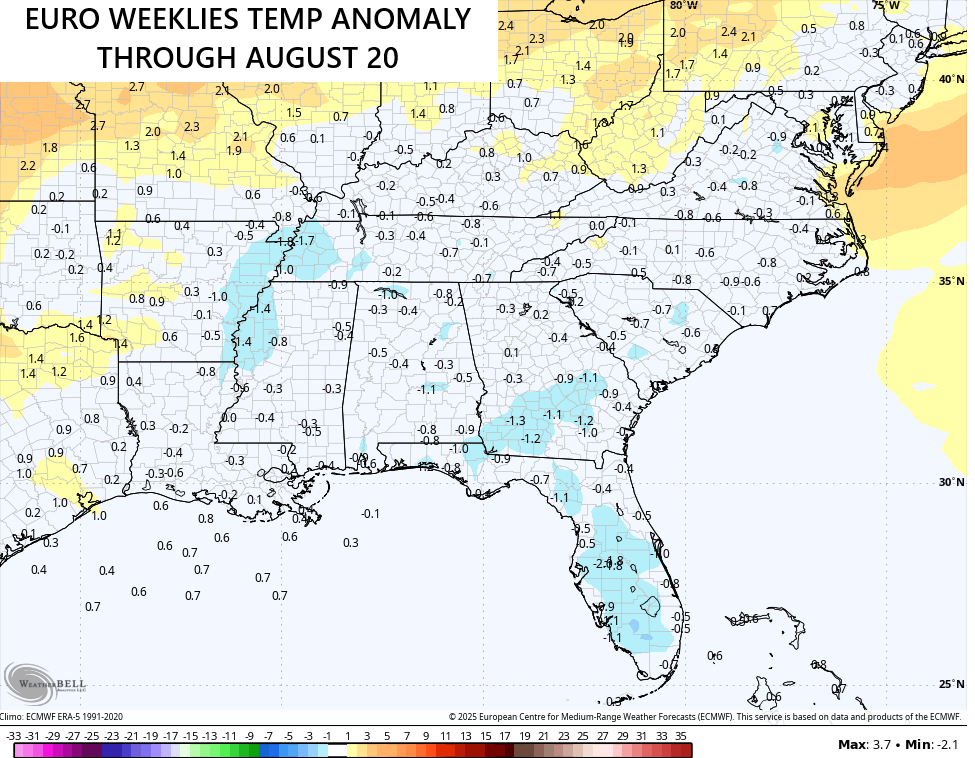
The control run of the Euro Weeklies shows temps going below normal…
I leave you with your storm tracking tools for the day…


Current watches

Possible Watch Areas

Make it a magnificent Monday and take care.

I didn’t realize we had a flash flood season. I thought this area is at risk for flash floods throughout the year. Isn’t January our wettest month ever? Almost 17 inches? I think it was 1950 Jan… I guess it makes sense though, since those thunderstorms which mostly happen in summer can drop tons of rain
Typically, May is the rainiest month.
ENSO / neutral plus a negative PDO equals above normal rainfall for the rest of Summer. If it stays in ENSO / neutral with a negative PDO, through the Winter, the Western part of the CONUS will have above normal temperatures, and the Eastern CONUS will have below normal temperatures, but if La Nina comes into play during the Winter months, all the action will shift to our northern borders. We Snow lovers in Kentucky won’t enjoy that.