Good Sunday, everyone. It’s another day of toasty temps with a few storms going up across Kentucky. As we roll into the week ahead, we are seeing much more of a stormy signature showing up and it’s one that may cause a few local issues.
Temps today are back into the high 80s and low 90s for the entire area. Humidity levels continue to rise a bit, but again, this is nothing like a few weeks ago.
A few showers and storms go up through the day, especially this afternoon and evening. Here are your Kentucky Weather Radars to follow whatever is out there…

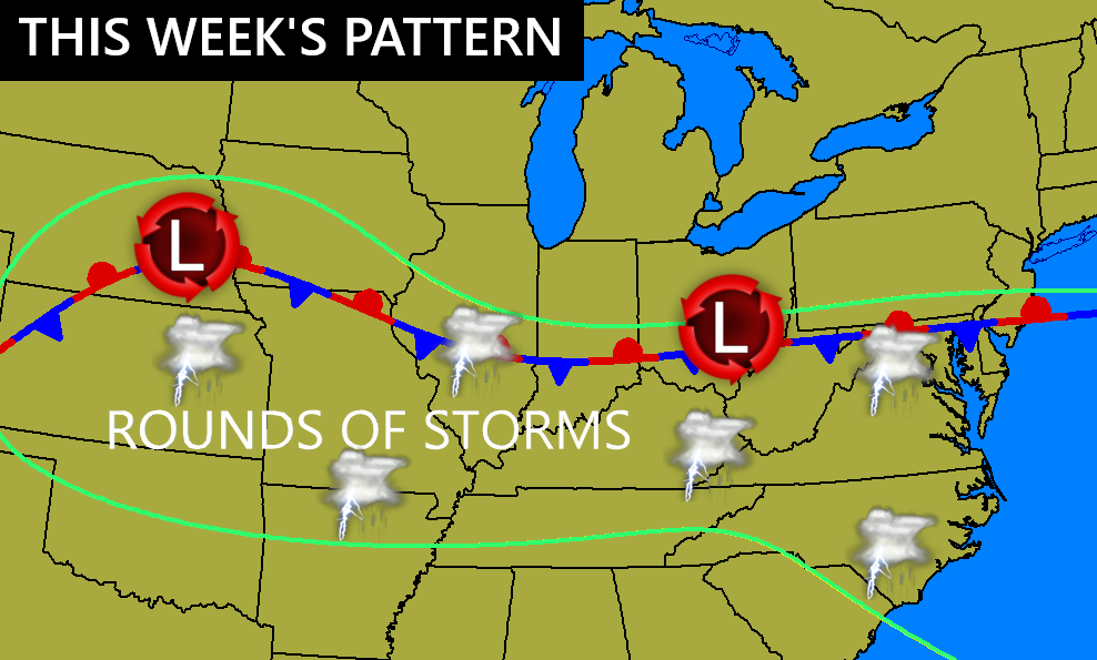
A better chance for showers and storms arrives Monday as a cold front drops in from the northwest. This boundary gets in and slows down on Tuesday. Once in here, it kinda hangs around in some fashion all week. Throw in some waves of low pressure along it and you get some rounds of showers and storms rolling through the region…
There’s a lot of tropical moisture available along and just south of this boundary and that shows up well in this Precipitable Water animation from the GFS…
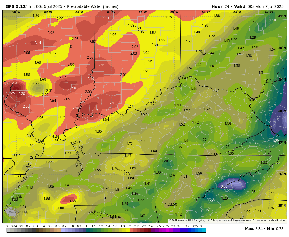
PWAT’s going above 2″ is a good indicator for storms that can produce local flash flooding issues. The GFS is seeing the potential for torrential rains with this rainfall forecast…
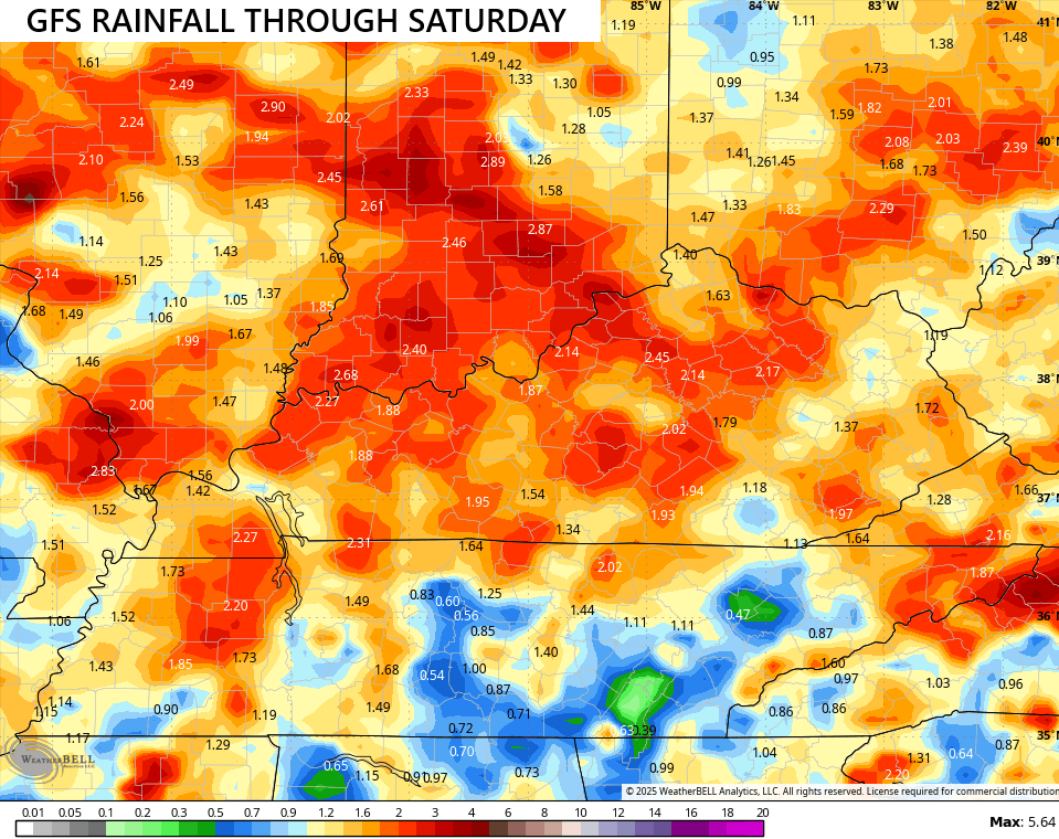
Keep in mind that individual thunderstorms can dump a lot more than that.
Additional showers and thunderstorms show up next weekend into the following week as a big dip in the jet stream shows up. As that lifts out, the potential is there for the Gulf to really open up and throw deep tropical moisture into our region.
Speaking of tropical… Tropical Storm Chantal is making landfall early today just southwest of Myrtle Beach…

Here’s what that looks like on satellite…

Have a sensational Sunday and take care.

Here’s to hoping we don’t get too much rain. We don’t need a lot.