Good Saturday, everyone. Our weekend is off and running with typical August temperatures across Kentucky and surrounding areas. Once we get into the week ahead, rounds of showers and storms look to kick back in.
Highs this weekend range from the mid and upper 80s across the eastern half of the state to the upper 80s and low 90s west. Humidity levels aren’t too bad for this time of year. There’s also the chance for isolated showers and storms going up, but most areas stay dry.
The potential for showers and storms ramps up in the week ahead, especially from later Tuesday all the way through next weekend. There’s some tropical moisture out of the Gulf that gets drawn northward into our region. This interacts with a front dropping toward us and slowing down and those will help fire off some storms.
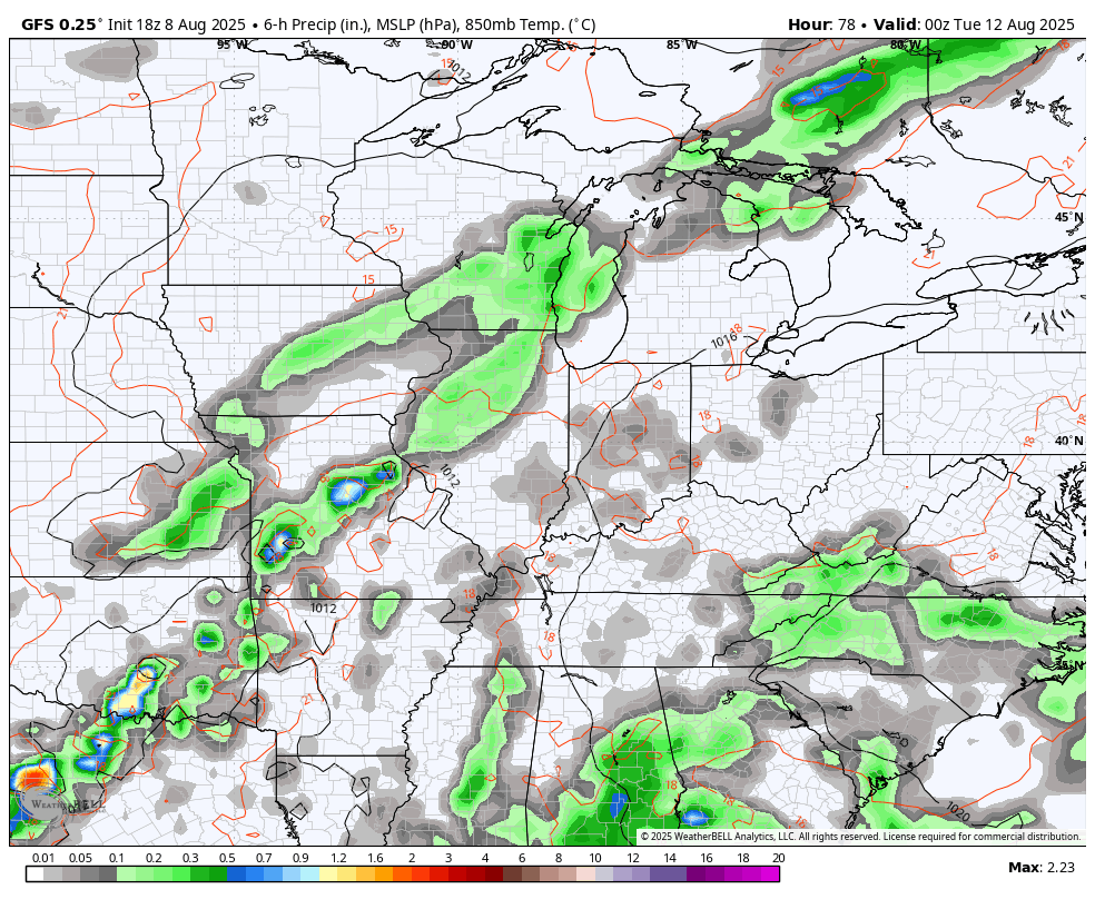
Here’s the GFS from Monday evening through next weekend…
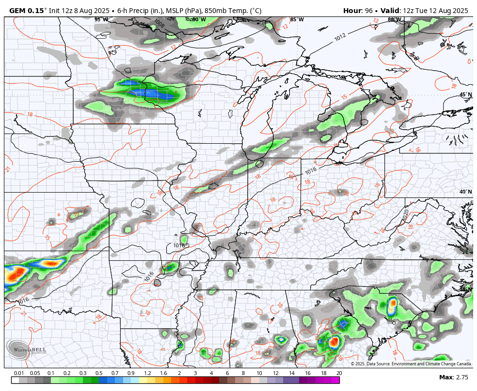
The Canadian has a similar idea…
The tropical Atlantic continues to look active over the next few weeks, especially with the system now coming off the coast of Africa. The National Hurricane Center is now highlighting that system for development over the next 7 days…

The latest from the EURO Ensembles continue to show this system developing as it gets closer to the Caribbean in the next 10 days. There’s a little more spread with the individual runs compared to the past few days…
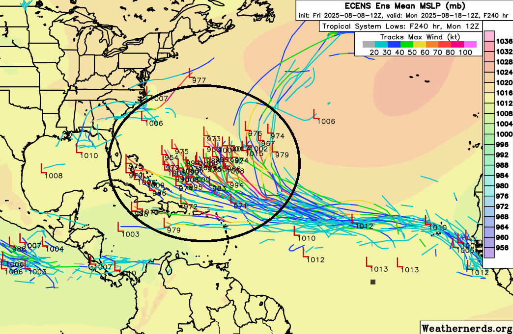
Now… there’s a ton of uncertainty with any tropical system from this far out, so it’s a HUGE ask of the models to try to figure things out. Big swings from run to run are likely for the next several days.
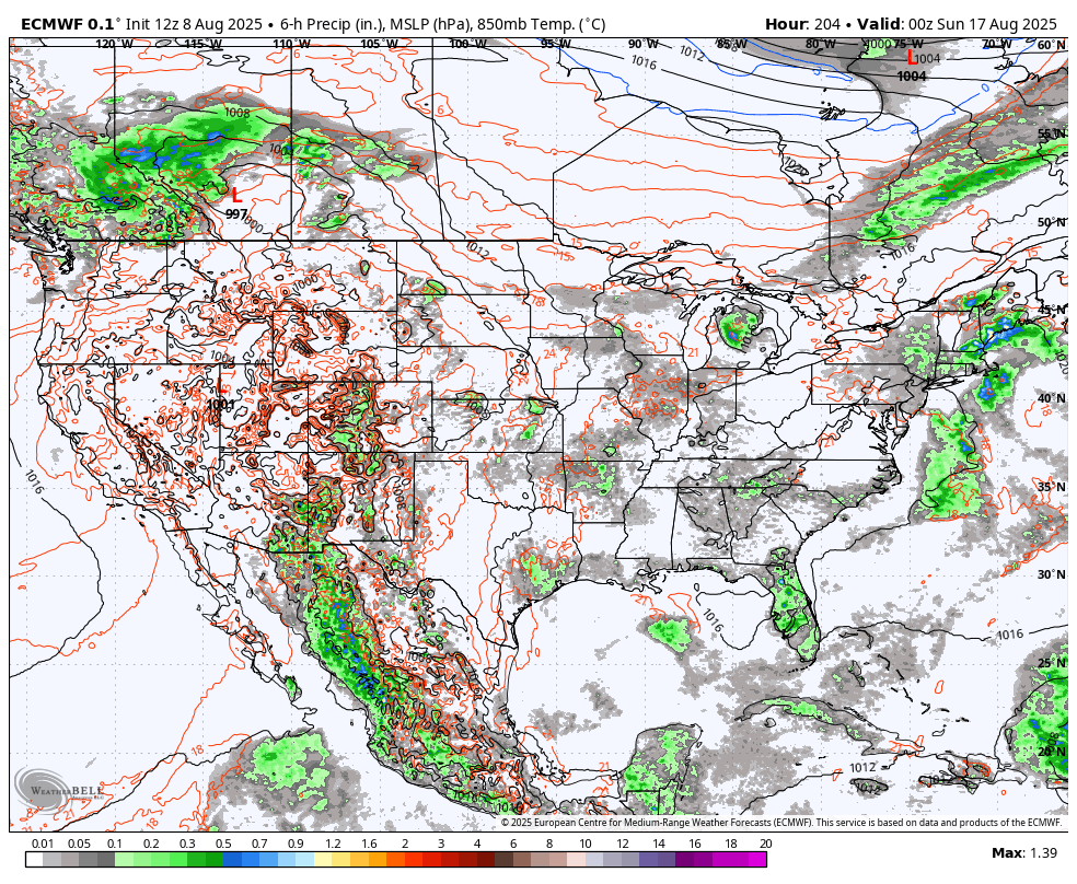
For fun, the latest EURO decided to go from a Gulf storm to one going up the east coast…
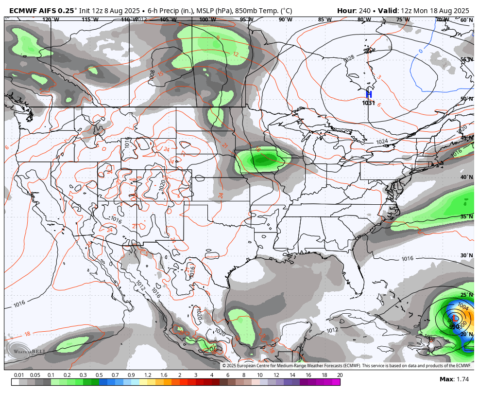
To further illustrate the wild model swings that typically happen from this far out, look at the EURO AI on back to back runs.
The morning run had this along the east coast…
The very next run went into the Gulf…
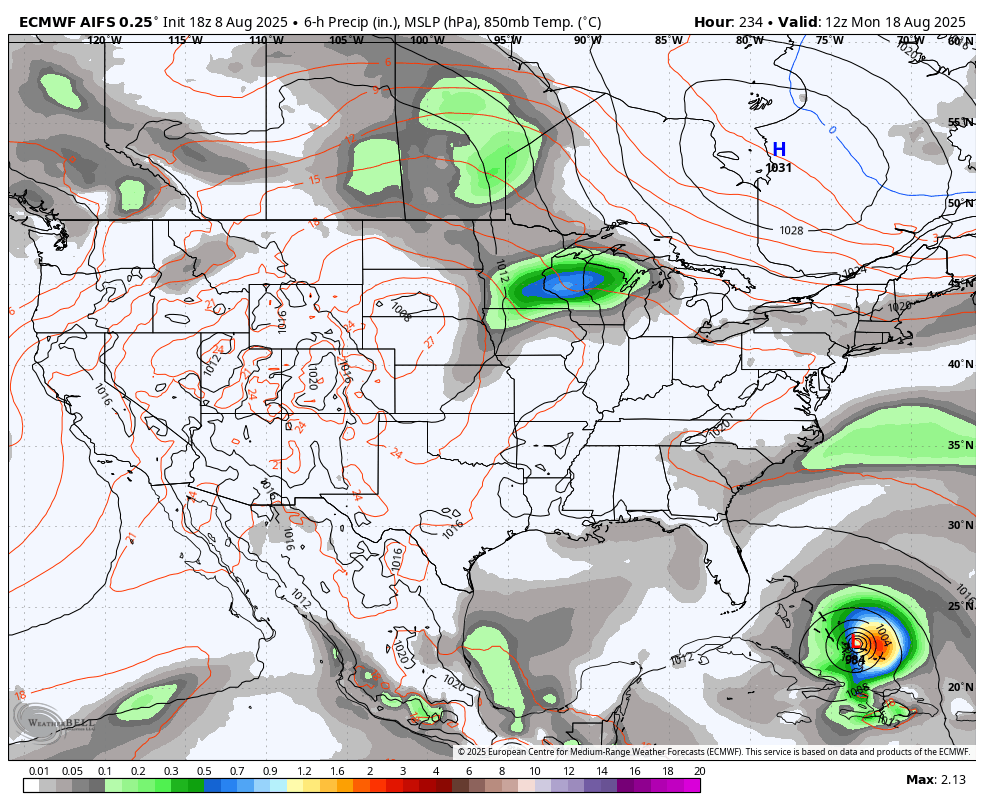
Even AI isn’t immune to large swings, folks.
I leave you with your isolated showers and storms tracking toys…


Make it a sensational Saturday and take care.

Thanks Chris. The various models are having to deal with the ” Marine Heat Wave ” that is now on going in the Tropical Atlantic. Unusually, very warm ( Surface Sea temperatures ) in the Gulf and Caribbean is enhancing the prospects of Tropical Storm development. In the Pacific, unusually cold ( Surface Sea Temperatures ) are continuing off the coast of California, but there is slight indications in recent days of some warming occurring in this region. The record ( negative four ) July reading of the ( Pacific Decadal Oscillation ) may make a run towards the positive later this month. Sure hope this happens.
Attach this to the above :
https://www.weatherstreet.com/hurricane/sea-surface-temperature-atl.htm
That first model run of the Euro AI showing a Tropical Storm moving up the East Coast would be a Major Blizzard, if it occurred in December. Just thought I would bring that to everyone’s attention just for fun.