Good Friday, everyone. We are closing out the week on a very familiar note as the pattern today is very similar to each of the past 4 days. Once into next week, the pattern starts to become more active as we watch the tropics start to do some serious flexing.
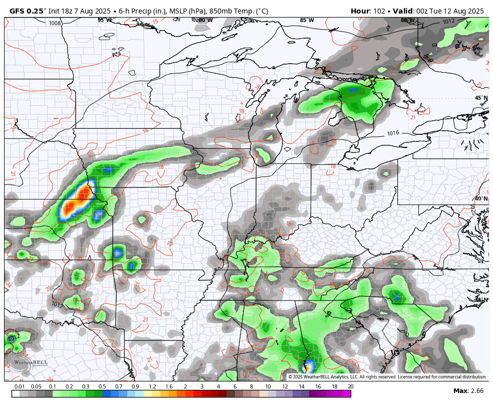
Temps out there today range from the low and mid 80s in the east to around 90 in the west. A dry morning will be followed by an afternoon featuring scattered showers and storms going up. Just like each day this week, pockets of flash flood producing rains may show up.
The weekend fins isolated storms around with upper 80s in the central and east and a few low 90s west.
The chance for showers and storms then increases early next week as a cold front drops closer to us from the northwest. This slows down very near or on top of us with the end result being a good shot for clusters of showers and storms.
This animation goes from Monday evening through Friday evening and illustrates my point…
The tropics continue to come to life and will really wake up later next week into the following week. The National Hurricane Center has two systems of interest for the next 7 days…

The most likely development on that map should develop and be another fish storm, staying well out into the Atlantic. The models are insisting on a big system coming off Africa next week, developing it and barreling it westward.
The various members of the Euro Ensembles develop this system, taking it toward the Caribbean in the next 10 days. I’ve circled this area, showing the clustering of these individual member tracks…
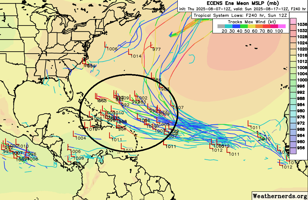
Now, that’s a long way out there and any POSSIBLE impact on the United States is even farther out in time. Models are ONLY to be used for trends in this time period to begin with, especially with tropical systems.
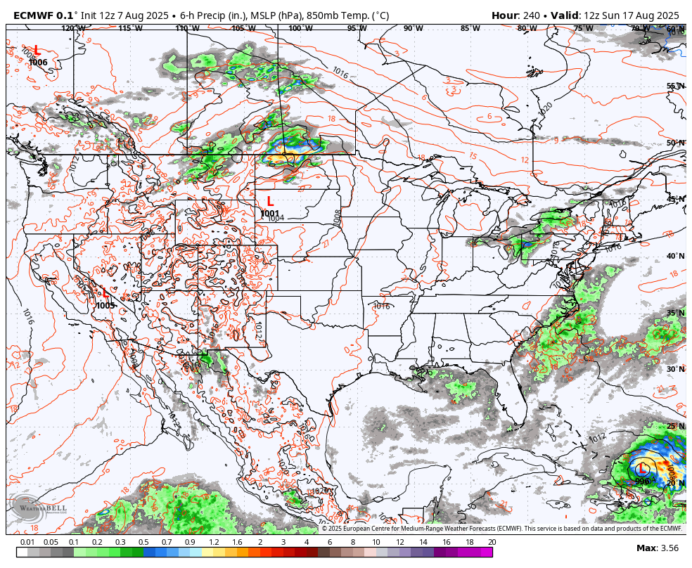
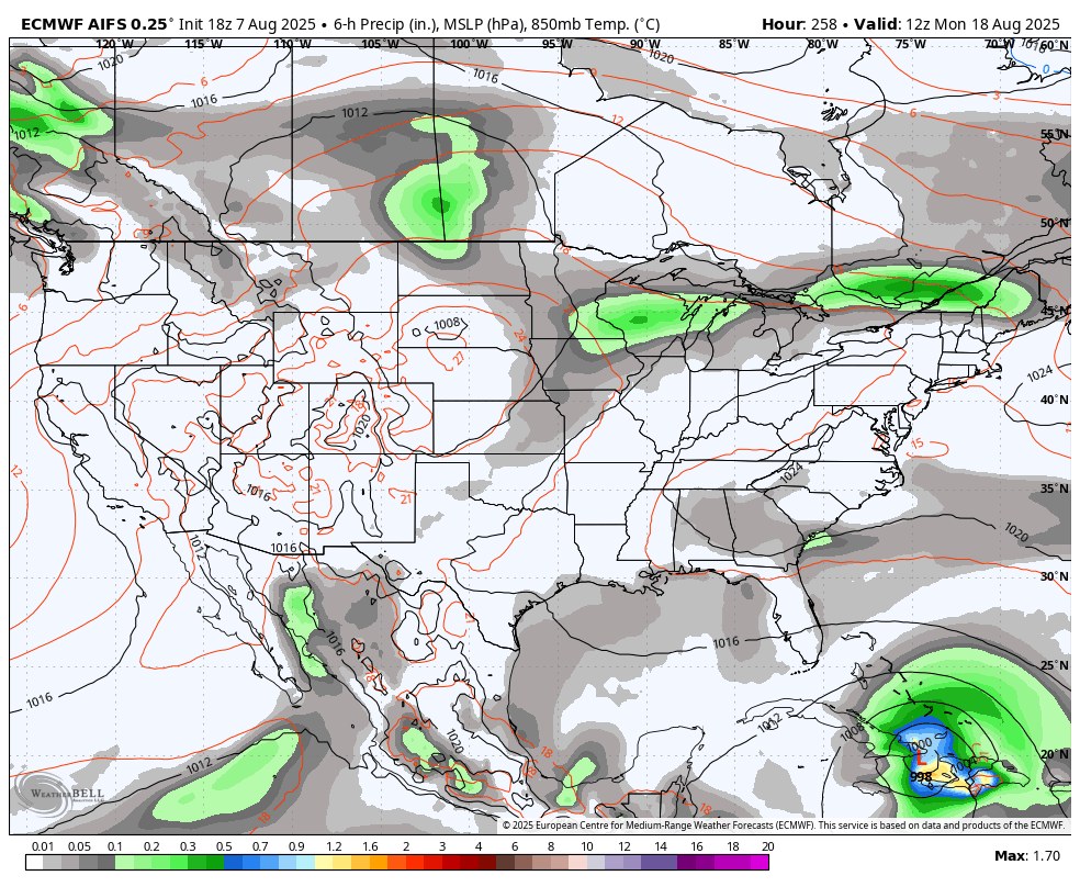
Still, the EURO and AI version of the EURO have had a threatening look over the past few days they continue to indicate this as something to watch…
EURO
EURO AI
Meanwhile out in the Pacific we find Tropical Storm Henriette looks to just miss Hawaii to the north and east…

Here are your tracking tools for the day…


Make it a fantastic Friday and take care.

Thanks Chris. The upper level ridge will isolate showers more today than yesterday. Looking like my County of Taylor is going to continue to be dry for quite sometime ? Well, that’s Mother Nature.
The MJO is currently in phases 1 – 3, which would Increase Tropical Storm ( Cyclonic Activity ) in the Atlantic and Eastern Pacific. Hope they all are ” Fish Storms, ” as I have Family living in Florida along the Gulf.
July 2025 featured a record PDO ( Pacific Decadal Oscillation ) of a negative 4.00. Never had a reading this much in the negative since the PDO monthy readings have been given. I don’t know, but this may have quite an impact on the World’s Climate.
https://www.weatherstreet.com/hurricane/sea-surface-temperature-atl.htm
I believe that the Euro models are on to something. Levels of Saharan dust coming off the African coast, which suppresses tropical system development, are lowering after being at record levels since spring. This will spur the creation of tropical waves in the equatorial Atlantic, where the sea surface temperatures are at record high levels. The upper air flow is the persistent east to west movement we would expect with an ENSO-Neutral weak La Nina condition. Finally, the mid Atlantic is relatively free of the shear which usually impairs tropical system formation.
So all the pieces are in place, and I would not be surprised to see this region produce several major hurricanes over the next 4 to 6 weeks.
I agree Joe. It’s just a waiting game in the Tropical Atlantic. No shear plus above normal SST is a “powder keg ” about to explode.
Typical August weather nothing new. Hope the models are wrong about the hurricane forecast. The whole country has suffer enough for the past 2 years.
Our Country has suffered longer than that. I’m not just talking about weather events.
True Schroeder
The PDO being a negative 4.00 is somewhat alarming to me, as this has never happened. It seems like the PDO is stuck in the negative, and ENSO / El Nino is completely erased from the World. Here’s the link that explains it calling it the ” New Normal. ” I feel something BIG ( weather event ) is going to happen that changes the World’s climate.
https://climateimpactcompany.com/
Here’s an article my Sister sent me from Florida :
https://www.fox35orlando.com/news/florida-faces-potential-heightened-risk-intense-hurricanes-due-marine-heatwave.amp