Good Thursday to one and all. It’s another day with scattered showers and storms as temps slowly get back to normal levels for this time of year. As we get into the next week and change, the tropics look to flex on the overall setup.
Scattered showers and thunderstorms will go back up this afternoon and evening, especially across the eastern half of the state. This will be surrounded by some sun and clouds with temps 85-90 in the west and middle 80s east.
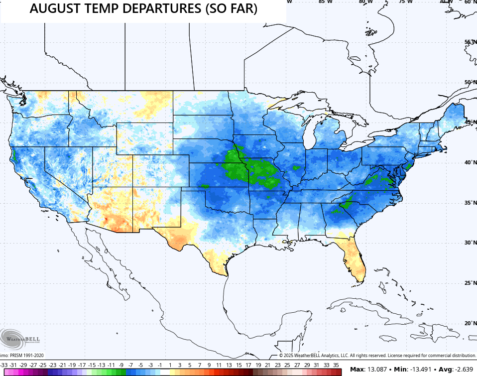
These normal temps are on coming after a super cool start to the month across much of the country. Look at the temperature departures so far…
Temps continue to inch up a bit into the coming weekend with the chance for a shower or storm to go up, but much of the time looks dry.
The threat for showers and storms will increase into the first half of next week ahead of a cold front dropping in from the northwest, bringing an increase in showers and storms…
The tropics are percolating and will eventually become a big player in the overall pattern for the second half of August. The National Hurricane Center continues to watch a few systems for the next week…

It’s likely to get very active during the second half of August and into early September.
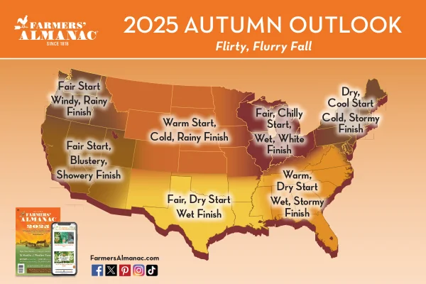
With fall just about upon us, it’s fun to look and see what the Almanacs are seeing for our region. the Farmers’ Almanac has us in the Fair and Chilly Start to Wet and White Finish…
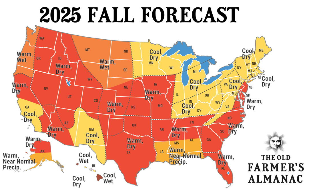
The Old Farmer’s Almanac isn’t nearly as descriptive as it puts us into the cool and dry category…
I’ll talk more about fall and throw out my super early thoughts about winter in the coming days.
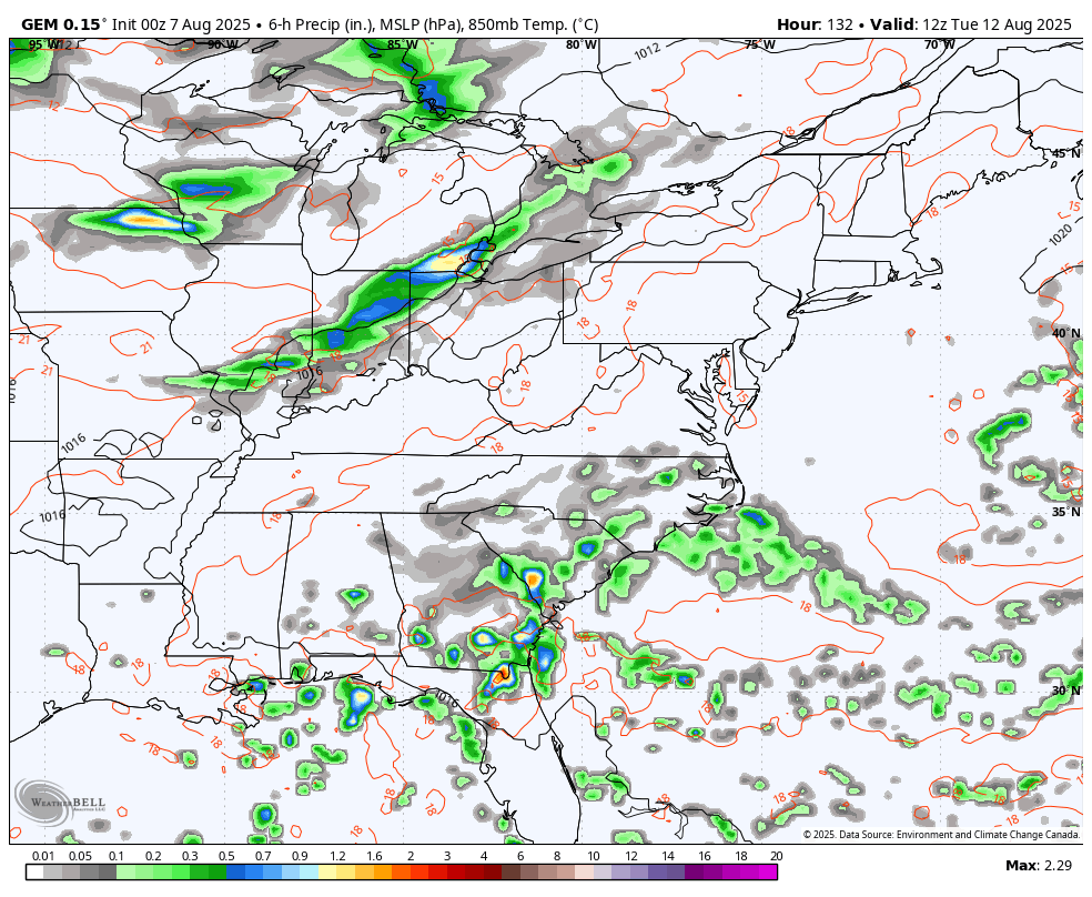
Here are your tracking tools for the day…


Make it a great Thursday and take care.

Thanks Chris. I don’t put much stock in these Fall and Winter forecast. Looking forward to your thoughts on Fall and Winter 2025 – 26 in the coming days.
Here’s NOAA’S long ranged forecast for Fall 2025 :
https://www.cpc.ncep.noaa.gov/products/predictions/long_range/seasonal.php?lead=2
I remember when NOAA came out with their Fall and Winter outlook back in 1969 – 70. I was a Senior in High School. It read, expect ” A Colder, Drier Fall and Winter, ” and they were Right On. We had Colder temperatures, and more Snow than Rain that Winter. I looked up what phase ENSO was in that Fall and Winter 1969 – 70. We were in a Weak ENSO / El Nino operating in a Positive PDO.
Thanks for the link. Gosh Schroeder, they show the whole country as being warmer than usual to some extent this winter! Not sure I’ve ever seen this before!
late reading the blog today… Literally as I type this the only shower on the entire radar is popping right over my area. it’s so weird I’ve seen this happen more than once in the past where it just randomly pops up right over my area with nothing else on radar anywhere…. then other times we get totally missed.
I think Lexington has a Rain Maker in town. LOL…
It’s been a really weird. Like each day, some part of Fayette county get inundated with rain. And on the radar, they just look like thunderstorms, but there’s literally no lightning and thunder. I don’t get it. Especially with the intensity of the rains. I think Chris posted near Fayette mall got over 3 inches today.
August hasn’t been super cool. It’s been slightly below average at best.
It’s 2 in the afternoon and it’s literally 70 F at my house
Eighty four degrees and partly Sunny here in Maple. I wish we would receive one of those issolated showers.
Because of an isolated shower. It’s 86 here in Richmond.
Low to mid nineties is in my forecast for next week.
Thank goodness for all the global warming or we would all be freezing in August.