Good Monday, everyone. It’s a brand spanking new week and the overall weather pattern undergoes some changes. These changes bring an increased threat for tropical downpour producing showers and storms. The setup after this may very well feature a big hurricane in the Atlantic and a deepening trough sweeping into the eastern half of the country. How will those two interact?
Temps today are seasonable for the middle of August with a couple of showers and storms popping up this afternoon and evening. This won’t be terribly widespread, but that looks to change a bit as early as Tuesday.
That’s when some deeper tropical moisture sneaks in from the Gulf and interacts with a cold front dropping into the Ohio Valley from the northwest. This boundary will ignite showers and storms through the end of the week…
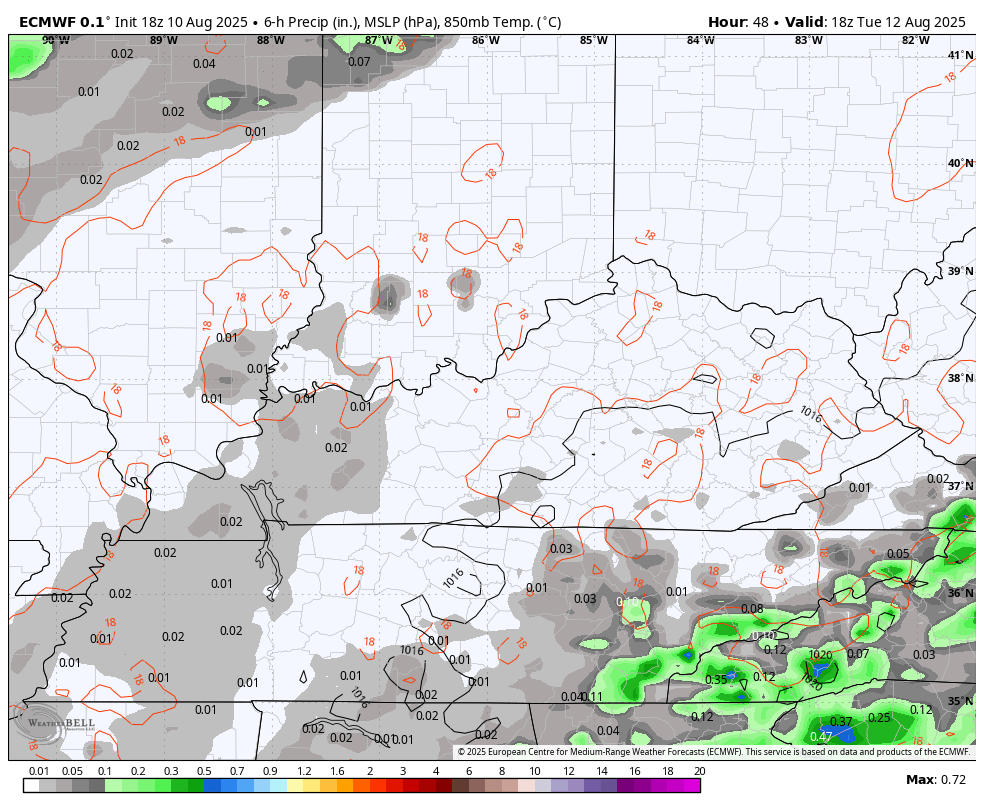
This setup can produce local high water issues, so let’s keep that in mind.
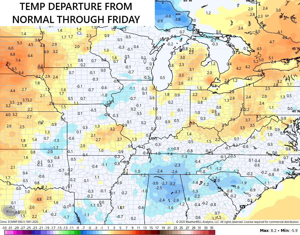
With the increase in shower and storm chances, temps will also be held in check somewhat. The 5 day average temps starting today show this from the Ohio Valley into the deep south…
Let’s get to the tropics where you may very well have a Tropical Depression or Tropical Storm Erin by the time you’re reading this…

This is the storm I’ve been talking about for a while now and you can see it, and another wave coming off Africa behind it, on this wide view of the tropical Atlantic…

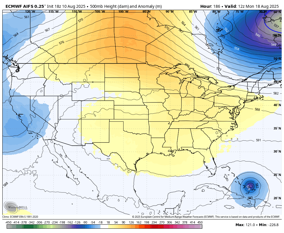
This storm is still more than a week away from POTENTIALLY impacting the United States. The latest from the EURO Ensembles show a system trying to turn north into the open Atlantic before it can get far enough west to impact the USA…
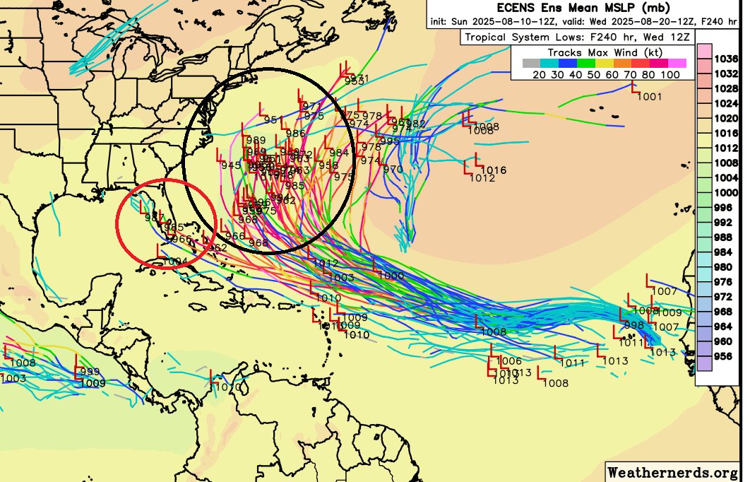
There were a few renegade members taking this thing toward Florida and I circled those in red.
The operational models are doing what we said they would and are showing some pretty wild swings from time to time. That said, we are noticing all of them going toward a deepening trough trying to get into the east around the same time as Erin is approaching. The timing of this trough is likely the key as to what track Erin takes.
The EURO has our hurricane just missing the east coast with that trough developing behind it…
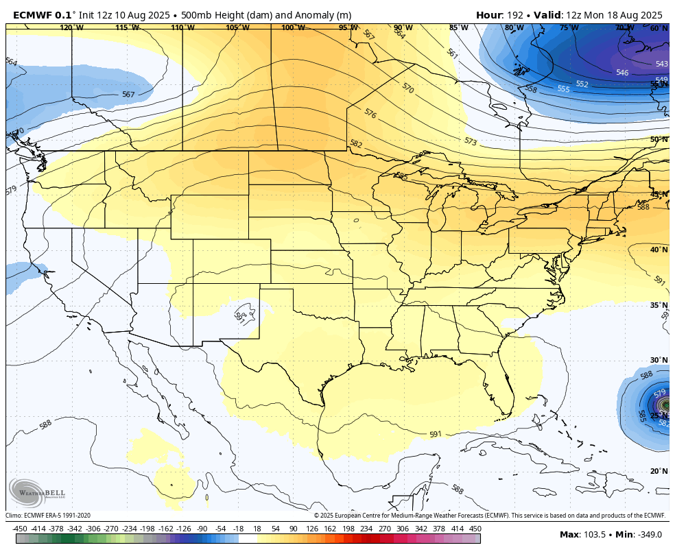
The AI version of the EURO is farther west with Erin as it rides the east coast with the trough digging in behind it…
It’s going to be interesting to see how this plays out, but folks along the east coast need to stay alert.
BTW, the air coming in with that trough later next week may be pretty darn cool around here and much of the eastern half of the country.
I leave you with your storm tracking toys for the day…


Make it Magnificent Monday and take care.

You can already feel the days getting shorter each day.
Of course it’s late Summer.
It won’t get too cool for a long time yet.
Time to let Summer go Jeff.
Incorrect take
Thanks Chris. I will be paying Close Attention, as I have a Really Uneasy Feeling about what may Happen in the Tropics, Especially around Florida.
Here in South Central Kentucky, I would Welcome one of those Slow Moving Rain / Showers before Cooler Weather arrives later next week. Until then ” We Bake in the Heat. “
https://www.weatherstreet.com/hurricane/2025/Erin.htm