Good Tuesday, everyone. Scattered showers and storms are back in all their summertime glory out there today. This action hangs around through the week before we track a nice jump in temps before the tropics and a trough take control.
Gulf moisture continues to stream into Kentucky and surrounding areas. This will combine forces with a front slowly sagging into the Ohio Valley to produce the afforementioned showers and storms.
The action is a little more concentrated during the afternoon and evening hours today through Friday. With the increased tropical moisture comes the potential for local downpours that can create some quick rises on creeks and streams.
The GFS is giving us a general idea of rainfall through Friday…
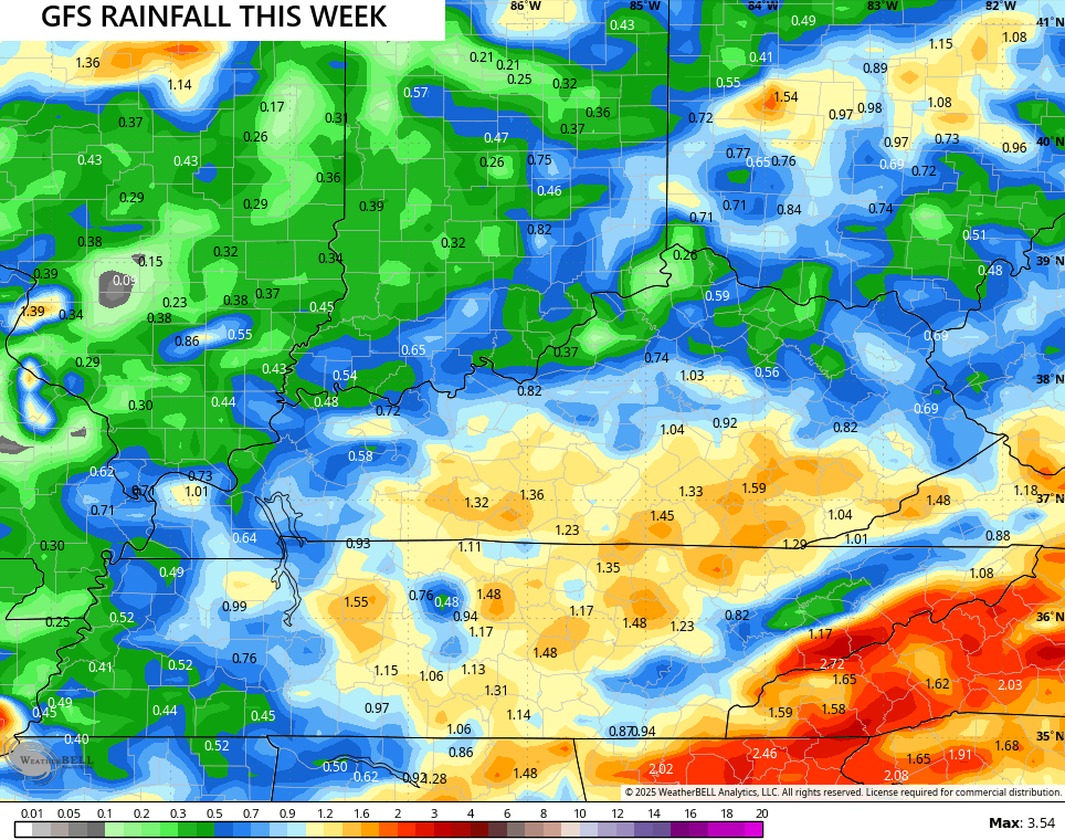
You can see the greatest chance for heavy rains being across the southern half of the state.
The threat for showers and storms decreases this weekend. As that happens, temps go up with 90ish a good bet for most of the state from Saturday through Monday.
During this time, the tropics take center stage with what will sone become Hurricane Erin somewhere off the southeastern seaboard. Erin shows up well on this satellite view of the Atlantic…

You can also see the disturbance behind that as it comes off Africa. That will be one to watch, as well.
Erin is forecast to roll toward the west northwest and should be a major hurricane by the weekend. Here’s the current 5 day forecast track from the National Hurricane Center…

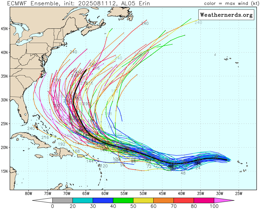
The latest from the EURO Ensembles show most individual members keeping Erin well off the east coast…
The latest from the operational Euro is showing a similar offshore track as a sizeable trough dives into the eastern half of the country…
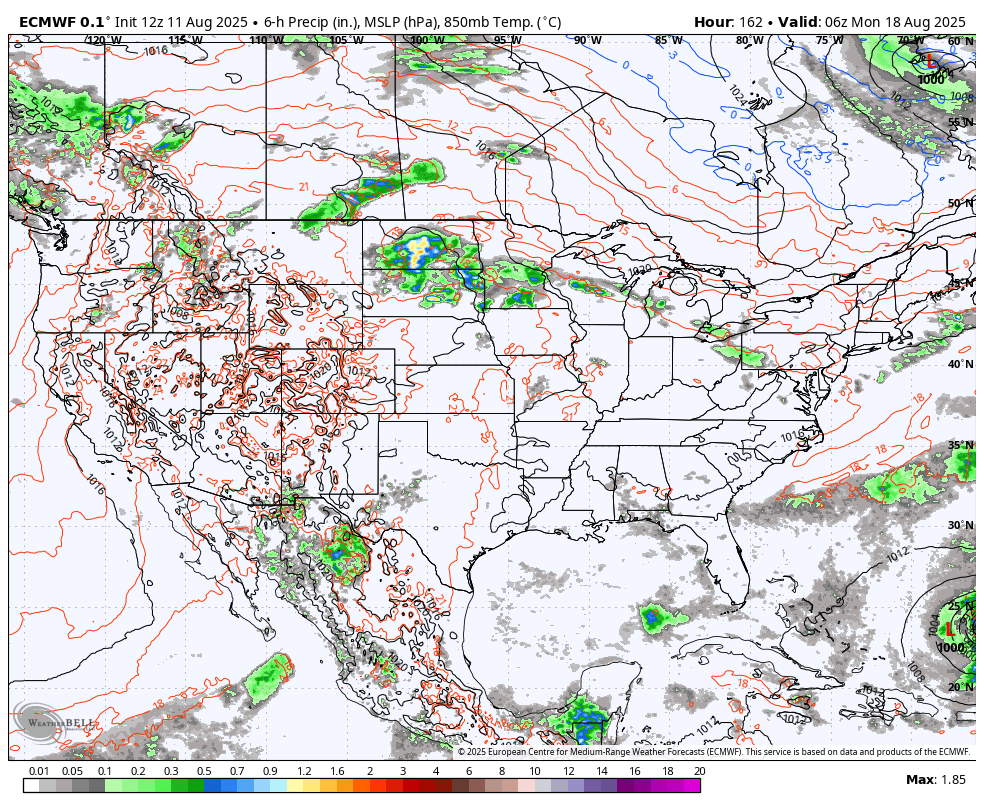
You will also notice the system coming after Erin showing up and getting to the Gulf (that’s still way too far out to even think about).
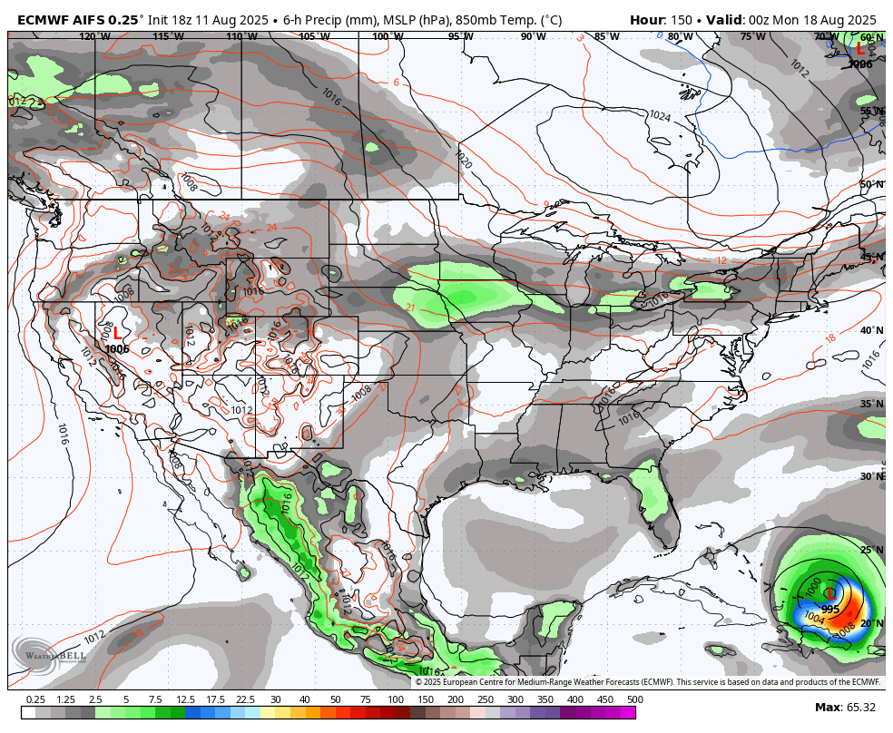
The latest AI Euro is a little closer to the east coast with Erin as the trough sweeps through. It also shows the follow up system…
I leave you with your storm tracking toys for the day…


Make it terrific Tuesday and take care.

Thanks Chris. Hoping there’s more of a chance of Rain / Showers today, and praying that Erin remains a ” Fish Storm. “
Not knocking on Chris, but were already in the 90’s here in my neck of woods. We had a little break when 1st week of August roll around we’ve been in the 90;s since late June. So ready for fall to come and enjoy the cooler temps.
Less than 45 days to go. We usually stop seeing 80 in early October.
Autumn will be here before we all know it. One thing about getting older is that time goes faster than you want it to. Mid – 90’s late this afternoon is a sure thing in my area. Don’t know if I would bet on any Rain / Showers.
Tropical Storm Erin is beginning to form an Eye Wall. See below :
https://www.weatherstreet.com/hurricane/2025/Erin.htm