Good Wednesday to one and all. It’s back to school day for a lot of kiddos across Kentucky and we have some scattered storms rumbling through for the big day. The scattered storms take a break this weekend as steam builds in, but the pattern does start to take on more of a September look next week.
Today’s showers and storms come at is in clusters with lots of dry hours between then. Any storm that’s out there will be loaded with lightning and torrential rains that can cause local high water issues. Temps today are mainly in the 85-90 degree range.
Isolated storms hang around Thursday into Friday with 85-90 degree temps being common.
Upper 80s and low 90s will be with us this weekend into Monday, making for a steamy middle of the month run of temps.
Tropical Storm Erin continues to churn way out there in the Atlantic Ocean and has a few systems that will likely develop behind it…

Erin is still forecast to become a Major Hurricane this weekend as it moves north of the Dominican…

The trend of this being a fish storm continues on the various forecast models we look at. The individual members from the Euro Ensembles are really in favor of this thing staying well off the east coast…
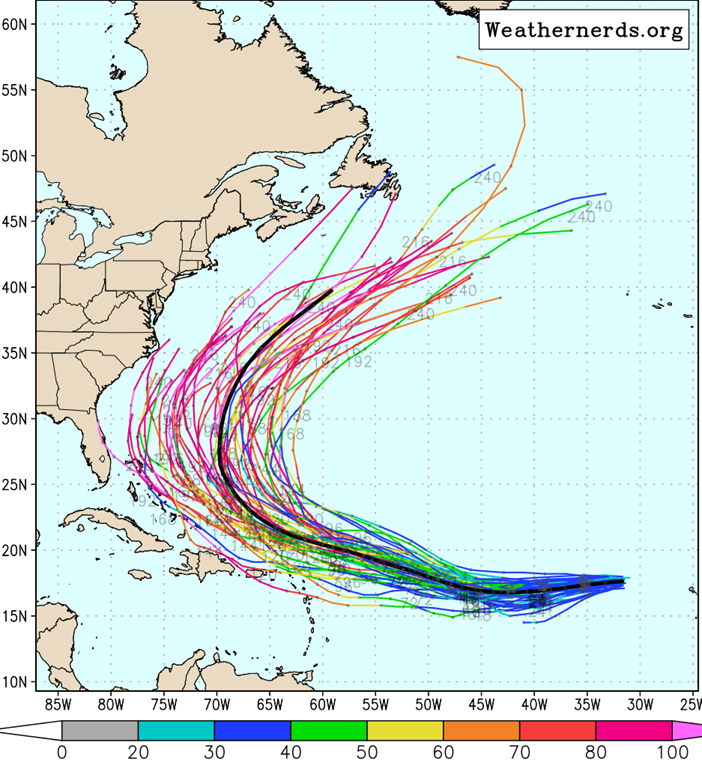
The operational models are also keeping Erin well off the east coast as a trough swings into the eastern half of the country…
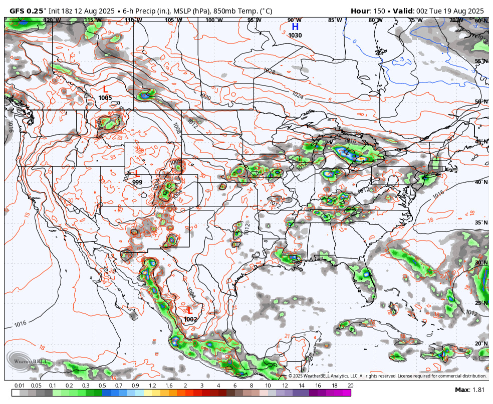
GFS
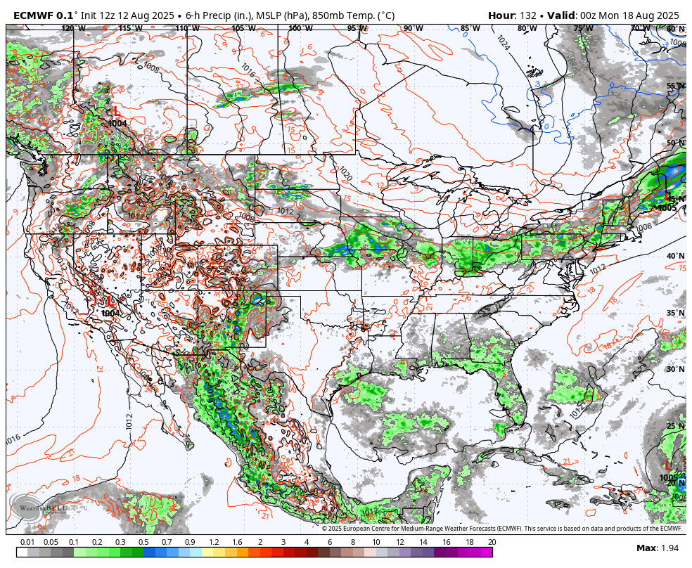
EURO
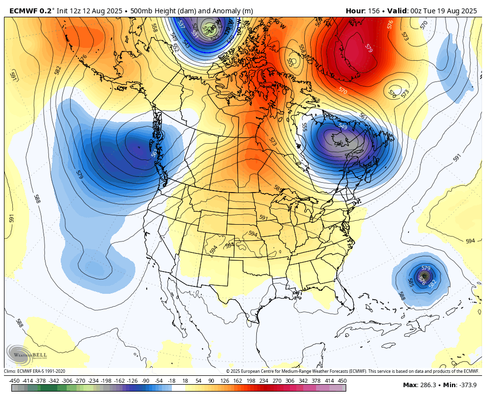
Here are those troughs taking us through the final week of August on the EURO…
I leave you with your storm tracking toys for the day…


Make it wonderful Wednesday and take care.

Thanks Chris. Can’t buy a drop of Rain in my area. Maybe today my area will get lucky. We haven’t had any this month, but this time of the year it’s normally on the dry side.
Looking at the track of Tropical Storm Erin, and soon to become a Hurricane in a couple of days, is quickly moving Westward. Still hoping that it remains a ” Fish Storm. ” ) We shall see.