Good Thursday, everyone. It’s another day of scattered showers and booming storms as we get set for a blast of heat. Temps head toward the 90s for the upcoming weekend and early next week. That’s before a dip in the jet stream throws us some much better air later in the week.
In the short term, it’s all about the scattered storms blowing back up today. Just like the past few days, these storms will put down torrential rains that can cause local flash flooding issues. These storms will also pack a lot of lightning.
Friday sees less coverage of the storms with just a few floating around during the afternoon and evening. Highs today and Friday range from 85-90 in most areas.
The storm chance is even smaller this weekend as temps soar into the 90-95 degree range. Thankfully, humidity levels won’t be super high so we won’t have an obnixous heat index to deal with. Still, the sweat factor is up there.
Monday will be similar in terms of temps with a scattered storm or two going up in the afternoon and evening.
What happens after this depends somewhat on what exactly happens with soon to become Hurricane Erin. This Tropical Storm continues to intensify as it races across the Atlantic…

The latest intensity forecast and track forecast from the National Hurricane Center looks like this…

Does Erin stay out in the Atlantic or does it come close to the east coast? We are still a few days away from that being known.
The latest tracks from the individual members of the European Ensembles are a little west of earlier runs with a couple right on the east coast…

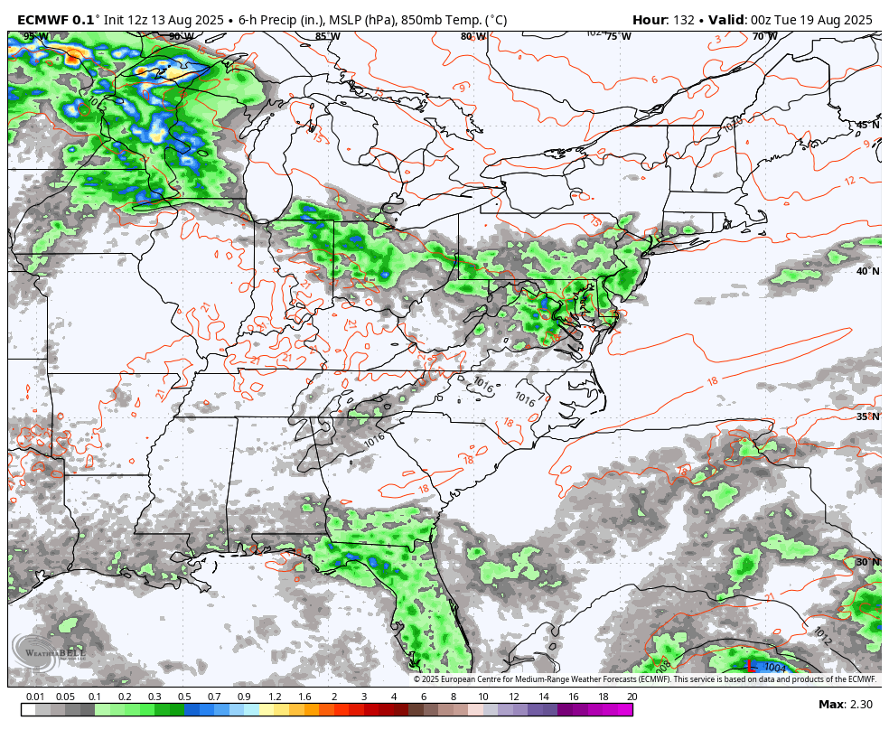
The operational run from the EURO had this thing really close to the east coast…
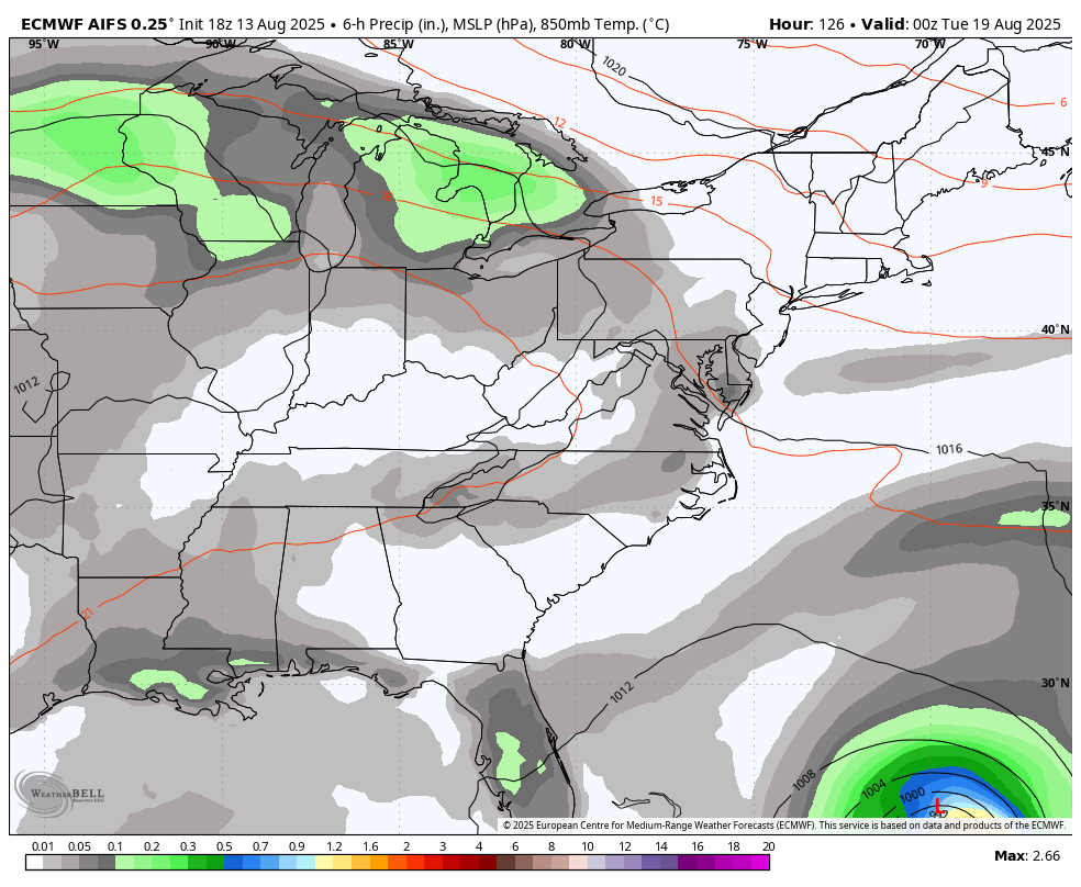
The AI version of the EURO is farther offshore with the track as it develops a stronger upper system on top of our region….
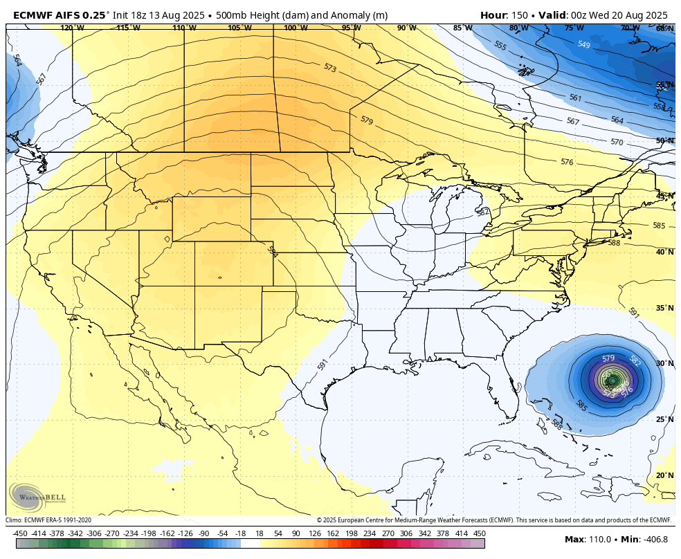
The AI Euro then uses that trough to carve out an even deeper trough coming in behind that…
The EURO is trying to do the same, albeit with a Gulf storm…
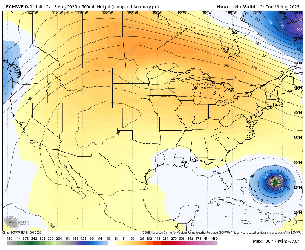
I leave you with your storm tracking toys for the day…


Make it great Thursday and take care.

Thanks Chris. Yesterday was another day without a drop of Rain here in Maple. Glad I watered my plants yesterday morning. The heat so far has not really been that awful, but in my local forecast 100 degree ( actual temperatures ) are showing up for the coming weekend. I blame the activity that’s going on in the Tropical Atlantic for the stagnate weather we are having here. We will have to wait and see what track Tropical Cyclone Erin or Hurricane Erin decides to take.
We finally got .13 inch of rain yesterday bringing us up to .59 for the month. I’m ready for the cool down.