Good Friday to one and all. We are toasting things up as we hit the weekend as our pattern turns downright hot for the next several days. Things change by the middle of next week as the first in a series of troughs settles into our region, bringing much better temps.
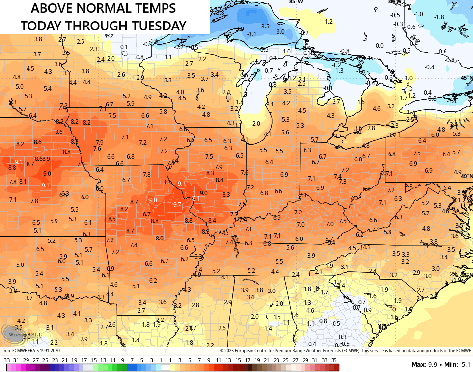
Isolated storms continue out there today with temps in the upper 80s and low 90s. This sets the stage for widespread 90-95 degree high temps this weekend through Tuesday. Overall, temps for our entire region average well above normal…
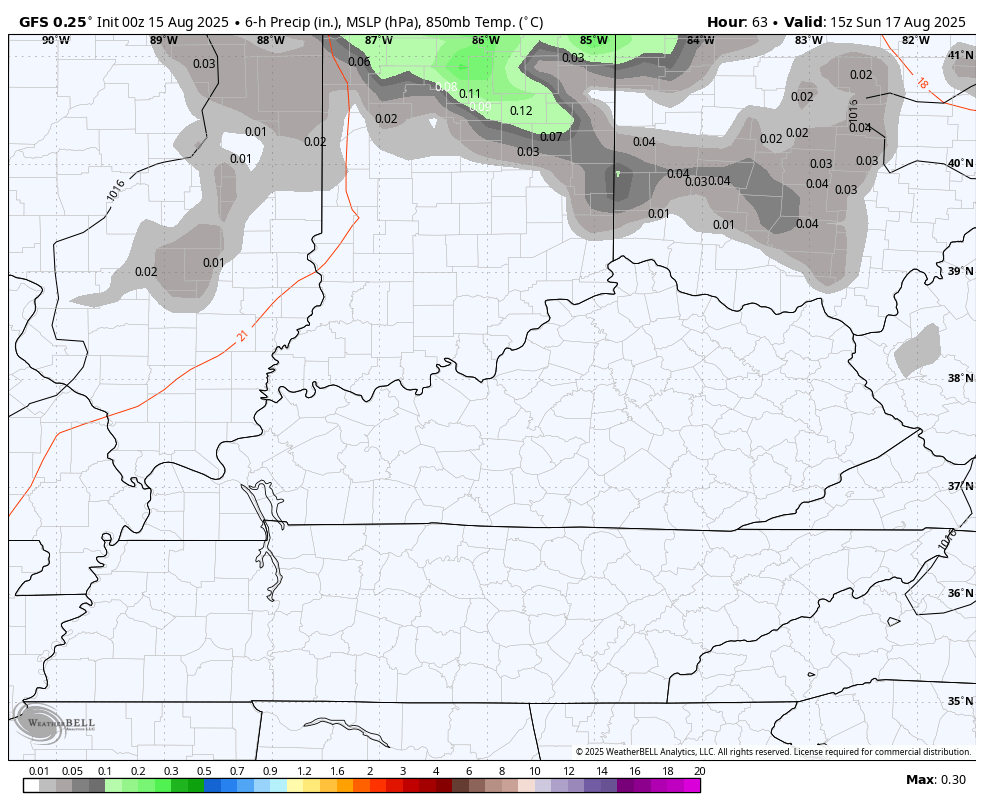
There is the chance for a sneaky thunderstorm cluster or two to drop into central and eastern Kentucky late Sunday into Sunday night…
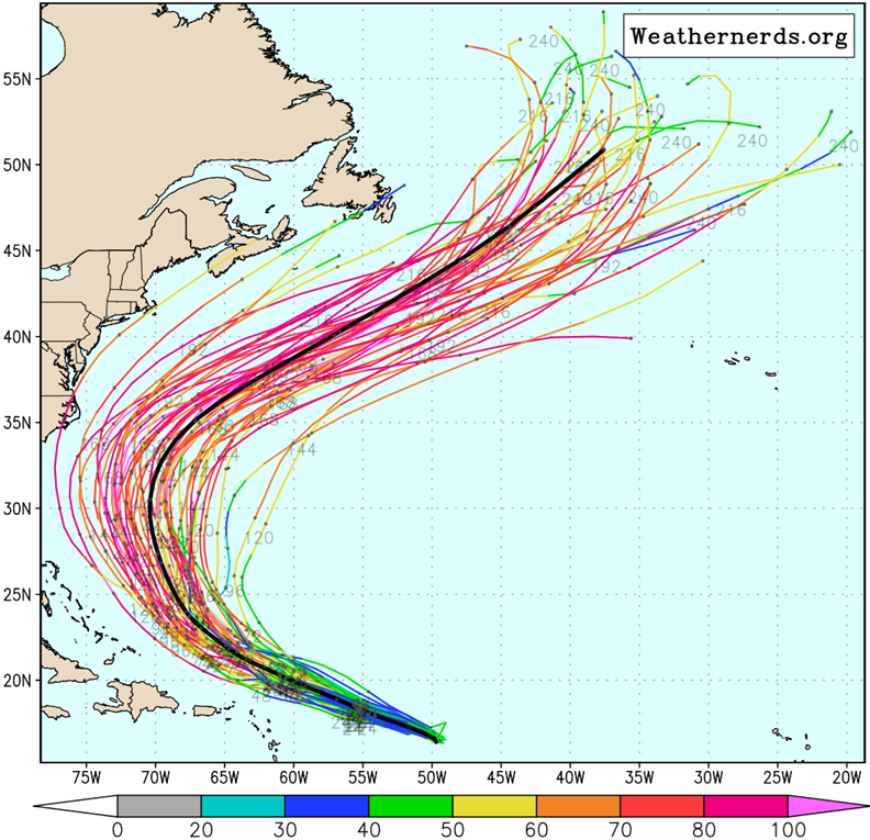
Before we get to next weeks changes, let’s talk about Erin. This storm becomes a hurricane today as it continues to get its act together…

The latest from the National Hurricane Center takes this to a Major Hurricane later this weekend as it slowly starts to turn toward the north…

The offshore track remains the favored track still as all but one of the members of the EURO Ensembles keeps this out to sea…
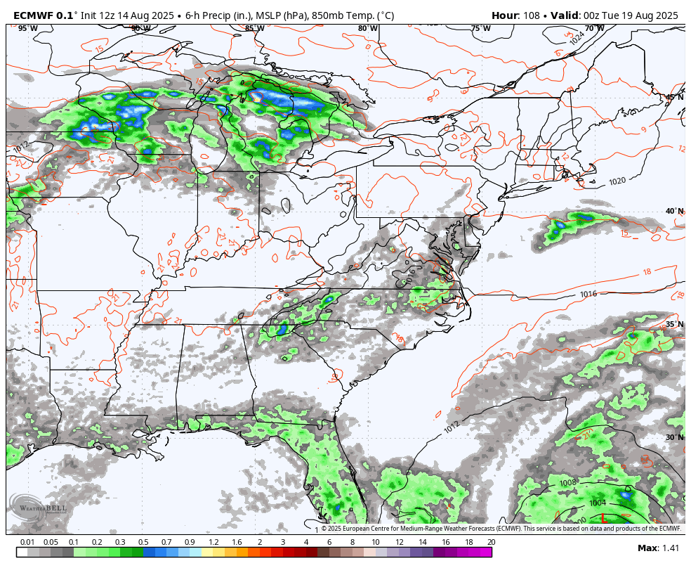
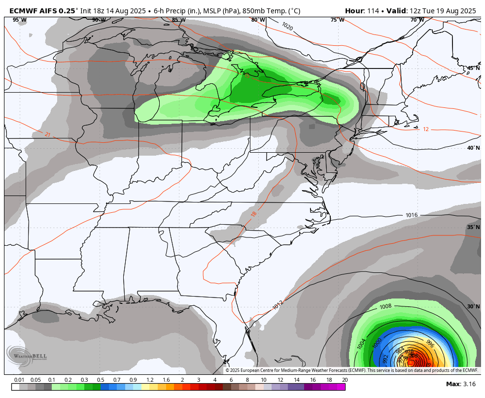
The latest from the EURO operational model is pretty much in step with the average of the Euro Ensembles in terms of the track. The EURO also shows our cold front dropping in from the northwest with an increase in showers and storms as some type of upper system tries to cut off.
This animation starts Monday night and goes through next Friday night…
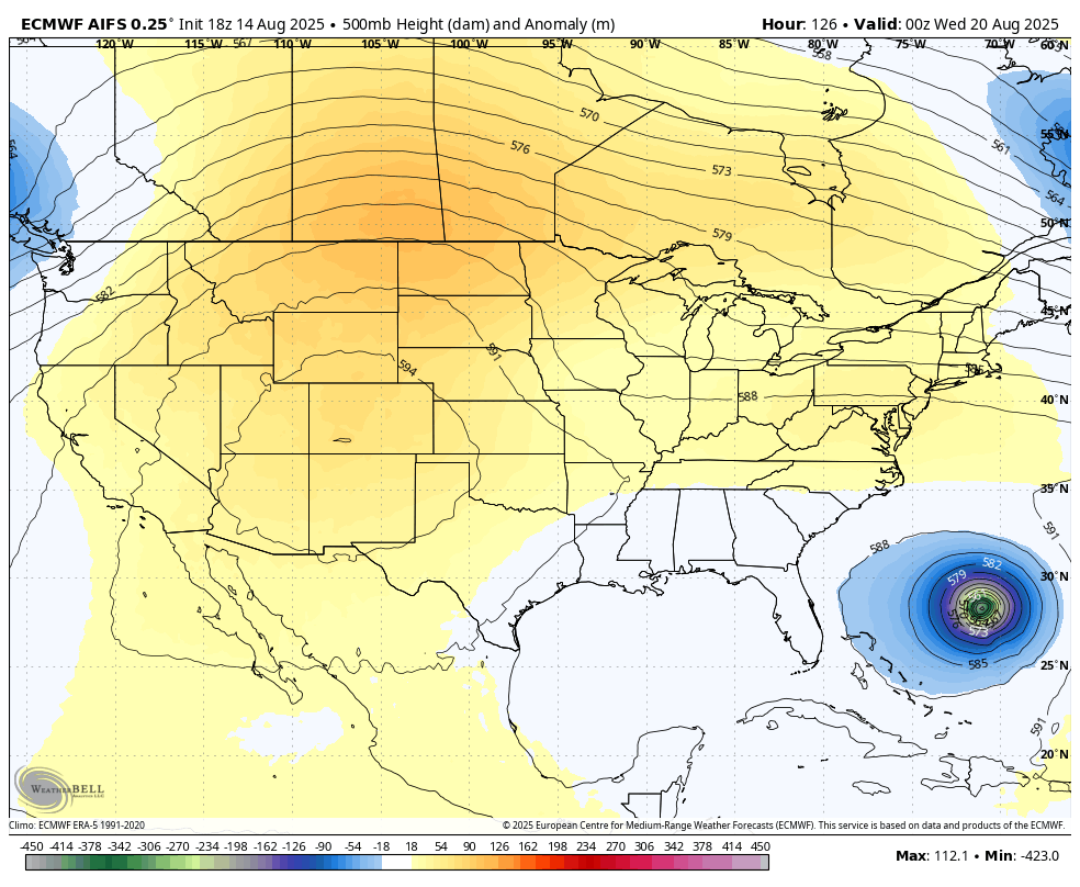
The AI version of the EURO has a similar track and also shows our system trying to cutoff in our region…
That’s a much cooler setup for the second half of next week into next weekend. The EURO family then keeps additional troughs digging into the east to close out August in the run up to Labor Day Weekend…
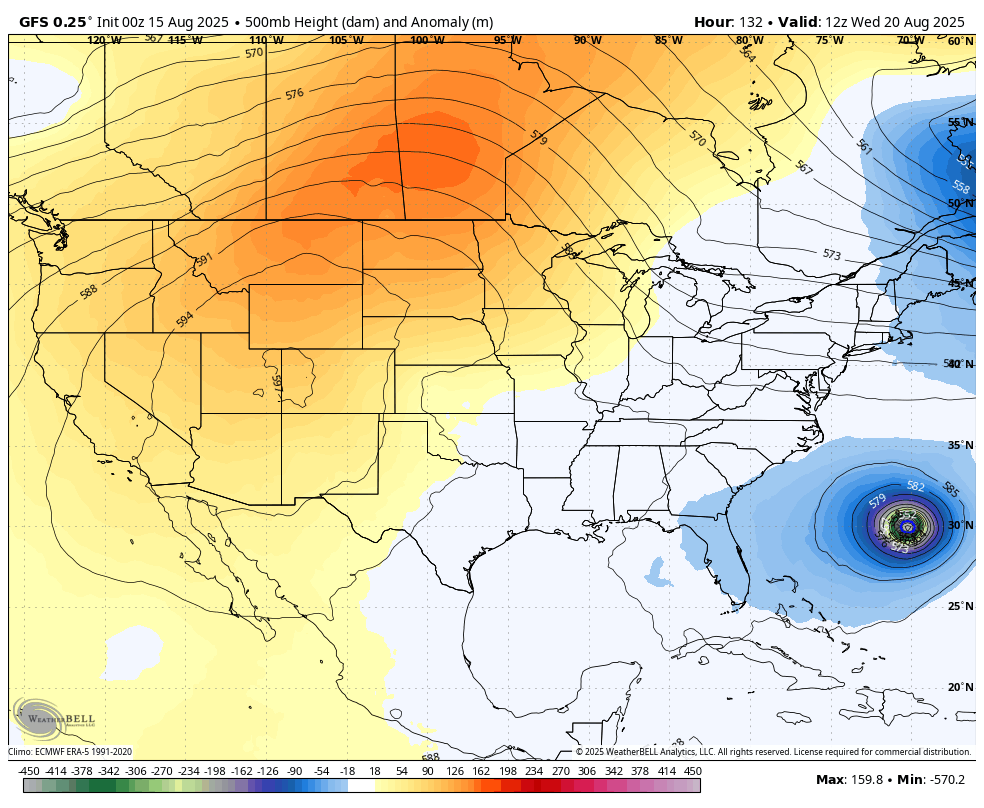
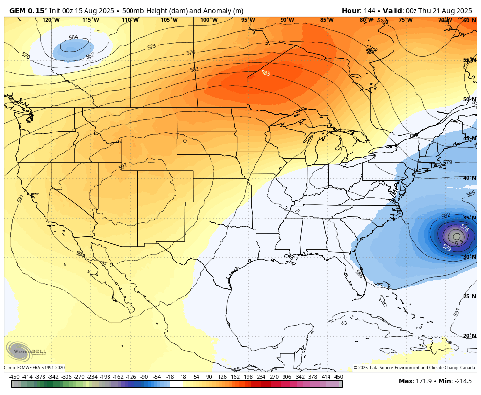
The GFS and Canadian Models are jumping in on this as well…
GFS
CANADIAN
A little bit of fall look and feel may very well show up during this time.
I leave you with your storm tracking toys for the day…


Make it fantastic Friday and take care.

Hopefully this will be our last round of extreme heat. looking forward to the cooler temps.
It hasn’t been “extreme”.
Thanks Chris. This period of Hot, Dry Weather reminds me of the Summer of 1988. A very Difficult Summer for a Person who Owns a Plant Nursery. Glad I don’t have that Problem Anymore.
As Hurricane Erin enters the mid Atlantic track, the High Pressure Ridge over our area Intensifies until Erin moves out and the Troughs move in, hopefully with Decent Rains and Much Cooler by the end of next week.
High Temperatures this Weekend are going to be Brutal. If you have any Sensitive Plants in your garden, Water them at least three times per week until the Extreme Heat and Drought is Alleviated.