Good Wednesday to one and all. Much better air is blowing into the Bluegrass state as a cold front pushes to our south. The real deal early fall feel is lurking behind the next front arriving this weekend. That one takes our temps well below normal for the final week of August.
Temps today are in the 80s with a few showers and storms around early today with the greatest chance across the south and southeast.
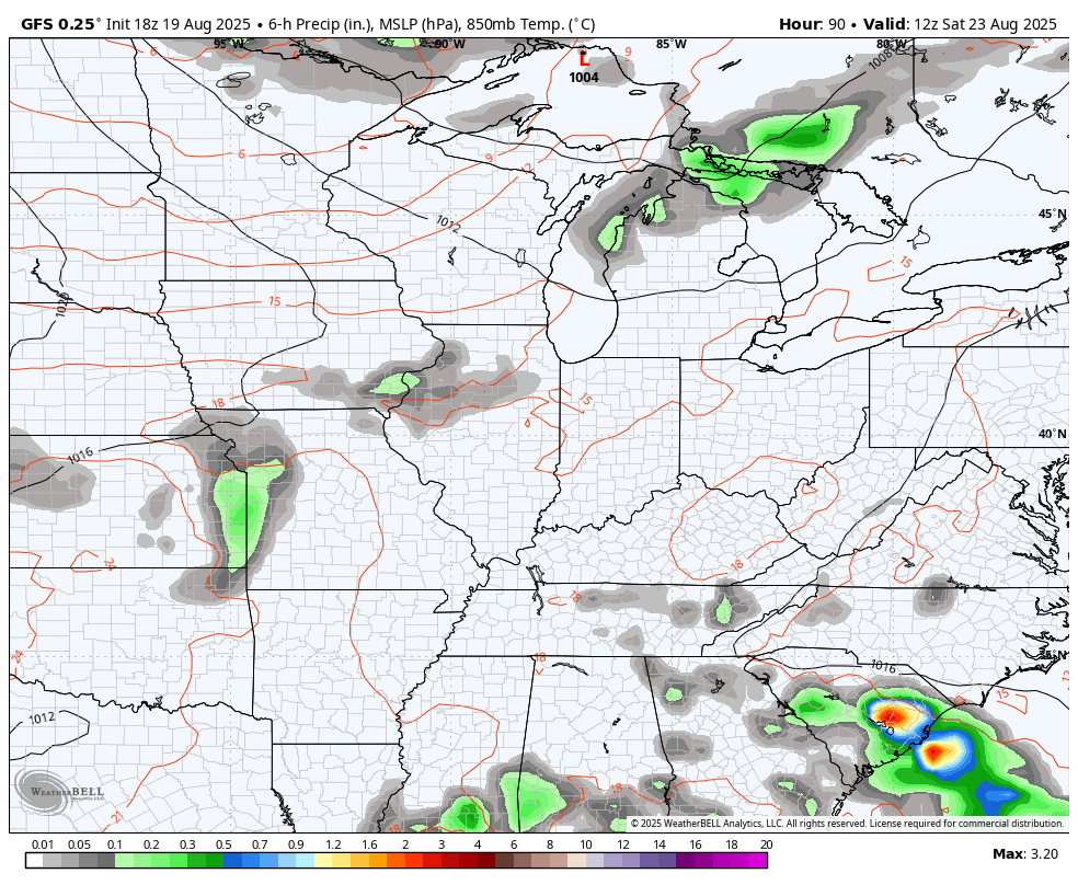
Thursday looks and feels really good with a mix of sun and clouds. The temps jump up a bit Friday and Saturday ahead of our next cold front arriving on the scene late Saturday into Sunday. This one has just a few showers and storms along and ahead of it…
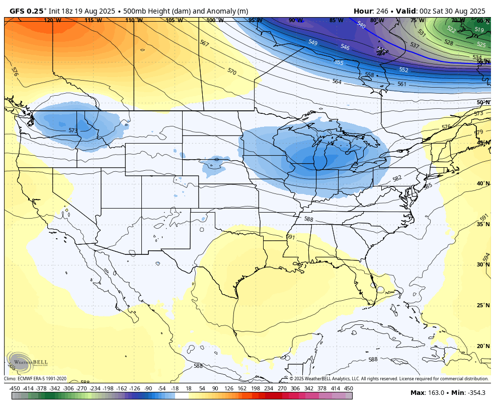
The air coming in behind this is well below normal and stays well below normal through next week. The Barney colors grow a little stronger with each run and not just for our region. This temp departure from normal animation starts Sunday and goes through the end of next week…
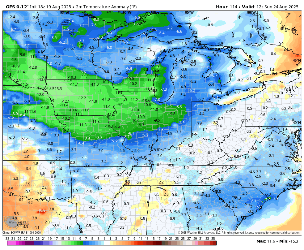
The GFS continues to be the coolest of the bunch with near record lows in the upper 40s…
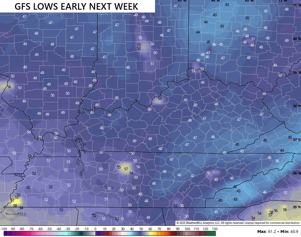
That may be too cool, but lows of 50-55 will certainly be a good bet. An extended run with highs in the 70s is also a good bet.
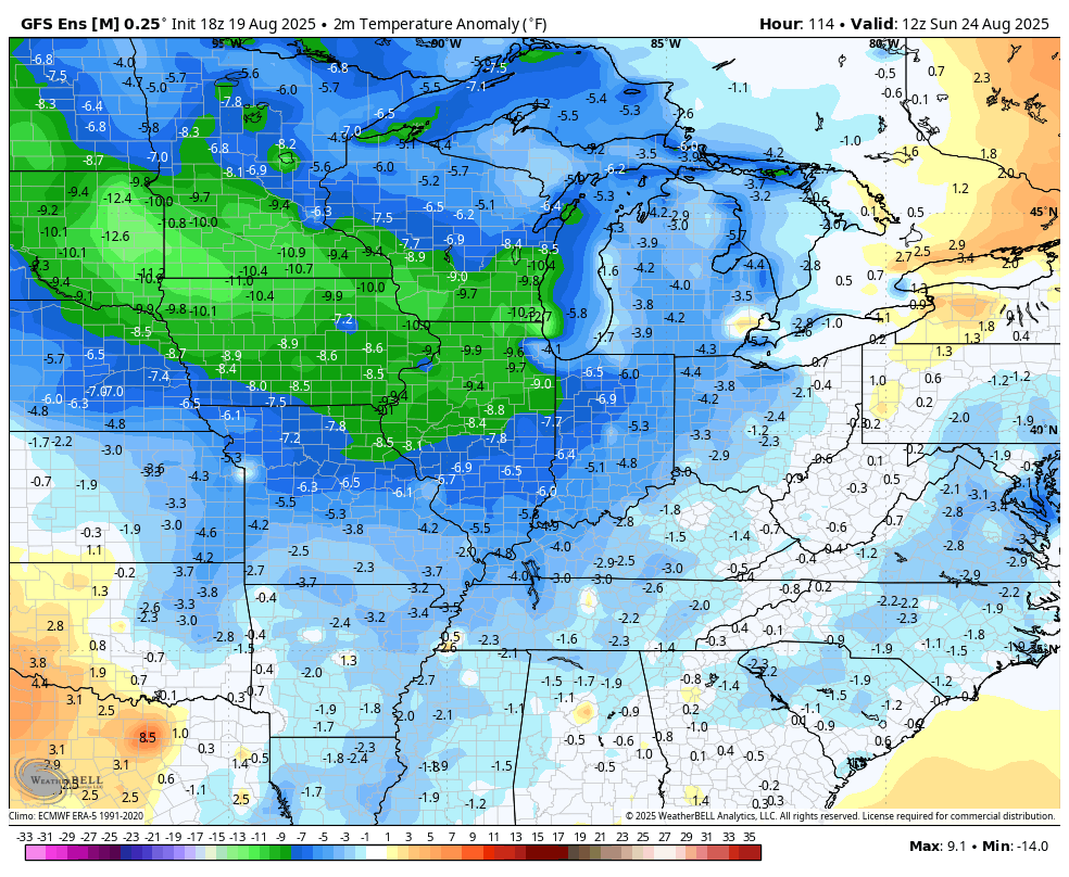
The GFS Ensembles is also all in on this cooler than normal setup…
The EURO AI was the first to show this deep of a trough and was also the first one to show that big blast of cool we had to start August. Take note of that as we head into the fall and winter.
In the tropics, Hurricane Erin continues to pass off the southeastern seaboard…

The track on this continues to keep this well offshore…

Tropical Storm force winds are likely across the coastal areas North Carolina with some major swells all along the east coast.
The next system right behind Erin is poised to develop, but may also stay a fish storm…

I’m sensing a theme here in the early part of the hurricane season.
This happens when you get a lot of troughs in the east and that’s exactly what tries to happen again in early September…
I leave you with your storm tracking toys for the day…


Current watches

Possible Watch Areas

Make it a wonderful Wednesday and take care.

What an exciting forecast!
Summer still isn’t over. 🙂
Bye 90′ s bring in the refreshing cool air.
Won’t last.
Thanks Chris. With Hurricane Erin moving away, the Troughs move in, but for How Long ? The Break in the Heat is most Welcome, but Summer Heat is Not Over by a Long Shot, based on Past Records. The Drought in my area is getting Serious, and there doesn’t look to be any Relief in Site. The Natural Vegetation in my area is beginning to show Signs of Stress. Can’t be good for Fall Foliage Color. Sorry for the Negativity, but I’m just reporting what is going on in my area. I Won’t be Commenting Anymore until Something Changes with the PDO ( Pacific Decadal Oscillation ) Going from a Record Negative Four to a Strong Positive would really change the Current Weather Pattern to the Better. That Would give us that Chance for a Beautiful Autumn, And more Snowstorms this comming Winter.
Yesterday afternoon the temperature recorded by my PWS reached 101.5°F, which is the highest daily temp we’ve seen in the past 3 years. The air was a bit dryer, so the heat index only reached 118°F. The lower humidity is partly due to the fact that for the past 28 days, we’ve had a grand total of 0.14 inches of rain, and the forecast for the next 10 days shows no relief in sight. Lawns in the Bowling Green area have a noticeable crunch when they’re walked upon.
It’s bad.