Good Tuesday, everyone. It’s hot again today as we gear up for a major pattern change arriving later this week and the weekend. One front arrives Wednesday with a much stronger front blowing in late Saturday. That one brings some real deal early fall temps.
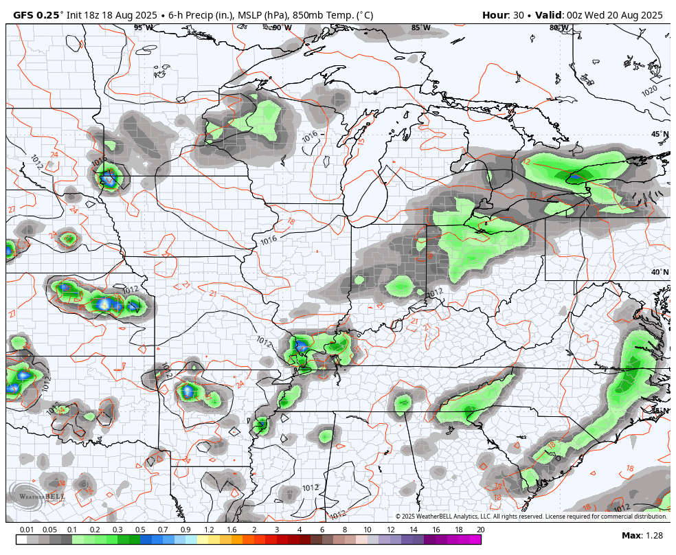
Temps today reach 90-95 in most areas with a storm or two going up. A slightly better shot at some storms arrives later tonight and Wednesday as front number one moves in. A lingering shower or storm hangs tough Thursday and Friday as temps come down to more normal levels for this time of year.
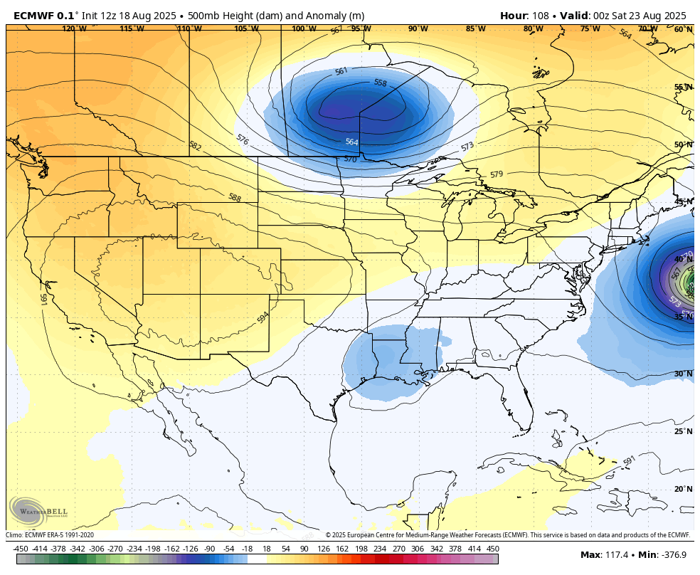
The next front slamming through this weekend is being pushed by a MAJOR trough digging into the eastern half of the country. You can see it all here on the GFS from tonight through the weekend…
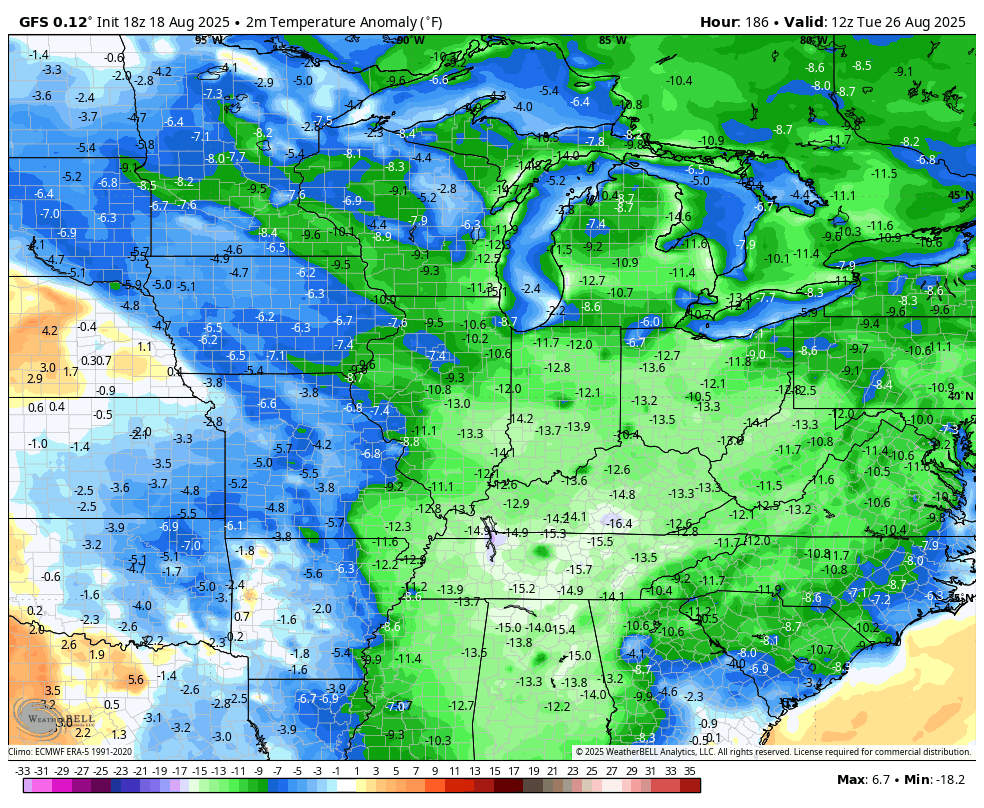
Well below normal temps crash in behind this front with Barney s colors showing up…
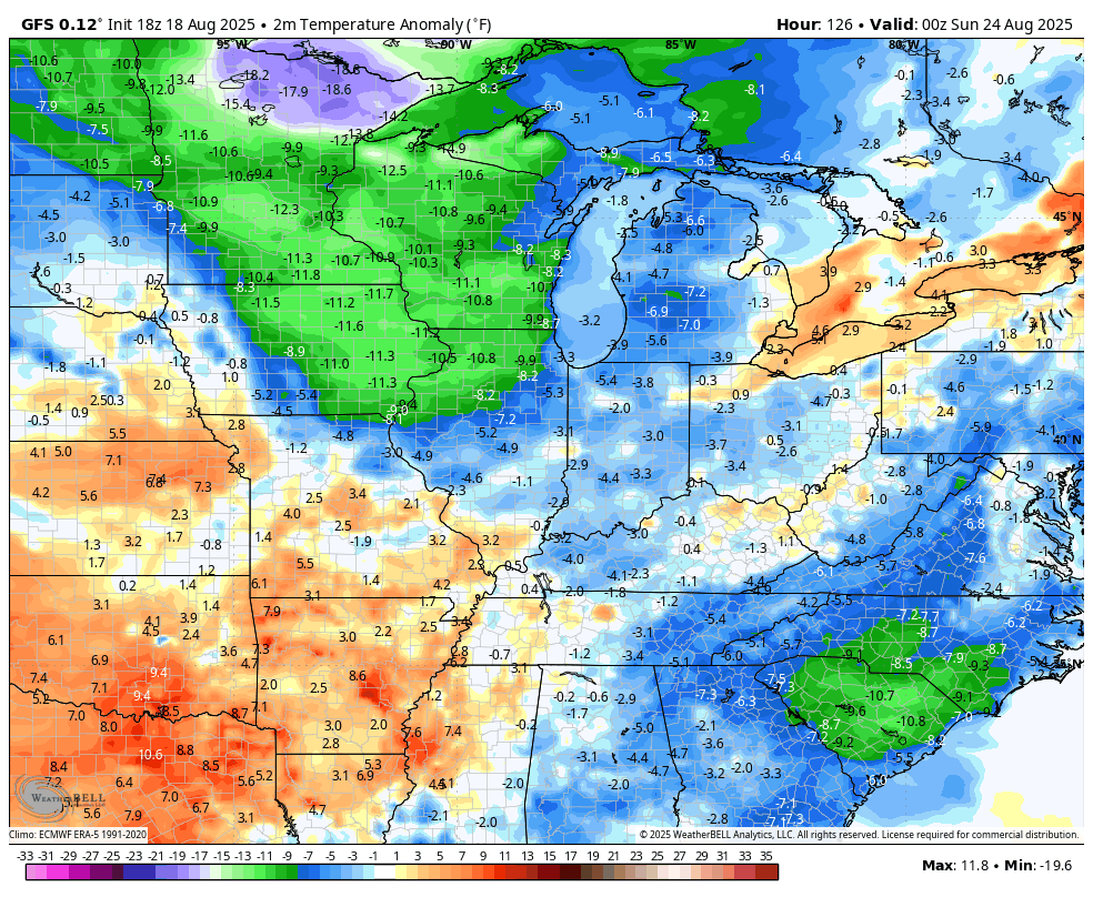
Highs in the 70s with lows, at least, reaching the 50s. The GFS says we flirt with some record lows in the upper 40s…
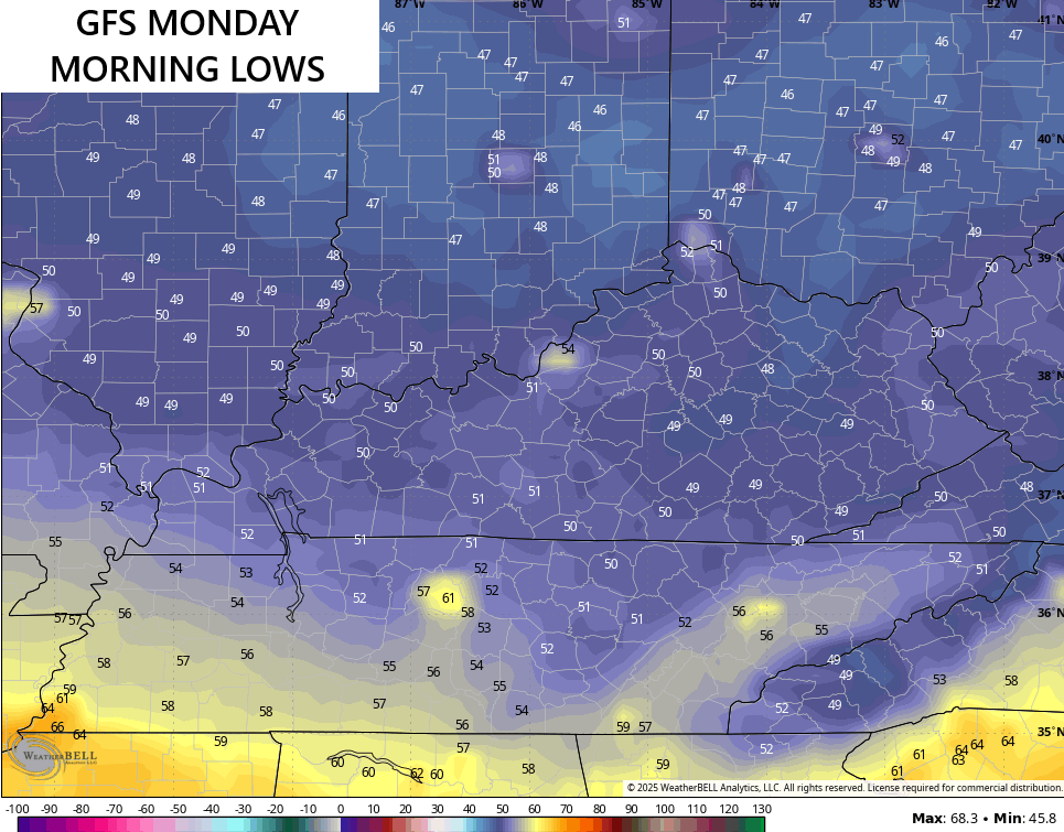
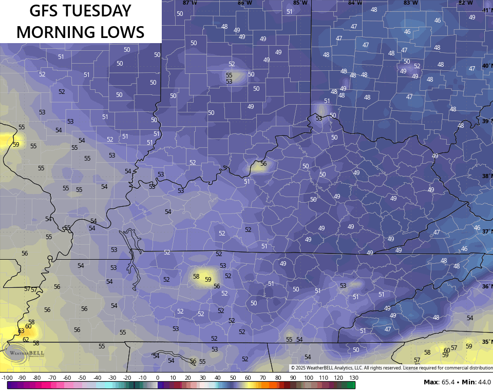
This below normal temperature pattern will likely hang tough next week into the start of Labor Day Weekend…
The tropics, as you know, are alive and kicking with Hurricane Erin, but additional systems will likely develop behind that fairly soon.
Let’s talk Erin before we get to the next possible system. Here’s Erin as it continues to churn well off the southeastern seaboard…

While the track remains well offshore, tropical storm force winds are likely along the North Carolina coast…

The swells along the east coast will be massive.
The next two systems coming behind Erin should develop in the coming days…

We will have to wait and see if one, or both, of those can make a run at the southeastern US. Regardless, the models like the idea of troughs hanging out across the eastern part of the country into the start of September…
I leave you with your storm tracking toys for the day…


Current watches

Possible Watch Areas

Make it a terrific Tuesday and take care.

This brief cool spell is common in August. No big deal.
Those hoping for a good shot of rain from that pattern changing system will be disappointed, as the front is likely to be moisture starved.
Sad, but true
Very typical for this part of the country. I wish I kept the Cabin my Father bought in the Coastal Mountains ( in the best climate of the CONUS, ) Oregon. It gets Hot there, but Not like here, and doesn’t last as long. Summer’s are short, and mostly Cool and Dry, and the Winter’s are ( wait for it ) Moderately Cold, with a Lot of Snow. Some Winter’s ( I don’t know about now, ) but up to 8 feet of the good packing Snowfall on the average. The reason we bought the property is that Rhododenrons grew to perfection. Our favorite plant, we sold in the Nursery. We were going to move an established Nursery from Indiana to Oregon, but found it not feasible. I guess we could have sold the property in Indiana, but don’t know to this day why we didn’t. Might have been a health problem ?
Looking forward to cooler weather