Good Monday, everyone. It’s another hot day across the Commonwealth but the focus is on a much cooler setup on the way. This slowly begins later this week with the full blast of cool air coming late this weekend into the final week of August.
Temps today are back into the 90–95-degree range for most of the state with the threat for isolated storms to go up.
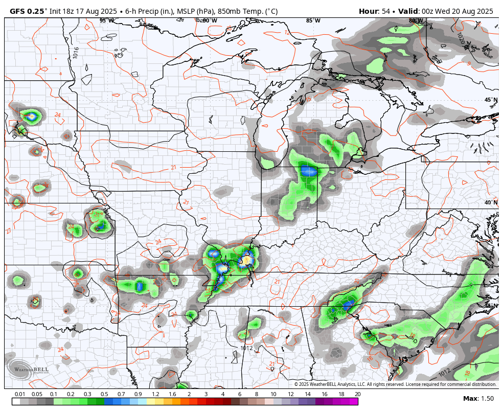
Similar conditions will be noted Tuesday as we get set for a cold front to drop in for Wednesday. This touches off showers and thunderstorms across the region and a few of those hang around into Thursday and Friday as temps come down several degrees from where they are to start the week.
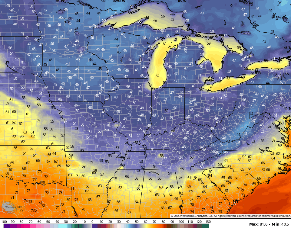
A true fall cold front then arrives this weekend, bringing the coolest air since spring…
Temps go well below normal with some Barney colors showing up into early next week. This temp departure from normal animation starts Sunday and goes into Thursday…
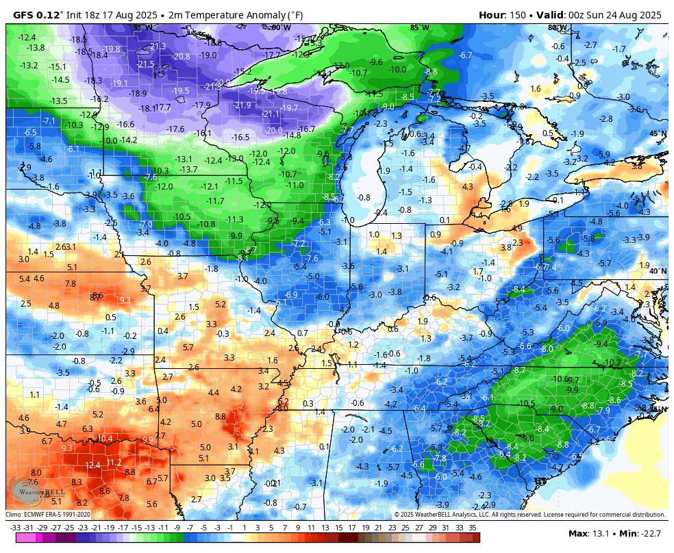
Some recent runs of the GFS take lows way down there by early next week. Upper 40s might be a stretch, but I can’t say there’s no chance of this verifying…
I can already smell the pumpkin spice lattes!
Hurricane Erin continues to churn, but has lost some steam…

This storm will remain well offshore, but this track will brush the outer banks with tropical storm force winds and huge tides…

The next system behind Erin continues to work into a region much more favorable for development…

There’s a more westward push with this storm right now, so we will wait and see what happens with this system as it nears the islands later this week.
I leave you with your storm tracking toys for the day…


Current watches

Possible Watch Areas

Make it a magnificent Monday and take care.

Pumpkin spice lattes are overrated. Apple is the real deal. And I don’t see it getting very cool.
I never Heard of Pumpkin Spice Lattes, of course I’m old, but Red Delicious Apples are my Choice for an Autumn Treat. I don’t Believe that Autumn Like Weather is Around the Corner. Summer Weather won’t let go until there is a Significant Decrease in Tropical Activity.
As of 5:00 AM EDT ” Category 4 Hurricane Erin located just East of the Southeast Bahamas ” slowly moving West expected to veer to the North / Northwest. ” We shall see what happens there ?
Still No Rain in my local forecast. I can’t remember when our last good Soaking Rain occurred ? Have to Water my plants this morning. Got to go before it gets too Hot.
We got 1.13 on Friday and 1.05 on Saturday, plus lost power for just over an hour with the Saturday storm. They were quick hitters but it was still nice to see rain since it had been so long. I am so ready for cool weather and football season.
Dottie, Wow send some of that Rain my way.
https://www.google.com/search?q=pumpkin+spice+latte&sca_esv=b9c8812b6c95ceb0&sxsrf=AE3TifNg6_ciQJuBMEyp_ERS0NO8N92vIQ%3A1755517124815&source=hp&ei=xBCjaIn2L_rakPIPwPu-qQM&iflsig=AOw8s4IAAAAAaKMe1L5mF11sFPSJjXzva_adMi93p2xf&gs_ssp=eJzj4tbP1TcwNDIuyjY2MmB0YPASLijNLcjOzFMoLshMTlXISSwpSQUAuEELKQ&oq=Pump&gs_lp=Egdnd3Mtd2l6IgRQdW1wKgIIADIREC4YgAQYkQIYsQMYgwEYigUyERAuGIAEGJECGLEDGIMBGIoFMg0QLhiABBhDGOUEGIoFMgoQABiABBhDGIoFMhYQLhiABBixAxjRAxhDGIMBGMcBGIoFMhAQLhiABBixAxhDGIMBGIoFMhAQABiABBixAxhDGIMBGIoFMgsQABiABBixAxiDATINEC4YgAQYsQMYFBiHAjIKEAAYgAQYQxiKBUjhhgFQsU9YqGJwAXgAkAEAmAGnAaABqASqAQMwLjS4AQHIAQD4AQGYAgWgAtIEqAIKwgIKEAAYAxjqAhiPAcICChAuGIAEGEMYigXCAgsQLhiABBiRAhiKBcICCxAuGIAEGNEDGMcBwgIOEC4YgAQYsQMY0QMYxwHCAgUQLhiABMICCxAuGIAEGLEDGIMBwgIREC4YgAQYsQMY0QMYgwEYxwGYAwnxBdkF2d6w9-TDkgcDMS40oAeURbIHAzAuNLgHyQTCBwUyLTQuMcgHJA&sclient=gws-wiz
Finally found out what Pumpkin Spice Latte is from the above link. NO THANKS !
I agree with you Schroeder!
Good way to destroy a good cup of coffee.
Not sure if this will show up, but I photographed an amazing shot of a cumulonimbus cloud yesterday afternoon. In the post I included a screenshot of the radar at the time the photo was taken.
https://x.com/derosajoe51/status/1957218250653352296?t=ipFhBla2p0ZYG_nLQ0Tzzg&s=19
Thanks for sharing Joe. Photo of the Cumulonimbus cloud came through just fine on my computer. I just wish this monster high pressure that seems to be centered over Taylor County would weaken some, so we could receive some of those heavy rain / showers.
Here’s a link for the summary of the severe weather and flooding that occurred in the Chicago Metro Area on from the afternoon of Aug. 16th to the early morning hours of the 17th: https://weather.gov/lot/2025_08_16-25SevereFlood
Thanks Mike for the link. The strong ridge is holding all the weather well to our North. I don’t really see any changes in the overall pattern. I think this pattern has been building for sometime now. All the Oceans are well above normal in temperature, as a Marine Heat Wave has been issued. First time I ever heard that term.
Here’s more on Marine Heatwaves across the Globe :
https://www.euronews.com/green/2025/07/27/marine-heatwaves-may-have-driven-the-worlds-oceans-to-a-critical-tipping-point-scientists-