Good Sunday, everyone. It’s another hot day with a few clusters of thunderstorms dropping in from the north and northwest. This heat streak lasts into early this week before things change up for the second half of the week and really change by next weekend.
Temps today reach 90-95 in many areas as a few clusters of showers and storms develop across Indiana and Ohio. These rumble into central and eastern Kentucky this afternoon and evening and a few of those may be strong or locally severe.
Some of the models are seeing the damaging wind potential…
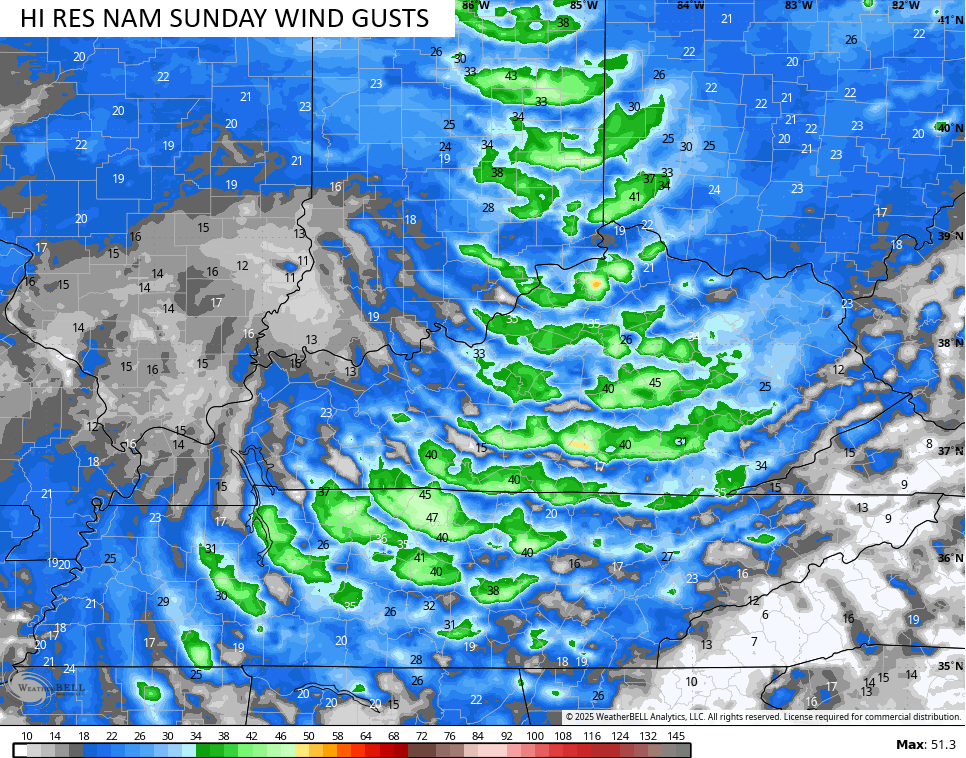
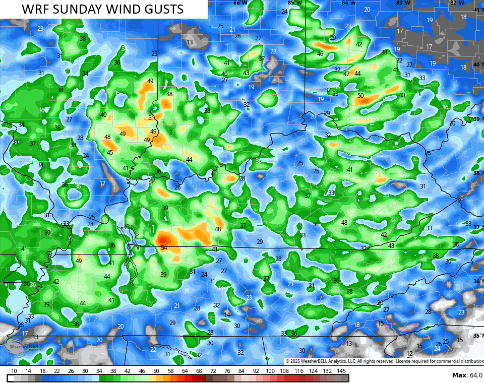
I doubt the Storm Prediction Center puts our region in the low-end risk, but if they do…

Local wind damage would be the main threat.
These storms will also be loaded with lightning and torrential rains that can lead to a few high-water issues.
Monday and Tuesday will feature similar temps to today with a couple of afternoon and evening storms.
Hurricane Erin became a Category 5 storm on Saturday as it strengthened about as quickly as a storm can. Here’s what the monster looks like right now…

The latest from the National Hurricane Center continues to show this storm tracking well off the east coast…

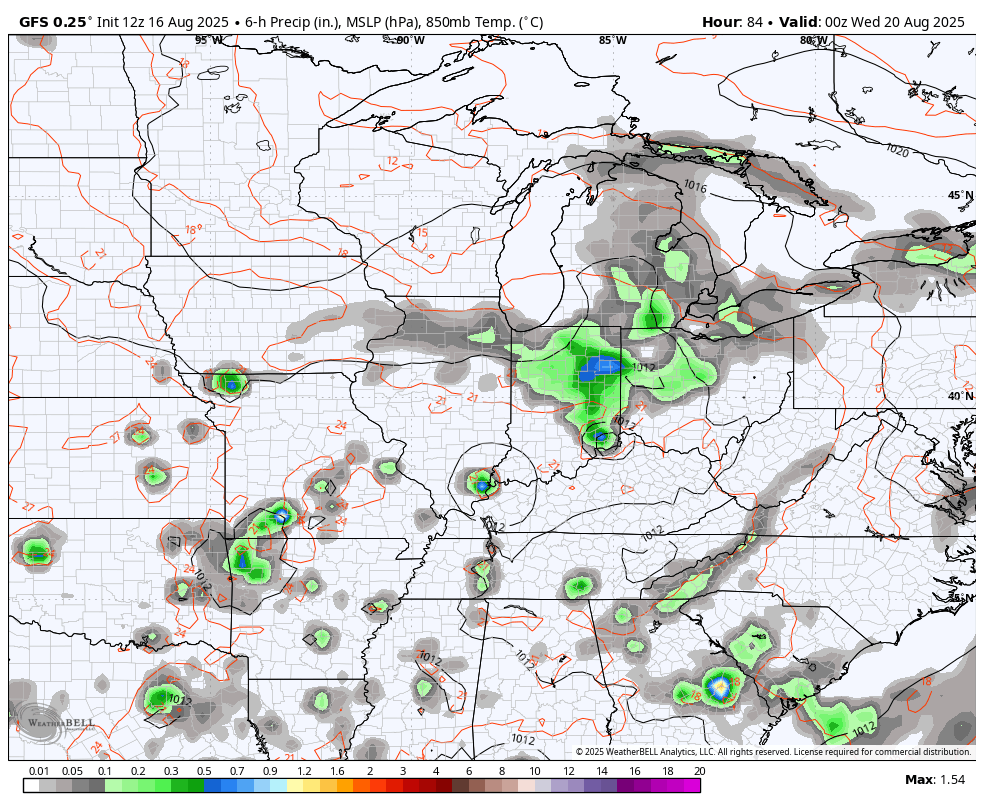
As Erin stays a fish storm, we watch a system dropping in from the northwest by Wednesday. That brings an increase in showers and storms and some of those may stick around for a few days as a slow low spins through. That will be followed by a powerful fall cold front arriving behind it next weekend…
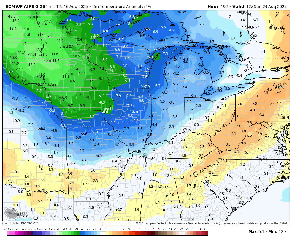
That second front is what really unleashes some real deal early fall air. Temps on the GFS go well below normal and stay that way into early the following week…
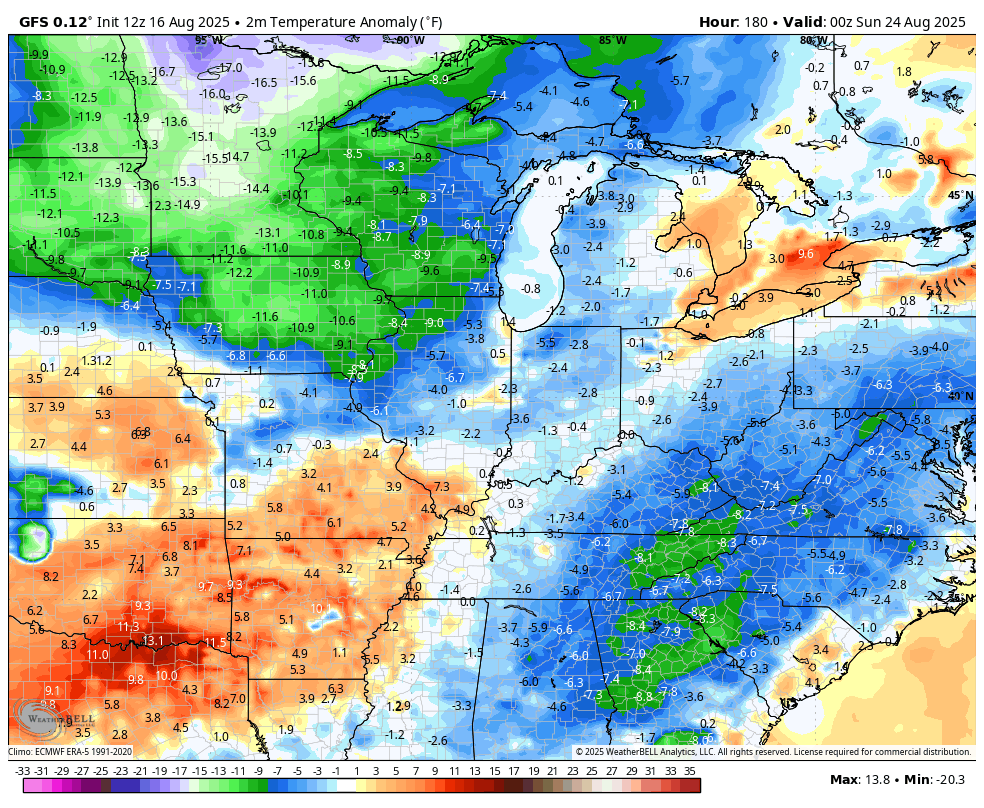
The EURO AI was the first to see all this and it continues to show well below normal temps during that same time…
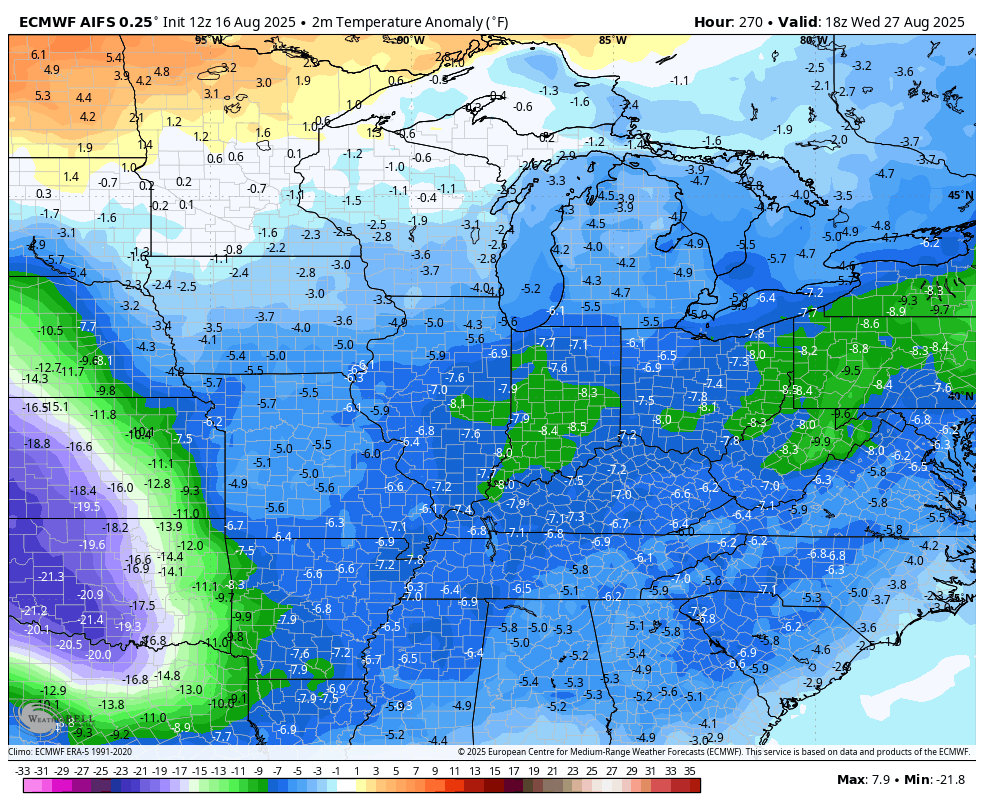
The EURO AI then keeps that rolling right on through the Labor Day Weekend…
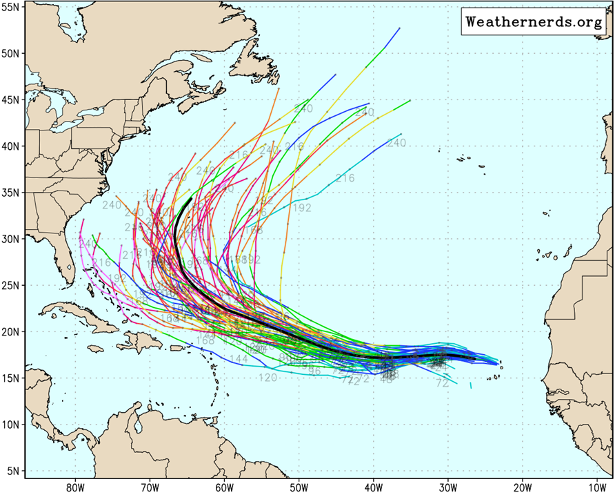
We shall see if it has that kind of longevity as we may have another big Atlantic hurricane to deal with in the early stages of that period. The National Hurricane Center is now highlighting this possible system…

The individual tracks from the EURO Ensembles suggest another fish storm, but it’s early in the forecast period…
I leave you with your storm tracking toys for the day…


Current watches

Possible Watch Areas

Make it a great Sunday and take care.

My AC has really had a workout , well it’s a heat pump. It’s 21 years old. I’m TERRIFIED something is going to happen to it.
Mark, I can remember when we had no air conditioning. We had floor fans and window fans, and there wasn’t any complants that I can remember. Now I don’t think I could live without it.
Thanks Chris. Yesterday afternoon it reached 97 degrees here in Maple. It cooled down to 68 degrees early this morning. As long as the Tropics are active the longer we will be stuck in this current weather pattern.
I’ve had it with heat and I’m ready for a change. I’m talking relief from +80°F dewpoints and 112°F heat index readings, like yesterday. Not looking for a Pot of Chili alert, just a few days of high temps in the low 80’s and matching lower humidity. There’s no denying the likelihood that the mid to upper 90’s will then return for a period of time. We just want a break and I think we’ve earned it.
Joe, I just stay indoors in the AC. I do go outside in the early morning hours to water my plants.
All the heat and humidity that’s been in the Chicago Metro Area the last few days has produced several rounds of strong to severe thunderstorms along with torrential rainfall and numerous flood warnings/advisories for many areas here. Just wish I could send some of this heavy rainfall we’ve gotten to you guys in KY who need it 🙂
Mike, the farther North around the perimeter of the High Pressure System where the air is ascending is where the most Rains are occurring. Here in Kentucky, I think the High Pressure System is centered right here in Central Kentucky with it’s descending air. Here in Maple, we haven’t received a drop of Rain so far this month.
I’ve been enjoying the weather of late, even seeing upper 90s to 100 in central Texas on my work trip this past week, but I won’t complain if it cools off. Good thing we were 20 inches above normal prior to July or the heat and potential drought would be worse.
Kentucky | U.S. Drought Monitor https://share.google/3jTVFRn0HrmATI7SU
Thanks Jeff, for the Link. I book marked the site for further reference. Glad you are enjoying the weather. I remember you predicted this months ago. By the way, my county of Taylor is in the abnormally dry category, and I don’t see any big changes the rest of this month. UGH !
Hopefully yall know I never root for droughts. It’s just a thought I had. Honestly, I hope it rains more than it snows this winter to come.
Me too Jeff.