Good Monday, everyone. Halloween Week is off and running on a damp note as showers roll across the state. This is the opening act for a much bigger system set to bring some wicked weather from late Tuesday through Thursday.
Let’s break it all down on a day-by-day basis…
TODAY
- Rounds of showers roll from west to east
- The greatest concentration is across the southern half of the state
- Locally heavy rains are a good bet in the south
- Highs are mainly in the 50s
TUESDAY
- A few showers remain in the east to start the day
- We have more dry than anything else into the afternoon hours for many
- Rain increases across western Kentucky during the afternoon and evening
- Heavy rains arrive from west to east Tuesday night
WEDNESDAY
- Widespread rain and heavy rains spin across the entire state
- Winds gust up through the day and may top 30mph at times
- Temps are chilly and may stay in the 40s
- Heavy rains continue into Wednesday night, especially in the central and east
- Local high water issues are possible during this time
THURSDAY
- Gusty showers continue across central and eastern Kentucky
- Winds are cold behind the departing storm system
- Gusts to 30mph or a tad higher will be possible
- Temps stay in the 40s for many
HALLOWEEN
- A few lingering showers will be possible during the day across central and eastern Kentucky
- As of now, the rain looks to be gone by trick-or -treat times
- Highs are in the 50-55 degree range with 40s for trick-or-treat hours
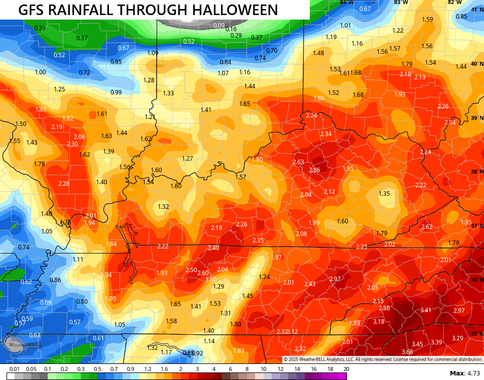
The forecast models are showing some healthy rain amounts, but they have their subtle differences. The GFS is now farthest north of the bunch with the heaviest rains…
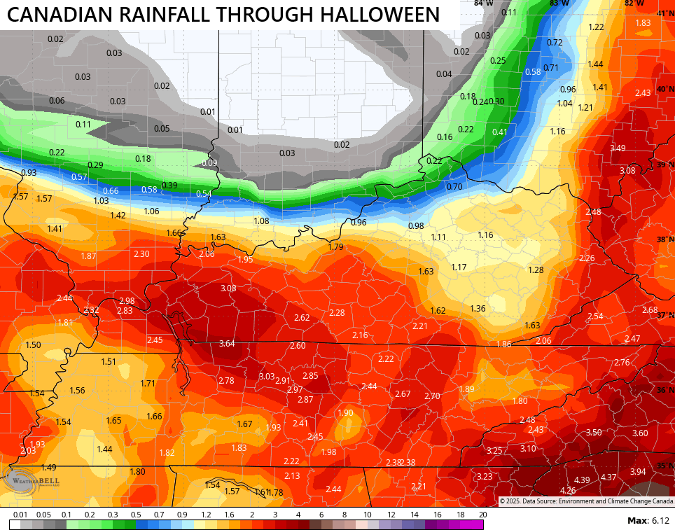
The Canadian has a super sharp cutoff on the northern edge…
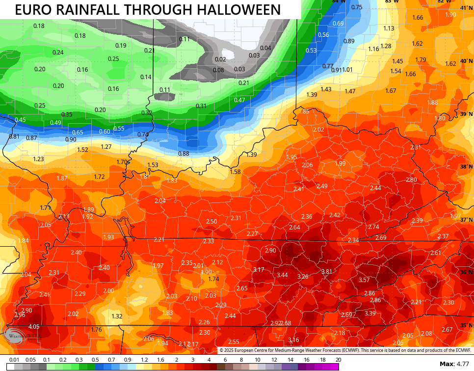
The EURO is a good comprimise…
As a winter weather lover, I’d love to see a similar setup to this storm 6 weeks or so from now…
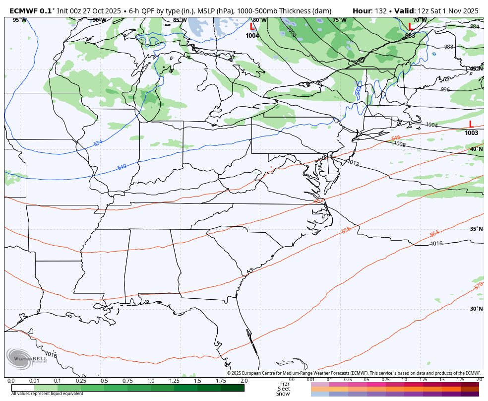
This will be followed up by a clipper looking system dropping in here to start November this weekend and may very well have another one right behind it early next week. Very chilly showers are a good bet with the outside shot of a snowflake…
Powerful Hurricane Melissa continues spin into Jamaica…

This storm is an absolute monster and is likely to go down as the worst hurricane hit on record for Jamaica and that’s saying something. Cuba is next…

Heartbreaking images will be coming from Jamaica, folks.
I will have updates as needed today and on my Meteorologist Chris Bailey Facebook Page
Until then, here are your rain and wind tracking tools for the day…


Make it a magnificent Monday and take care.

Poor Jamaica 🙁
Poor Jamaica indeed, Jeff, that system is monstrous. The eyewall is as compressed as I’ve ever seen one, and Melissa’s forward motion is slow and steady towards the heart of the island, which means Jamaica will be exposed to the storm’s effects for a significantly longer period of time. Initial impact will include Melissa’s northeast quadrant, which is the area where the strongest winds are located. The sea is more shallow along the island’s south shore, which will will raise storm surge from 10 to 15 feet above sea level, and sea surface temperatures averaging 90°F mean that the storm has plenty of fuel. It will be catastrophic.