Good evening, everyone. Rain is slowly increasing from west to east across the state as low pressure number one impacts the region. Low pressure number two is the big daddy sweeping in here for Halloween Week.
Here’s a breakdown:
- Rain rolls from west to east tonight with the greatest concentration across the southern half of Kentucky.
- Locally heavy rains are likely with this.
- Showers then set up across much of central and eastern Kentucky Monday and Monday night.
- Tuesday only finds a few showers around the state with a lot of dry weather a good bet.
- The big upper level low and surface low then roll right across Kentucky Tuesday night into Wednesday.
- Heavy rain is likely during this time.
- Widespread rains continue Wednesday night and Thursday as our low wraps up to our east and northeast.
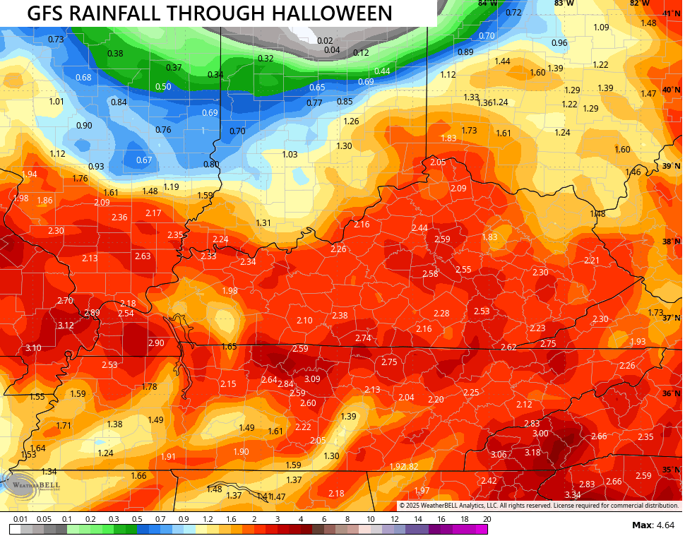
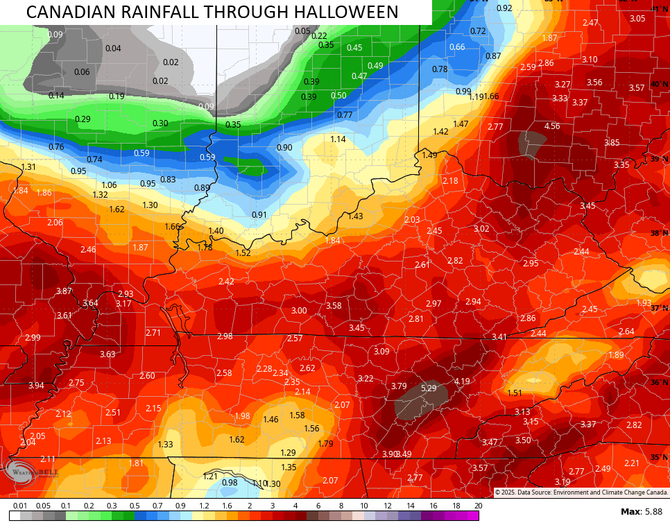
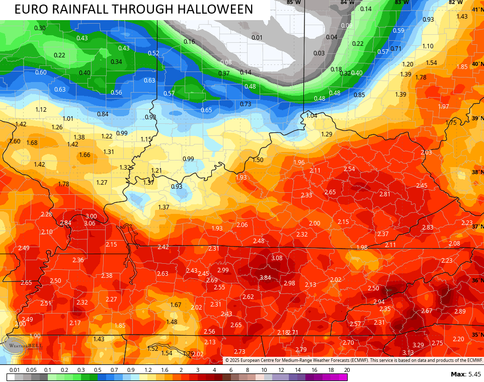
- A general 1″-3″ of rain looks likely, and this may be enough for a few local high-water issues.
- Wind gusts to 30mph will be possible from time to time.
- Chilly temps will also be noted with highs that may not get out of the 40s Wednesday and Thursday.
- I can’t rule out a few leftover showers lingering into part of Halloween.
In terms of the models, we are in decent agreement with everything. Here’s a look at how much rain they think will fall…
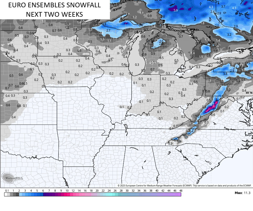
Several winter looking troughs look to dig in behind this departing system into early November. The Ensembles continue to see the threat for a few early season flakes during this time…
Hurricane Melissa continues to approach Cat 5 status as it churns near Jamaica…

Here’s the latest forecast from the National Hurricane Center…

A full update comes your way later tonight. As usual, I have your Kentucky Weather radars fired up and ready to track the showers across the state…

Enjoy the evening and take care.
