Good Sunday, everyone. We are getting ready for that big Halloween Week storm system to blast through Kentucky and surrounding areas. This storm will have a huge impact on the entire eastern half of the country for the big week.
Let’s break down how this plays out around here:
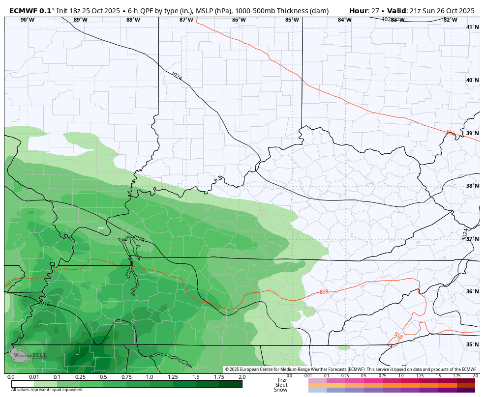
- Rains overspread the state from west to east today, reaching the north and far east by tonight.
- Monday looks soggy with fairly widespread rains across central and eastern Kentucky. Locally heavy downpours are likely.
- Scattered showers are with us early Tuesday before gusty rains increase from west to east late in the day.
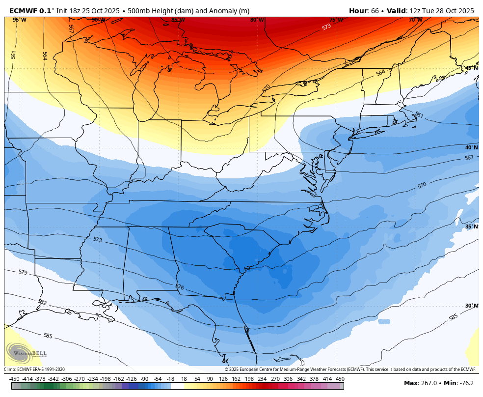
- Those rains are ahead of a potent upper level low and surface low spinning right on top of Kentucky.
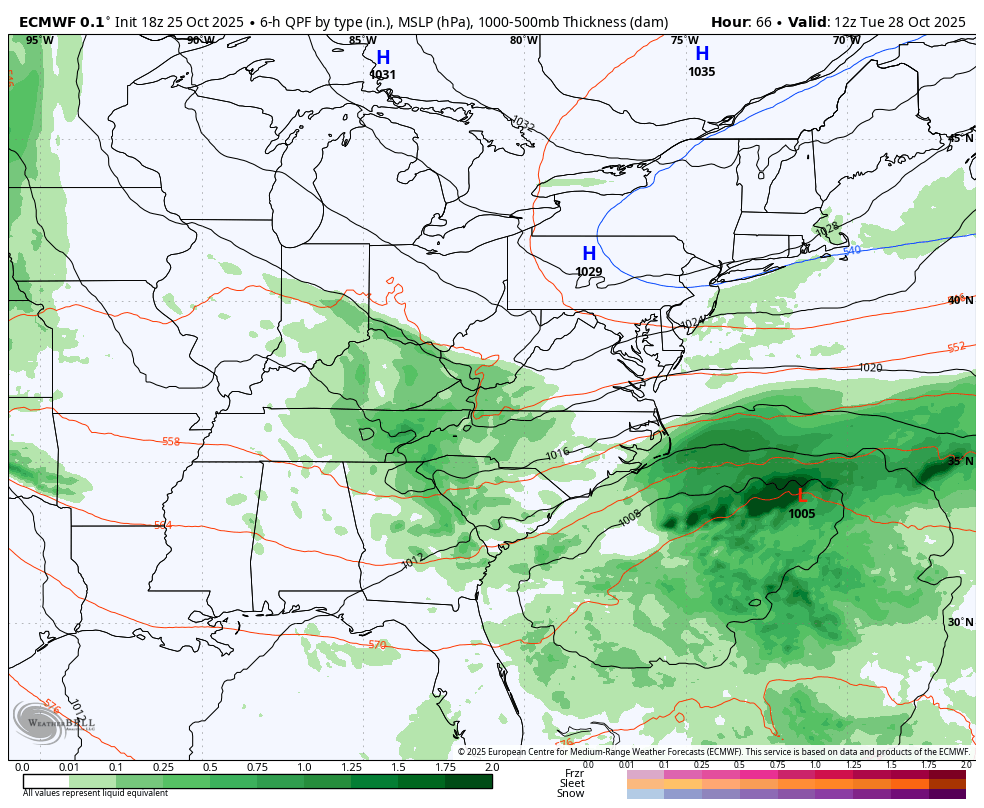
- Those two in tandem will create widespread heavy rains Tuesday night and Wednesday.
- As the low wraps up to our east and northeast Thursday, wraparound showers will continue to be common in the central and east
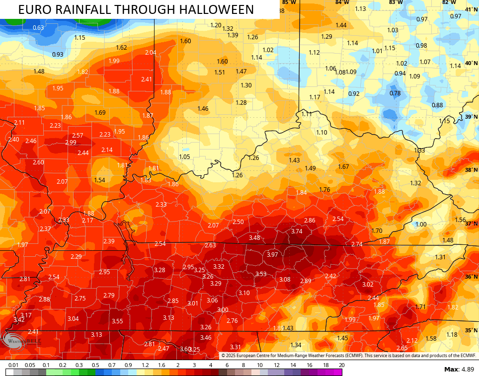
- A general 1″-3″ of rain will show up across the state during this time with pockets of higher totals. Local high water issues can’t be ruled out.
- Winds are gusty this entire time and may reach 30mph on occasion.
- Temps are chilly and may not get out of the 40s Wednesday and Thursday.
- Some leftover showers may linger into the start of Halloween, but most of the moisture from this looks to be gone.
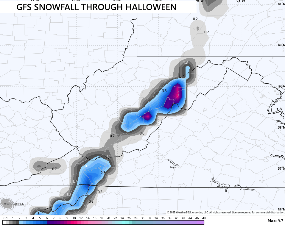
- Can the highest mountains of southeastern Kentucky get in on a flake late Thursday or Thursday night? Maybe, but the best chance is over in WV.
In terms of the first system, watch how the rains pick up later today and then really get going tonight and Monday. This animation goes through 8am Tuesday…
Looking at the upper levels, we find one heck of a looking system spinning right on top of us Wednesday and Thursday…
That kind of deep upper level system is sure to spawn a healthy surface low and that’s what we see on the EURO. Our animation starts at 8am Tuesday and goes through 2pm Halloween…
Here’s the rainfall forecast from that run of the EURO…
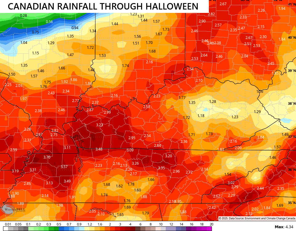
The Canadian has more of a robust low tracking a bit north, thus bringing heavier rains farther north…
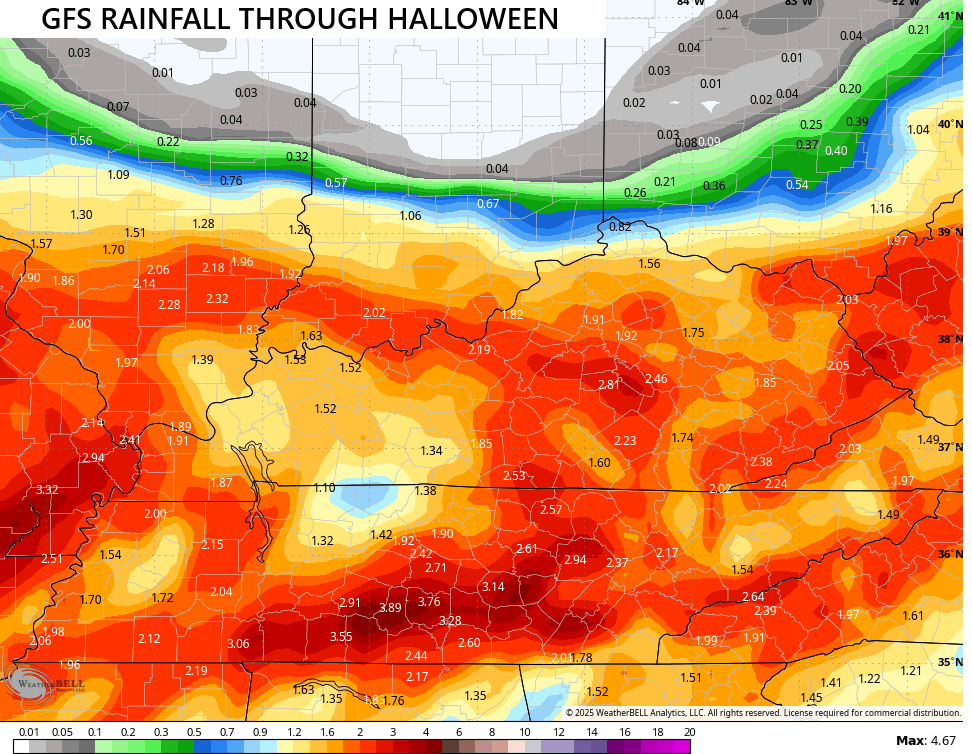
The GFS is still playing catchup and is too far south with everything, but it’s getting there…
Speaking of the GFS, it’s the operational model most in love with Appalachian Mountain snows and even some in the high ground of far southeastern Kentucky…
While we get ready for this big fall storm system, Hurricane Melissa is becoming a Cat 5 storm and obliterating Jamaica over the next few days. Look at this monster…

The track on this will also go right into Cuba by Tuesday…

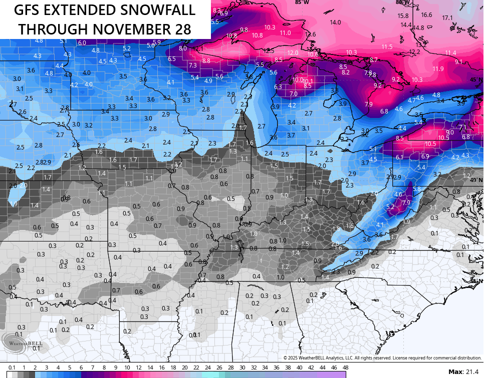
Looking deeper into November via the GFS Extended, we find the model seeing the early season flake potential around here. This map goes through Black Friday…
I will have another update later today. Until then, I have your Kentucky Weather radars fired up and ready to track the showers across the state…

Have a great Sunday and take care.

*thumbs down*
Thumbs up for all the higher elevations of the first accumulating Appalachian Snows. Our area of Kentucky, the Snow amounts are well overdone. Should be zero amounts.
Hurricane Melissa, looks to be the most destructive Hurricane of the season. My prayers go out for all of Jamaica.