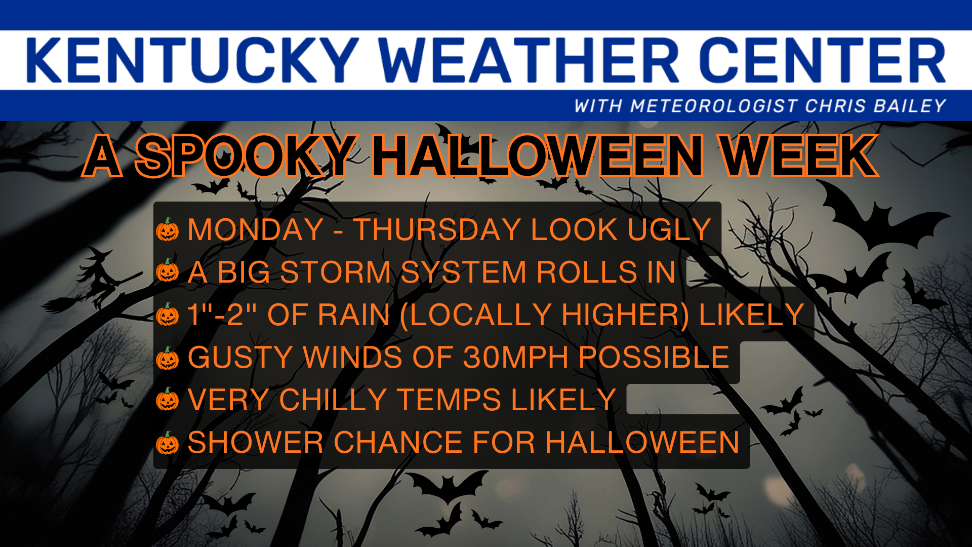
Good evening, everyone. It’s been a gloomy day for many of us as that sneaky band of sprinkles and light showers showed up for a few. As we head into Halloween Week, our weather continues to look pretty darn ugly.
With a few of those showers out there this evening, here are your Kentucky Weather Radars to follow along…

The next round of showers increases from west to east Sunday into Monday as low pressure streaks by to our south. That’s the opening act for the bigger system coming for Tuesday Through Thursday. That’s the one bringing some nasty weather.
Here’s a breakdown of what to expect…
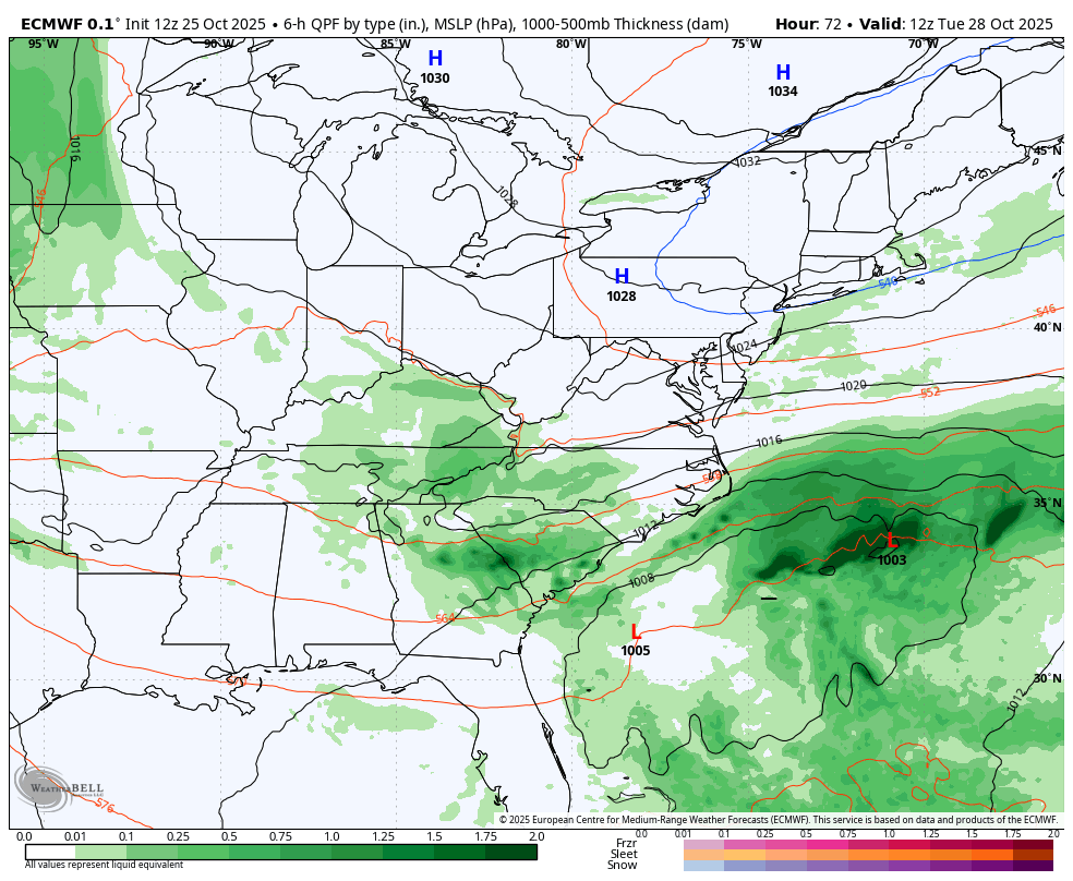
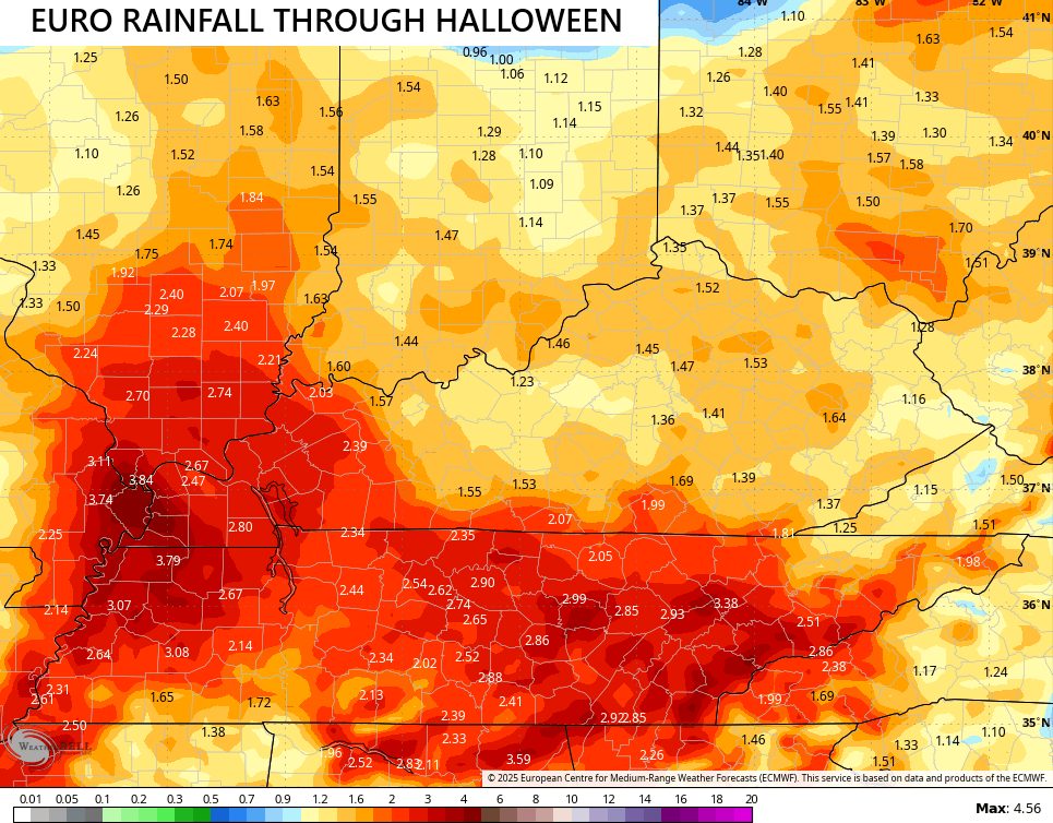
The EURO has been the steadiest model of the bunch with the whole setup and now we find the other models quickly matching it. Here’s the latest EURO…
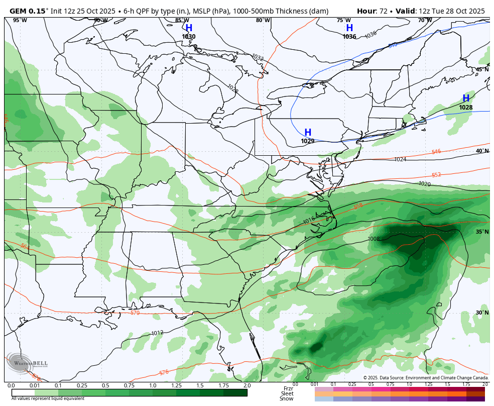
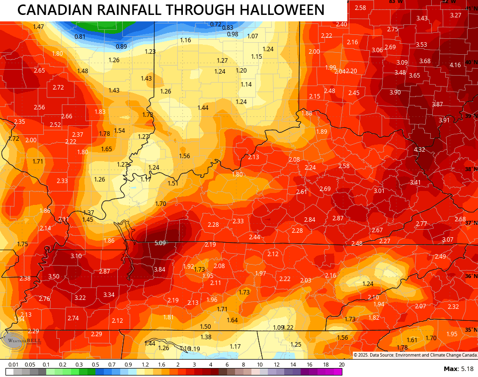
The Canadian is even stronger with our system but matches up well…
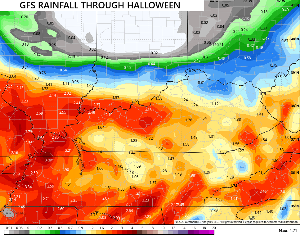
Even the poor GFS is correcting toward the right solution and it’s doing so in a hurry. This is still not perfect, but it’s getting there…
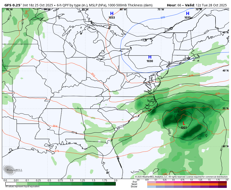
The models are spitting out a general 1″-2″ of rain with higher amounts showing up in a few spots…
I could see some local high water issues developing at some point Wednesday or Thursday. This will happen with highs likely not getting out of the 40s for many.
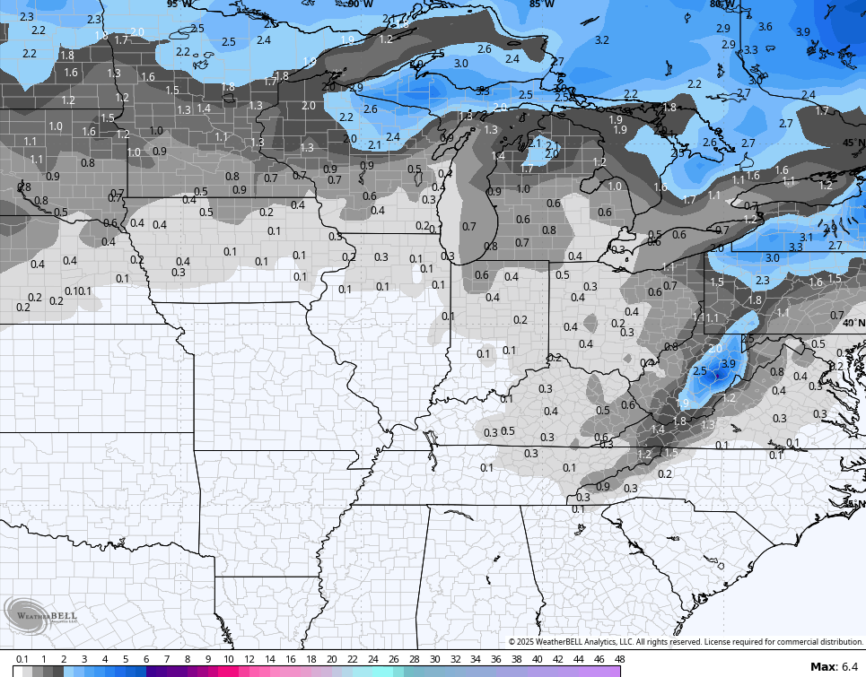
This system will produce some snows in the high elevations along the Appalachian Mountains, with an outside chance for some of those flakes in far southeastern Kentucky Thursday or Thursday night.
Speaking of flakes, the GFS Ensembles are seeing the opportunity into early November…
Enjoy the rest of your Saturday and take care.
