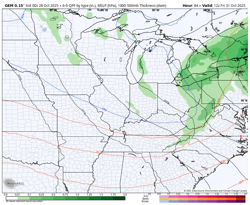
Good Tuesday, everyone. Our first system is winding down after putting down 1″-2″ of rain in some areas of the state. Now it’s time for the main show to take center stage in the days leading up to Halloween. This brings a lot of ugly into town before we clean it up on Halloween.
Here’s the latest breakdown of what to expect:
TODAY
- A few showers remain to start the day
- We have more dry than anything else into the afternoon hours for many
- Rain increases across western Kentucky during the afternoon and evening
- Heavy rains arrive from west to east later tonight
WEDNESDAY
- Widespread rain and heavy rains spin across the entire state
- Winds gust up through the day and may top 30mph at times
- Temps are chilly and may stay in the 40s
- Heavy rains continue into Wednesday night, especially in the central and east
- Local high water issues are possible during this time
THURSDAY
- Gusty showers continue across central and eastern Kentucky
- Winds are cold behind the departing storm system
- Gusts to 30mph or a tad higher will be possible
- Temps stay in the 40s for many
HALLOWEEN
- A mix of sun and clouds will be noted
- Can the northwest wind spit out some sprinkles or a shower?
- Highs are in the 50-55 degree range with 40s for trick-or-treat hours
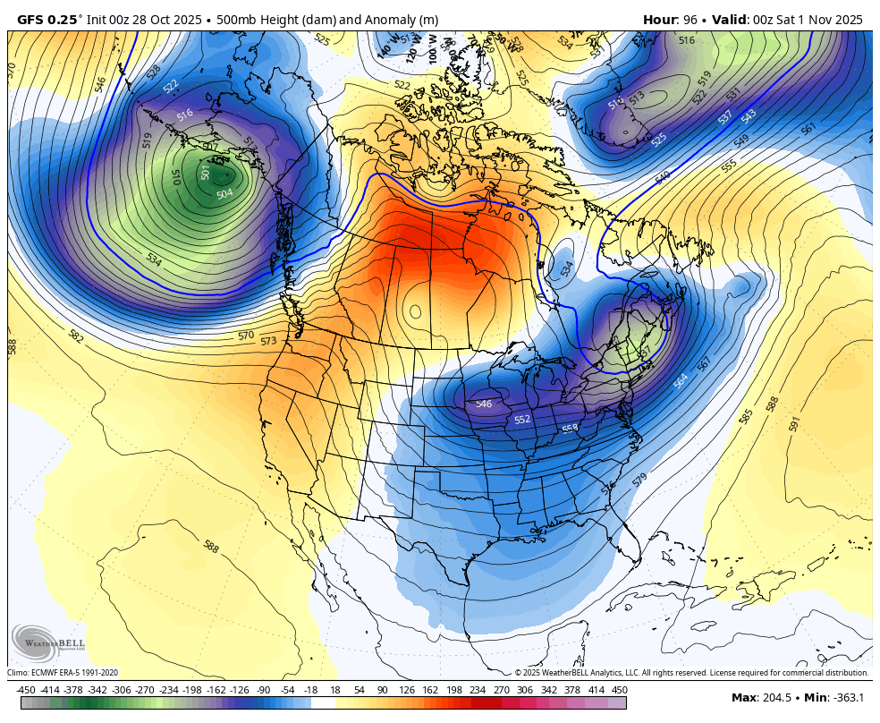
The Canadian gives us the best flow for a Halloween shower or two, especially in the north and east…
The models are struggling with how to play the troughs diving into the east in the first week of November. The GFS goes from a couple of small troughs to a some DEEP troughs…
After a below normal first 10 days or so to November, the pattern goes toward a back and forth look into the middle of the month. That means we will have to be on the lookout for the second severe weather season trying to throw something our way.
The pattern likely starts to trend back toward a trough in the east to end the month and then may really kick in as we head into December. I’ve made no bones about the fact I think this winter starts early this year with December having a lot of potential.
The EURO Weeklies go into the first week and change of December and are offering up a healthy winter look…
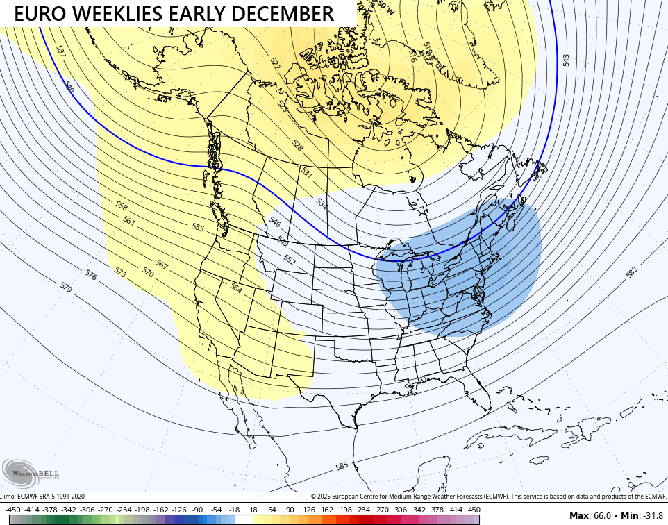
I’ll take that!
Hurricane Melissa continues to break all kinds of records as it nears Jamaica…


That’s catestrophic.
I will have updates as needed today and on my Meteorologist Chris Bailey Facebook Page
Until then, here are your rain and wind tracking tools for the day…


Make it a terrific Tuesday and take care.

Those weeklies will bust.
The leaves here have really shown its colors since the weekend. Last week about this time the leaves were still solid green. It’s amazing how nature works.
Sorry my brain wasn’t function should be Leaf’s
Winterlover, you were right the first time, leaves is the plural of leaf
Leaf’s sort of indicates that it is something that belongs to a leaf.
Thanks Joe.
Melissa continues to be an absolute monster. Central pressure has dropped to 892 mb, which is tied for 3rd place on the all-time low barometric pressure, but that’s a little misleading. Those all-time record lows were recorded when the respective storms were far out to sea, while Melissa’s was recorded mere miles from landfall. If ever there was a candidate to be labeled a Category 6 storm, this would be it!
Ocean water temperatures south of Jamaica are in the +90°F range, so additional strengthening is not out of the question. After moving west-northwest for a while yesterday, the storm has turned to the northeast, placing the center of Jamaica squarely in the storm’s path.