Good Tuesday, everyone. Let’s start things out by giving a big thank you to all our Veterans out there! You are very much appreciated! I wish I could give our vets some better weather because it’s still pretty nasty out there. Wicked wind chills start the day with some big winds to end the day.
Wind chills this morning will range from the high single digits to low teens in many areas. Actual temps will reach the upper teens and low 20s for many. By the afternoon, temps reach the upper 30s central and east with some 40s in the west.
Our temperature map will help you out…

Record cold is going all the way into south Florida and has engulfed the entire eastern half of the country…
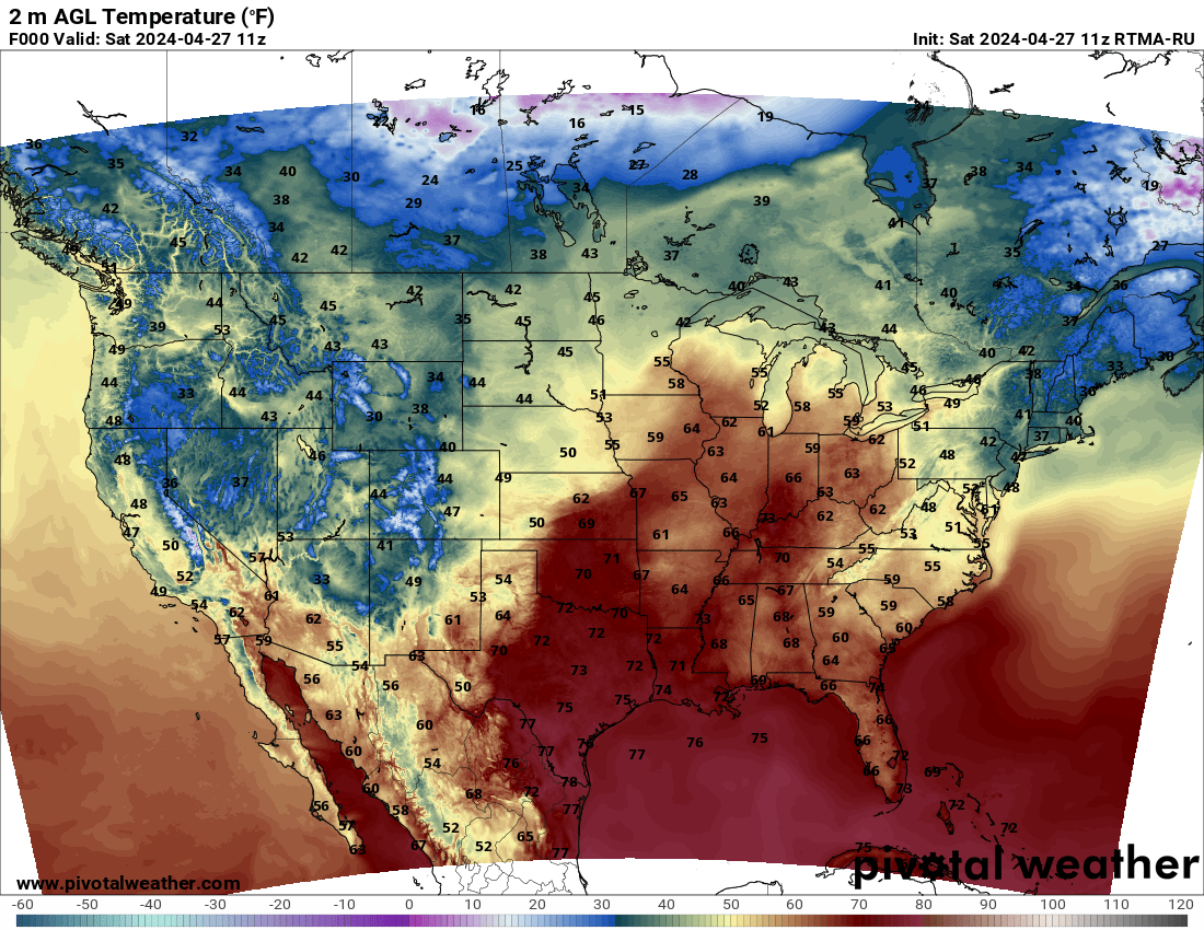
Oh and those wind chills are nasty…
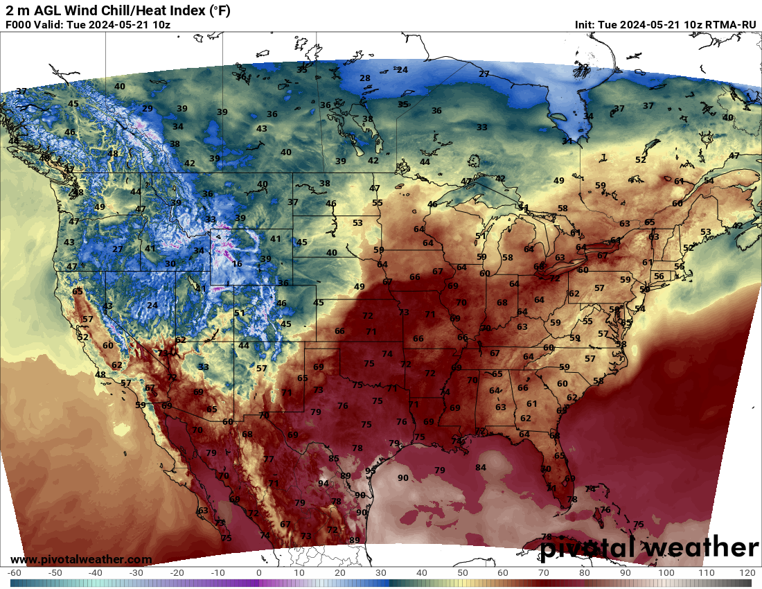
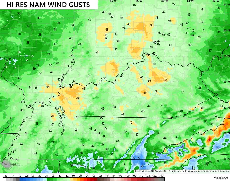
The winds flip around to the west and southwest later today and into Wednesday. This wind will peak close to 40mph at times in some areas. Once again, we find the Hi Res NAM going above and beyond…
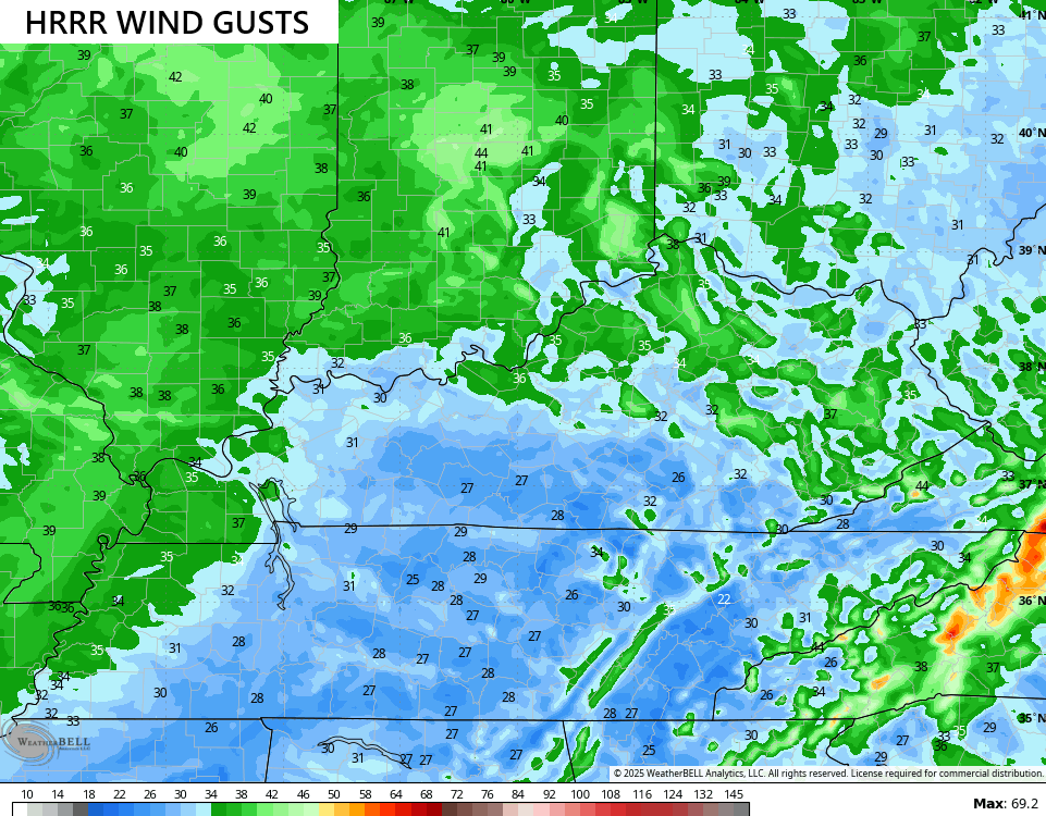
The HRRR isn’t as impressed but still pushes 40…
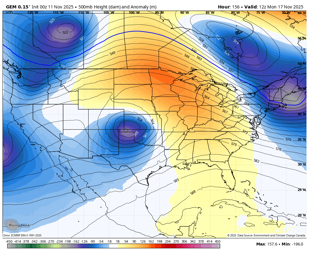
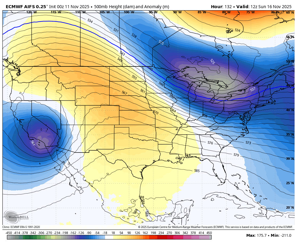
Temps surge by the end of the week into the weekend as we turn it mild for a few days. That’s ahead of a cold front dropping in with a big drop in temps later Sunday and Monday. This is when we watch the major blocking start to really show up across the higher latitudes. The models are slowly starting to see this and will adjust in the coming days.
Watch how they are showing some pretty big dips and potential storm systems. Here’s the Canadian next week…
The EURO and EURO AI are also seeing this well…
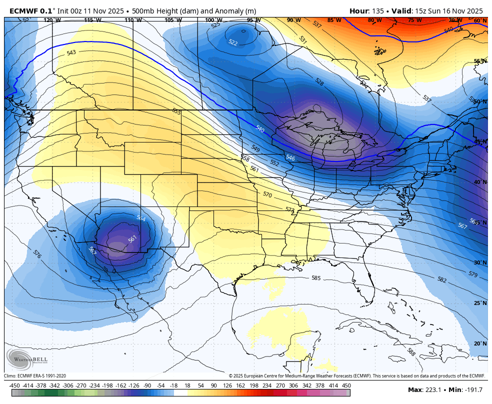
Blocking like that can lead to some extreme scenario underneath and that’s something we have to watch for. I’m still thinking we can get another thunderstorm to snowflake system at some point next week.
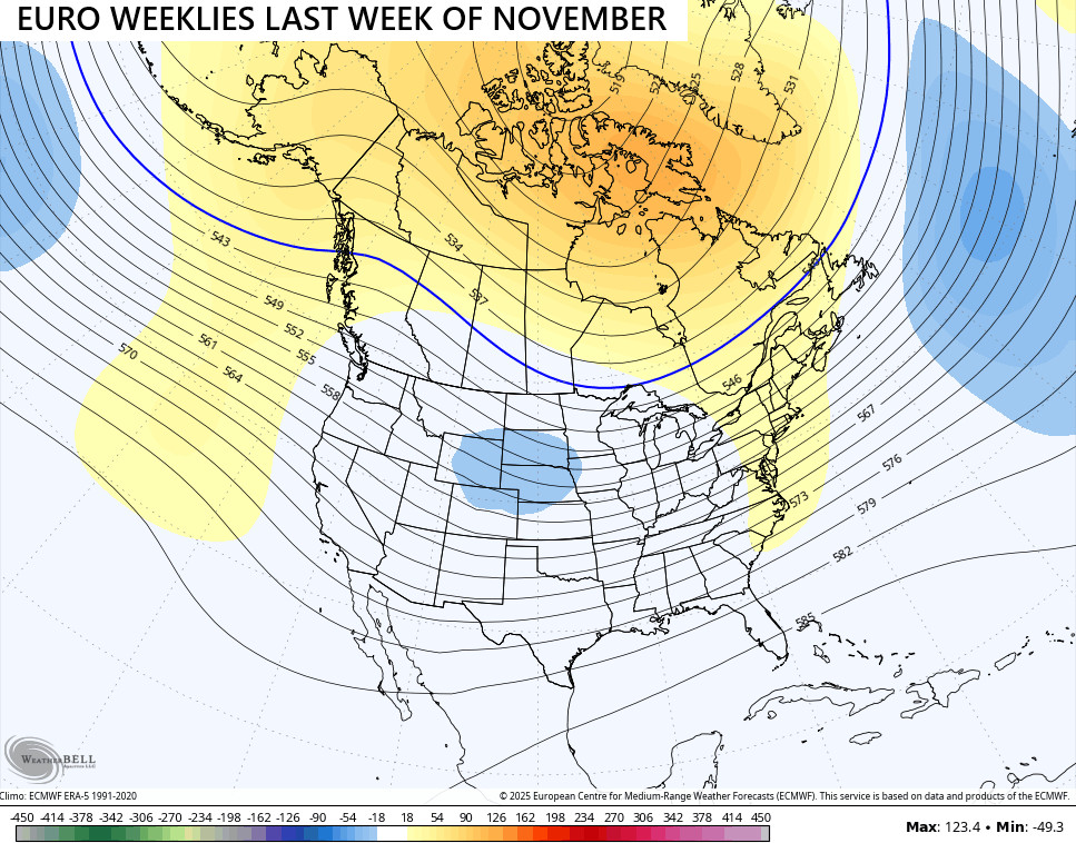
We continue to lay the groundwork for what should very well be a wild December for winter weather loves. The high latitude blocking we’re seeing in the Medium Range has been forecast for a while and the models keep this going through Christmas, at least.
The latest from the Euro Weeklies continues to show this pattern kicking in to end November…
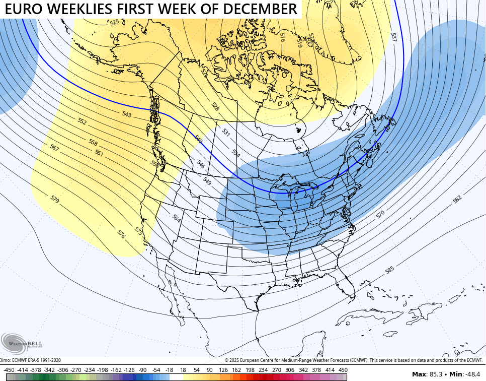
Watch this trough deepen during the first week of December…
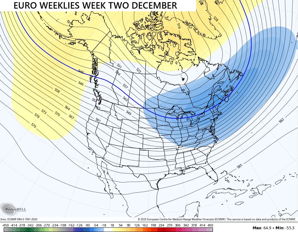
And week two…
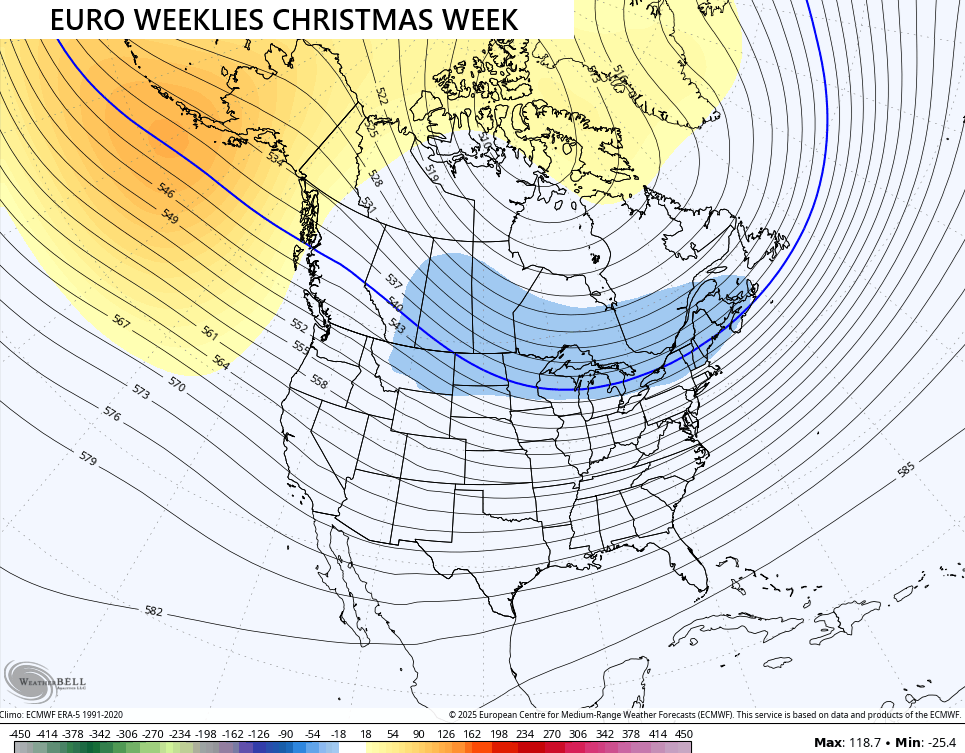
The Euro Weeklies now go through Christmas Day and they continue to like the deep trough idea…
The average snowfall forecast from the 101 members that comprise the EURO Weeklies looks like this…
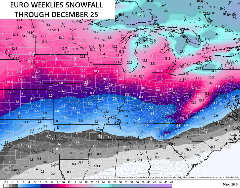
That isn’t meant to be taken verbatim, but it gives us a good idea that plenty of snow chances show up during this same period.
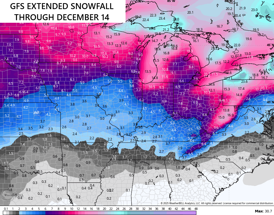
The GFS Extended doesn’t go out as far as the Euro Weeklies, but it’s also showing plenty of snow chances…
I’ll have another update or two later today and on my Meteorologist Chris Bailey Facebook Page
Until then, here are your tracking tools for the day…


Have a terrific Tuesday and take care.

I hope these models fail. 🙂
On this special day, I honor ALL those who have served honorably in the Military – in wartime and peacetime.
Thanks Chris. The NWS is on board, as well as The Climate Impact Company, for a Colder than Normal December. However you, predicted this weather pattern change back in the late Summer. Great Work Chris.
Climate Impact Company forecast : )
https://climateimpactcompany.com/u-s-week-2-5-outlook-looking-colder-for-december-2-2/
Colorful maps, very nice to see
BBRRRRRRRRR!!!!!
Thanks Chris and THANK YOU VETERANS!