Good evening, everyone. Our blast of winter weather continues across the region but is slowly winding down. Now comes a major flip ushered in by some big time winds. This flip is living on borrowed time as this pattern wants to hit winter running.
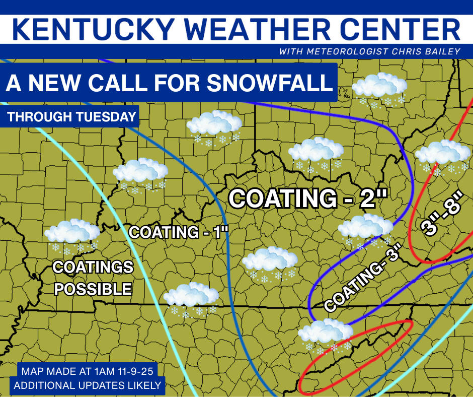
The forecast for snowfall worked out pretty darn well…
Black ice is a real issue tonight, especially on bridges and overpasses. Some delays and cancellations are a good bet once again tomorrow.
Temps didn’t get out of the 20s this afternoon for many areas. Lexington was at 30 at midnight and that was the high for the day. Check out how rare this is…
Lexington hit 30 degrees for the high today. There are only 5 other days in recorded history that featured a high temp of 30 or below this early in the season.
30 on October 30 1917
30 on November 2 1954
30 on November 3 1966
30 on November 4 1991
29 on November 10 1913 #kywx— Chris Bailey (@Kentuckyweather) November 10, 2025
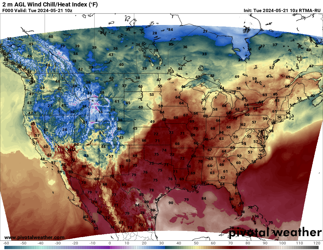
Here’s a look at your current temps…

Historic cold is going all the way to the deep south…
Brutal wind chills will be near 10 tonight, and we aren’t alone with the bitter wind chills…
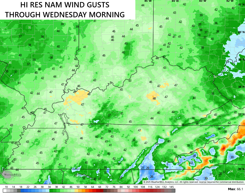
Winds become westerly and southwesterly later Tuesday and those will really crank Tuesday night as milder air returns. Gusts of 30mph-40mph will be likely with some models going above and beyond…
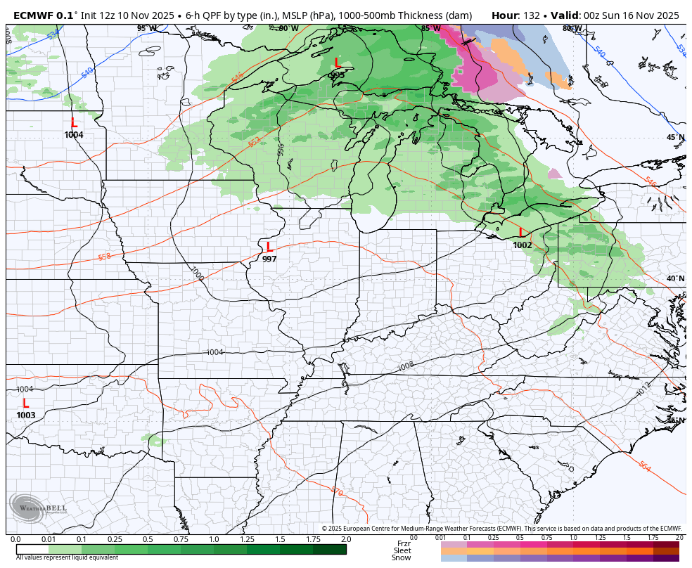
The amount of blocking is already taking a toll on the models as they’re swinging back and forth from run to run on how to handle the late weekend system and the ones coming in next week. The EURO takes us from mild to much colder with the late weekend and early next week system…
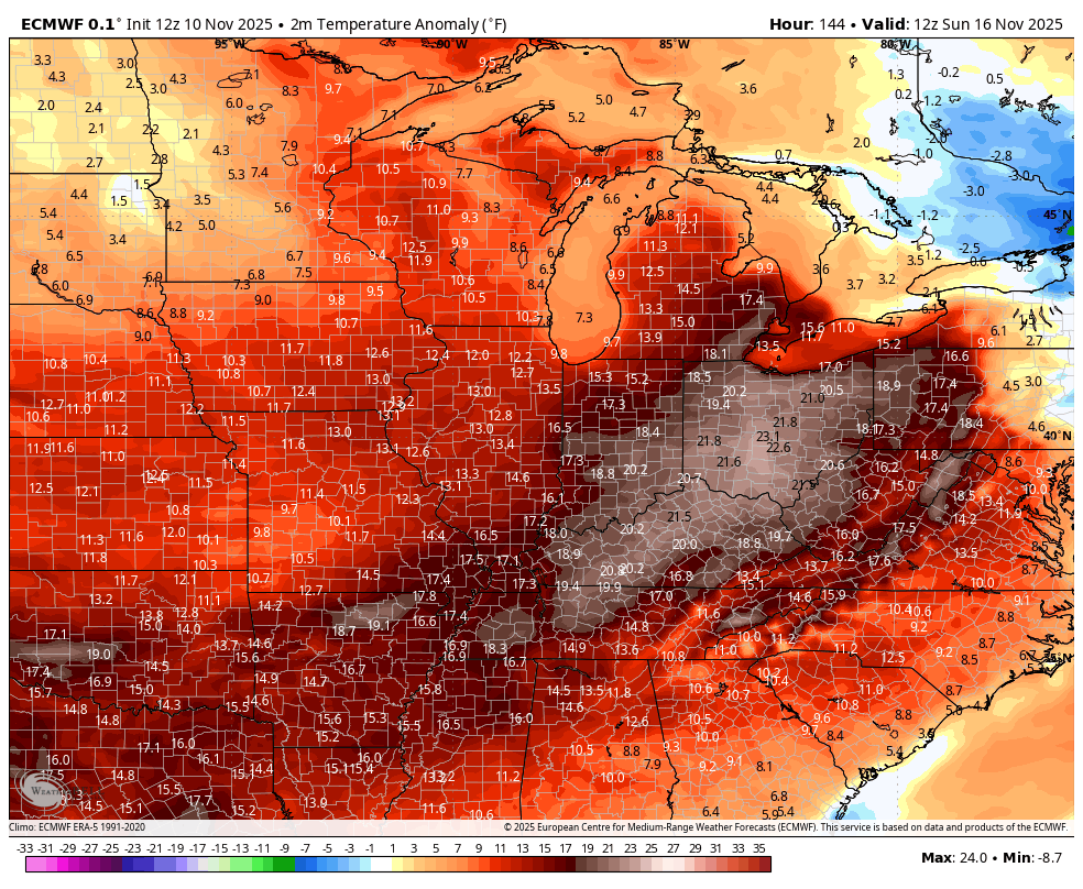
Watch this wild temp swing as we go MUCH above normal to below normal…
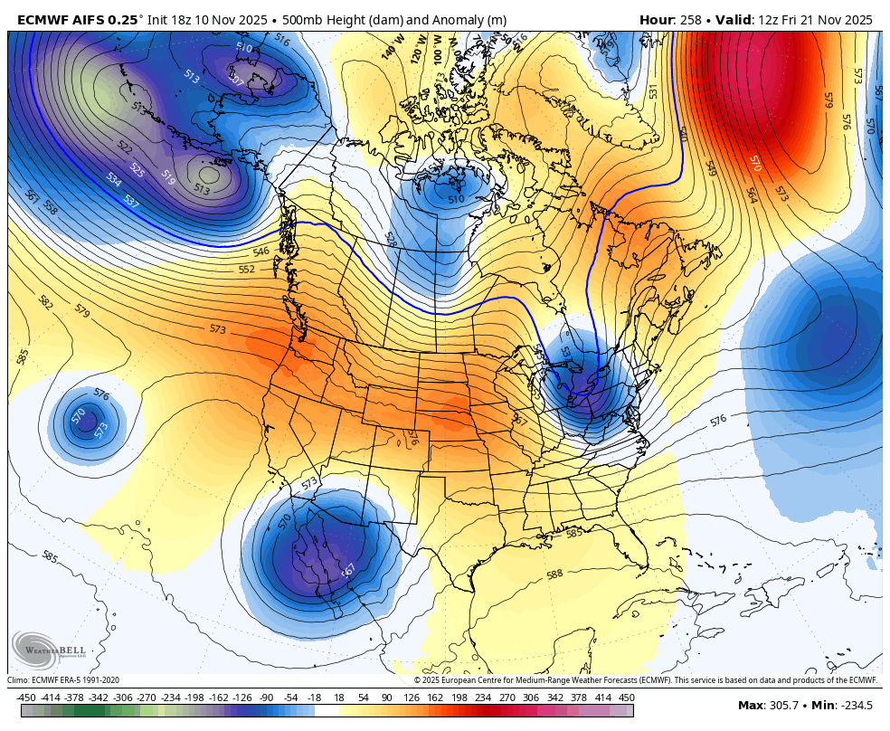
As the models start getting a better idea of the amount of blocking, we will see them developing deeper troughs and that’s what the EURO AI is starting to do. This animation takes us from the weekend through the start of Thanksgiving week…
The EURO Weeklies just keep getting colder and snowier for December and I’ll have those later tonight.
Look for a few more evening updates on my Meteorologist Chris Bailey Facebook Page
Until then, here are your tracking tools for the day…


Have a magnificent Monday and take care.
