Good Friday to one and all. Rounds of rain continue to push across Kentucky as a stubborn boundary keeps on keeping on. As the rains clear out later Saturday, we watch another rainmaker roll in early Thanksgiving Week. This system ushers in cold air for the Thanksgiving Weekend with the chance for some flakes to show up.
Let’s start with the current system before we look farther ahead.
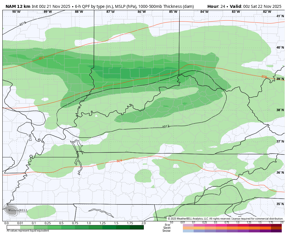
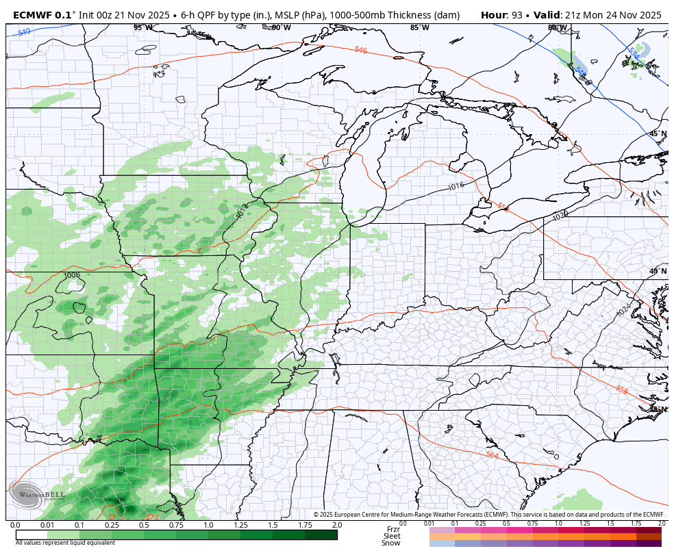
Rounds of rain and some thunder are rolling from west to east with another 20 degree north-south temp gradient likely. This action tapers off from west to east early Saturday, but some low clouds and drizzle may linger through much of the day.
This animation goes from 7pm this evening through 7pm Saturday…
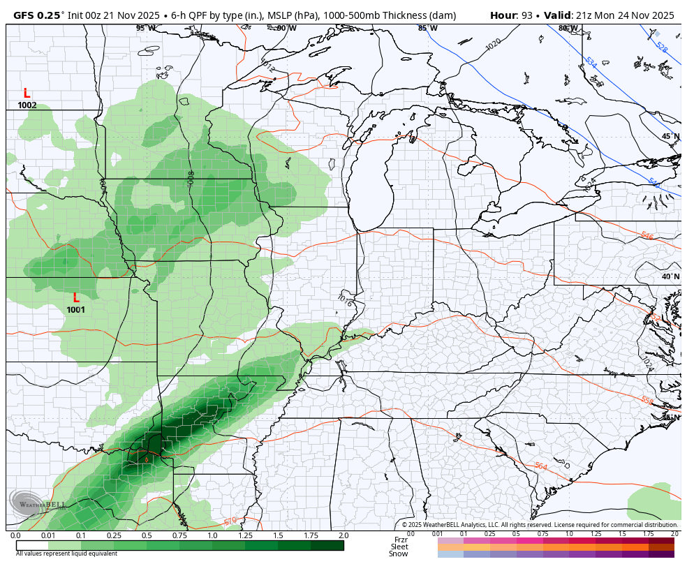
The Thanksgiving Week setup continues to be one that begins the transition into winter. We have rain arriving later Monday into Tuesday as temps run mild still. This is ahead of a sharp cold front moving in late Wednesday into Thanksgiving morning. That boundary may have a wave of low pressure along that can bring a few showers and a flake. The chance for a disturbance right behind that is still there for Black Friday.
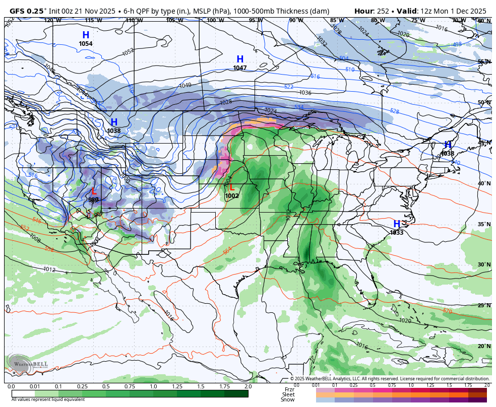
The GFS sees the wave of low pressure but doesn’t really see many flakes as the cold crashes in…
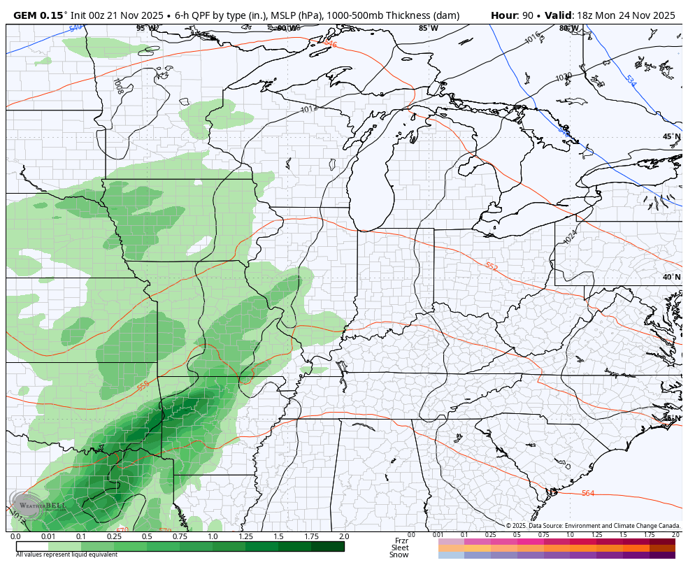
The Canadian has less wave along the boundary but sees the disturbance behind it with the light snow to our north…
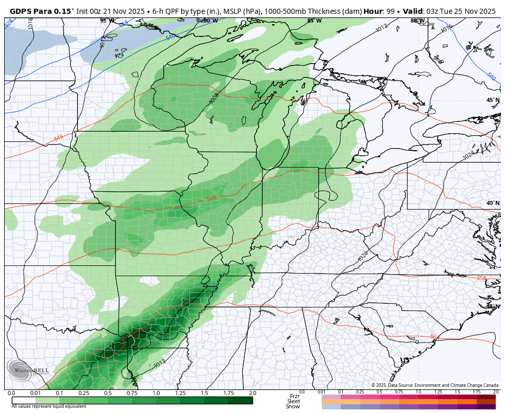
The Parallel Canadian is probably closest to the model that matches my thoughts as it does see a stream of some flakes with the Black Friday disturbance…
The EURO continues to feature the wildest swings from run to run. The model doesn’t think too much of the Thanksgiving cold front because the model is suddenly developing a low behind it that runs through the northern Ohio Valley…
I’ve talked about a southeast ridge offering some initial resistance to this major pattern change and that’s still the case. My last post lamented about an early December signal for a strong storm system that I believe can bring us heavy rain and storms to some snow. Sure enough, some of the models are seeing that as the arctic cold wins the fight…
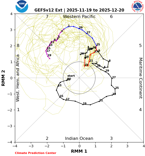
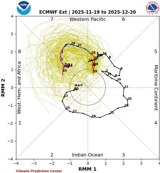
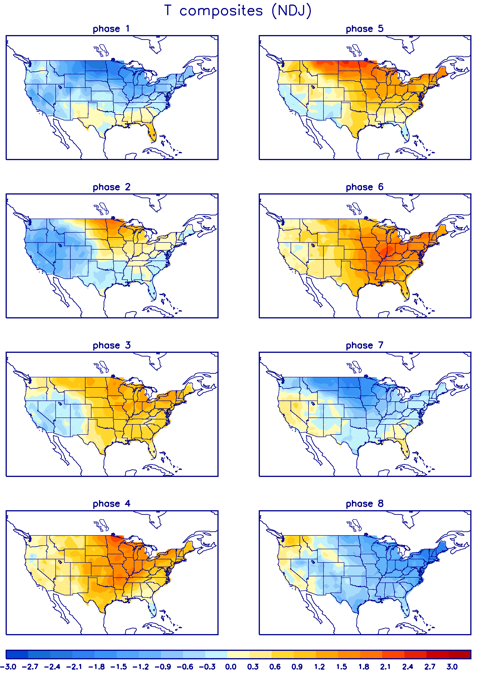
If we take a look at the latest forecasts of the Madden-Julian Oscillation, or MJO we find all the long range forecasts looking pretty similar. Now, these charts are really hard to decipher if you don’t know what you’re looking for. Let me give you a brief description… We have 8 phases of the MJO and those are numbered on the outer edge of the chart. The main squiggly line is the forecast line. The black part of the line is where the MJO has been. The colorful parts of the line show the forecast out in time. The numbers along the line show the corresponding dates for the next month.
The GFS Extended forecasts the MJO into Phase 7 to start December and then into Phase 8 by the middle of the month…
The EURO Weeklies are faster into Phases 7 and 8…
What do the corresponding temperature maps typically look like in those phases? Cold for much of the nation in December…
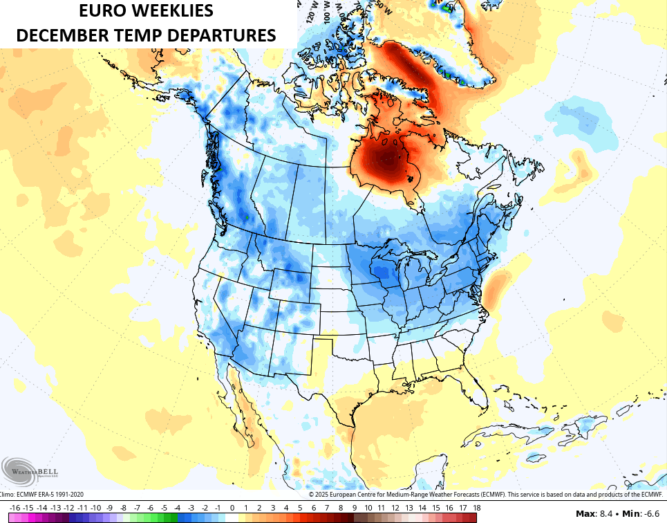
That looks a lot like what the EURO Weeklies are seeing as they continue with coast to coast colder than normal temps for December…
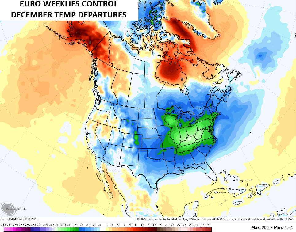
The Control Run of the EURO Weeklies shows the potential I’m worried about…
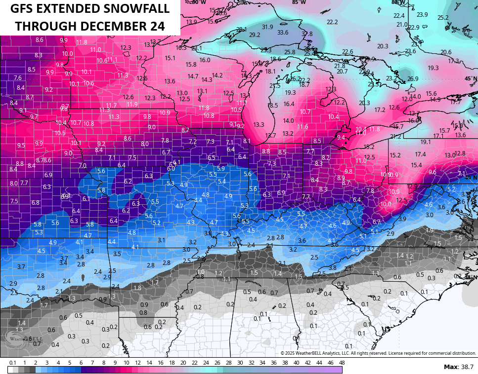
The extended models continue to go all in on the potential for a lot of winter in December. The GFS Extended goes through Christmas Eve and likes the snow potential…
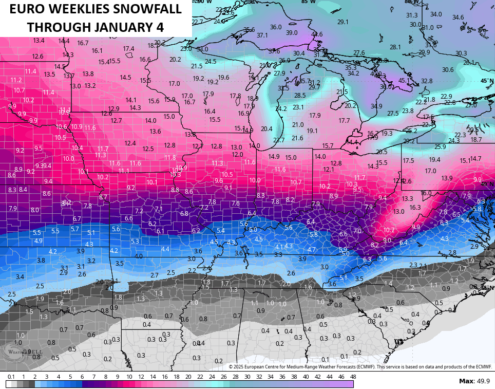
The EURO Weeklies go a little farther out in time but also show a lot of snow chances…
I will have another update or two later today and, of course, I’ll have updates on my Meteorologist Chris Bailey Facebook Page
Until then, here are your tracking tools for the day…


Make it a fantastic Friday and take care.

Thanks Chris. Just viewed your Winter forecast, and your presentation and what may happen this Winter in the way of weather was Excellent ! Your Bold Prediction for a ” White Christmas ” would be great for all the Snow Lovers. I’ll take any kind of weather type for Christmas though. Hoping the early Spring happens in March, but that may mean a longer Severe Weather season. As always we shall see.
All I know about MJO is that it is a system that propagates around the equator changing weather patterns. It’s very difficult to learn how this Oscillation really works with all the other Oscillations that effect our part of the World.
I’m tired of this ugly weather the last couple days. Cold with sunshine looks pretty good right now.
Chris, saw your new show last nite and it was great!