Good Saturday, everyone. Our weekend is off and running with the dreary stuff slow to break, but some better weather rolls in for our Sunday. that leads us into an active Thanksgiving Week of weather with another rainmaker ahead of a touch of winter just in time for the big Holiday Weekend.
Low clouds, fog, drizzle and showers will be noted this morning in many areas. The low clouds and drizzle will likely hang tough for many into the afternoon with slow clearing showing up from northwest to southeast.
Clearing skies settle in for Sunday with highs generally in the 50s. Sunday is your day for any outdoor activities.
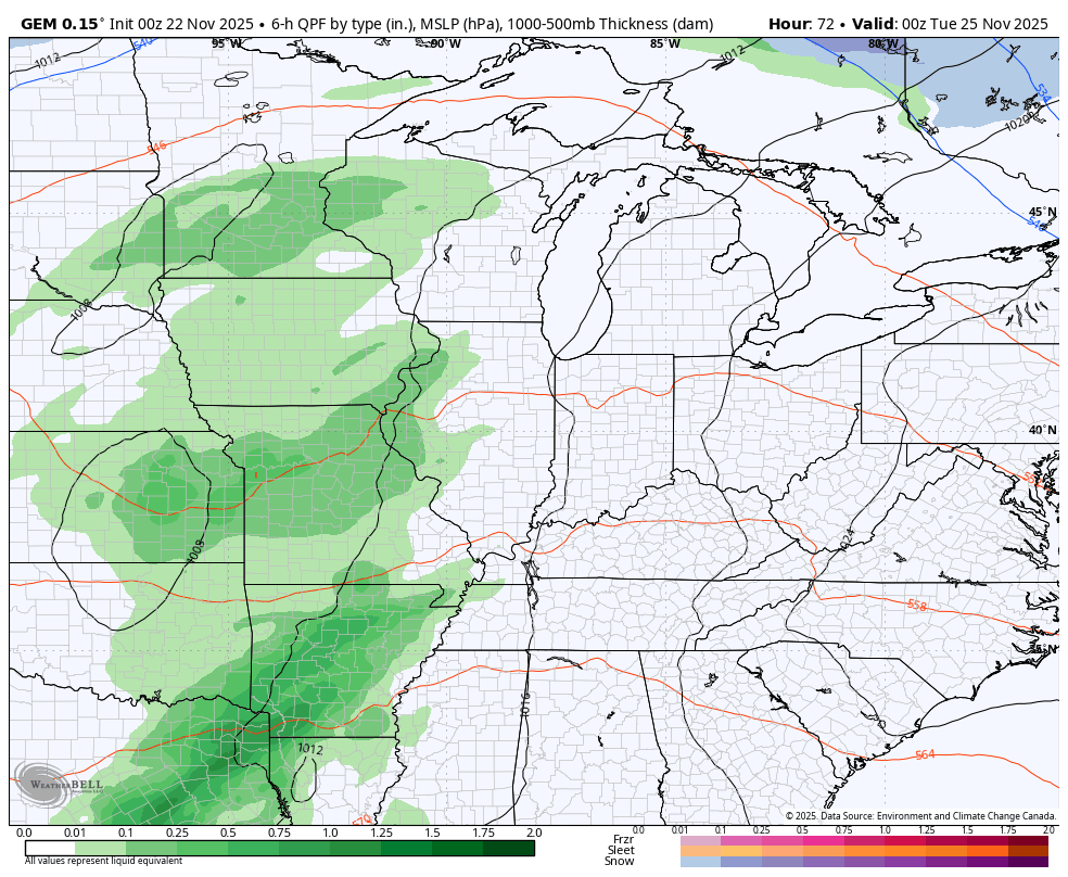
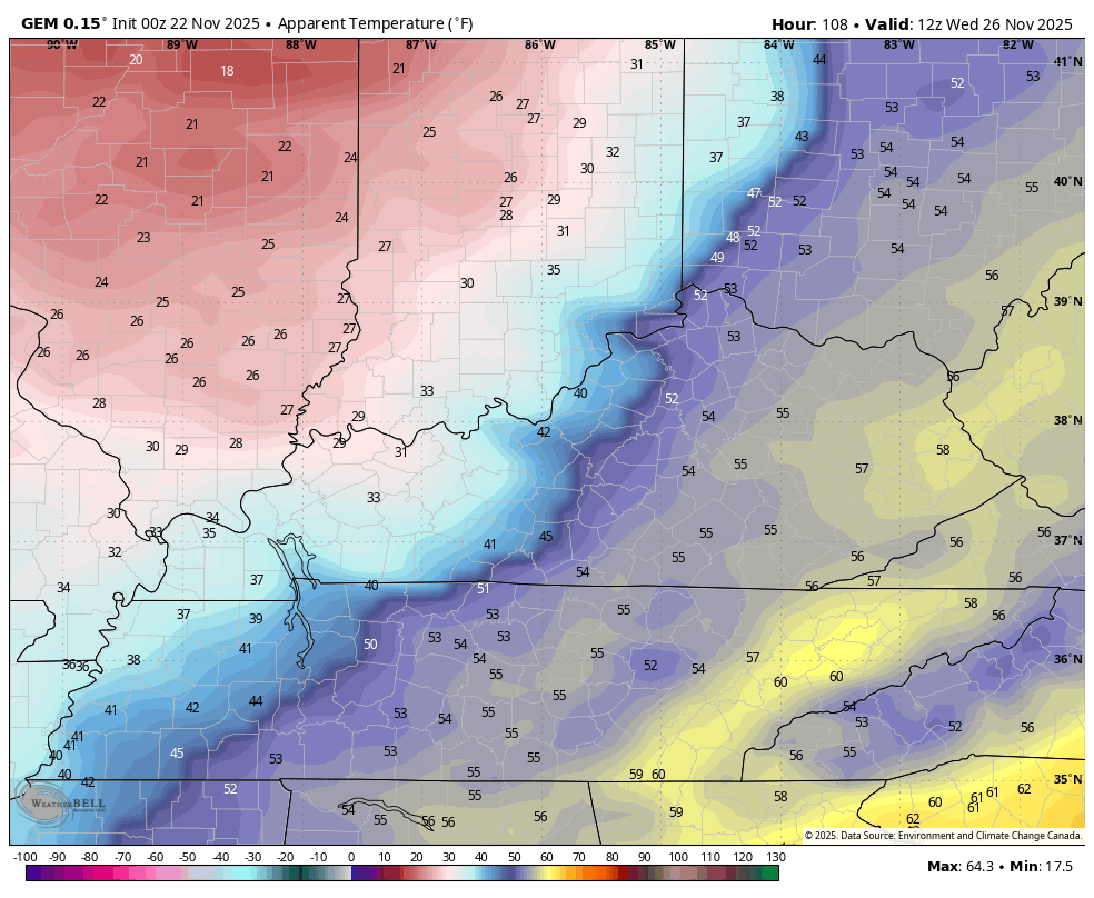
Clouds increase on Monday as low pressure moves our way from the southwest. that brings rain in here Monday night and Tuesday as temps jump on a southwest flow. The big cold front arrives on Planes, Trains and Automobiles Day Wednesday. Winds are gusty with falling temps and showers along and ahead of the boundary. A flake or two will try to fly behind that Wednesday night into Thanksgiving morning.
A small disturbance will zip through the base of the cold shot on top of us by Friday and has the chance to bring some flakes with it, especially in the north. Here’s what all that looks like…
Here comes Barney…
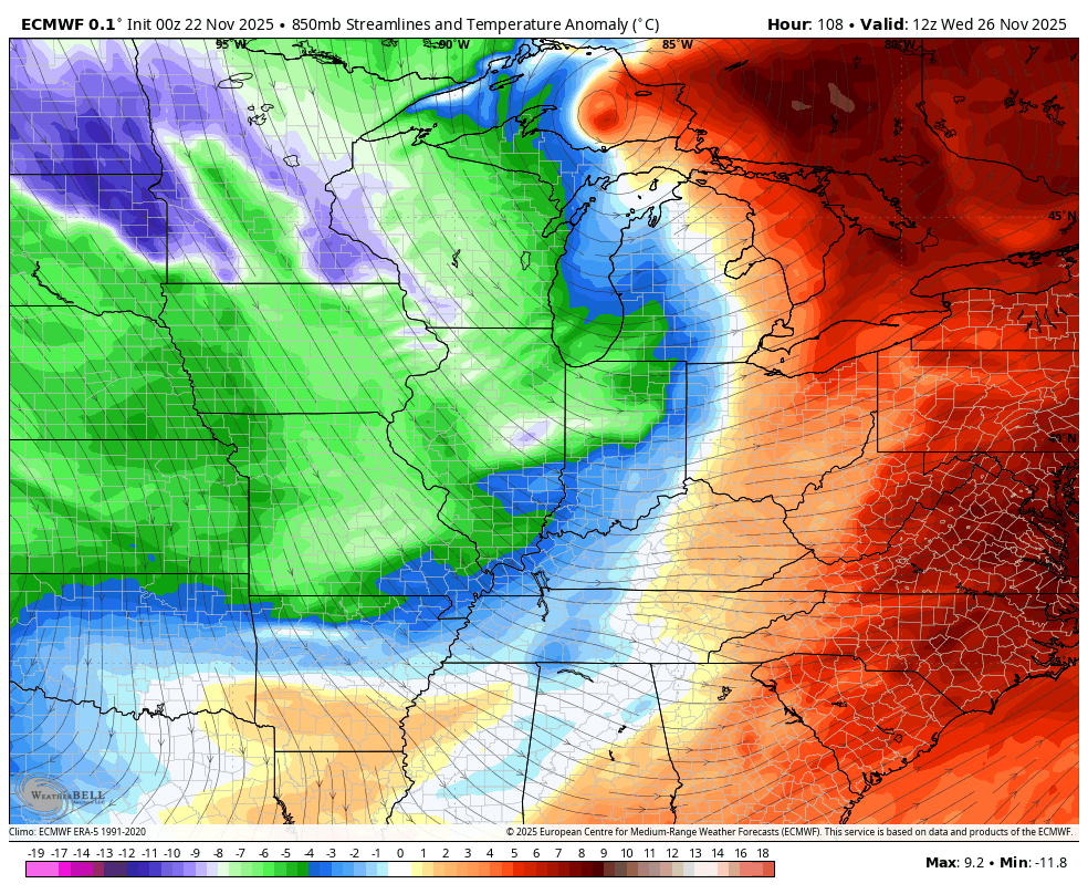
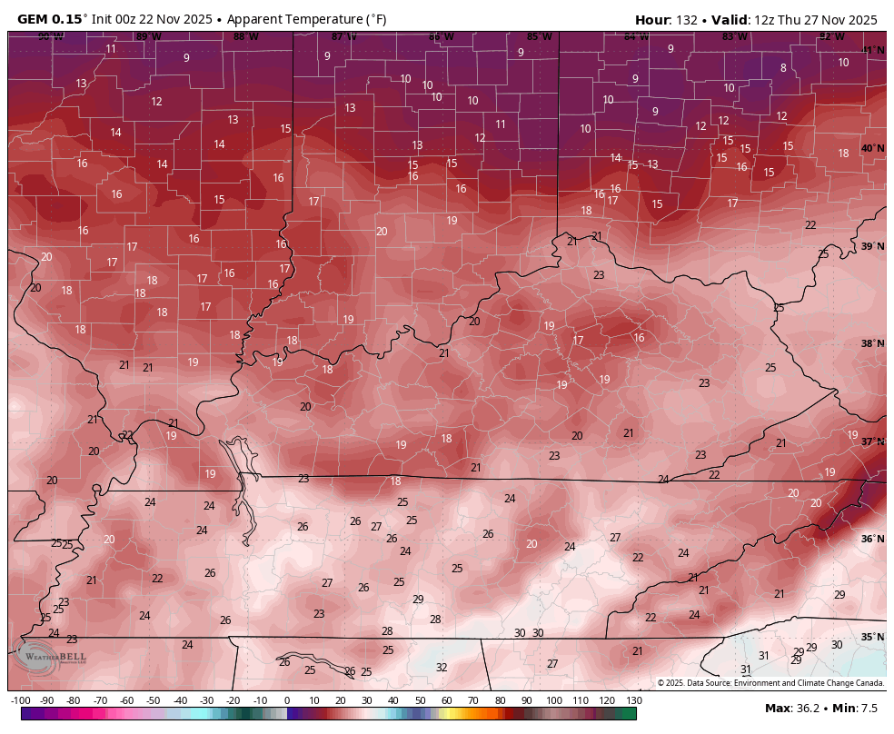
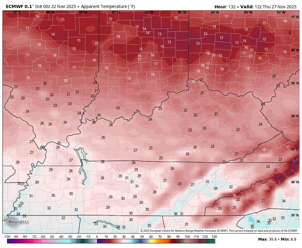
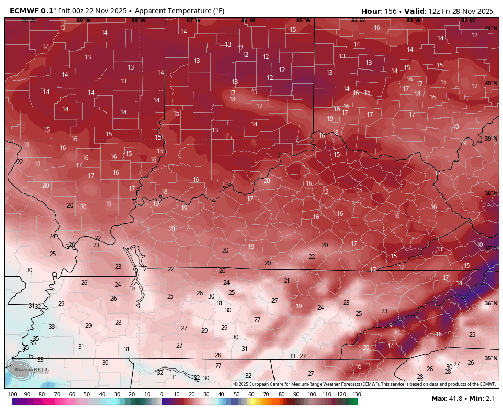
Temps drop all day Wednesday with highs ranging from the mid 30s to low 40s from Thanksgiving Day through Saturday. Gusty winds will make it feel much colder. Check out the wind chills for PTA Day on Wednesday. This is the Canadian from 7am to 11pm…
Wind chills in the teens will then be notes Thanksgiving Morning then again Friday morning. Here’s how everything in between looks for wind chills on the Canadian…
And the EURO for the same time…
That cold wind keeps those frigid wind chills through Friday into Saturday morning…
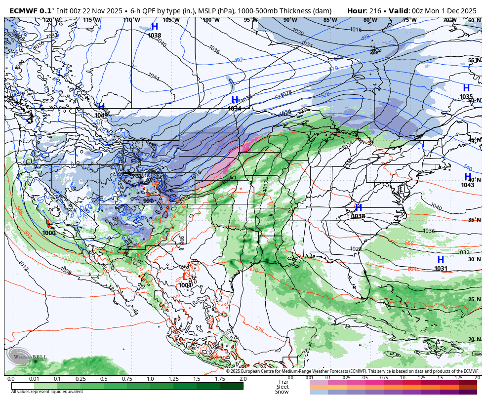
That shot of cold eases starting Sunday as that southeast ridge flexes for a few days. As this happens, the next round of arctic cold is diving down the Plains. This sets our region up in the battleground with the potential for heavy rain, strong storms before snow potential in the first 5 days of December.
How all this plays out will take a while to figure out and I assure you that every single forecast model run you’re seeing right now does not have the proper handle on things.
If we look at the trend from the GFS, we find the model seeing the cold progressing more than previous runs, but we also continue to see the GFS developing a spurious tropical system. Not only is it developing a spurious tropical system, but it’s also bringing it out of the Caribbean through the Gulf and making landfall on the Gulf Coast…
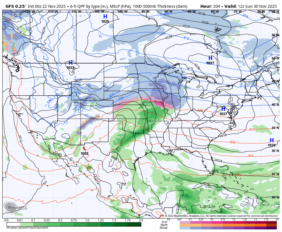
Again, if the models are developing phantom tropical systems, you know they’re struggling in a BIG way.
The EURO does not have a tropical system, and it is also correcting east as it turns things colder, quicker…
The EURO AI Ensembles give us a good view of how the cold regains control…
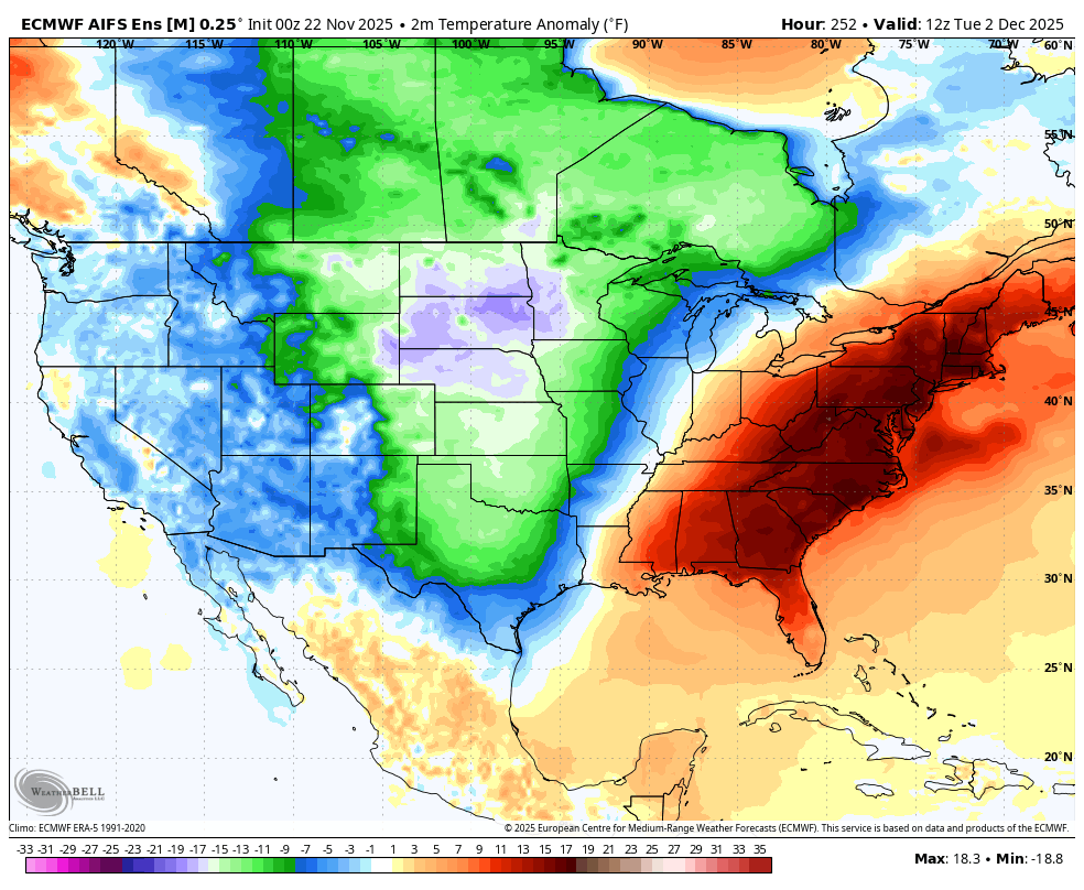
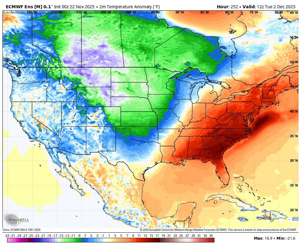
The same goes for the EURO Ensembles…
I’ll have another update later today and will also have updates on my Meteorologist Chris Bailey Facebook Page
Until then, here are your tracking tools for the day…


Have a great Saturday and take care.

Thanks Chris. Here’s a model that shows most of the Arctic Air will be more North / Central where the Snows will be increasing Southward. The Southeast Ridge influence is beginning to show up on this model. I’m hoping the Arctic Air will not make it into our area of the CONUS, because of all the High Pressure to our South will only make us more vulnerable to an Ice Event, like we had in 2009. We are just too far South this Winter for a Major Snowstorm, on account of another La Nina Winter. If a weak El Nino ever develops along with a positive Pacific ( PDO ) this coming late Summer, next Winter may be the opposite. Again, we shall see.
https://climateimpactcompany.com/u-s-midday-update-the-expected-evolving-snow-cover-is-the-cold-weather-key-for-december-2/
Just found the Current Position of the Polar Vortex on the Ventusky Weather Site. The Upper Low Pressure System is just North of Siberia / Russia : )
https://www.ventusky.com/#p=12;-59;0
Current Temperatures over Snow covered Siberia are in the minus 50’s.
No Thanks !!!
Funny how the models are loved during summer, but bashed in winter.
When the models are correct in the Winter, in the way of a Major Snowstorm, the models are popular. In the Summer, the weather is just plain boring, unless we have a Hurricane to track.