Good afternoon, everyone. I thought I would drop in a little earlier than normal for this update as we continue to look ahead toward an action-packed pattern to end November and begin December. It’s a pattern loaded with storm systems as winter starts to flex.
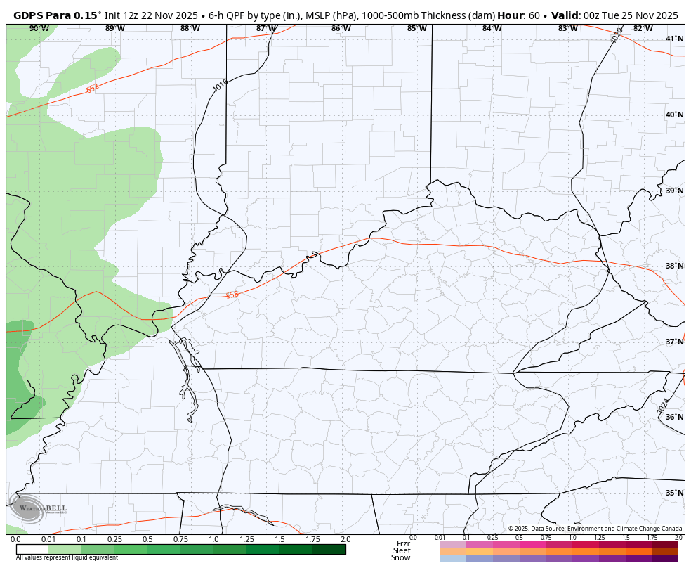
Before we get to the models seeing a faster change to cold to start December, let’s talk about our Thanksgiving week. Rain moves in later Monday into Tuesday as low pressure rolls from southwest to northeast. This brings showers and storms along with a brief temp spike.
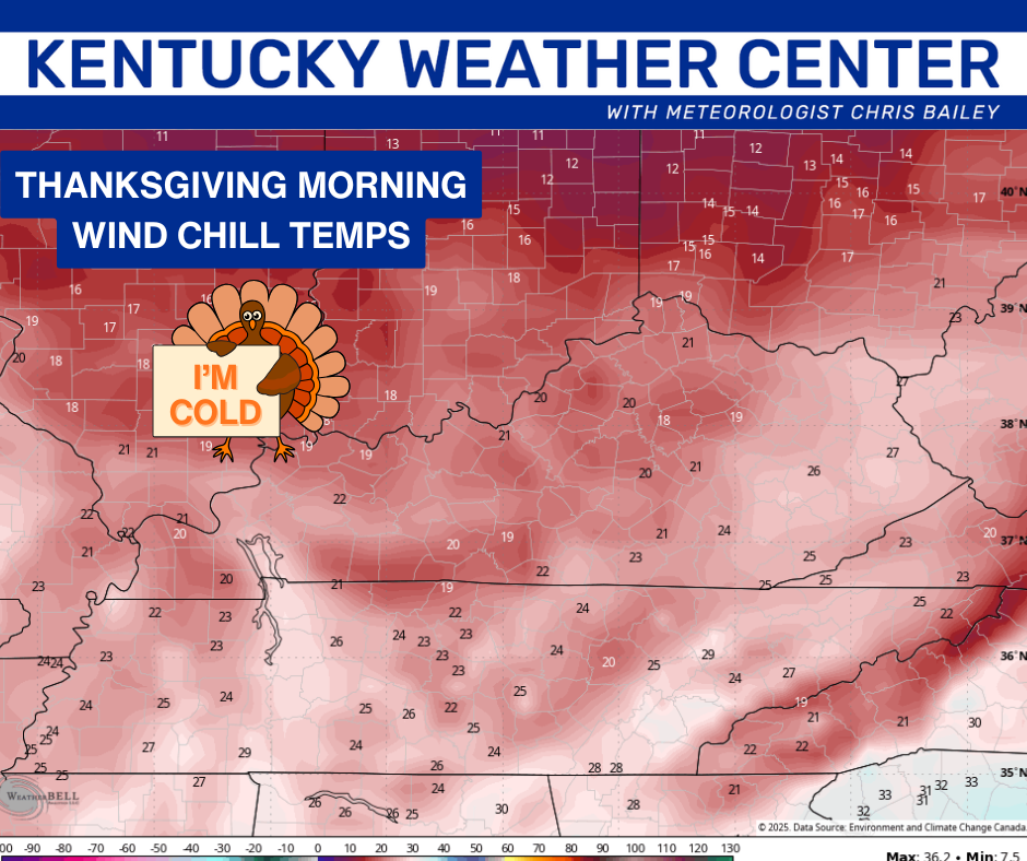
A strong cold front comes in behind it on Wednesday with gusty showers ahead of it and falling temps and the chance for some flakes behind it. Those flakes may very well fly Wednesday night into Thanksgiving Morning.
The Canadian family continues to see this well. This animation runs from Monday evening through next Black Friday…
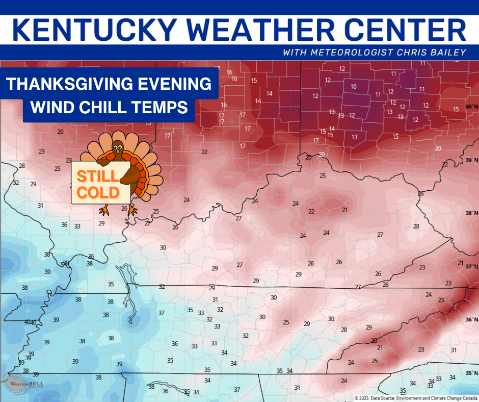
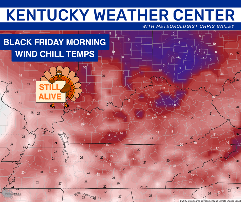
I’m still watching Friday for the flake potential with a weak disturbance passing through. Temps are frigid with wind chills dropping way down there Thanksgiving Day into Black Friday…
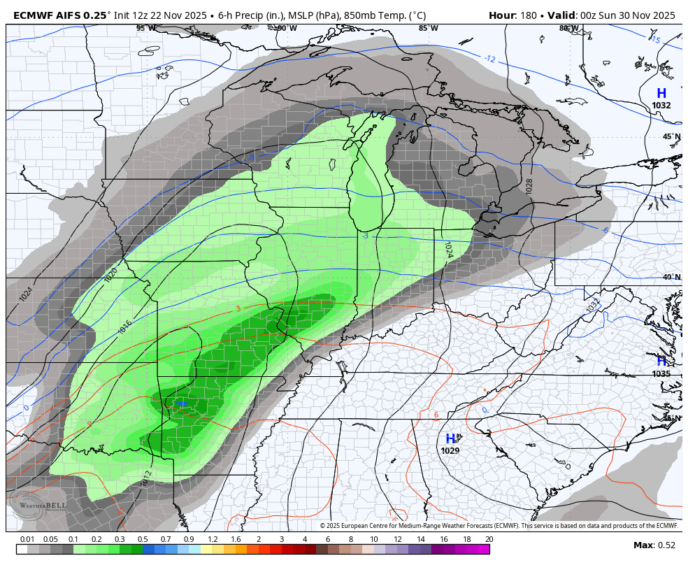
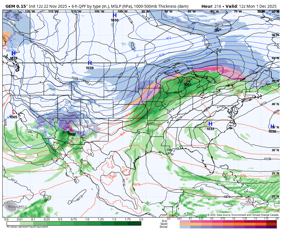
Temps jump late this weekend as a strong storm system develops in the Plains. The models are quickly focusing farther east with the track of this system as they start to get a handle on the amount of arctic air coming into the country and that troughs don’t want to hang out long in the southwest.
The EURO AI doesn’t give us precipitation types, but you can see rain to snow on this with the system to end November and begin December…
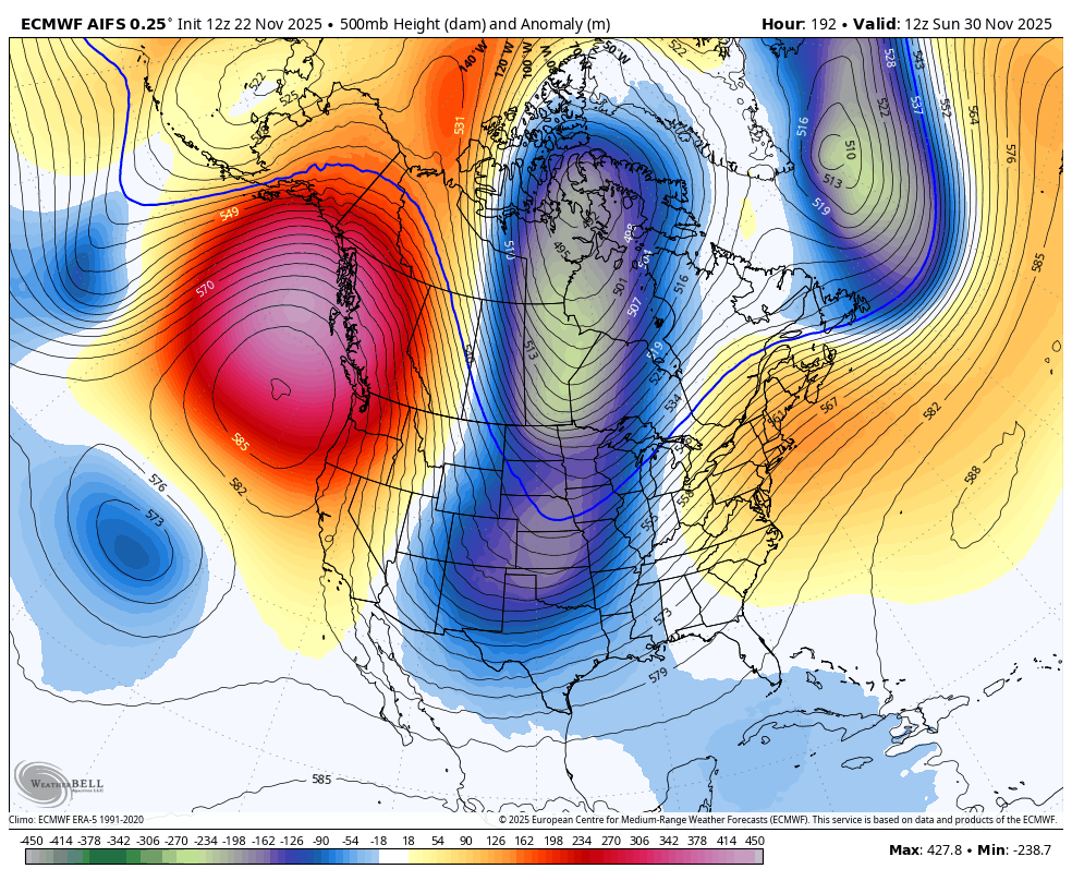
Look at that deep trough all of a sudden showing back up on the EURO AI for the first few days of December…
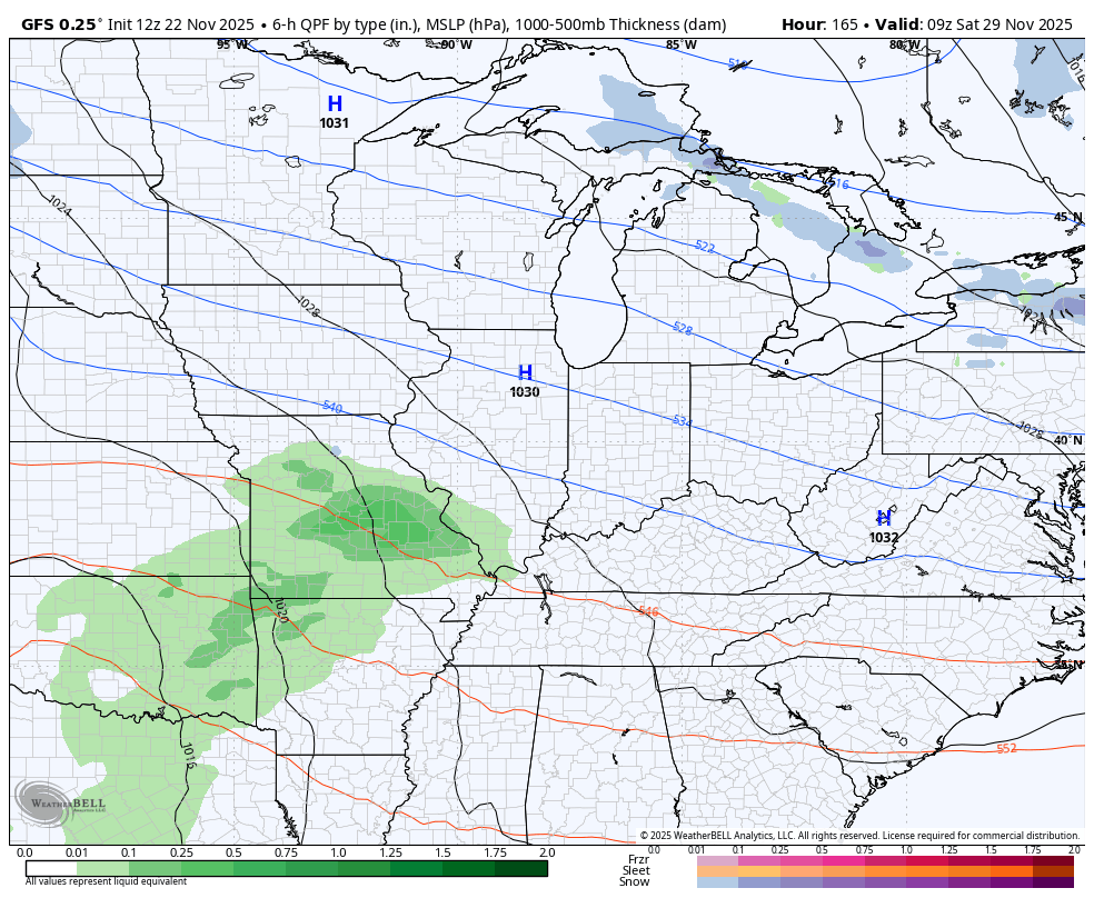
The GFS isn’t that aggressive with the cold, but you can clearly see how it’s much farther east and faster with the entire setup. The GFS has a series of lows passing through here late Thanksigivng Weekend into the first three days of December. The latest model run had snow to heavy rain/storms then snow during the aforementioned time span…
Again, neither of those models will be correct, but we are looking at the trend. The trend is for the winter potential to return quicker than the models were seeing yesterday.
One of the reasons the GFS flipped is it’s no longer seeing a landfalling tropical system along the Gulf Coast to start December. However, it’s still trying to make that happen later in the first week of the new month…
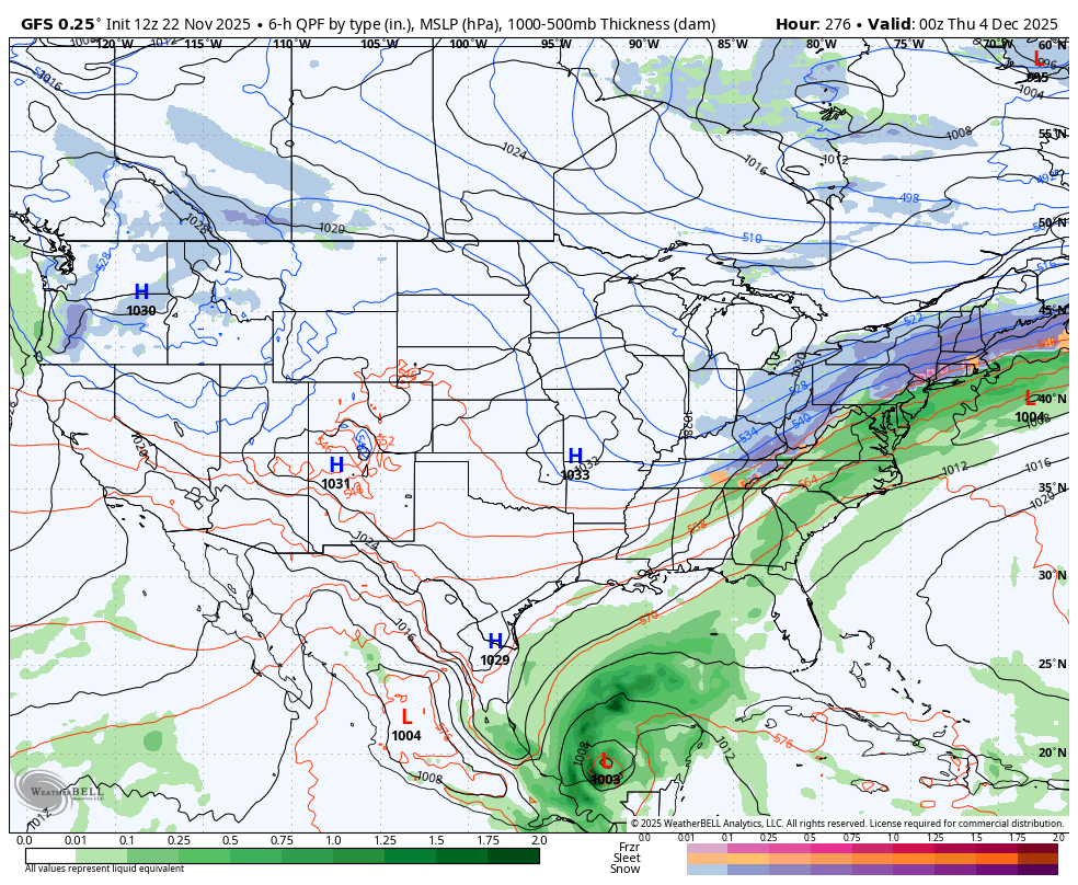
What the GFS is trying to do is not going to happen, but unfortunately the development of that system is impacting the entire model run. I hope forecasters out there understand this. For the record, there has never been a tropical system in the Gulf during this time…

I suppose there’s a first time for everything, but the odds are firmly stacked against it.
Another model that’s trending farther south, but doesn’t go out as far in time, is the Canadian…
There’s a chance I throw you another update later tonight, but like the GFS Gulf hurricane, the odds are firmly stacked against it. haha
Enjoy the evening and take care.

Thanks Chris. I remember back in January 1978, that a tropical storm in the Gulf merged with an Arctic Air Ma#ss, and a Blizzard Warning was issued 3 hours before the storm’s merging. That night we had 50 MPH winds with very heavy Snow. The next Morning, we had a 20 foot Snowdrift in our driveway, and a temperature minus 12 degrees. That happened in a weak El Nino / positive PDO Winter. I have my doubts that we would have that scenario in our continuing La Nina / negative PDO since 2019. I just expect, that in my area of the State, the Snowfall will be well below normal this coming Winter. It has been since 2015 Winter. At my age I really don’t want any extreme Arctic cold, or Blizzards, or Ice storms, but Ice storms seem more likely than a Snowstorm in my area. The Ice storm in 2009 was the worse I’ve seen in my 74 years. No power for over a month !
https://www.weather.gov/ind/blizzardof78