Good Sunday, everyone. We have a pretty nice day taking shape across Kentucky and surrounding areas, but that’s about to change. Our Thanksgiving Week looks active with a change to winter arriving right on cue for the holiday weekend. That’s also a period we now find the models trending back to where they started.
Our Sunday starts with fog and low clouds for many areas. Where the clouds try to linger, temps may be held below 50. For areas getting in on sunshine, say hello to the mid and upper 50s.
In the overall scheme of things, I have no changes to the forecast for the holiday week ahead. Here’s a breakdown:
MONDAY
- Temps remain mild as clouds increase and thicken through the day.
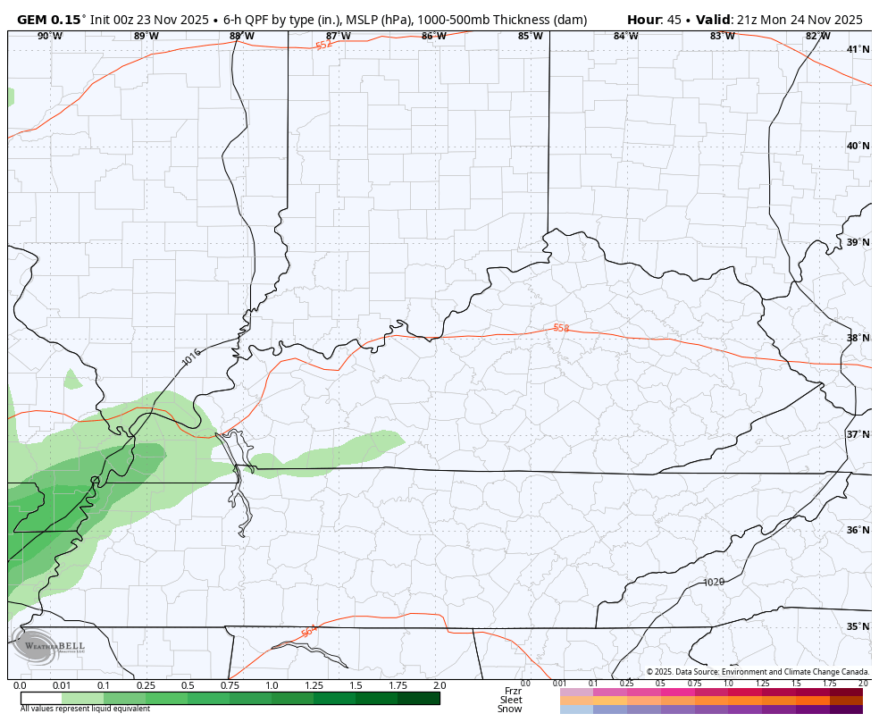
- Rains arrive in the west during the afternoon and evening.
- Those rains overspread the rest of the state Monday night.
TUESDAY
- It’s a very mild wind coming from the southwest ahead of a potent cold front.
- Rounds of showers and some thunderstorms sweep across the state.
- Locally heavy rains can spit out another inch or two for some.
- Winds are gusty.
WEDNESDAY
- The cold front sweeps in quickly from the west.
- Gusty showers will be noted along and ahead of this boundary.
- Temps are in the 40s ahead of this front then crash through the 40s and into the 30s by evening.
- Any leftover moisture Wednesday night would be in flurry form.
THANKSGIVING
- It’s a cold day across Kentucky with temps in the upper 20s to start. Highs range from the mid 30s to low 40s.
- Gusty winds will make it feel even colder.
- Wind chills will be in the upper teens and low 20s in the morning.
- Afternoon wind chills will be in the upper 20s and low 30s.
- Evening wind chills drop to around 20.
- There’s still the chance for a few morning flakes in the north and east.
BLACK FRIDAY
- Temps are even colder with lows in the upper teens and low 20s to start.
- Highs are in the 30s.
- Gusty winds make it feel even colder throughout the entire day.
I continue to like what the Canadian is doing with this whole setup, and it continues to be the model that likes the flake chances early Thanksgiving morning. This animation goes from Monday evening through Black Friday morning…
There is a ton of model disagreement with how to handle the setup later in the weekend into the following week. With the southeast ridge flexing and the arctic air flexing in the Plains, it’s going to set us up in the battleground area and that means a lot of precipitation falls around here.
Heavy rain, storms and some snow will all be possible in the first week of the month. How we get to each of those will be a work in progress for a while.
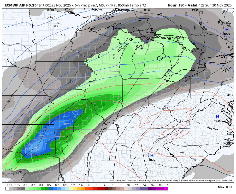
The EURO AI continues be faster with this setup, bringing a lot of rain in here late Sunday and Monday with some wraparound flakes and cold…
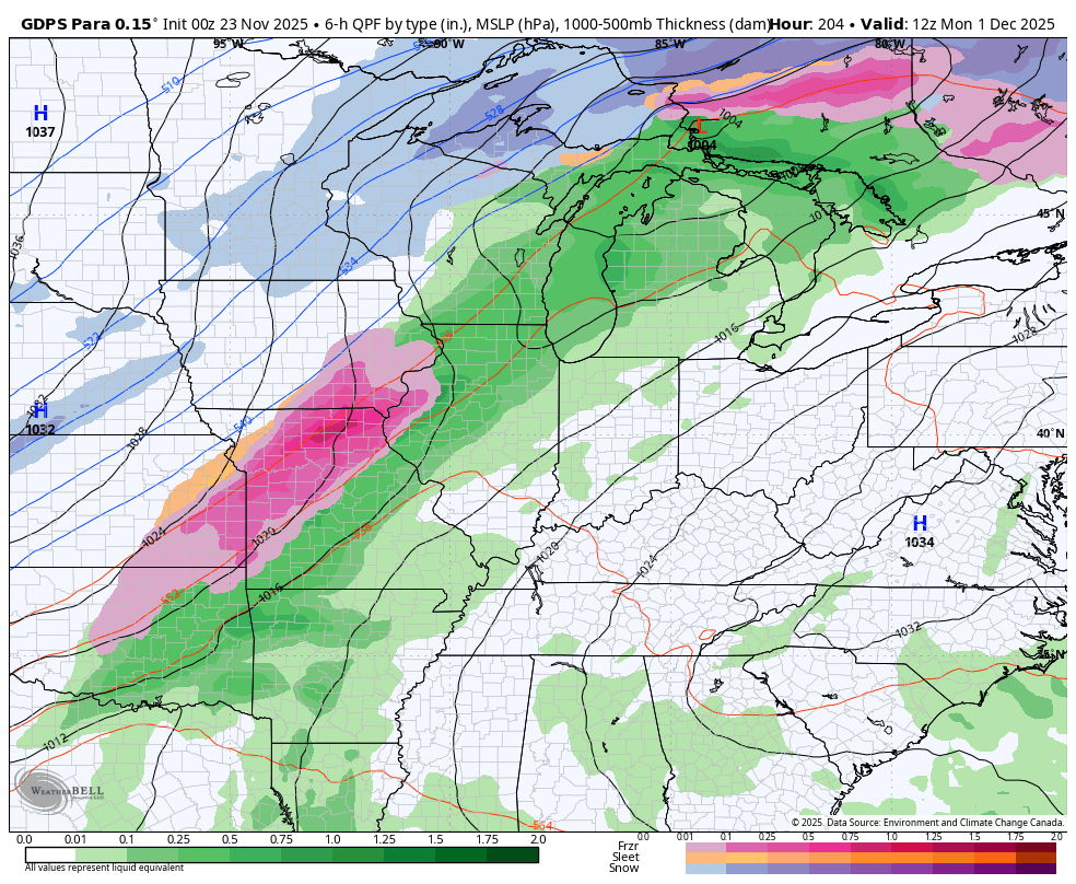
The Canadian family is a little slower and more active with the whole scenario. This model doesn’t go out as far in time as the others…
The GFS continues to throw us some absolutely wild swings with each run that happens every 6 hours. The overnight run of the GFS is back to showing the first ever Tropical Storm or Hurricane hit on the United States in December which throws the entire run out of whack…
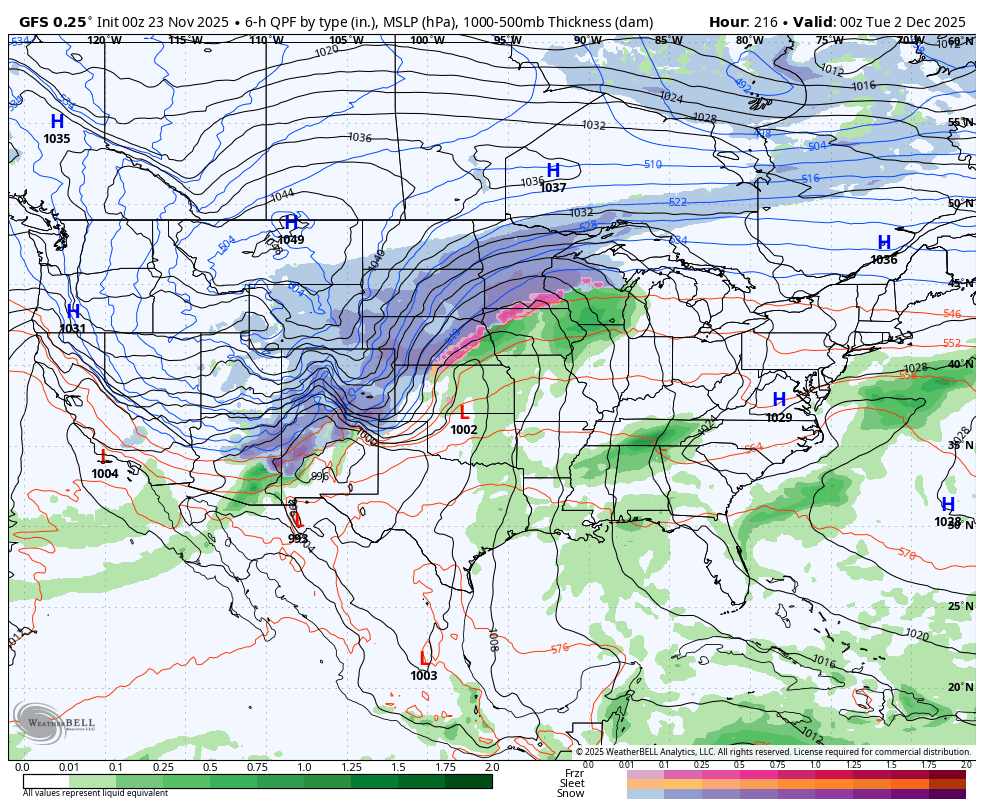
I’ll give the GFS one thing… It’s persistent in showing something that has never happened in recorded history.
If we take a look at the latest forecasts of the Madden-Julian Oscillation, or MJO we find all the long range forecasts looking pretty similar. Now, these charts are really hard to decipher if you don’t know what you’re looking for. Let me give you a brief description… We have 8 phases of the MJO and those are numbered on the outer edge of the chart. The main squiggly line is the forecast line. The black part of the line is where the MJO has been. The colorful parts of the line show the forecast out in time. The numbers along the line show the corresponding dates for the next month.
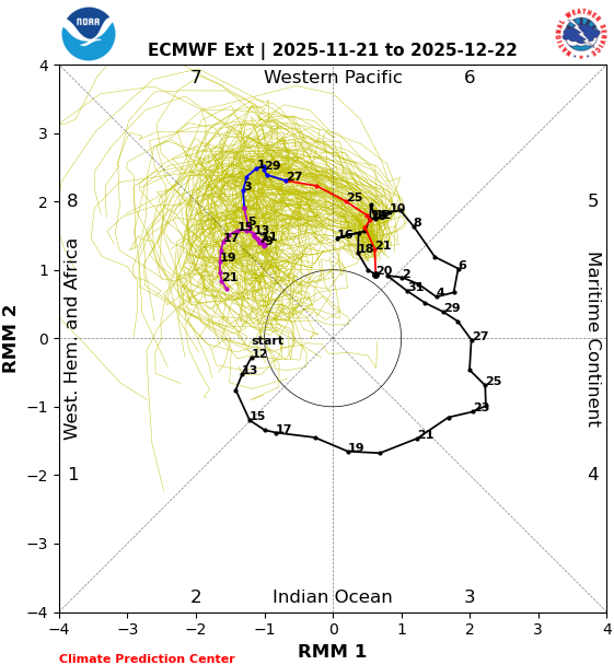
The CFS is a little slower getting into Phase 7, but has a similar overall progression through the middle of December…
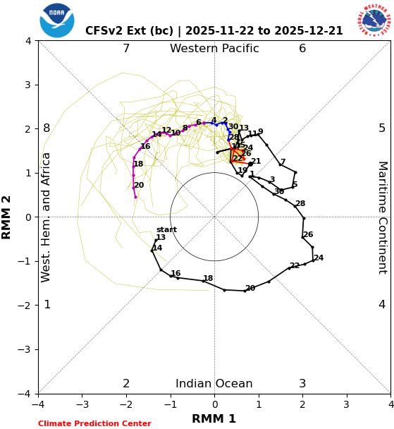
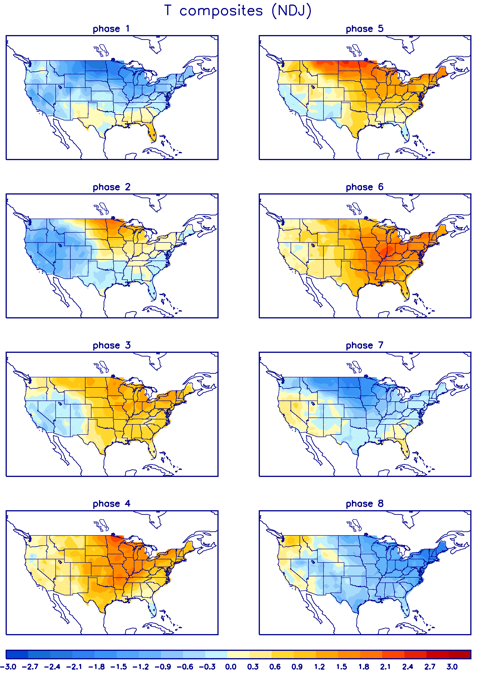
Again, Phases 7 and 8 are cold for much of the country…
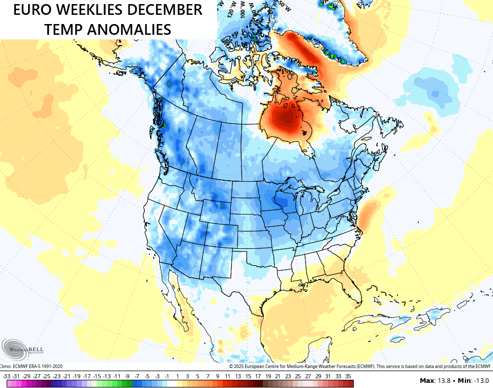
The EURO Weeklies continue to look the part for December…
I’ll have another update later today and will also have updates on my Meteorologist Chris Bailey Facebook Page
Have a wonderful Sunday and take care.

Thanks Chris. On that precipition model ( GDPS Para ) displaying the types, there’s more Ice ( freezing rain and sleet ) and mostly Snow well North of Kentucky. Warm high pressure aloft sitting on below freezing temperatures at the surface. No thanks for that weather setup, but it could happen in La Nina Winters.
The MJO may propagate into composite ( DJF ) phase 8, but may continue to propagate into phase 1, as we progress into mid – Winter, which would indicate a ” La Nina type Winter. ” Cold and Snowy from the Pacific Northwest to the State of Maine. Kentucky would be in the middle, so any kind of weather type could happen. Warm and Dry from the State of Texas to the State of Georgia is a sure bet.
Very interesting article about the Cold and Snow potential in early December : )
https://climateimpactcompany.com/u-s-sunday-report-steadily-snow-cover-develops-across-the-northern-u-s-this-week-set-up-for-much-colder-air-which-could-surge-south-to-texas-3/