Good evening, everyone. We’re putting the wraps on our weekend and rolling into Thanksgiving Week with a lot of active weather ahead. This has active pattern has the chance to throw some winter weather out way over the long holiday weekend.
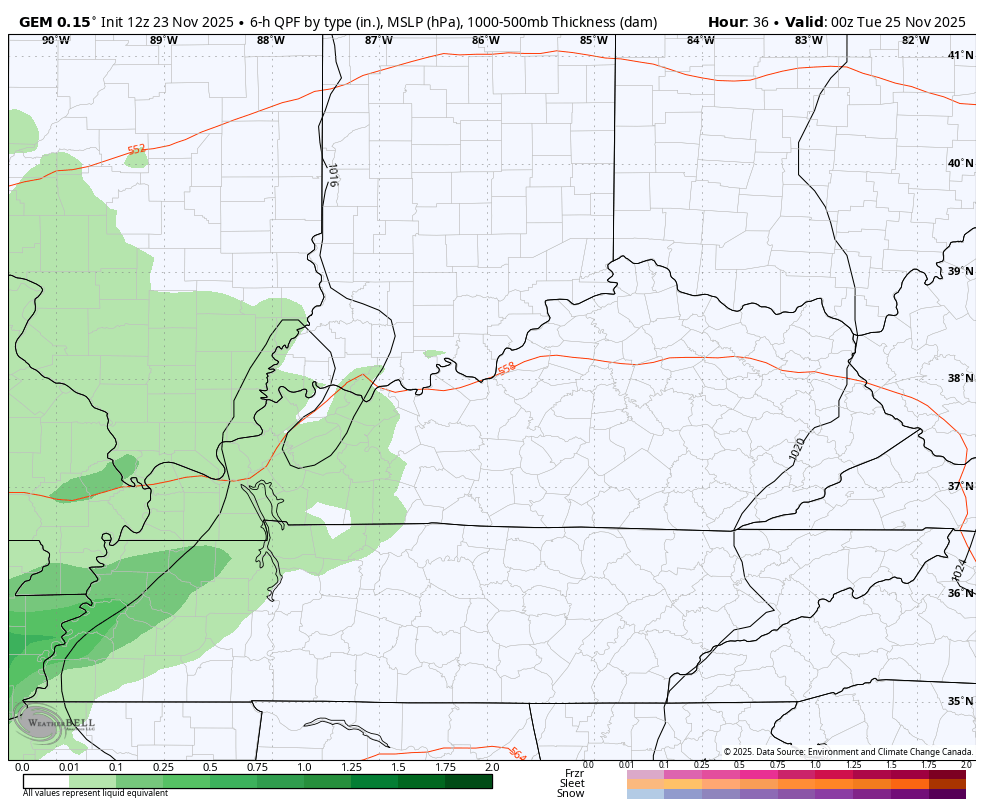
Let’s start with the first system rolling in later Monday into Tuesday. This will bring rounds of rain and some rumbles of thunder along for the ride during this time. Winds will be gusty as temps stay pretty mild.
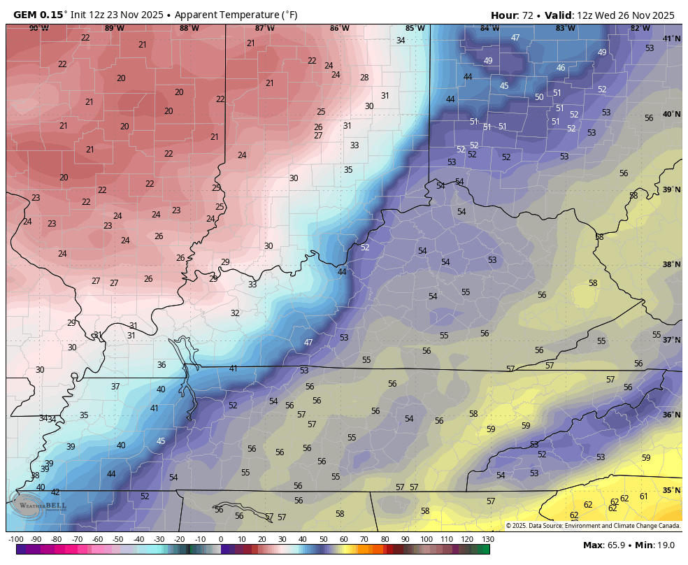
That all changes with a cold front sweeping in early Wednesday. Temps start in the 50s before the sun comes up then drop through the 40s and into the 30s during the day and evening. Gusty winds will make it feel much colder. Showers along and ahead of the front have the chance to end as a few flakes Wednesday Night and early Thanksgiving morning.
The Canadian family continues to be the ones showing the flake possibilities…
I mentioned the cold winds on Wednesday. Check out those crashing wind chills from 7am to 7pm…
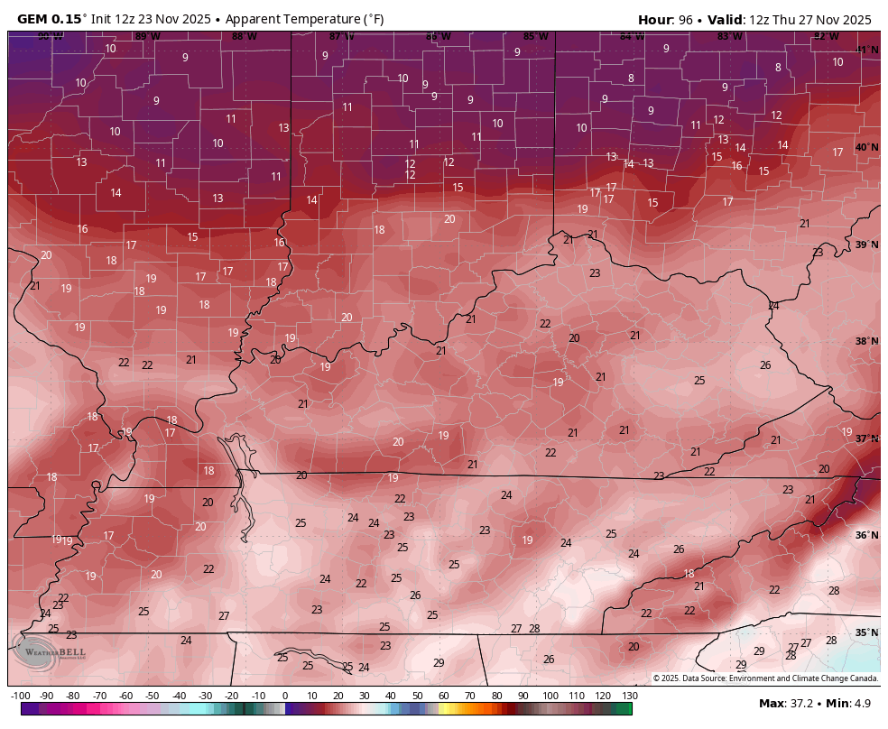
That sets the stage for very cold wind chills from Thanksgiving Morning through Black Friday morning. The Canadian may be a tad too low with those Friday morning wind chills, but you get the idea…
Remember the disturbance I talked about having the chance to bring some flakes in here Friday or Saturday? That disturbance is now showing up as a much stronger system that rolls right on top of us this weekend into early next week.
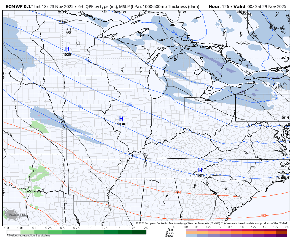
The recent trend among all the models is to bring precipitation in here in the form of snow on Saturday before cold rains take over into Sunday and Monday. That leaves a boundary set up from southwest to northeast into early next week, bringing another low or two through here.
The GFS is even seeing all this a little better now…
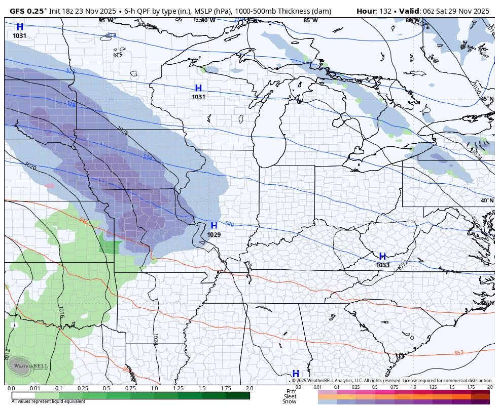
Here’s where the GFS thinks sees some snow through Thanksgiving Weekend…
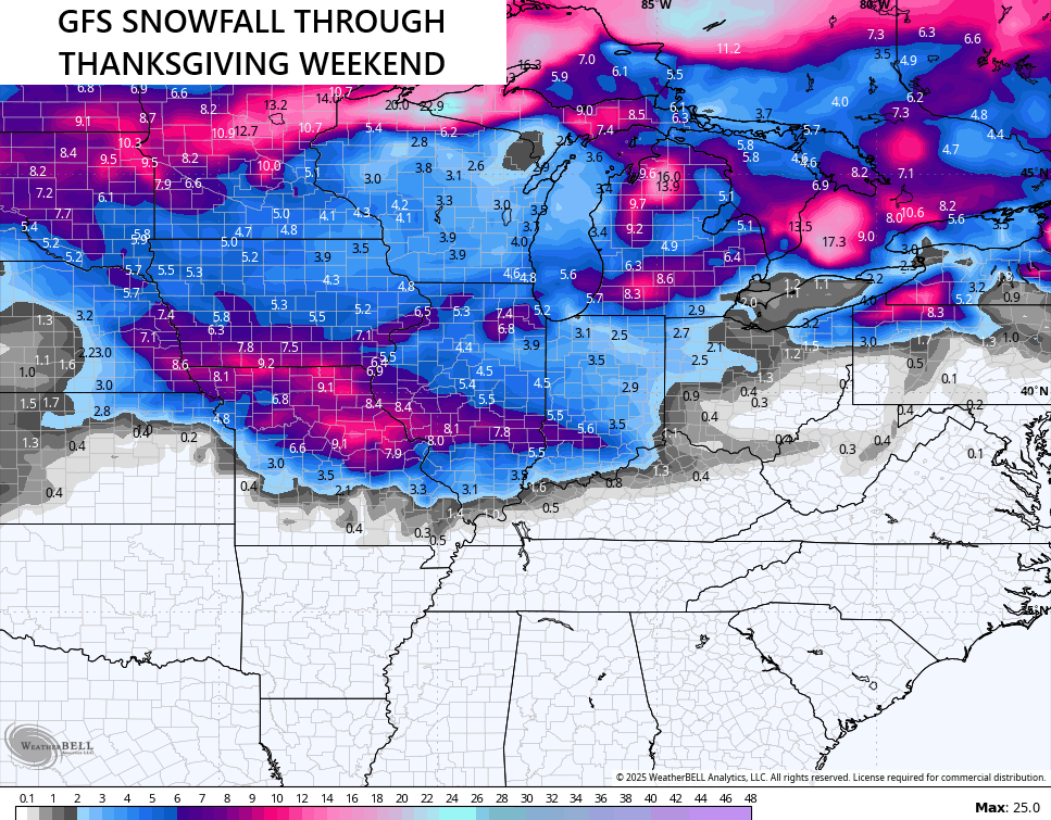
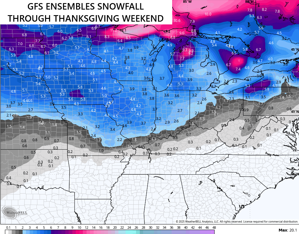
What you see across Kentucky would be the front end stuff on Saturday. The GFS Ensembles are also seeing this…
The EURO AI was the first to start picking up on this and it continues to see it well…
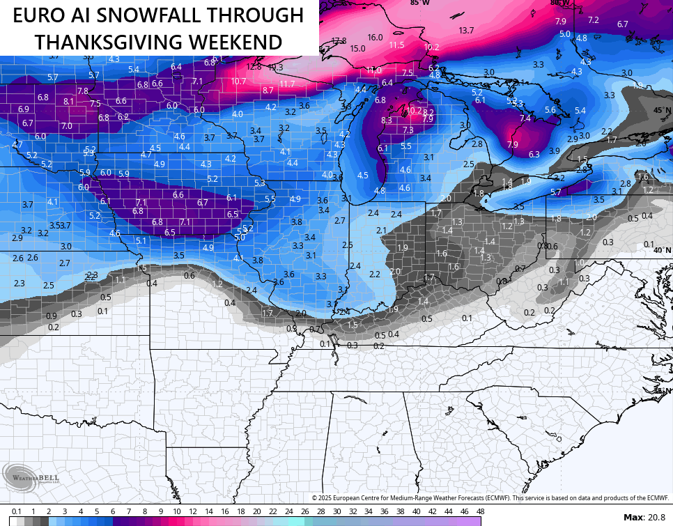
The late day run of the EURO only goes out 144 hours but it’s also seeing the possibility of some front end flakes moving in here from the west on Saturday…
It’s interesting to see the models pushing farther south with everything as they start to see the cold air better and better. That in turn pushes that southeast ridge farther south.
I said our region will be the battleground and that certainly appears to be the case.
I’ll see you guys with a full update later tonight. Enjoy the evening and take care.
