Good Monday, everyone and welcome to Thanksgiving Week. While most of the people out there are counting down to Turkey Day, KWC readers are counting down to Planes, Trains and Automobiles Day on Wednesday. No matter which one of those you celebrate, the weather pattern looks active with some winter showing up.
Let’s start with today and hit the fast-forward button. Our Monday is super foggy to start with clouds thickening throughout the day. Highs range from the mid and upper 50s north to the low 60s in the south.
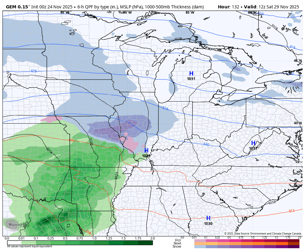
Showers and some thunder roll into western Kentucky this afternoon with that action overspreading the rest of the state tonight and Tuesday. Winds are cranking during this time with some of us picking up another inch or two of rain. A potent cold front crashes in behind all this early Wednesday with gusty showers ahead of it and the chance for a flake or two behind it Wednesday night into Thanksgiving Morning. Here’s the Canadian showing this whole setup from this afternoon through Thanksgiving morning…
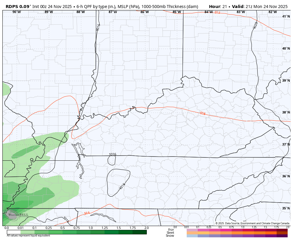
You can see the best chance for a flake or two is in the north and northeast.
The cold is the real deal coming in behind this front. Wednesday’s temps are in the 50s in the wee hours of the morning then drop quickly through the 40s and into the 30s by late afternoon and early evening. The gusty winds will make it feel much colder for the busiest travel day of the year…
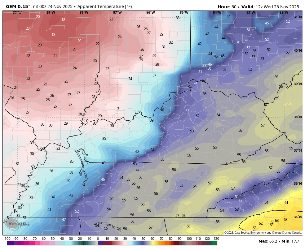
That sets the stage for cold turkey on Thanksgiving Day with highs from the mid 30s to low 40s with those winds making it feel frigid. Wind chills are in the high teens to start the holiday and turn even colder by Thursday night and Black Friday morning. This wind chill animation starts at 7am Thanksgiving and goes through 7am Black Friday…

Highs on Black Friday are in the 30s for most of the state with wind chills making it feel like the 20s most of the day.
This brings us to the part of the forecast that has all kinds of question marks as we still can’t get the models to fully agree with what happens from Saturday into early next week. The amount of dramatic swings in all the models is about as pronounced as I’ve ever seen and that’s saying something.
The latest EURO does a 180 and allows for a deep trough to squash any kind of southeast ridge that it had been showing. Watch this trough sweep in to end November and Start December…
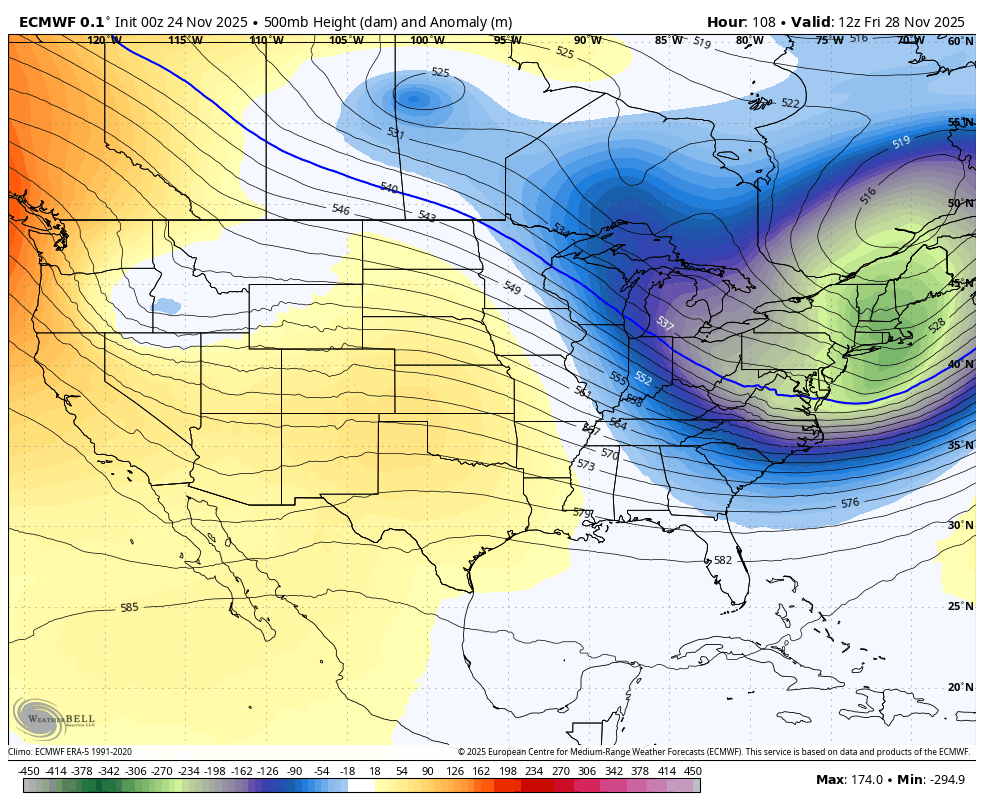
That setup would bring one main storm system rolling through here this weekend…
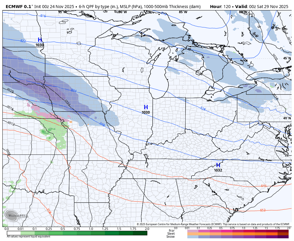
The Canadian isn’t too dissimilar with the first system, but it keeps just enough of a southeast ridge to bring additional systems through here…
Both of those models are much colder and farther south and southeast with this whole setup. Will they continue to trend that way?
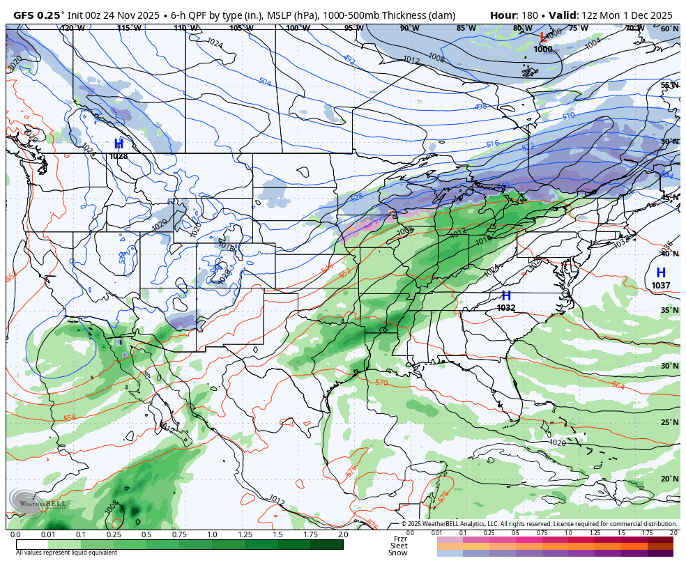
The GFS gives us a totally different solution each time the model is run. The latest run now has a much lighter weekend system, instead jumping a stronger system very far to the west before bringing it through by Monday and Tuesday…
I’ve been documenting the GFS issues that are REALLY bad. For several days in a row, the GFS was forecasting the first ever December tropical storm or hurricane hit on the US in the first few days of the month. Well, this run from the model gave up on that idea, but it’s trying to incorporate some kind of tropical connection from the Pacific into an upper level low dropping way too far southwest. Watch how it pulls that system across Mexico into Texas and then brings that moisture all the way to our region…
Honestly, what on earth is going on with the American Model? Most runs are entirely unusable right now.
Another update or two comes your way later today, of course, I’ll have updates on my Meteorologist Chris Bailey Facebook Page
Until then, here are your tracking tools for the day…


Current watches

Possible Watch Areas

Make it a great Monday and take care.

Thanks Chris. Hoping the Southeast Ridge stays put for the entire Winter. Keeping Ice Storms away, but it also will keep Snowstorms away, and extremely cold Arctic outbreaks. We can’t win Winter Lovers, with La Nina in charge.
The answer to that GFS question is as follows : )
The GFS weather model’s recent inaccuracies are attributed to a combination of factors, including it’s lower resolution a ” convective feedback bias ” where it erroneously spins up systems and potential issues with data like using climatological averages instead of real – time data particularly over tropical waters. Also reductions i n weather balloon launches, due to budget cuts. So sad this is going on in our Country. I wish things would get back to normal. The way it use to be.
https://climateimpactcompany.com/u-s-early-notes-an-update-on-the-snow-and-ice-potential-as*sociated-with-the-developing-cold-pattern-2/
Sometimes I think that GFS stands for Ghastly Forecasting System. Its software is WAY overdue for an update, which is necessary so that that the high/low temperature and moisture extremes we’ve been experiencing over the past few years, are the new normal. As it stands right now, the GFS program is basically a chaos amplifier.
However, on the totem pole of DC fiscal priorities, NOAA’s budget has been slashed to levels that are lower than they’ve been for many years. That’s pretty crazy, since weather is one of the biggest drivers and impacters to economic change, worldwide!
Joe, what’s going on in this Country scares the hell out of me. I don’t think that it will ever be like it was back in the 1950’s and 60 ‘s. The weather was different then than it is now, and everyone was more content with their lives.