Good evening, everyone. We continue to track rain across the region as our pattern starts to look and feel more like winter as we gear up for that long Thanksgiving weekend. This setup continues to trend back toward winter with the signal to end November and begin December.
We know rain comes in tonight and Tuesday courtesy of that low pressure. That will be followed by crashing temps behind a Wednesday cold front. The air behind that has the chance to spit out some flakes.
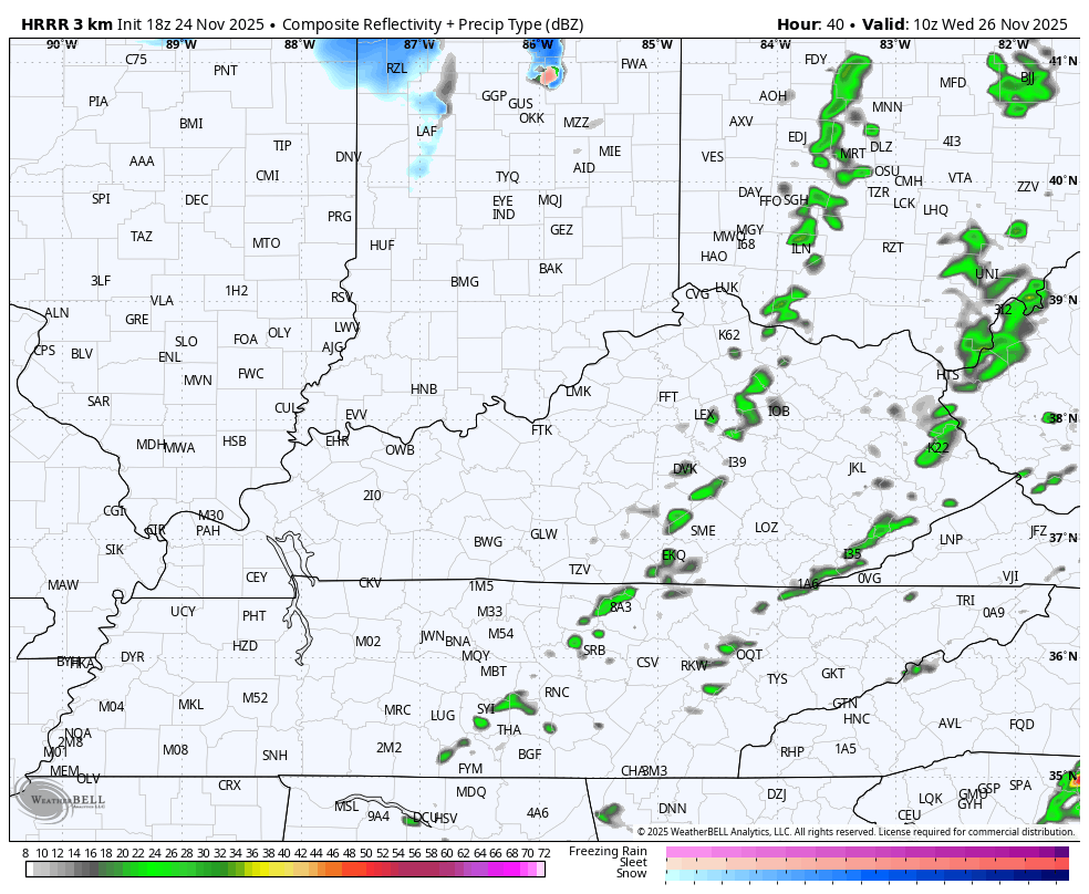
The HRRR Future Radar only goes through Wednesday afternoon but it’s picking up on some action in the north…
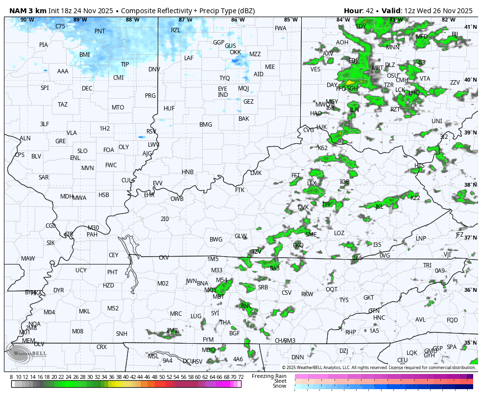
The Hi Res NAM Future Radar is also showing a few flakes late Wednesday into Wednesday evening…
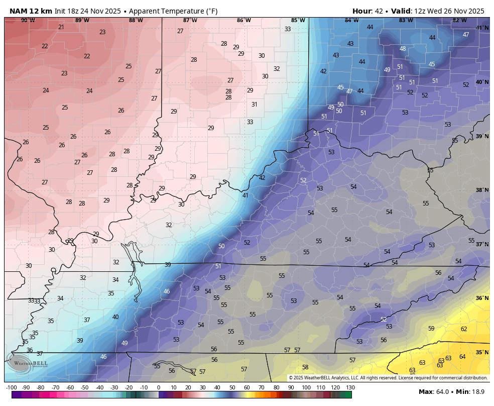
Temps drop all day long from west to east Wednesday with a blast of arctic air surging in. Wind chills drop into the 20s Wednesday afternoon and evening with teens by Thanksgiving Morning. This animation starts at 7am Wednesday and ends at 7am Thanksgiving…
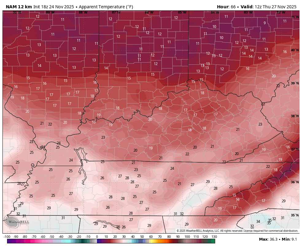
Wind chills on Thanksgiving Day are Frigid on this animation starting at 7am and going through the evening…
Friday is even colder with dry weather for holiday shoppers. Another system then moves in quickly on Saturday, bringing the chance for snow and rain. We warned you the models would trend back toward colder and they are doing just that.
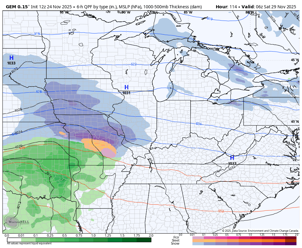
The Canadian Model looks like this with another snow and rain maker following into the first half of next week…
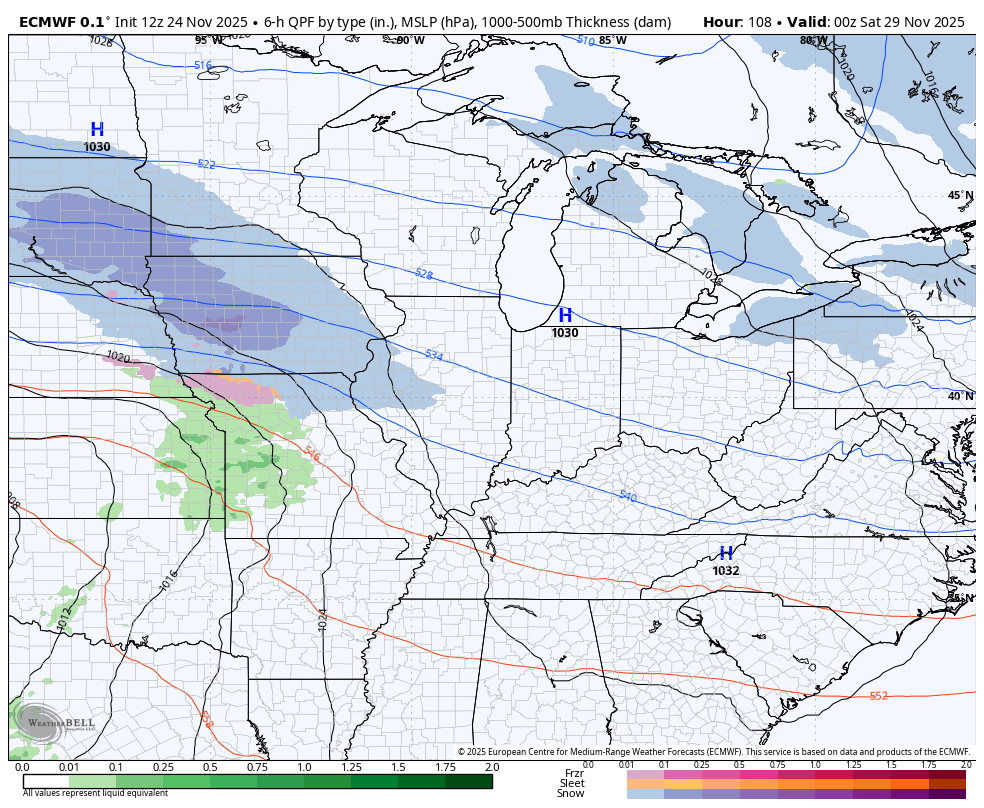
The EURO is in the process of coming farther south and east with these systems and sees the winter weather potential…
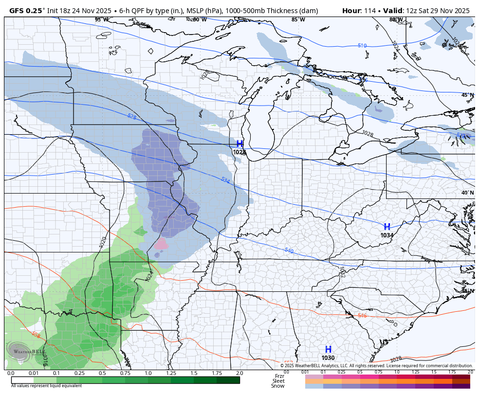
The GFS is correcting farther and farther east with each run and now sees the chance for some snow on Saturday then possibly with the next system a few days later…
I will have a full update later tonight. and I’ll have updates on my Meteorologist Chris Bailey Facebook Page
Until then, here are your tracking tools for the day…


Current watches

Possible Watch Areas

Make it a great evening and take care.
