Good Tuesday, everyone. It’s a wet, windy and mild day but Old Man Winter is about to flex a little bit as we head into the long Thanksgiving Holiday Weekend. This includes frigid wind chills and the potential for rain and some snow.
Today’s rains are coming in from southwest to northeast and will be heavy at times. Some thunder may also get into the mix on a gusty southwest wind that boosts temps into the 60s. Winds are a big player with some local gusts to 40mph possible.
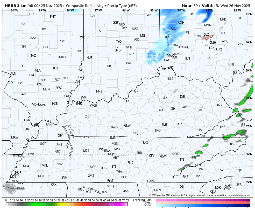
A strong cold front then slams through here late tonight into Wednesday morning. This will have some showers along and ahead of it with enough moisture behind it to spit out a few flakes Wednesday afternoon and evening. These flakes show up on the HRRR Future Radar from Wednesday afternoon and evening…
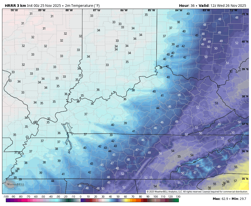
The HRRR is also really aggressive on the cold surging in on Wednesday. This animation shows the temps from 7am to 7pm…
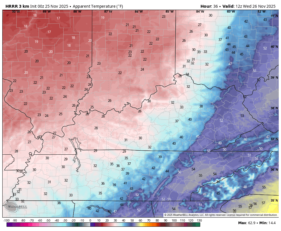
The Wednesday wind chills for the same time period…
Temps range from the mod 30s to low 40s for highs on Thanksgiving with mainly low and middle 30s for Black Friday. Wind chills are even colder during this time. This animation goes from Thanksgiving morning into Friday morning…
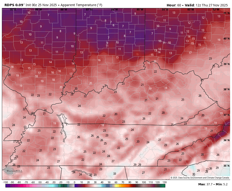
Black Friday is a frigid day with lows in the upper teens and low 20s with a wind chill much lower. Highs are in the low and middle 30s but it feels like the 20s.
This brings us to the weekend as winter flexes and fights back any attempt by the southeast ridge to flex. I’ve said for a while now this places our region in the battleground with several storm systems moving in from southwest to northeast.
Our precipitation types depend on the track of each individual low, but the overall signal continues to edge everything slightly farther south and southeast with each run.
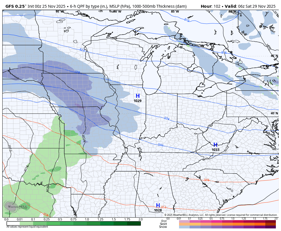
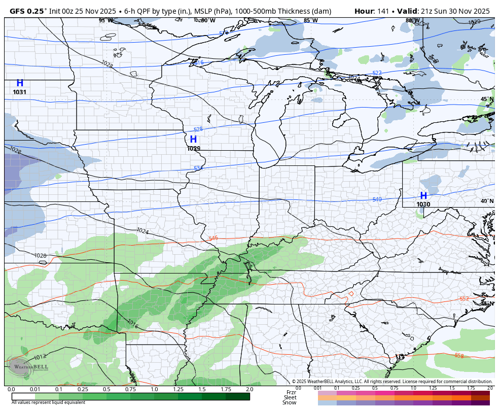
The first system moves in Saturday into Sunday with the models really just now starting to get a better handle on this. As you know, they’ve had some of the wildest swings I’ve ever seen in Medium Range forecast models.
The GFS went from taking this system so far north and west it barely had any impact on us, to now being weaker and farther south with snow and some rain developing with it Saturday into Sunday…
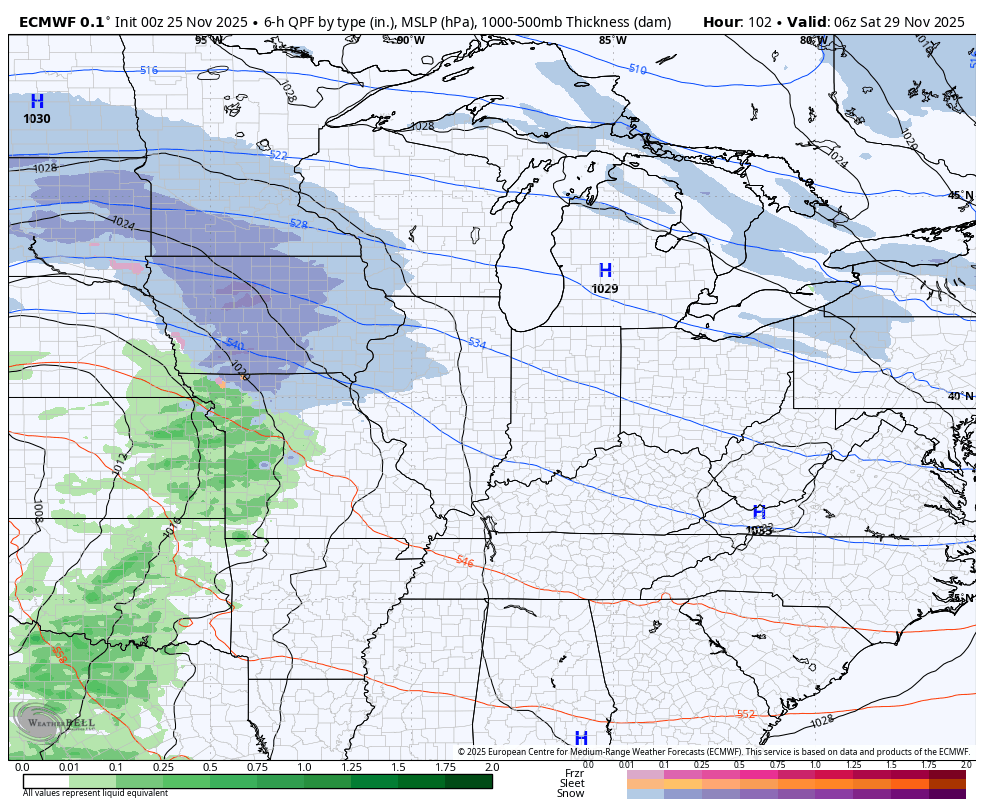
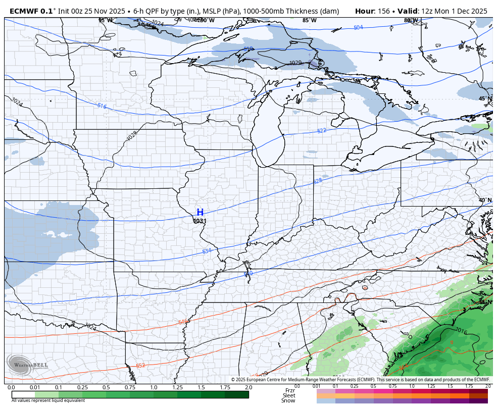
The EURO has also had a lot of issues with this and it’s likely a bit too strong with our system. It brings mainly rain with a touch of a mix to start and end this weekend…
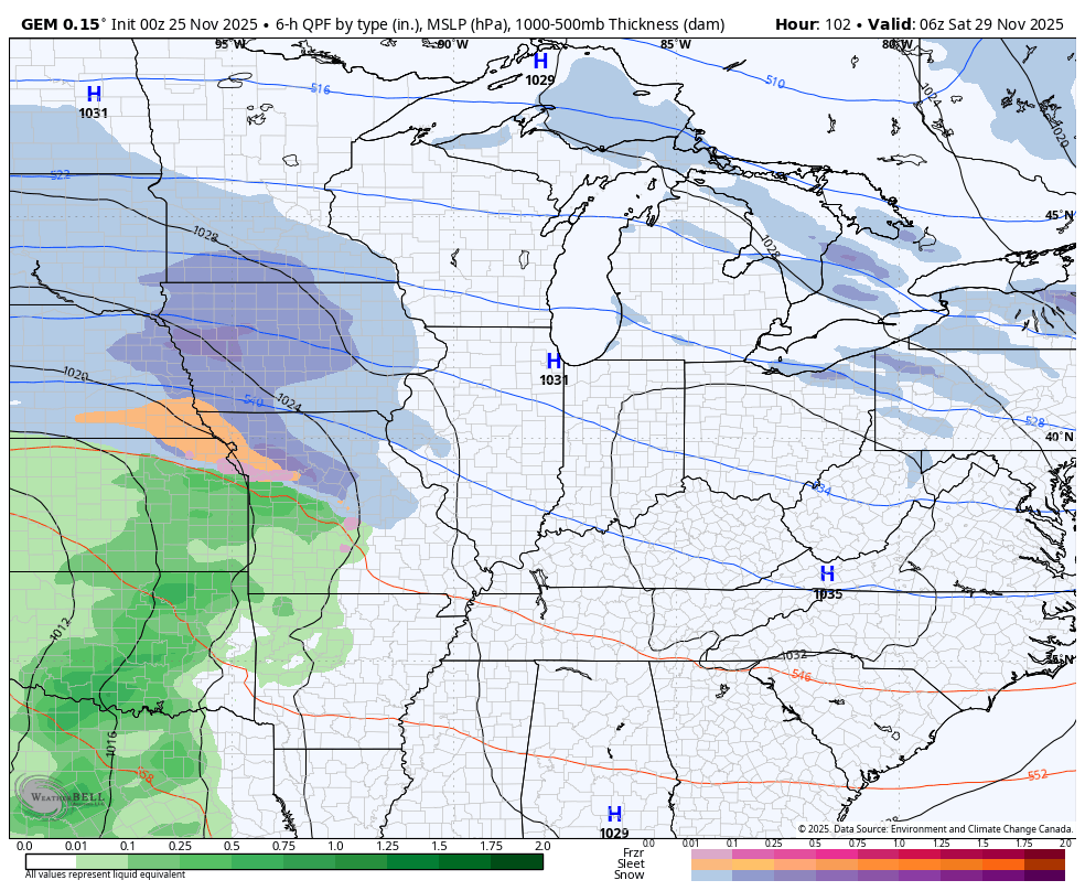
The Canadian is much more in line with the EURO…
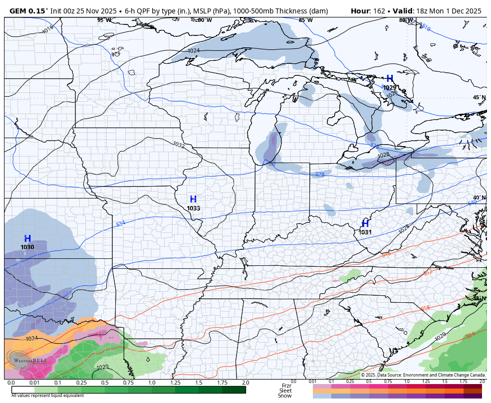
Another storm system follows that up quickly early next week with the models all showing something entirely different. Still, most have more of a winter weather signal with this. Here’s the Canadian from late Monday through Wednesday…
The GFS during the same time…
The EURO is leaving too much energy behind and only has a light snow maker…
Not a single model run from above is correct, but the trends are continuing to go back toward winter. To what extent remains to be seen, but the end of November into the first week of December will bring some seriously harsh winter weather to a lot of the country.
I will have updates later today and I’ll have a few updates on my Meteorologist Chris Bailey Facebook Page
Until then, here are your tracking tools for the day…


Current watches

Possible Watch Areas

Make it a terrific Tuesday and take care.

Thanks Chris. We will just have to wait and see what happens with the weather. Just like in the ” old days. ” With a weak La Nina in place, my guess would be that most of the Snow and Cold will be well to our North and West, but there may be brief Winter weather events in our area of the CONUS. I just hope it’s not an Ice storm.
The latest on La Nina from the Climate Impact Company : )
https://climateimpactcompany.com/weekly-enso-diagnostics-weak-la-nina-continues-3/