Good evening, everyone. The winds of change are blowing across Kentucky as we gear up for your big Thanksgiving Holiday Weekend. This is the weekend we’ve spotlighting for a big change to winter and that’s arriving right on cue.
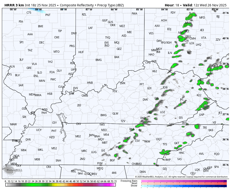
Gusty showers are out there this evening and will continue through early Wednesday as a cold front races in from the west. As cold air crashes in behind this boundary, a few snowflakes may show up across parts of central and eastern Kentucky Wednesday late afternoon and evening.
The future radar from the HRRR continues to show some flakage…
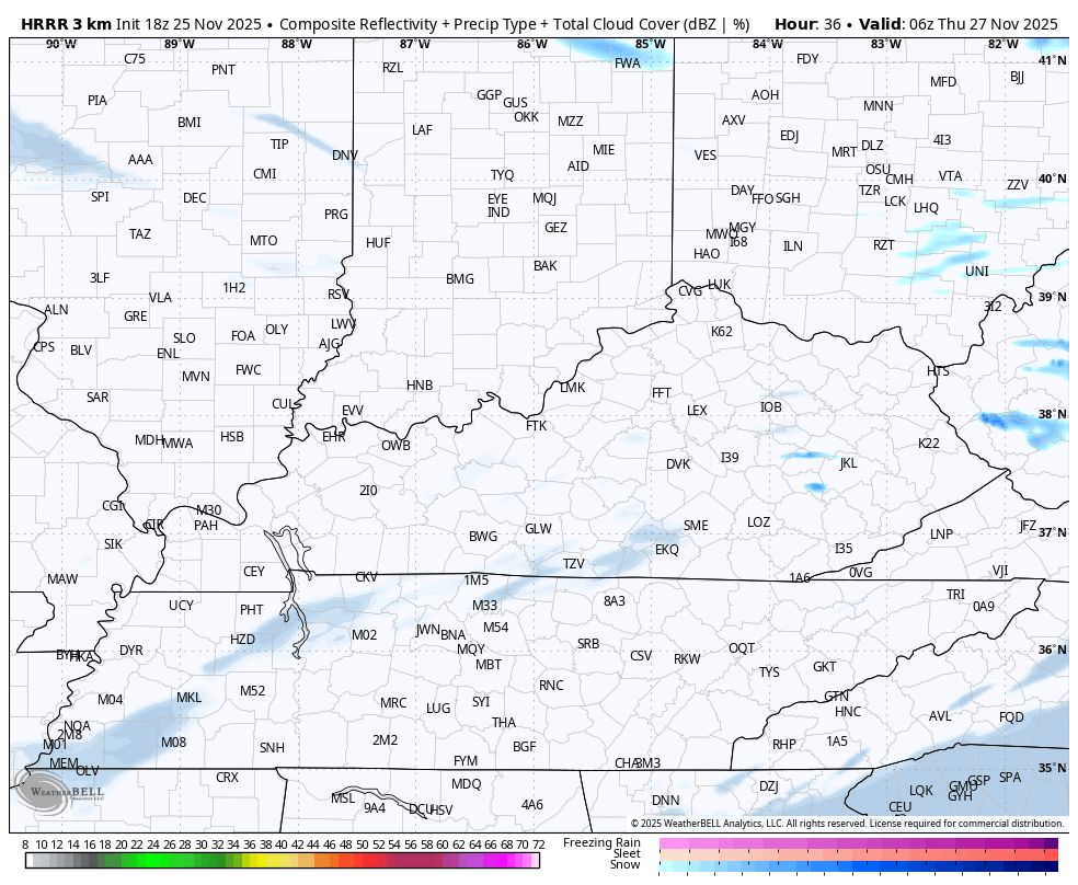
The same future radar and cloud cover forecast for Thanksgiving Day shows some clouds and even the flake chance in the northeast…
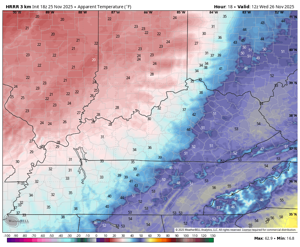
In terms of the crashing temps on Wednesday, watch the wind chill numbers from the HRRR from 7am Wednesday to 10
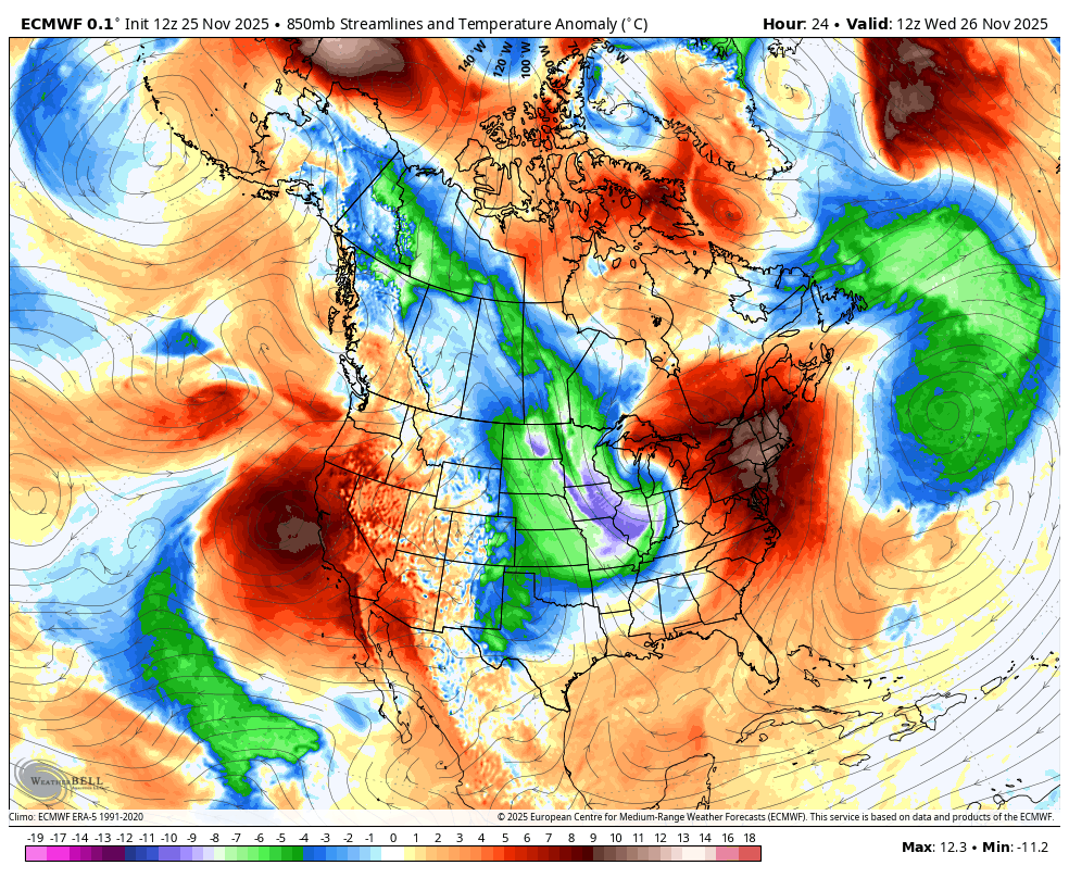
The cold air continues to flex and will continue this weekend into the first week of December. Talk of a massive southeastern ridge was nothing more and idle talk as the pattern just is not in the mood to keep troughs away from the eastern half of the country.
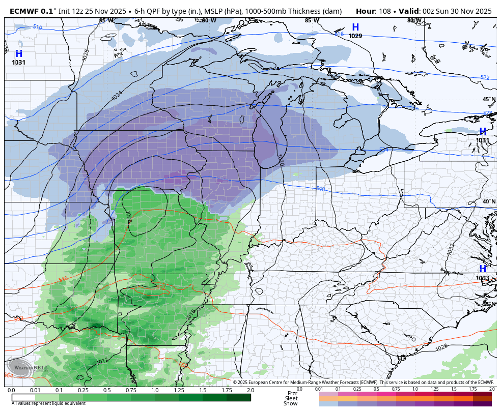
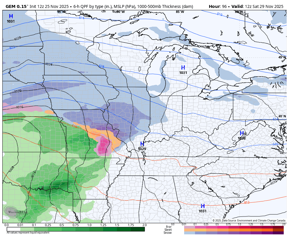
The first system coming our way late Saturday into Sunday will bring rain and a touch of snow with it as it zips through. I actually like what the GFS looks like with that system, but the system behind it is likely too far south..
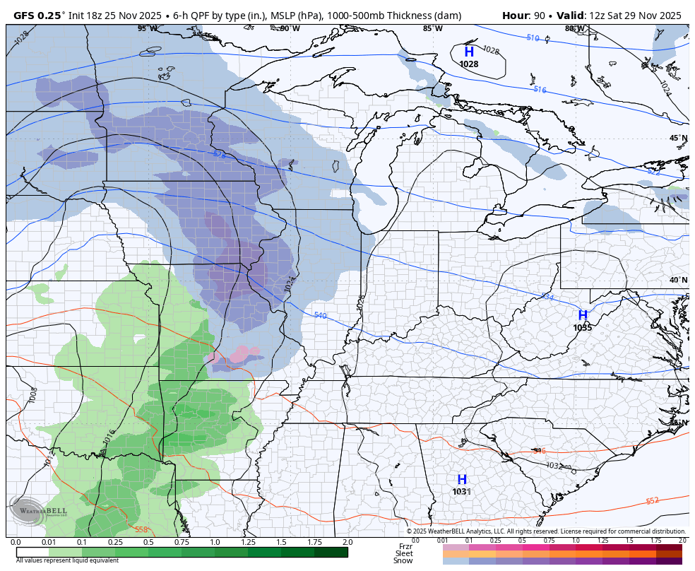
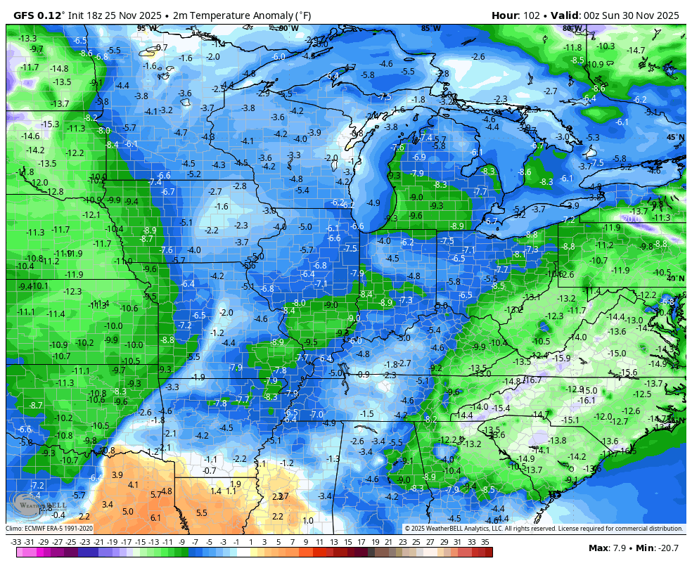
Of course, that’s a lot of arctic cold coming in behind that. Look at how far below normal the numbers are…
In terms of the other models, they are seeing a similar setup with the weekend system and the one coming behind it…
EURO
CANADIAN
The models are also going back much colder into the first few weeks of December. Look at these deep troughs on the EURO through December 10th…
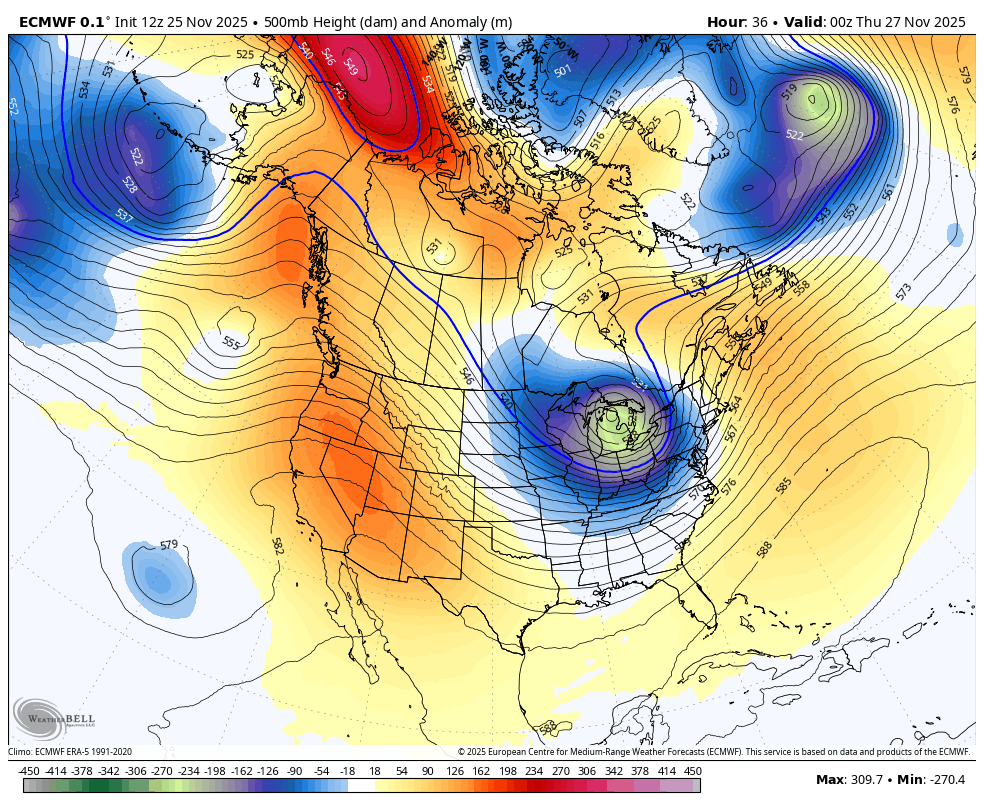
That’s a lot of Barney with each trough…
I will have your full update later tonight with the always entertaining…

I’ll also have a few updates on my Meteorologist Chris Bailey Facebook Page
Until then, here are your tracking tools for the day…


Make it a great evening and take care.
