Good Saturday to one and all. We have a rain and light snowmaker rolling across the region this weekend with a bigger system targeting us to kick off what is likely to be a harsh month of December.
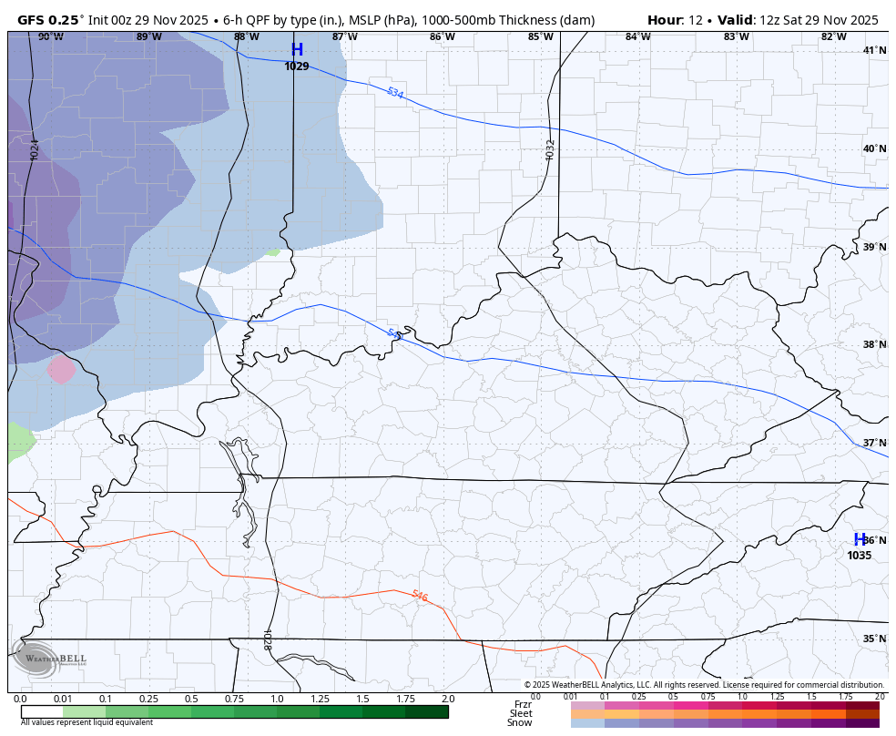
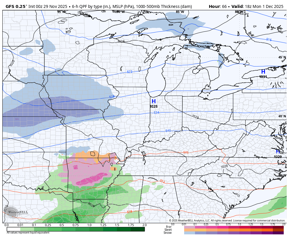
I have no changes to the system moving from west to east out there today. A band of light rain and light snow impacts western Kentucky early today then heads to the east later this afternoon and evening. This thing is moving so quickly that we aren’t getting much warm air advection out ahead of it. That only means a modest temp jump ahead of this system with low and mid 30s in the north and 40-45 in the south.
Most areas will switch over to plain old rain this evening and if we are to get a little sticking snow, it’s across the north…

The one model holding out hope for more snow farther south is the GFS…
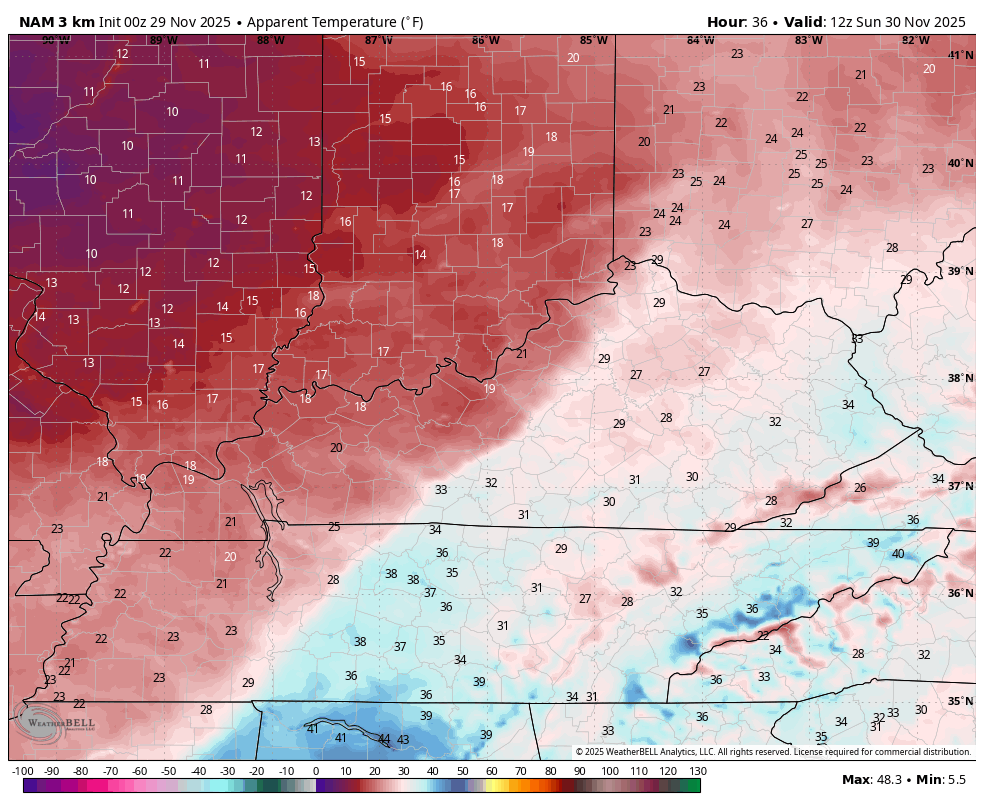
A few flurries will fly behind all this into a windy and frigid Sunday. Temps drop into the upper 20s and low 30s by mid-morning and they stay there through the day. Throw in that strong northwest wind and you get wind chills dropping into the teens. This wind chill animation starts at 7 Sunday morning and ends at 7 Sunday evening…
The winter storm system moving our way late Monday into Tuesday is one we usually see around here a time or two each winter. A weak low runs toward the southern Appalachian Mountains with a stronger low rolling up through the Mid-Atlantic states. Our entire forecast depends on the lead low with just how far north it gets and how strong it gets. The farther north and stronger it is, the more rain. The weaker and south, more in the way of snow or a wintry mix.
Right now, I’m thinking this low works toward the Kentucky Virginia border then into southern West Virginia, though that’s not even close to being set in stone. Until the low track is set in stone, trying to pinpoint exact details for any specific location is futile.
I have come up with a general map highlighting the area most likely to be impacted…

How much of an impact is the question of the weekend. This one will require a First Call map and has the chance to reach low-end WST range.
The forecast models will likely converge on a common track later today or early Sunday. Right now, there’s still some pretty good disagreement.
The Canadian is flatter and colder with the lead low and has a messy signal…
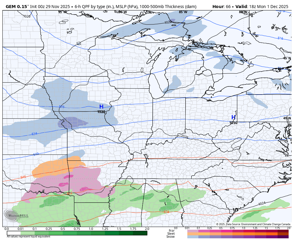
I’m not agreeing with that much of a freezing rain signal at all.
The EURO has a similar track with the lead low but does not bring in much freezing rain with only a small mix zone…
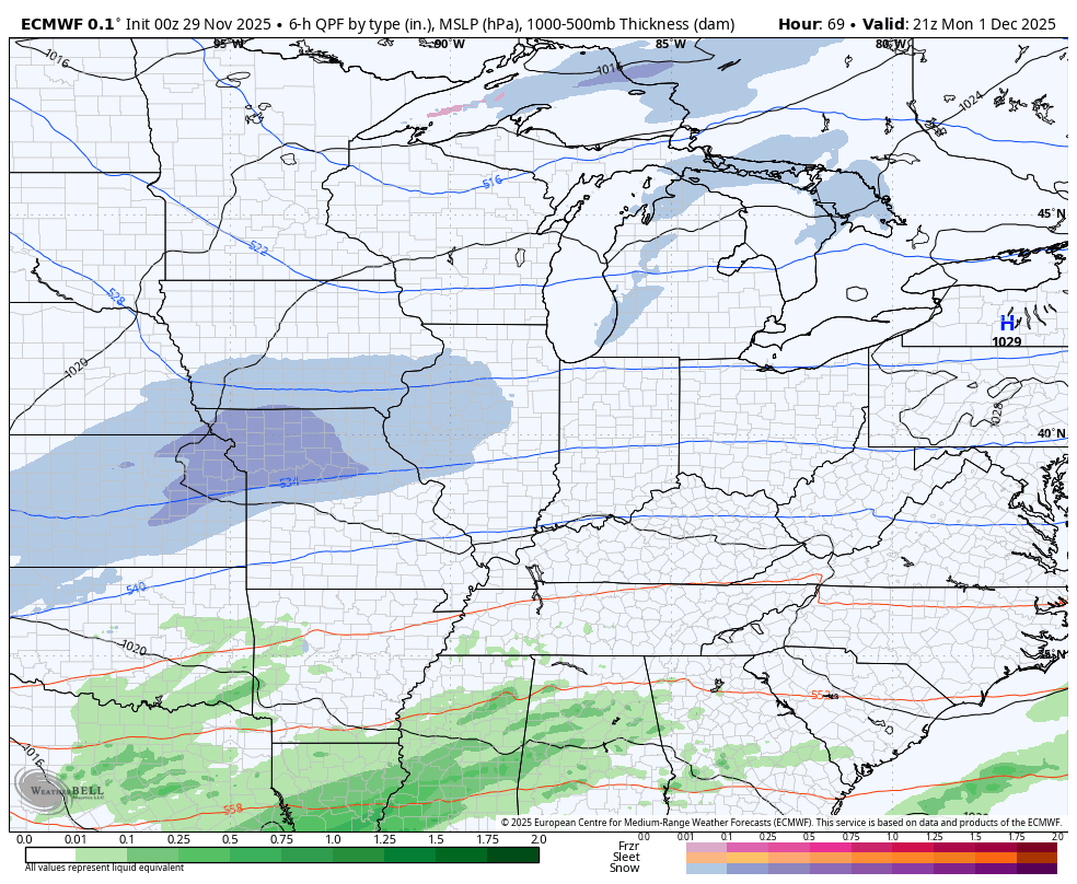
One of the biases of the GFS is to put too much emphasis on a lead system and that appears to be what’s happening here. It looks too strong and too far northwest with the track of that first low…
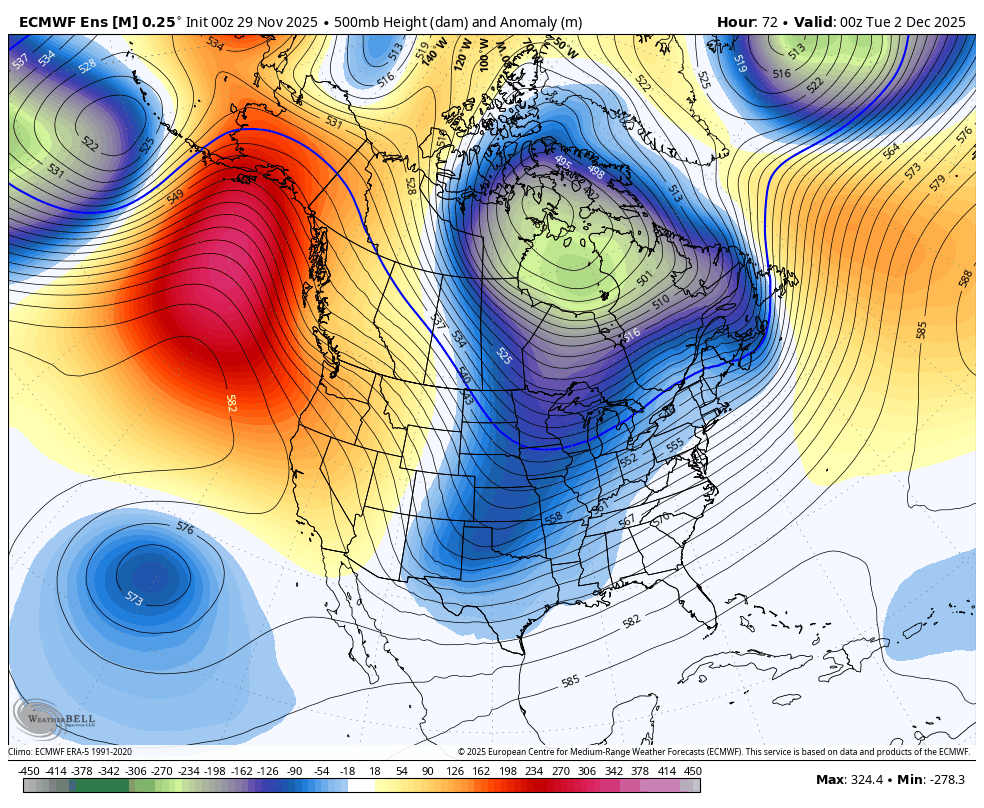
Y’all wanna see what a harsh winter pattern looks like for the eastern two-thirds of the country? The EURO Ensembles show deep trough after deep trough as far as the model can see into the middle of December…
The signals for this started to show up in my initial winter weather research back in summer so it’s good to see this actually coming to fruition.
I will have two more updates late today so check back. I’ll also have a few updates on my Meteorologist Chris Bailey Facebook Page
Until then, here are your tracking tools for the day…


Make it a sensational Saturday and take care.

Thanks for the update Chris.