Good Sunday, everyone. It’s our first Winter Storm THREAT of the season and it’s coming more than a month earlier than last year. This Winter Storm THREAT is for late Monday and Tuesday as a developing storm system takes aim at the region.
For those new to KWC, I put out a Winter Storm THREAT to heighten awareness to the possibility of snow and some ice and that’s what we have here. There is the potential for a few spots to push the 4″ criteria. As we get closer and confidence increases, we upgrade to a Winter Storm ALERT. If confidence goes the other way, we stand down and wait for the next one.
As of now, this system is on low-end side of the WST spectrum.
Before we get to that system, let’s talk about today.
Our cold front is rolling through eastern Kentucky early this morning and has a few showers along and ahead of it. Skies briefly clear behind it before clouds and some flurries roll in from the northwest. Temps crash into the upper 20s and low 30s and stay there. Gusty winds make it feel frigid with wind chills in the teens at times.
Here’s a quick breakdown of the Winter Storm THREAT:
- Weak low pressure moves into the Southern Appalachian Mountains Monday night and early Tuesday. This low looks to get to about southwest Virginia near the Kentucky border. At the same time, the main low rolls from the deep south through the Carolinas.
- This type of a setup means all modes of precipitation are likely to fall across the state. That’s something I’ve highlighted for days now.
- Snow, Sleet, Freezing Rain and Rain will develop across southwestern Kentucky Monday afternoon and spread northeast.
- A corridor of healthy winter weather is likely to show up. The exact placement of that is still a bit of a work in progress.
- Areas of southern and southeastern Kentucky may see plain old rain for several hours Monday evening into the wee hours of Tuesday morning.
- As the lows press to our east, everyone switches over to some light snow late Monday night into Tuesday with the focus on the central and east.
- This is NOT a major winter storm, but it will be a high impact system on roads.
- Yes, I do expect all kinds of delays and cancellations on Tuesday.
Here’s your First Call For Snowfall…
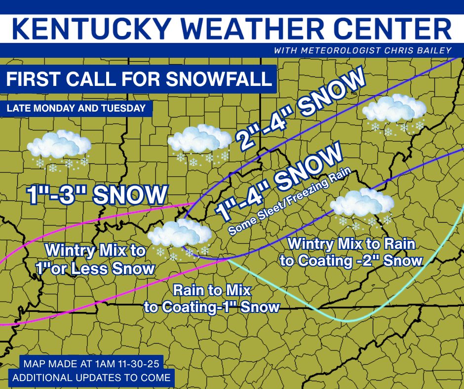
That most certainly will be updated numerous times today and into Monday.
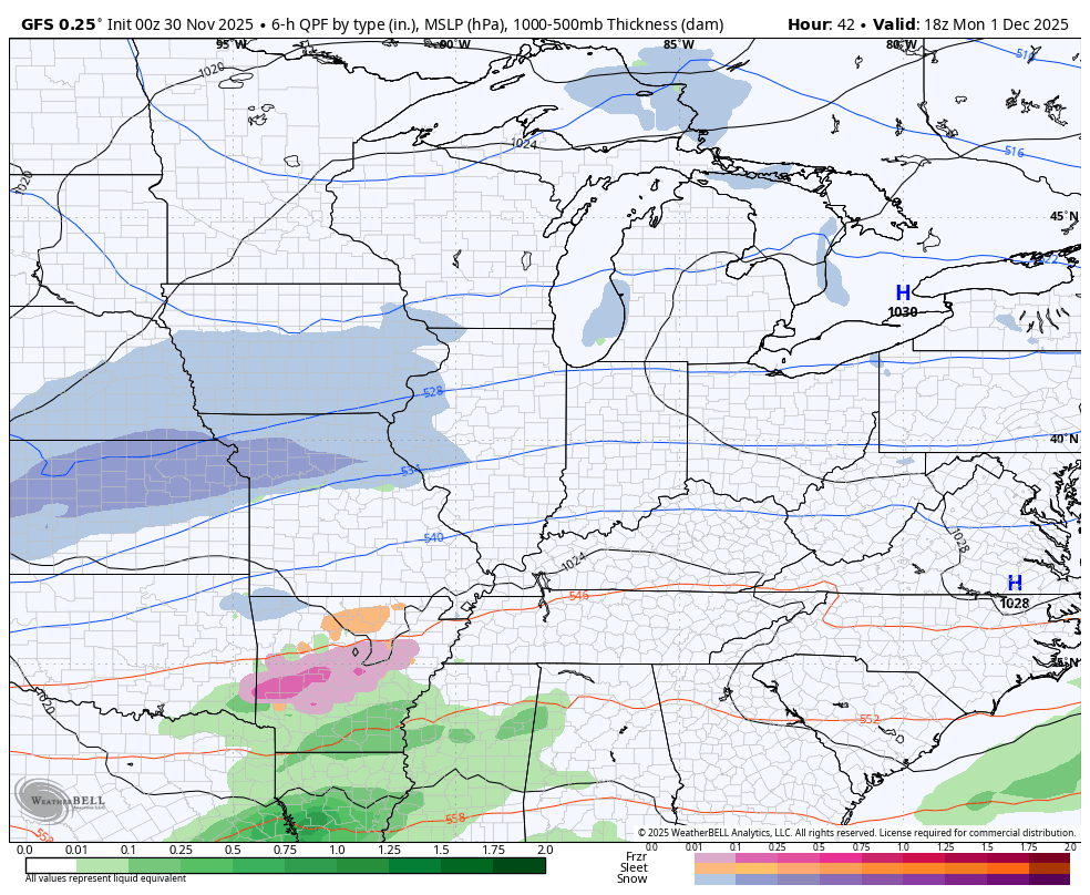
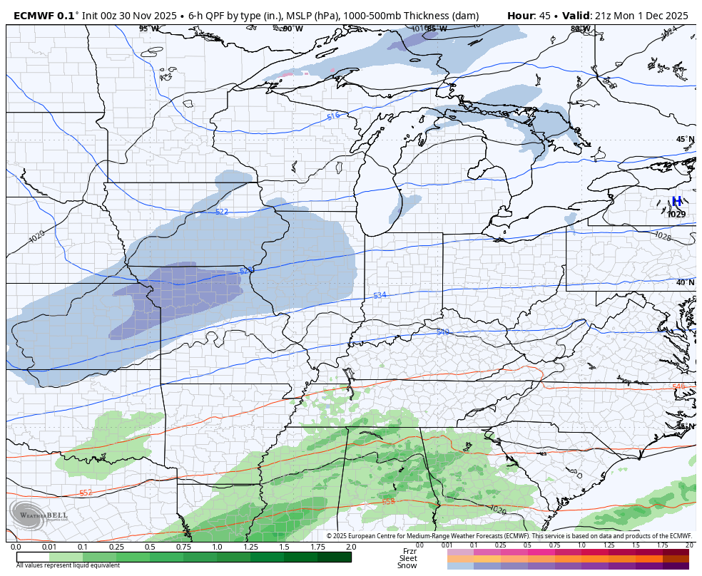
As far as the models go, we are finding better, though not perfect, agreement. The GFS seems to have a pretty good handle at the moment…
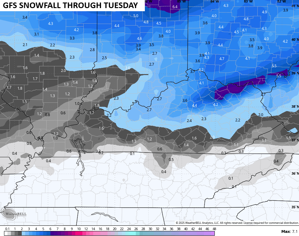
The snowfall map from that run…
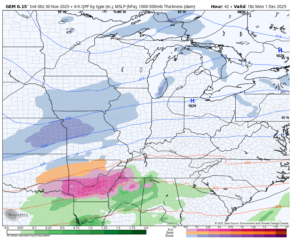
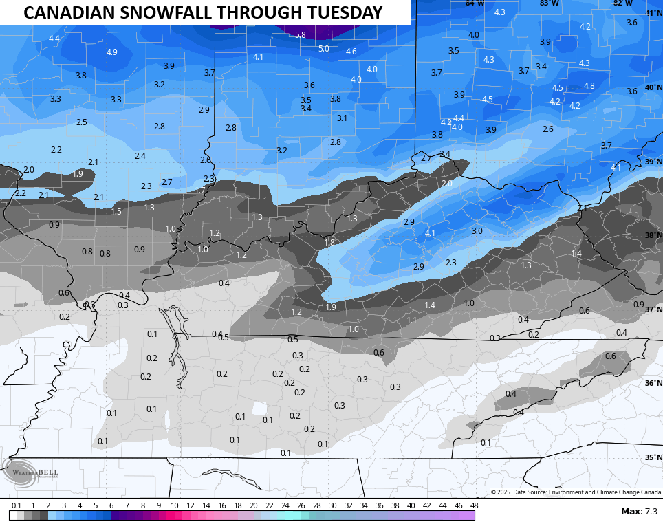
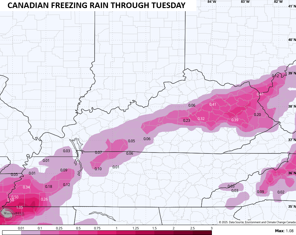
The Canadian Model is similar but I’m still not digging the tremendous amount of freezing rain it’s trying to spit out…
The snow map from that run…
And the likely overblown freezing rain forecast…
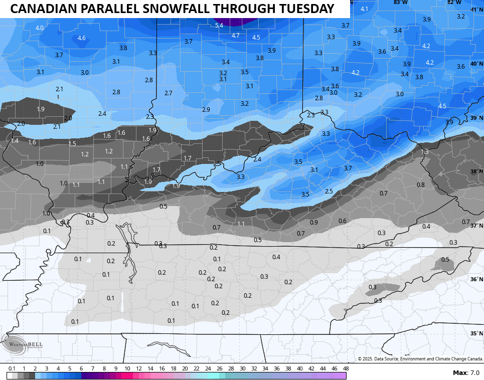
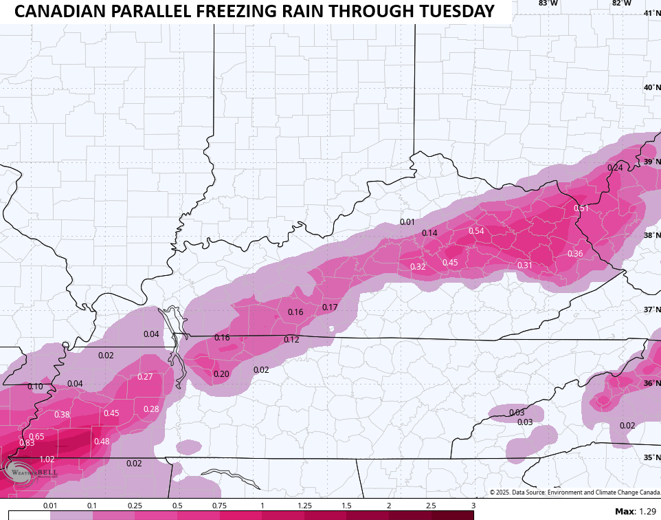
The new version of the Canadian is similar on both accounts…
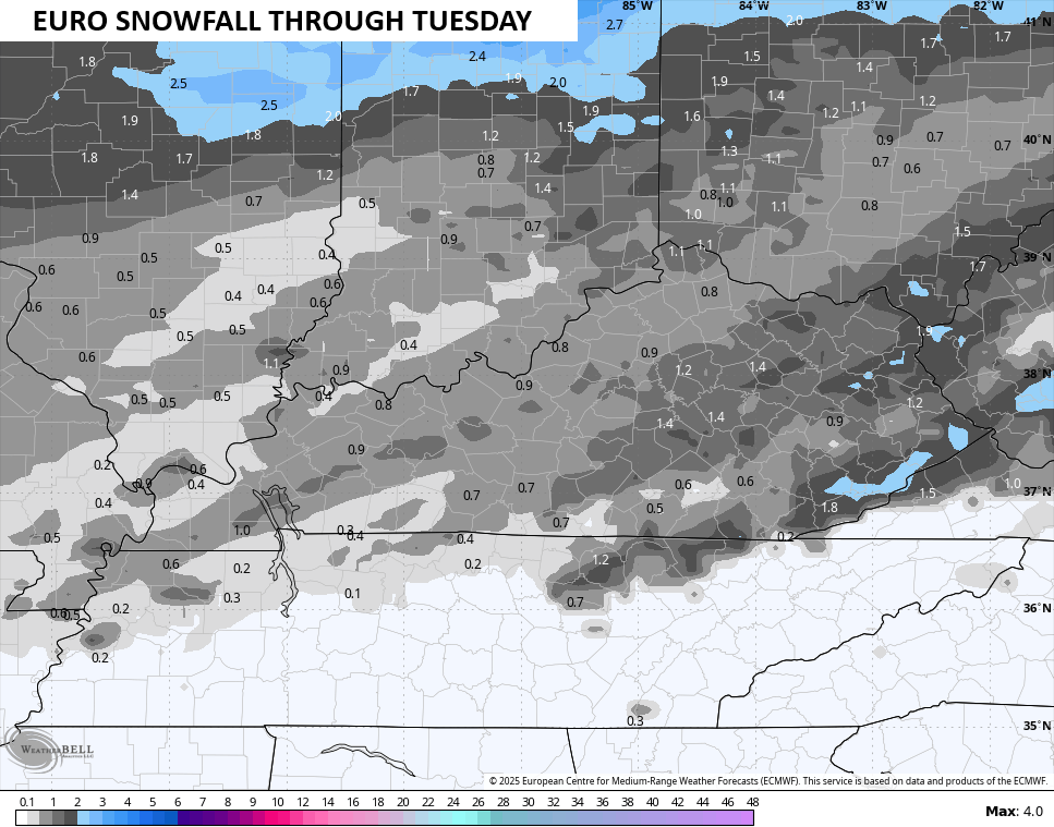
The EURO continues to be the flattest and most progressive of the models and has mainly a light snowfall for most…
Here’s the snowfall map from that run of the EURO…
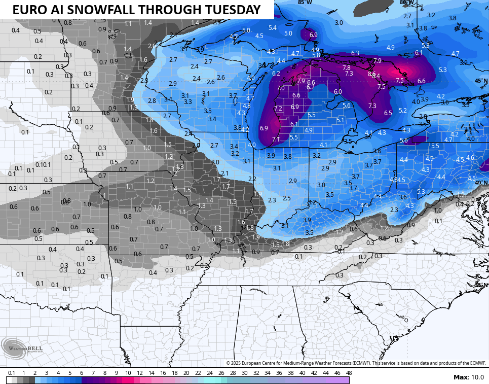
The AI version of the EURO does not agree and looks like the GFS and Canadian Models…
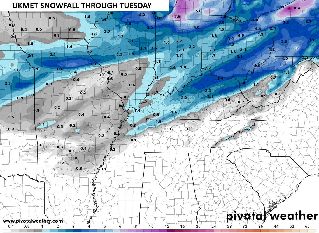
The UKMET is also similar…
Behind this comes a cold front with some flurries on Thursday. That will be followed up by a similar looking storm system by Friday and Saturday. That will also spell some serious troubles for the forecast models so don’t give any one model or any one run much attention.
We know December is going to be harsh across the country and now we get the EURO Weeklies going into the middle of January and they keep the cold coming. This is an average of 101 different members that make up the EURO Weeklies…
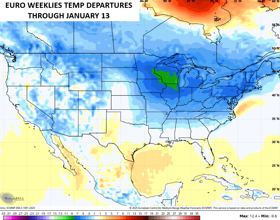
That is absurd cold for a 45 day average departure from that many different members that typically don’t do well in seeing cold air. I’m not sure that’s cold enough, folks.
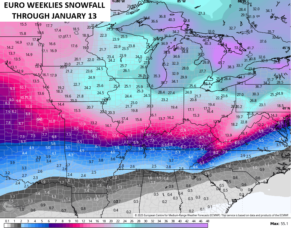
Oh, the 101 member average shows a lot of snow chances through this period…
I will have updates later today so check back. I’ll also have a few updates on my Meteorologist Chris Bailey Facebook Page
Until then, here are your tracking tools for the day…


Make it a great rest of your day and take care.

What’s interesting with this last system that moved through is that I thought WE were supposed to get some rain, but as I type this, no measurable precip has fallen at all, so not only did we get no snow, we got no rain, or at least VERY little. I do see some on the radar to the west but it doesn’t look like much.
We didn’t receive any measurable rain here either, but colder / drier winds have arrived. Making for a miserable weather day.
Thanks for the update Chris. I will really be surprised if any accumulating Snows occur in the forecast period. The strong ” Southeast Ridge ” will interrupt both the temperature and precipitation patterns. This weekend’s weather proved that.
https://www.cpc.ncep.noaa.gov/products/precip/CWlink/MJO/CLIVAR/ecmf.shtml
Showing phase 8 into mid December..Might stay in phase 8 all month..Lol..
Meanwhile if you like warmer weather like me gefs is showing warmer after the 10th with a +EPO and -PNA..Don’t believe it but we can keep our fingers crossed..
Weather history was made yesterday at Chicago’s O’Hare Airport. The 8.4 inches of snow that fell Saturday was the largest one-day snowfall in the month of November in Chicago history, and was the largest snowfall since January 2021. The NWS Forecast Office in Romeoville received 8.5 inches.
Here is a summary of the event. https://weather.gov/lot/2025_11_29_WinterStorm
Mike, just saw your post. Your really in the right spot for the most Snow this coming Winter. Here in Kentucky, we will have to wait on El Nino phase for training Snowstorms. The La Nina we have now is suppose to last 30 more years, so I think my last major Snow ( 2 feet ) occurred at Christmas, 2004 in Indiana. Kentucky just doesn’t have interesting Winters in the way of Snowstorms.