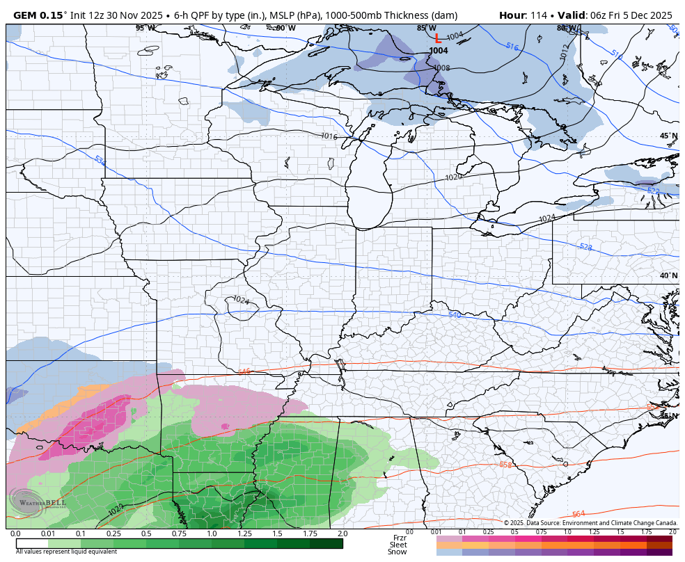
Good afternoon, everyone. Our Winte Storm THREAT continues for late Monday into Tuesday as our first winter storm of the season gets ready to impact our region. This storm kicks off what should become a harsh month of December for much of the country.
It’s usually a good sign when I start out by saying… I have no real changes to the forecast I already have out. So far, we are seeing things progressing as planned as our lead low works toward the Kentucky/Virginia border Monday night with the main low rolling from the deep south to the Carolinas. Here’s the Monday night look showing these lows…
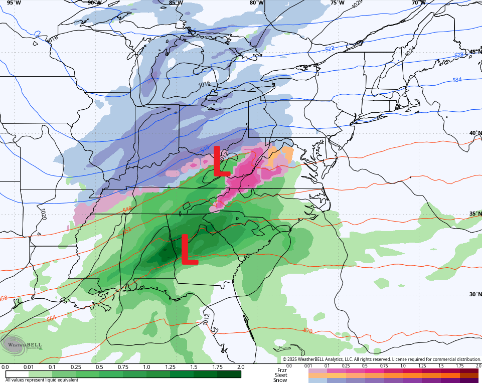
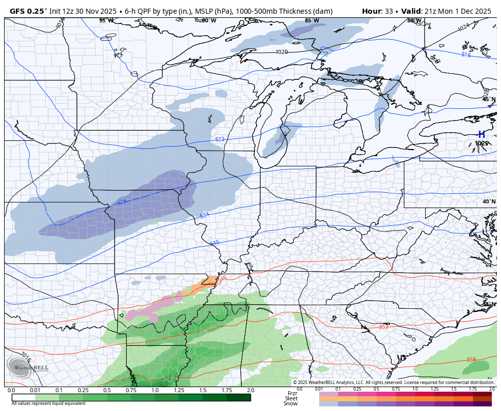
The lead low then gives up its energy to the main low as it rolls up the east coast on Tuesday. You can clearly see this on the GFS animation from Monday afternoon through Tuesday evening…
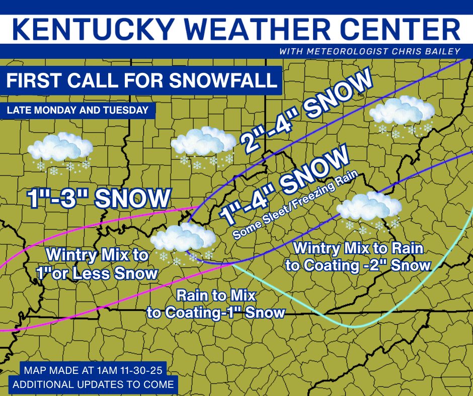
I’m rolling with my First Call for Snowfall but there’s a chance I have to nudge a number or two up…
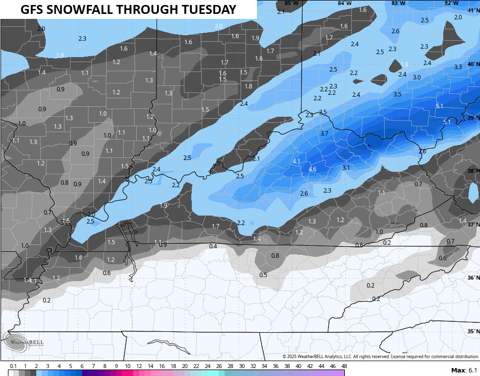
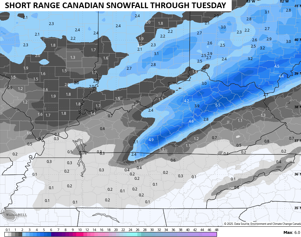
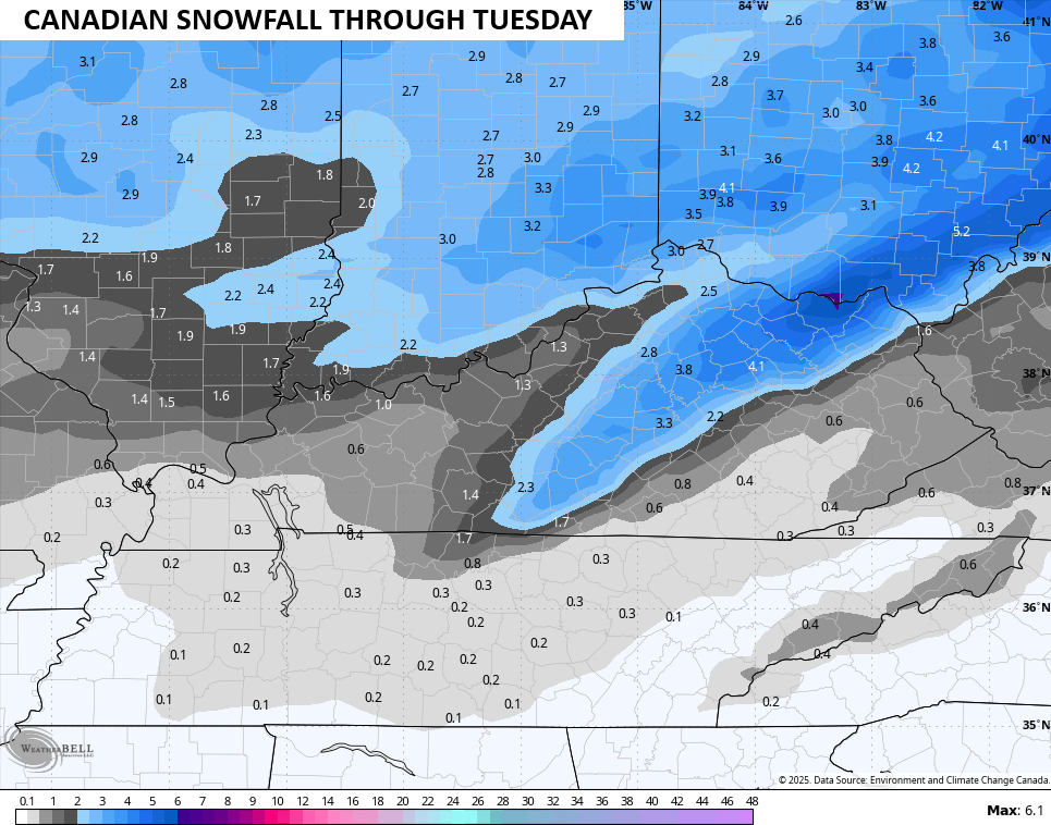
The snowfall forecasts from the models are pretty much in line with my forecast but have an area that’s a little beefier with snow totals and they have the heavier band a little farther southwest…
The EURO AI is similar…
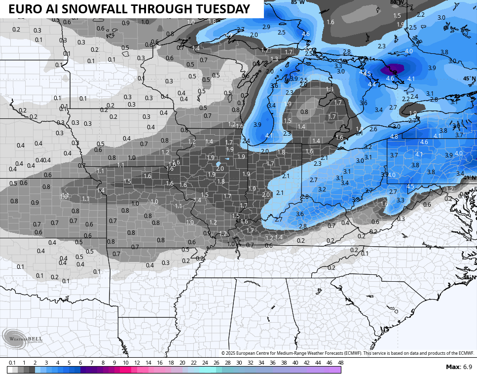
Even the EURO is coming around to showing what everything else has been seeing for a few days now, but it still has work to do…
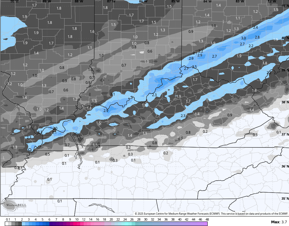
So you can see how the potential is there to push 4″ of snow in some areas. 4″ from a single event is the criteria for a Winter Storm Watch anywhere in Kentucky. I do think a WSW would be warranted for several counties from the Bluegrass Region to northeastern Kentucky.
We do this all over again with what may be another Winter Storm THREAT Friday and Saturday. That will be followed by a series of clippers, one of which may really to deepen…
I will have updates later today so check back. I’ll also have a few updates on my Meteorologist Chris Bailey Facebook Page
Until then, here are your tracking tools for the day…


Make it a great rest of your day and take care.
