Good Monday and welcome to December. A winter storm system moves in later today and tonight, giving us a very wintry and messy start to Meteorological Winter. This system brings snow, sleet, some freezing rain and rain to the commonwealth.
A Winter Weather Advisory is out for many areas but isn’t expansive enough on the southern edge (as of this writing). I can see a part of this getting upgraded at some point later today…

I’ve only made minor adjustments on my New Call for Snowfall…
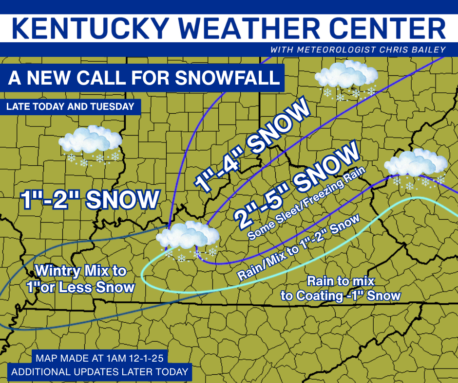
I’ll update that throughout the day with the Last Call for Snowfall likely coming today at 4pm on WKYT and WKYT+.
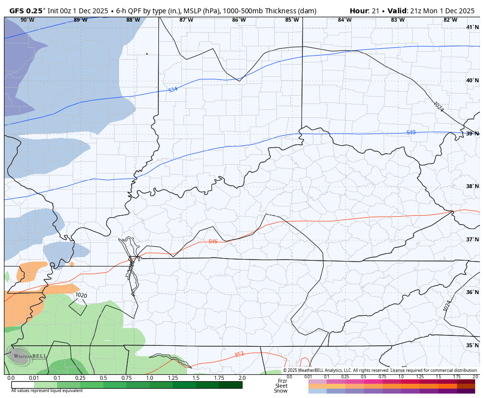
The GFS oddly enough has been the most consistent model of the past several days. It continues to take our lead low to near the Kentucky/Virginia border late tonight as the main low scoots by to our south and east. This scenario brings a wintry mix into western Kentucky this afternoon with rain overspreading far southern Kentucky at the same time. All this progresses to the east and northeast tonight into Tuesday morning. Lingering snow showers and flurries would then be noted across central and eastern Kentucky during the afternoon.
Here’s the GFS from 4pm today through 1am Wednesday…
The GFS continues to be the most amped up with the moderate to heavy snow band extending from central Kentucky into the northeast…
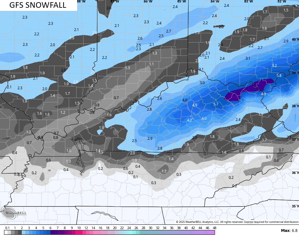
That band would be mainly after midnight tonight and would be pretty much gone by daybreak.
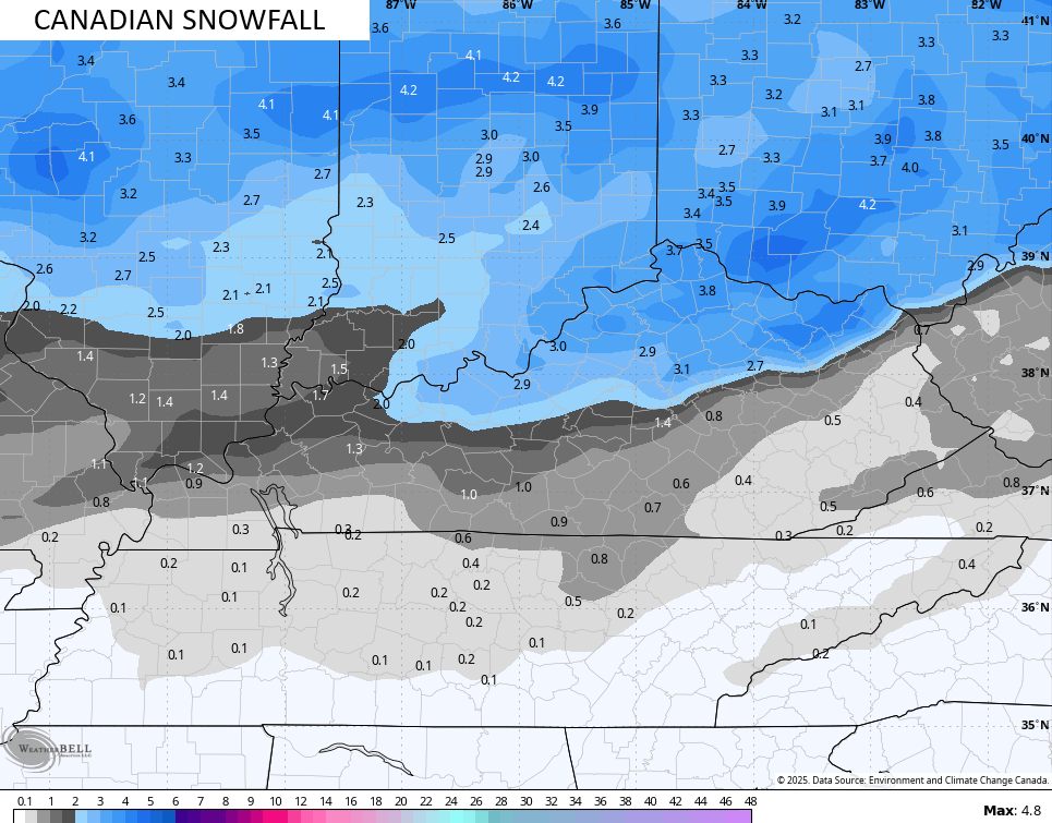
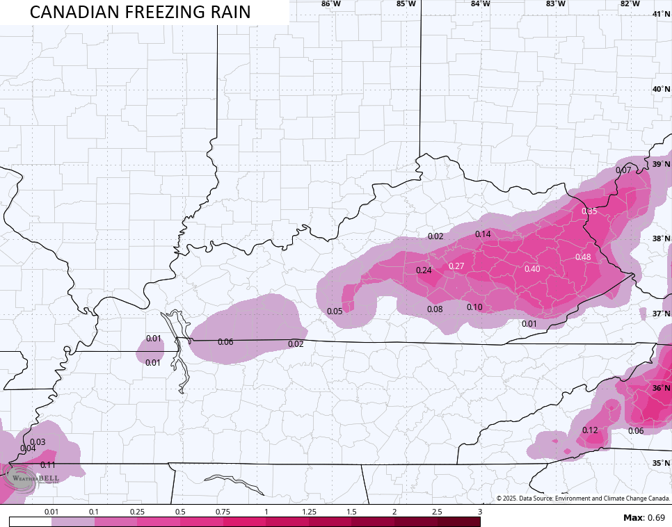
The Canadian has a similar band of snow, but has way more freezing rain on the southern edge of it. Here’s the snow map..
The model continues to spit out an inordinate amount of freezing rain and I think this is way overblown…
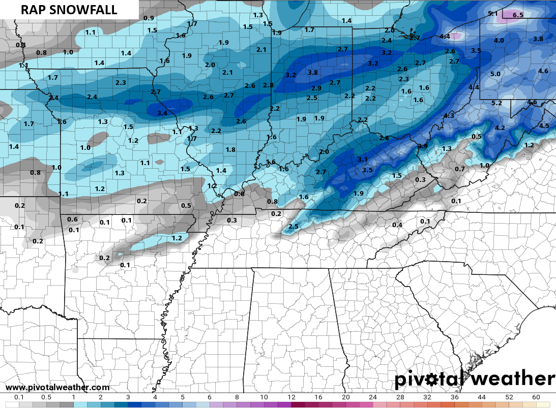
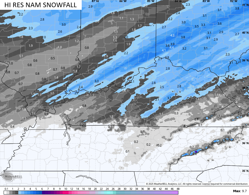
The latest from the Hi Res NAM is a little streaky, but has the general idea…
The ICON is seeing that same band of snow but is a little farther south and looks too sparse elsewhere…
![]()
![]()
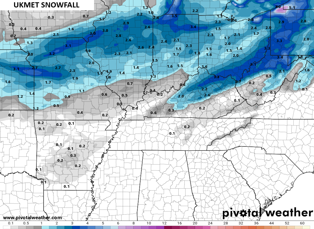
Our band shows up on the UKMET as well…
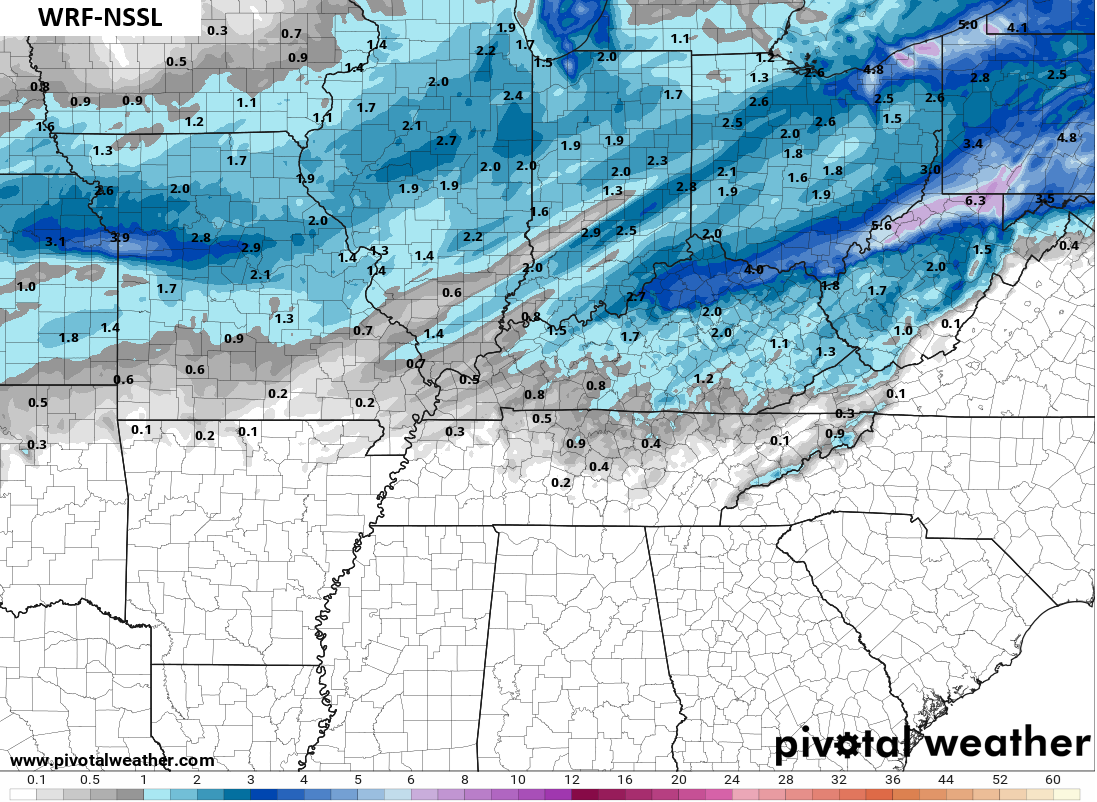
The WRF runs several different versions with the NSSL version being the most generous…
Wednesday looks seasonably cold and quiet with what should be a decent snow pack for much of the region. An arctic front drops in on Thursday and brings a few flurries or even a snow shower. This may actually have a stronger push to the south than I thought. If that’s the case, it may steer the weekend system well away, but that’s not a given just yet.
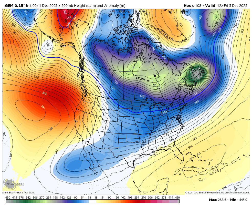
This is a frigid pattern where our attention turns to clippers from this weekend into next week. One of these may really dig in and amplify into a bigger system. You can see the Canadian trying to do that at the end of this run…
Updates will come your way later today. I’ll also have a few updates on my Meteorologist Chris Bailey Facebook Page
Until then, here are your tracking tools for the day…


Make it a magnificent Monday and take care.

Thank you CB! There was a day where a snow like this would shut down this website!! I think that was preface Facebook and all that followed! I met a lot of nice people during that time. One who I still keep in touch with! Back then I begged for a big, shut down the state snowfall, These days I’m happy with whatever comes! I do still want that big one, but only on the weekends when most all is off work! I have grandbabies now to share my joy of snow. TImes the do change! -Patty