Good afternoon, everyone. Our fast-moving winter storm continues to take aim at the region through early Tuesday. While not major, this system has a significant travel impact on the area and will lead to all kinds of delays and cancellations.
In the overall scheme of things… I have no real changes to the forecast I have out there. You knew that was coming, didn’t ya? ha
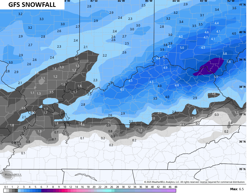
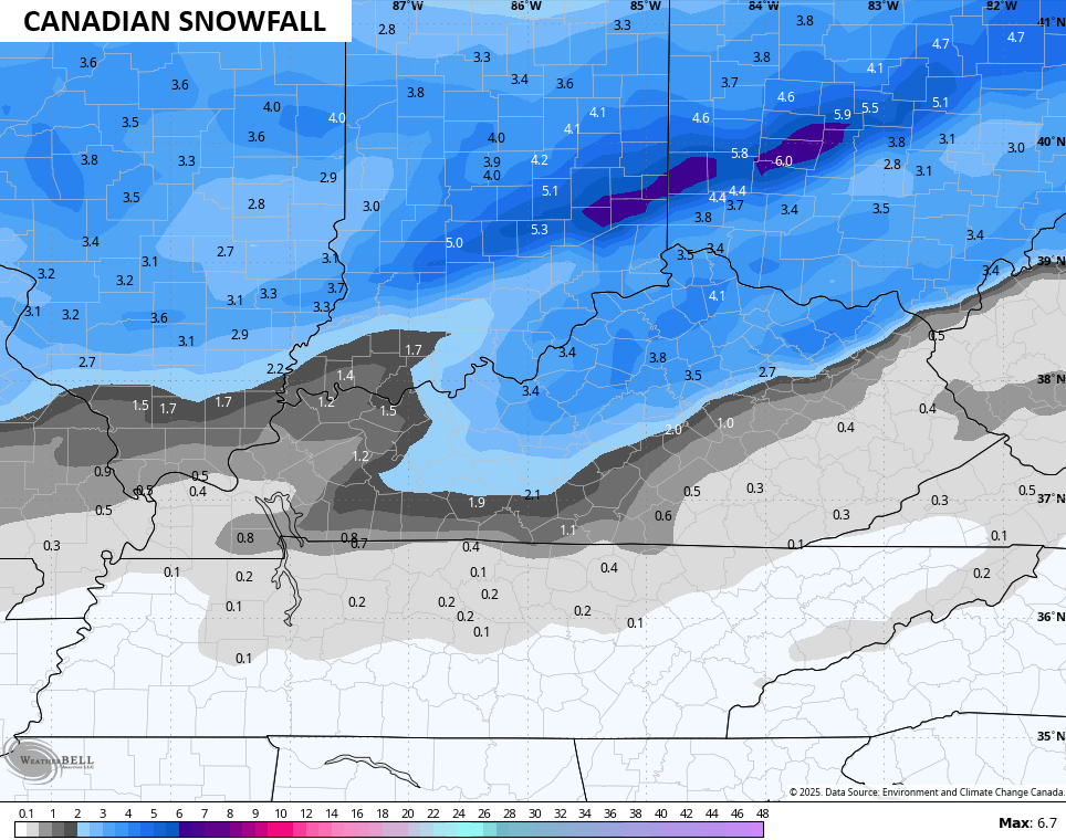
In the medium range, the GFS was awful with this system as it changed from one run to the next. In the shorter term, the GFS hasn’t budged in showing a healthy hit for many across the state. Here’s the latest run from this evening through Tuesday evening…
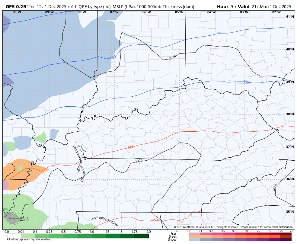
It’s going to snow VERY HARD for a few hours late tonight, especially in the Bluegrass Region north and northeast.
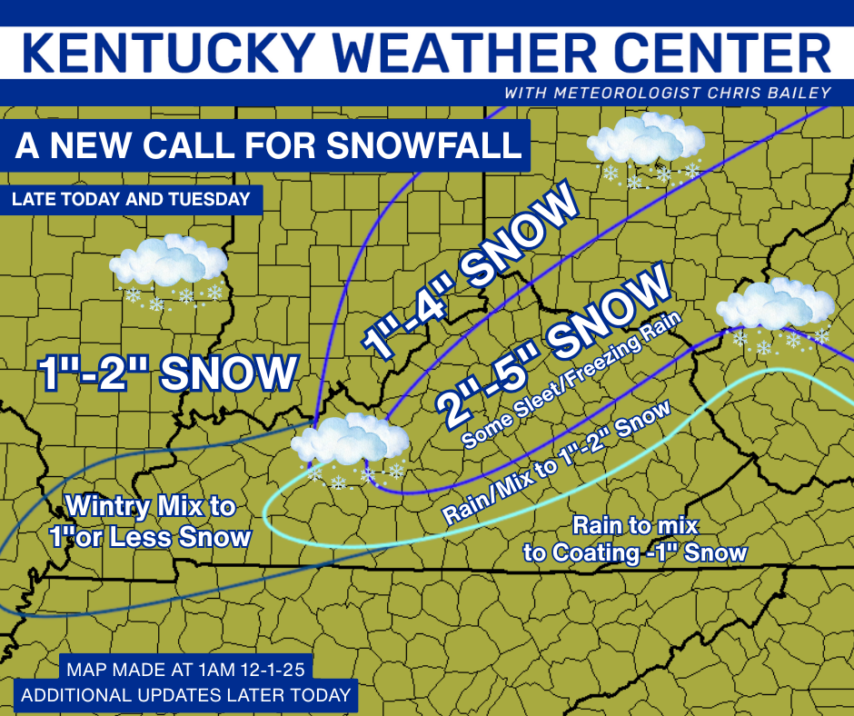
I’m rolling with the current Call For Snowfall that I put out last night…
The NWS continues to be slow to respond to come around with this storm. They currently have a Winter Weather Advisory out for the northern half of the state…

That Advisory should be extended at least 2 counties farther south. 4″ of snow with any storm is the criteria for a Winter Storm Warning and I can easily see some of the Advisory upgraded.
I say all this not only because of the forecast I’ve had out, but because there is STRONG model support.
The GFS likes Warning criteria snows for a lot of people…
The Canadian family is coming around to that idea…

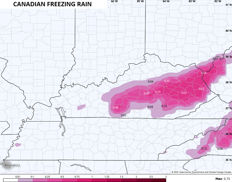
The Canadian continues to spit out some hefty freezing rain for some, but I still maintain that’s overblown…
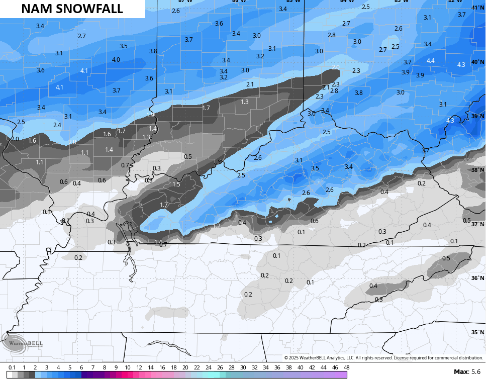
Even the NAM is seeing the potential…
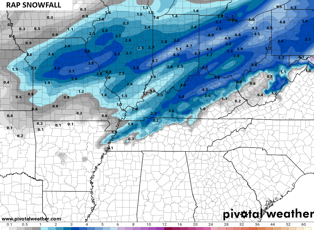
The RPM is on board, too…
I will have updates later today and on WKYT-TV at 4pm. We will also have a full half hour dedicated to this storm at 6:30pm on the CW Lexington and WKYT+. That’s our brand new First Alert Weather Show that airs each weekday. I’ll also have a few updates on my Meteorologist Chris Bailey Facebook Page
Until then, here are your tracking tools for the day…


Make it a great day and take care.
