Good evening, everyone. It’s all systems go for a winter storm to impact Kentucky tonight into Tuesday morning. Snow, sleet, freezing rain and rain are all showing up as our system increases from southwest to northeast.
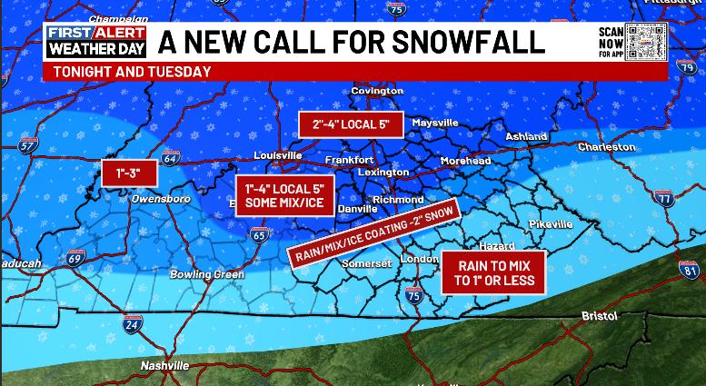
The Winter Weather Advisory got expanded farther south and that’s a good thing but it’s still not far enough south. I’m still worried about a corridor of snows that can push the 4″ mark, which is Winter Storm Criteria for Kentucky. Here’s a look at the current Winter Weather Alerts…

Here’s the latest call for snowfall…
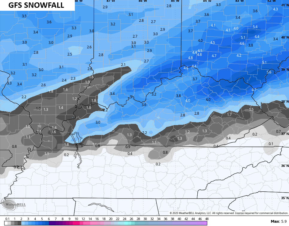
The late afternoon models all decided to trend straight toward what the GFS has been saying for days now and that’s for a heavier and more widespread system. Here’s the latest look from the GFS…
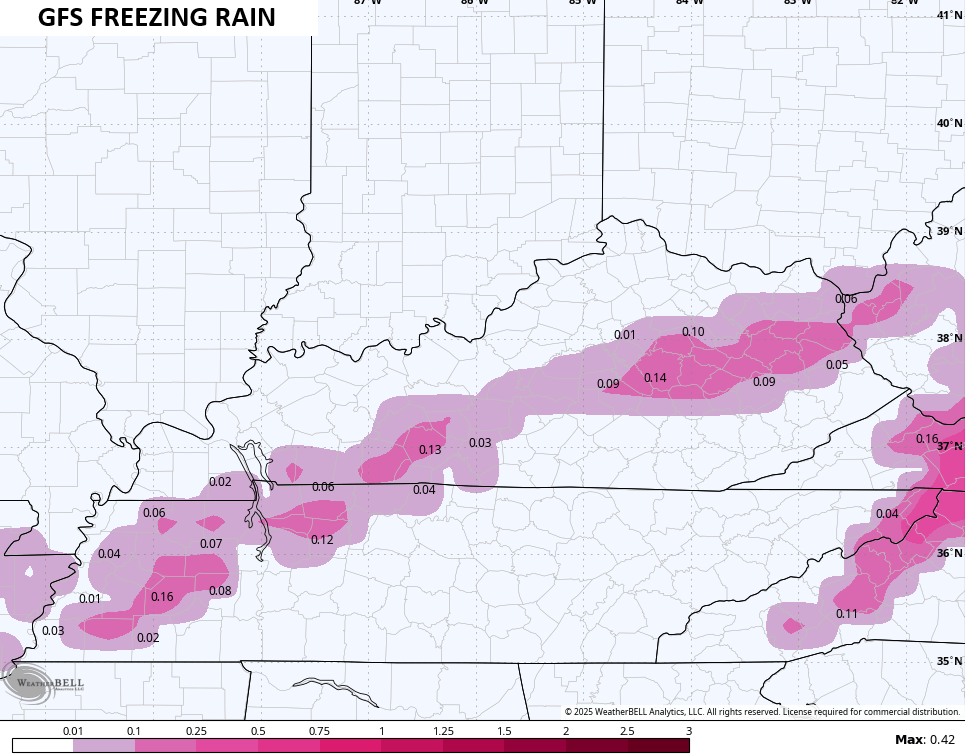
The model is now seeing some freezing rain…
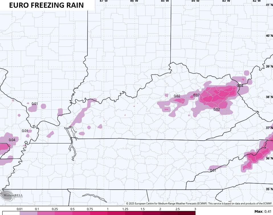
The EURO is now seeing a hefty snow system, similar to the EURO…
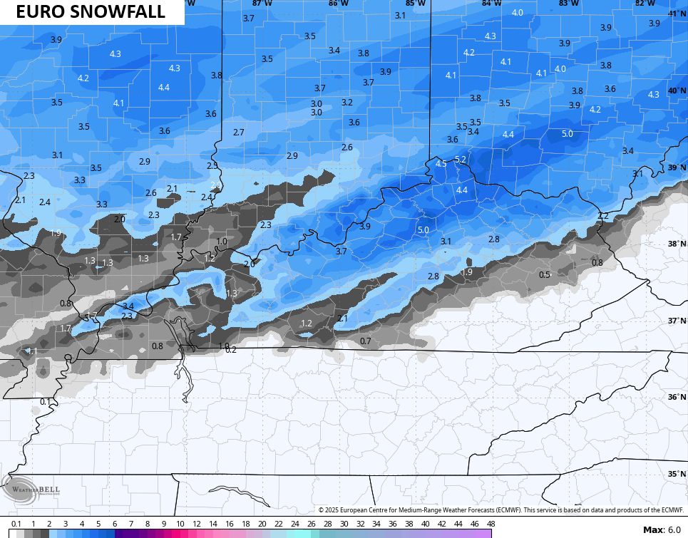
It’s also seeing a little more freezing rain…
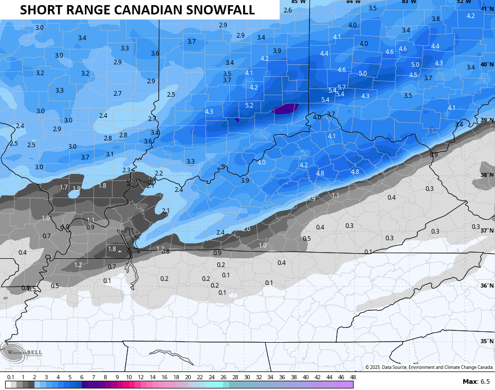
The late day Short Range Canadian also beefed up snow totals…
It has a much greater swath of freezing rain that would cause issues…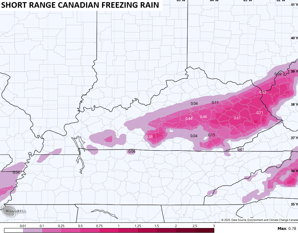
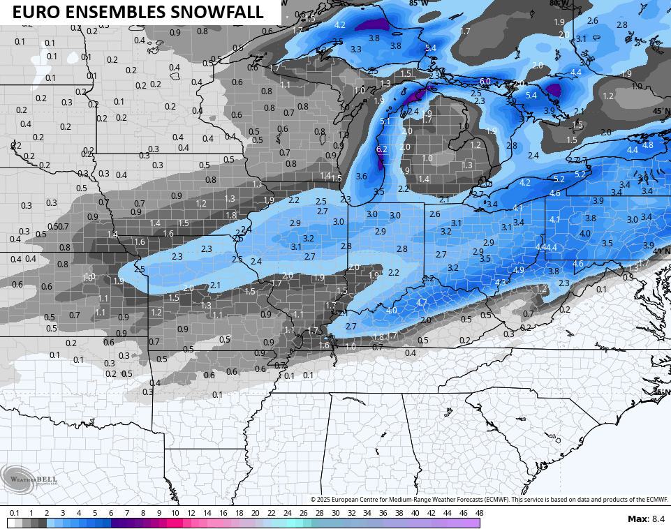
Even the average of more than 50 members of the EURO Ensembles show a healthy snowfall…
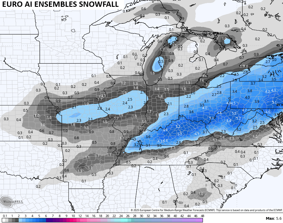
The AI Ensembles are much more generous…
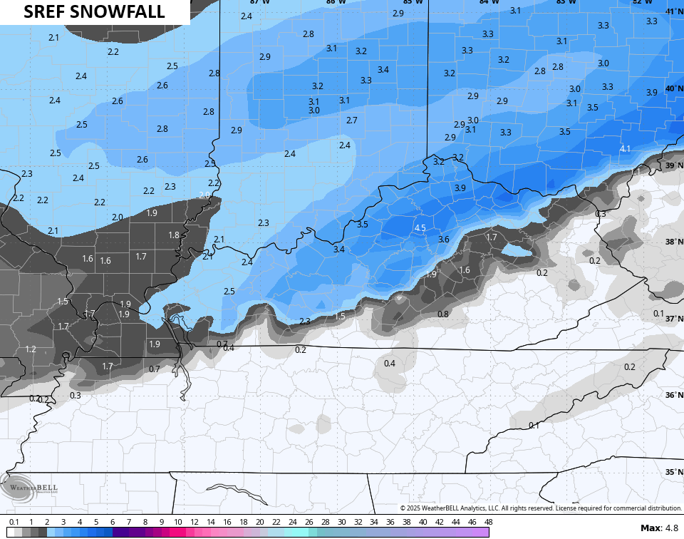
The Short Range Ensembles Forecast average looks like this…
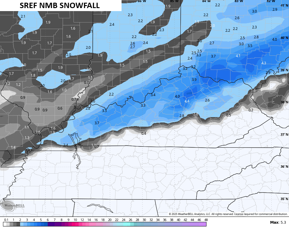
Here’s one of the single runs…
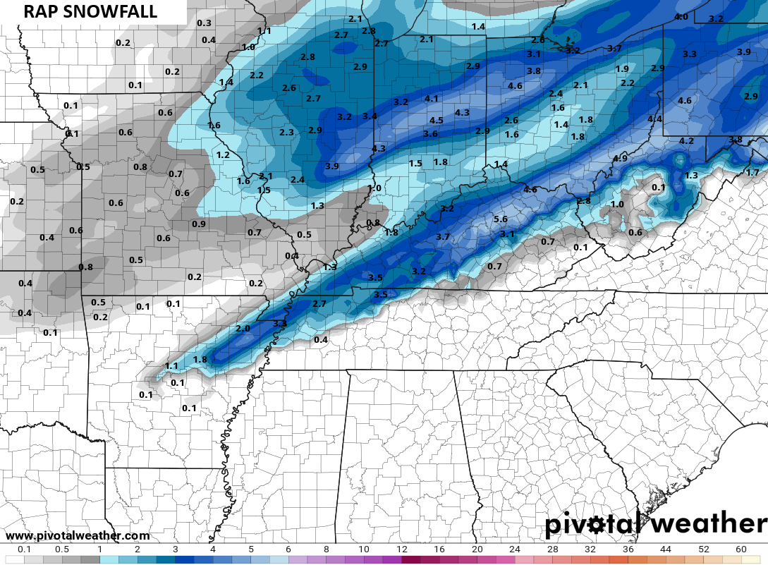
And finally the RAP snowfall forecast…
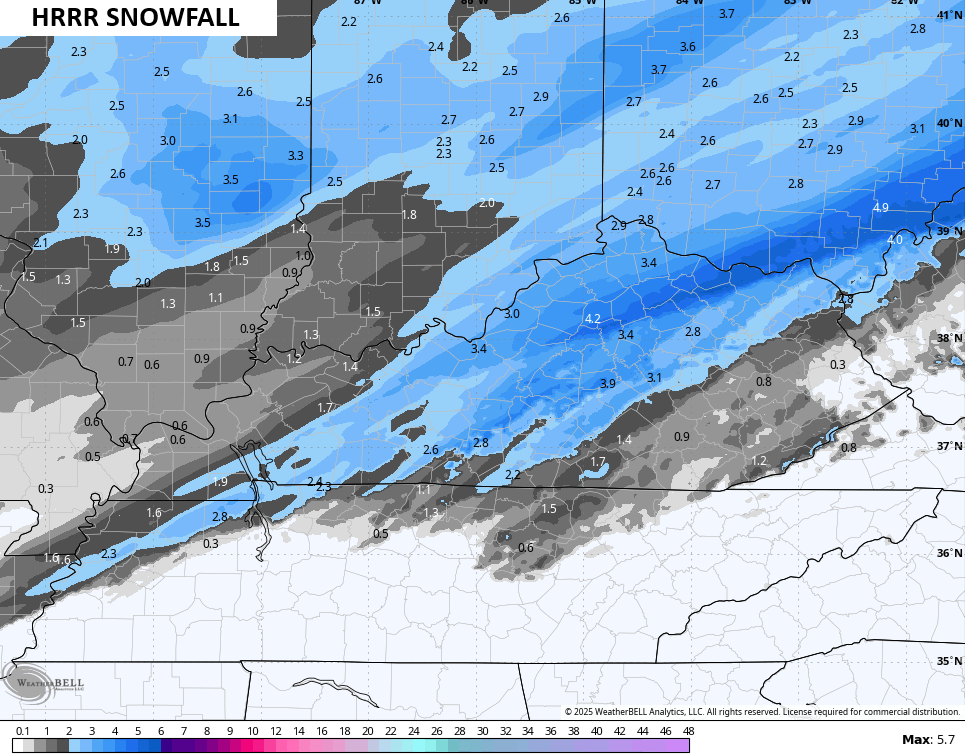
Oh wait… One more… Here’s the HRRR
I may have another update later this evening and will have the latest on WKYT NEWS on the CW Lexington at 10pm then on WKYT at 11. You can also watch everything we do streaming on WKYT+. I’ll also have a few updates on my Meteorologist Chris Bailey Facebook Page
Until then, here are your tracking tools for the day…


Make it a great evening and take care.

We can already verify for sure by both radar and direct observation that most of the models arent showing the precipitation going far enough to the south. I am concerned that people in these areas will be caught off guard by this inaccuracy. Also, if the ice totals shown by the Canadian verify, we’re in big trouble