Good Saturday to one and all. It’s another much colder than normal day across Kentucky as we track another potential light winter weather maker. This arrives late Sunday into Monday and can put down a little light snow. This is ahead of a pattern that may take a major winter turn later in the week ahead.
Before we look ahead, let’s look at exactly how cold we are to start December. The first 5 days are in the books and we’ve had two snow systems to go along with one of the coldest starts to the month in a long time. Look at how much of the country is MUCH colder than normal, so far…

Today is another cold one with mainly 30s for highs and the chance for a flake or two in the north. Temps for Sunday will hit 40 or better for many, especially across the south. That’s ahead of an arctic front dropping in from the northwest late Sunday into early Monday. A touch of a mix is possible ahead of this with the main action coming in behind it.
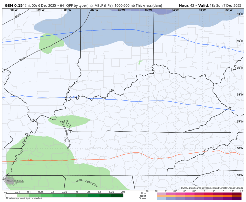
Right now, that action looks fairly light as a wave of low pressure develops along the boundary. The models are having issues with how to handle this setup but the NAM seems to have a good handle…
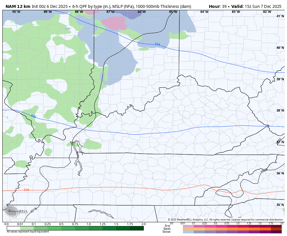
A band of LIGHT accumulating snow is possible across the area with the best chance in the south and east. The Canadian is also on this…
I’ve talked a lot about how the models are struggling more than ever as they can’t even agree on something happening on the day of, let alone a week or so ahead. The extreme pattern across North America and the angle of the bitter cold coming from Alaska and northwest Canada is giving the models fits. I’ve seen this before and I think some of it can be traced back to the fact the models have a major struggle with that kind of an angle and the interaction with the Rockies.
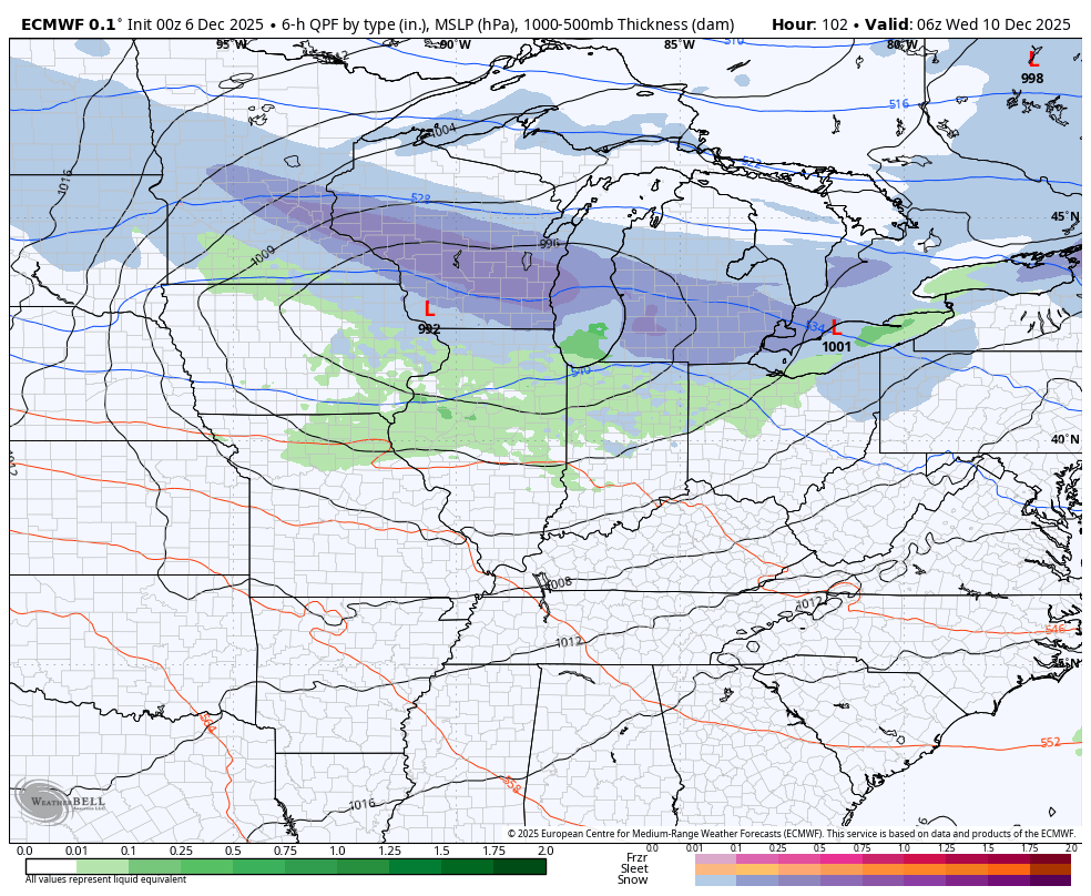
That said, the pattern setup will throw several clippers at us next week into next weekend with the potential for one of these to really amplify. Asking the models for specifics is silly, so just use them for a general pattern. That general pattern shows clippers. Here’s the EURO from Wednesday through this time next weekend…
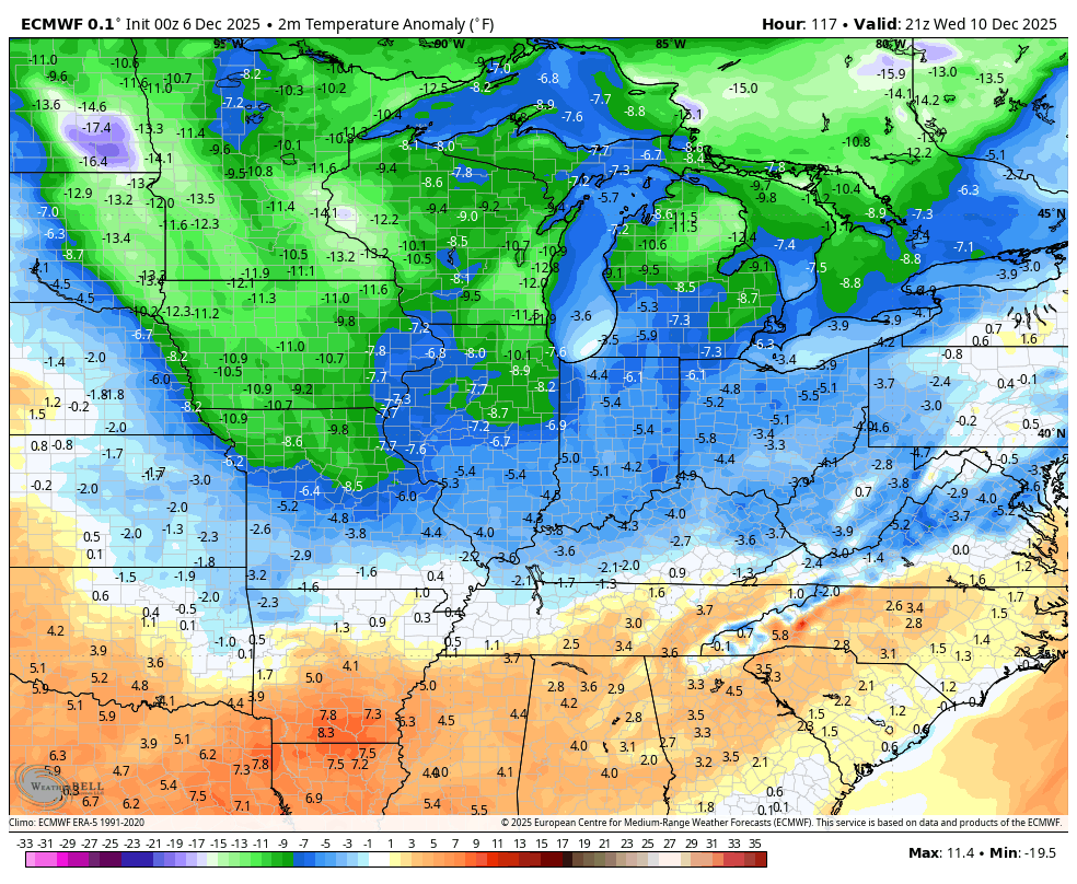
A major arctic outbreak is a good bet behind all this…
So the models that had been trying to throw another ridge into the east are doing what we talked about and backing off. This has been something we’ve seen time and time again for the past few weeks or longer. Remember, a week before Thanksgiving you had folks talking about what a warm first week of December we would have because SOME of the models were showing a fantasy ridge. We see how that turned out this week.
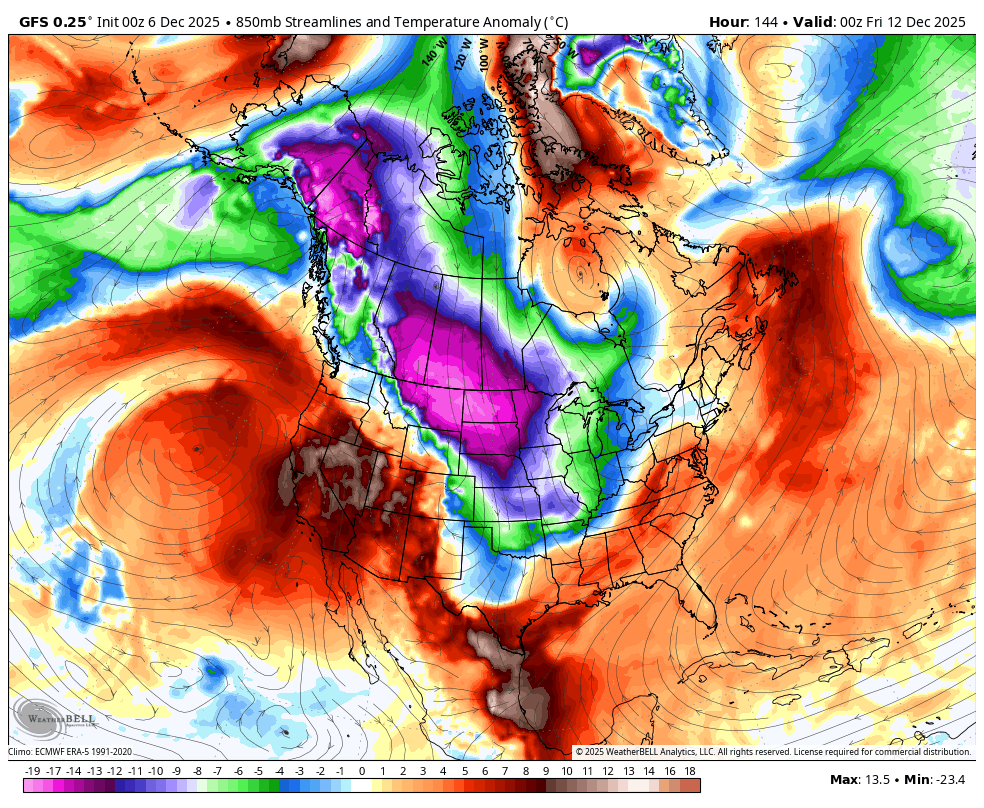
Upping the ante on severe cold is a cross-polar flow potentially setting up around mid-month. That’s when arctic air straight from the North Pole drops in. You can see that happening on the overnight run of the GFS. Watch how that flow sets up and just keeps throwing arctic blasts into the country through the end of the run on December 21st…
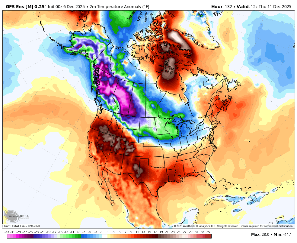
The GFS Ensembles give a more muted look as it smooths things out over time, but you can still see this pattern…
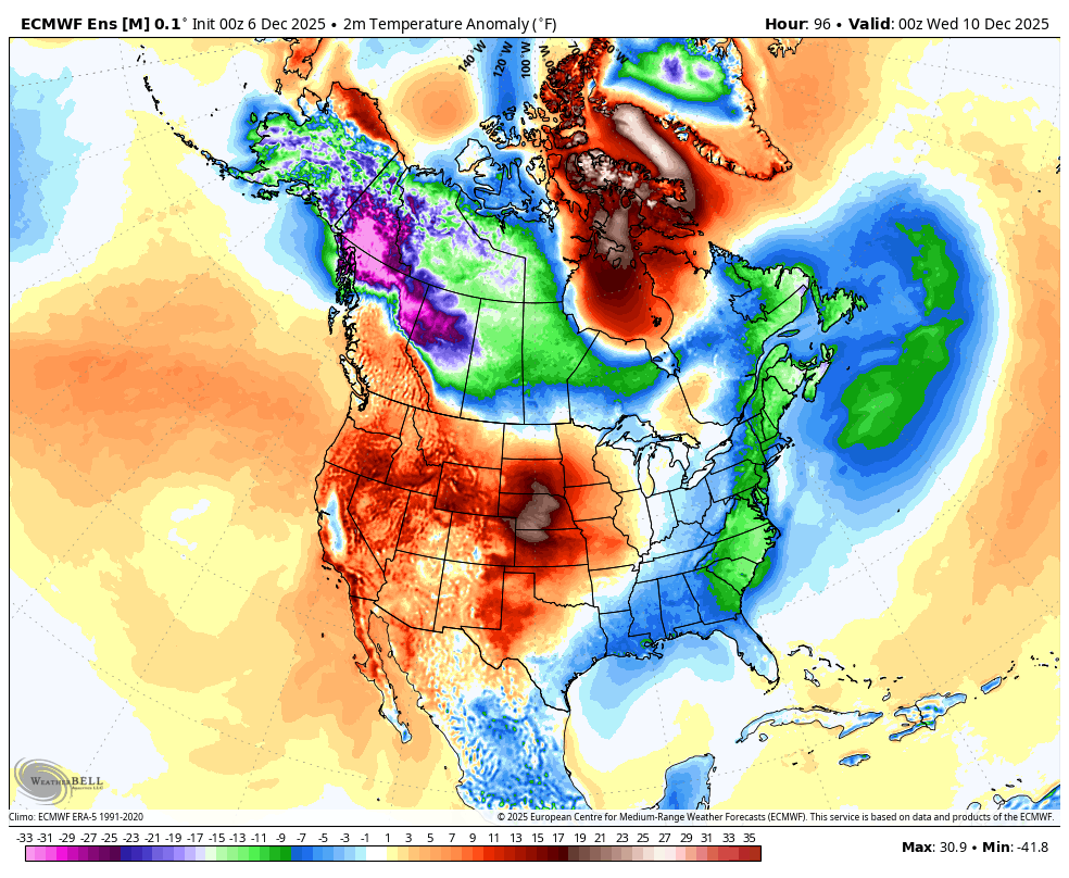
 The same goes for the typically even more muted EURO Ensembles…
I will have updates later today and will also have a few updates on my Meteorologist Chris Bailey Facebook Page
Until then, here are your tracking tools for the day…


Make it a sensational Saturday and take care.

Hopefully we see some snow.
That would be a miracle Russell, but one can hope. Western and Central Kentucky have been in a ” Snow Drought ” for 10 years now. Our last El Nino year /with a positive Pacific was the Winter 2015. I built a Snowman, and took a picture, and have been hanging it on the wall for Christmas decoration.
Illinois Mike,
I was in Chicago yesterday for work and the snowscapes were awesome to see with the impressive work done by road crews.
Yeah Jeff, they certainly have had a lot of work this past week. And 2 to 4 more inches of snow is on the way after midnight tonight through Sunday morning for the Chicago Metro Area.
My younger Sister, who lives in Northern Indiana, has gotten better than 7 inches of Snow last week. They have road crews that stay on the job, to keep the roads safe for drivers. No one complains about the roads being unsafe.
Here in the SW Suburbs of Chicago, we have around six inches of snow on the ground after compacting. Today is actually the warmest day of the month, right at 32 degrees, but more snow and cold is on the way here.
Two to four week outlook from the Climate Impact Company : )
https://climateimpactcompany.com/u-s-week-2-4-outlook-cold-north-warm-south-persistence-maintained-2-2/
One can’t believe any Model forecast Chris. As always a wait and see game.