Good Sunday, everyone. We have a light snowmaker moving into the region tonight and early Monday. This leads us into a week that will take us into what will be a very harsh winter pattern around here and for much of the country over the next few weeks, at least.
Before we get to the harsh stuff, let’s talk about what’s going on out there today. Temps are actually the mildest we’ve had since before Thanksgiving as the numbers range from the upper 30s to upper 40s across the state.
An arctic front drops in here this evening and has a few showers ahead of it with a period of light snow developing behind it. That happens tonight and early Monday as a weak wave of low pressure pops along this boundary to our southeast.
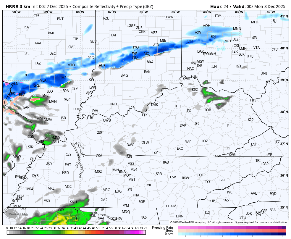
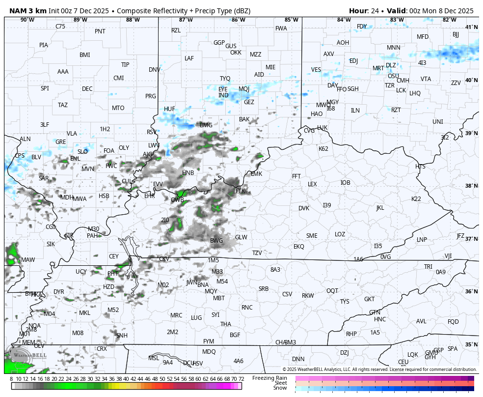
The future radars from the HRRR and Hi Res NAM are fairly similar in showing the potential for a light snowfall for parts of the region, especially central and eastern Kentucky.
HRRR
Hi Res NAM
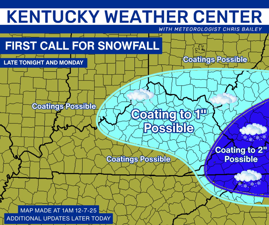
This looks like lots of coatings to perhaps an inch in some spots with far southeastern Kentucky having a better chance at a little more than an inch. Here’s a First Call for Snowfall…
We may very well have a few delays and cancellations with our 3rd snow system to impact Kentucky in this first week of December.
Temps spike Tuesday into Wednesday, and we may even make a brief run at 50. What goes up, must come down, though. The first in a series of clippers looks to move in here late Wednesday with a shower or two ahead of it and a flake or two behind it. This lays the groundwork for a harsh winter pattern.
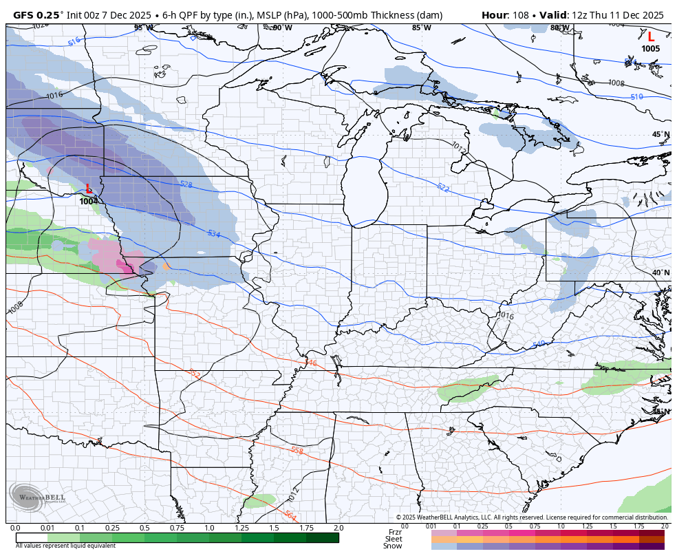
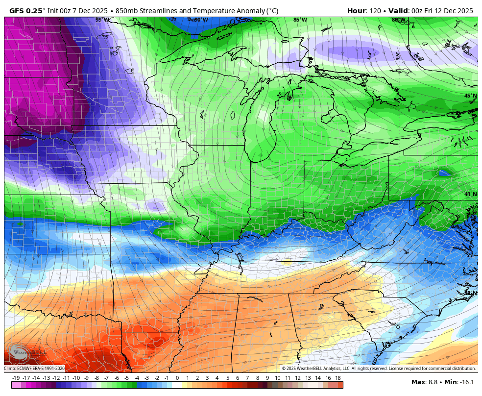
The boundary sets up just to our south as much colder air develops. The next clipper rolls along this boundary by Thursday and Friday and may very well have accumulating snows along it for our region and will be followed up by what is likely a major arctic blast with some snow ahead of it next weekend.
Here’s the GFS with both of those…
Bitterly cold air crashes in behind these and another one set to follow…
The EURO is seeing the series of clippers, but changes from run to run on the specifics on how it handles each of them…
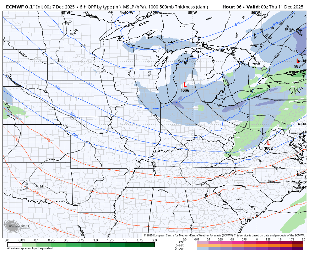
The forecast models will continue to struggle with this pattern as they simply cannot handle everything going on.
I will have updates later today and will also have a few updates on my Meteorologist Chris Bailey Facebook Page
Until then, here are your tracking tools for the day…


Make it a great Sunday and take care.
