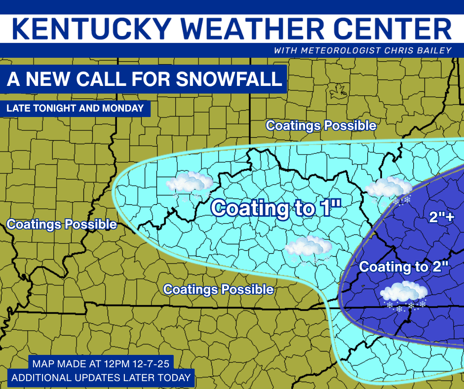
Good afternoon, everyone. We have another light snow system pushing into the region tonight and early Monday. This system will likely bring some snow days and delays to areas of central and eastern Kentucky. All of this is ahead of a bigger push of harsh winter weather.
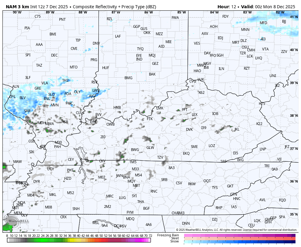
An arctic front drops in tonight with a wave of low pressure developing along it to our southeast. A few evening showers develop, but most of the moisture is behind the boundary and that means a decent area of light snow. This will spin through the east and southeast through Monday afternoon before departing…
Widespread coatings to 1″ of snow will be common with higher amounts in the southeast. Here’s the New Call for Snowfall…
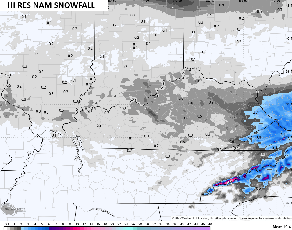
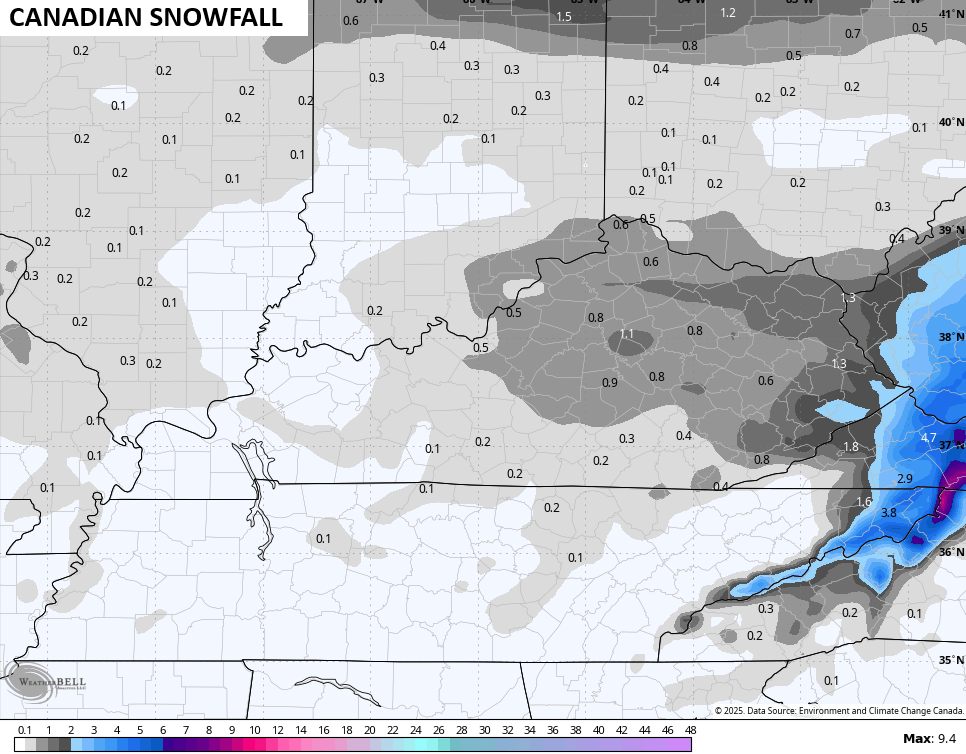
The forecast models are in line with my thinking…

After a nice rebound in temps Tuesday and early Wednesday, look out below! Some serious arctic air drops in with a series of clippers impacting our region. These will likely put down snow, but you won’t find the models figuring all that out for a few more days.
They have the theme correct, though…

I will be on WKYT-TV tonight starting at 6pm, and I’ll have updates later today and will also have a few updates on my Meteorologist Chris Bailey Facebook Page
Until then, here are your tracking tools for the day…


Make it a great rest of the day and take care.

Right on schedule, we’re on the verge of the first of several stretched polar vortex incursions; this is some real deal cold, which is noticeably missing from regional 5 and 10-day forecasts. This is mostly due to the fact that so many apps and local media rely on the notorious GFS model for temperature forecasts. Models that are still seeking a solution So, one major requirement needed for snow in south central Kentucky will be in place, but it won’t mean a thing unless we can establish a flow of moisture from the Gulf of Mexico. Clipper systems might squeeze out some flurries, but festive flakes simply won’t cut it.
JOE, THE LONG RANGE MODELS ARE SEEING ONE RIGHT BEFORE CHRISTMAS. WEATHER THAT WILL COME TO A FRUITIS REMAIN TO BE SEEN.
Well set your clock by it. WKY……anyone…..